The best MTB trails in Nindirí
5.0
(1)
67
riders
17
rides
Mountain bike trails in Nindirí offer a diverse landscape shaped by volcanic origins, providing varied and challenging terrain. The region is situated at the foot of the Mombacho Volcano and borders Lake Cocibolca, featuring both rugged paths and serene lakeside routes. Riders can explore areas within the Masaya Volcano National Park, which encompasses the Masaya and Nindirí volcanoes. This geology contributes to varied elevations and technical trails suitable for mountain biking.
Best mountain bike trails in Nindirí
- The most popular…
Last updated: July 1, 2026
5.0
(1)
7
riders
21.3km
01:43
270m
270m
Moderate mountain bike ride. Great for any fitness level. Advanced riding skills necessary.
8
riders
38.7km
02:37
280m
280m
Moderate mountain bike ride. Good fitness required. Suitable for all skill levels.

Sign up for free
8
riders
30.8km
02:04
300m
300m
Moderate mountain bike ride. Good fitness required. Advanced riding skills necessary.
5
riders
Moderate mountain bike ride. Good fitness required. Advanced riding skills necessary.
5
riders
22.4km
01:34
210m
210m
Moderate mountain bike ride. Great for any fitness level. Advanced riding skills necessary.
3
riders
36.9km
03:10
860m
860m
Moderate mountain bike ride. Good fitness required. Advanced riding skills necessary.
4
riders
30.3km
02:41
760m
760m
Moderate mountain bike ride. Good fitness required. Advanced riding skills necessary.
4
riders
20.8km
01:30
320m
320m
Moderate mountain bike ride. Good fitness required. Suitable for all skill levels.
5
riders
26.8km
02:20
640m
640m
Moderate mountain bike ride. Good fitness required. Advanced riding skills necessary.
5
riders
30.9km
02:30
610m
610m
Moderate mountain bike ride. Good fitness required. Advanced riding skills necessary.
Get access to more routes and recommendations from other explorers.
Sign up for free
Already have an account?
Our route recommendations are based on thousands of hikes, rides, and runs completed by other people on komoot.
Start today with a free account
Your next adventure awaits.
Login or Signup
Popular around Nindirí

Tips from the Community

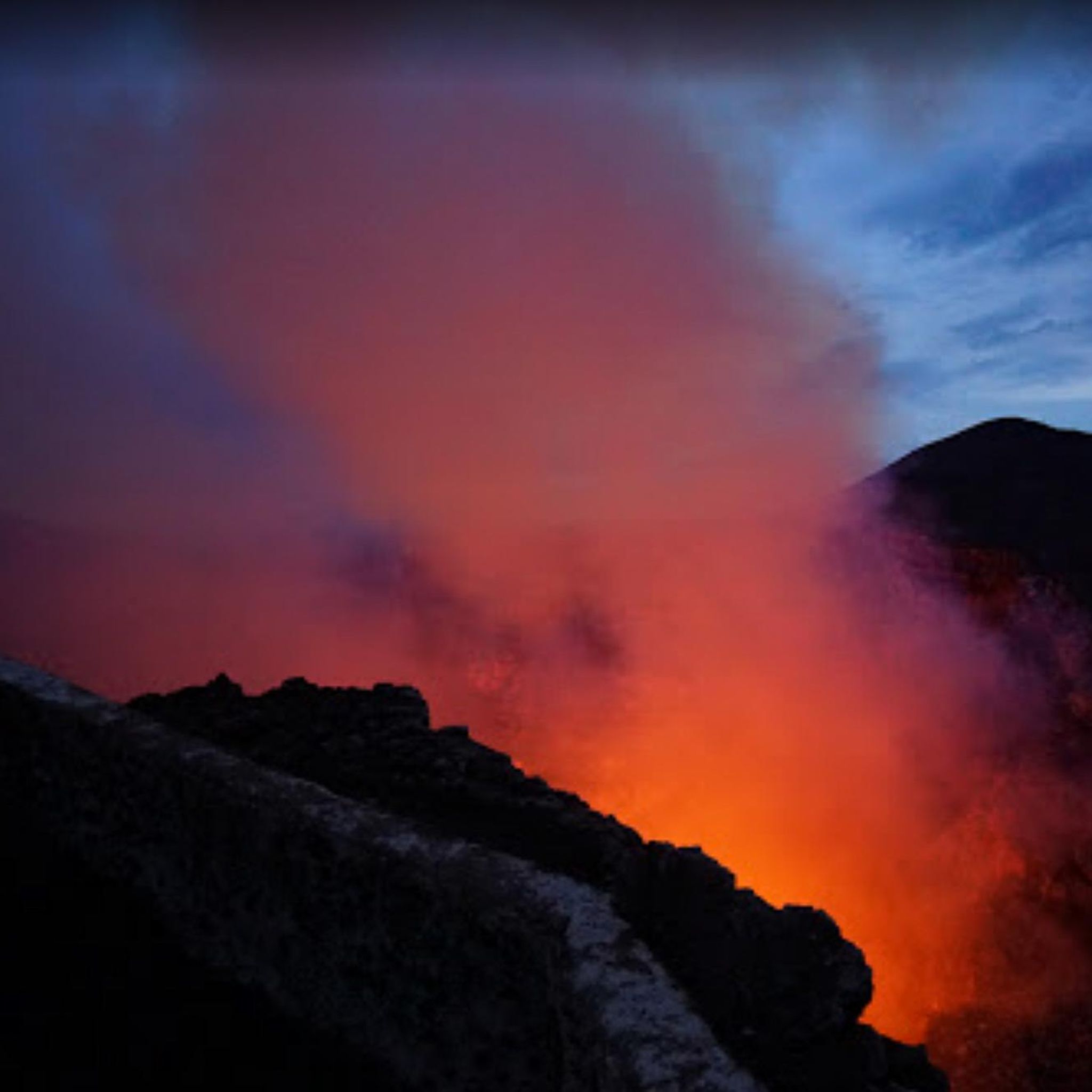
Here you can stand at the mouth of an active volcano and look into it. Spectacular! Entry to the national park costs 10 USD. The way up the volcano is very easy by car (paved). By bike it is a bit strenuous as it is quite steep. But it is worth it. Tip: It is best to come at dusk. Then you can see the magma really bubbling in the mouth.
0
0
Frequently Asked Questions
How many mountain bike trails are available in Nindirí?
Nindirí offers a selection of 17 mountain bike trails, ranging from easy to moderate difficulty. The majority, 15 routes, are considered moderate, providing a good balance of challenge and accessibility for various skill levels.
What kind of terrain can I expect on Nindirí's mountain bike trails?
The terrain in Nindirí is largely shaped by its volcanic origins, offering a diverse and often challenging experience. You'll encounter rugged paths, varied elevations, and technical sections, particularly within the Masaya Volcano National Park. Some routes also feature serene lakeside paths along Lake Cocibolca, providing a mix of environments.
Are there any family-friendly mountain bike trails in Nindirí?
Yes, Nindirí has 2 easy-rated mountain bike trails that are suitable for families or those looking for a less strenuous ride. These routes offer a gentler introduction to the region's beautiful landscapes.
What are some notable natural features or viewpoints along the trails?
Nindirí's trails offer access to spectacular natural features. You can explore areas within the Masaya Volcano National Park, which encompasses the Masaya and Nindirí volcanoes. Many routes also provide scenic viewpoints overlooking Lake Cocibolca and the surrounding volcanic landscape. For instance, the El Ángel Viewpoint loop from Condominios Madroño leads to scenic vistas.
When is the best time of year to go mountain biking in Nindirí?
The best time to explore Nindirí's mountain bike routes is typically between November and April. During these months, rainfall is minimal, which makes for more favorable riding conditions and ensures trails are less muddy and more accessible in the tropical climate.
Are there any long-distance mountain bike loops in Nindirí?
Yes, Nindirí features several longer loop routes. For example, the Masaya Volcano National Park loop from ROTONDA KM 14 covers 24.1 miles (38.7 km) and takes approximately 2 hours 37 minutes to complete, offering an immersive experience through volcanic terrain.
What do other mountain bikers say about the trails in Nindirí?
The mountain bike trails in Nindirí are highly rated by the komoot community, with an average score of 5.0 stars. Over 50 mountain bikers have used komoot to explore the varied terrain, often praising the unique volcanic landscapes and diverse riding experiences.
Are there any challenging mountain bike trails for experienced riders?
While Nindirí currently lists 15 moderate trails, the volcanic terrain and varied elevations mean many routes offer technical sections and climbs that can be challenging. For example, the View of the Hills loop from Urbanización Madrid features significant elevation gain, making it a demanding ride.
Can I find routes that offer views of the Mombacho Volcano?
Yes, Nindirí is situated at the foot of the Mombacho Volcano, and many routes in the area provide views of this majestic peak. The broader volcanic landscape contributes to the challenging and scenic biking routes, allowing riders to appreciate the volcano's presence.
Are there any specific routes that are popular among local mountain bikers?
Local mountain bikers frequently enjoy routes like the Mirador de Nindiri loop from Nindirí, a moderate 13.3-mile (21.3 km) trail. Another favorite is the El Ángel Viewpoint loop from Condominios Madroño, known for its varied terrain and scenic viewpoints.
What is the typical duration for mountain bike rides in Nindirí?
The duration of rides varies depending on the route and your pace. For instance, the popular Mirador de Nindiri loop from Nindirí typically takes about 1 hour 43 minutes, while longer routes like the El Ángel Viewpoint loop from Km 17.5 Carretera a Masaya can take around 3 hours.
Are there any routes that pass through cloud forest ecosystems?
Yes, given Nindirí's location at the foot of the Mombacho Volcano, some routes or nearby areas offer access to cloud forest ecosystems. These areas are rich in wildlife, including howler monkeys and exotic birds, providing a unique natural experience alongside your ride.
Most popular routes in Nindirí

Get inspired with the komoot mobile app


Explore more
Browse the best MTB trails in other regions.
