The best walks and hikes in La Perla
5.0
(19)
129
hikers
7
hikes
Hiking in La Perla offers access to high-altitude mountain environments, including trails around Pico de Orizaba, Mexico's highest peak. The region is characterized by challenging ascents and volcanic landscapes. Hikers can expect varied terrain, from rugged mountain paths to routes through areas like Sierra Negra. The elevation changes significantly across the area's hiking network.
Best hiking trails in La Perla
- The most popular hiking route is Pico de Orizaba Summit loop from Refugio Piedra Grande, a 4.6 miles (7.3…
Last updated: August 11, 2026
5.0
(2)
85
hikers
7.35km
06:28
1,280m
1,280m
Hard hike. Very good fitness required. Sure-footedness, sturdy shoes and alpine experience required.
5.0
(3)
22
hikers
8.63km
03:47
670m
670m
Hard hike. Good fitness required. Sure-footedness, sturdy shoes and alpine experience required.

Sign up for free
5.0
(1)
13
hikers
5.02km
04:40
970m
970m
Hard hike. Very good fitness required. Sure-footedness, sturdy shoes and alpine experience required.
4
hikers
22.3km
09:58
1,670m
1,670m
Hard hike. Very good fitness required. Sure-footedness, sturdy shoes and alpine experience required.
5.0
(10)
3
hikers
6.65km
02:13
280m
280m
Moderate hike. Good fitness required. Easily-accessible paths. Suitable for all skill levels.
Get access to more routes and recommendations from other explorers.
Sign up for free
Already have an account?
Our route recommendations are based on thousands of hikes, rides, and runs completed by other people on komoot.
Start today with a free account
Your next adventure awaits.
Login or Signup
Popular around La Perla

Tips from the Community

There is an entrance fee, it includes many attractions such as the cable car and the crystal viewing platform.
0
0

Bring a sub-zero sleeping bag and a suitable tent. The camping area is reserved for tour agencies with paid guides. To reach the refuge, a four-wheel-drive 4x4 vehicle is required, as the terrain is very uneven and rugged.
0
0

Just want to enjoy a very healthy, safe and fun route. Cheer up.
0
0

The 'Labyrinth' section: This is between 4,800m and 5000m and can be technically more demanding under bad snow conditions. If snow is scarce you will need to use your axe and may require protecting the route depending on your experience. Assess this with your guide or speak to other climbers at the hut. Route description: Three sections 1. Hut to 4,750m is steep rocky/scree terrain. 2. From 4,750m to 5,050m is mixed ice/snow/rock. 3. Above 5,050m glacier
0
0
I climbed this with a Mexican guiding company owned by a friend of mine. This is a great peak and after getting up to the Piedra Grande hut we did a short acclimatisation hike on the first day. The summit day we were away at 1.15am and after a night time slog up the shale/rocky path to the Labyrinth we found that there was quite a bit of ice on the route that required front pointing and pick work. This was done in rope teams but it was easy enough. After getting through the Labyrinth we started the three hour cold, windy slog that took us up the steep 40 degree slope up to the summit. It was cold and very windy this day but we were rewarded with top summit views. A hard 8 hour slog in total to the summit. Quite a good time and we took 4 hours on the decent. All in all a great mountain day but hard work. For route and comprehensive mountain information click here: https://www.komoot.com/tour/1403847665
1
0


use special equipment (Crampons, Ice Ax, Cane, Helmet) and the 3 layers of clothing for the cold.
2
0
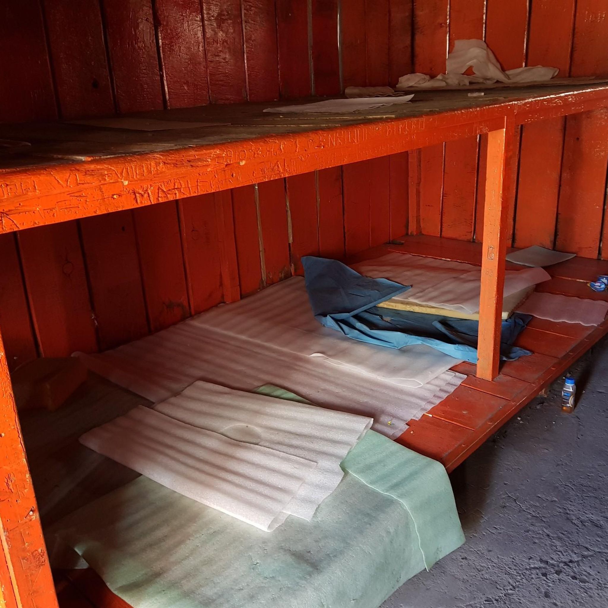
The Piedra Grande Hut is a large building that could sleep about 40-60 people. There is no charge to sleep there. Leaving your gear during your climb is a bit of a risk. The hut is in good condition but basic shelter is all you get. Any supplies (food, water, fuel) you need to plan and bring on your own. It is a busy hut and can get full quite easily on weekends.
5
0
Frequently Asked Questions
How challenging are the hiking trails in La Perla?
Hiking in La Perla is characterized by high-altitude mountain environments and challenging ascents, particularly around Pico de Orizaba. The region offers a range of difficulties: there is 1 easy route, 2 moderate routes, and 4 difficult routes available. Hikers should be prepared for varied terrain and significant elevation changes.
Are there any family-friendly or beginner hiking options in La Perla?
While many trails in La Perla are challenging, there are options suitable for beginners or families looking for a less strenuous experience. The region features 1 easy route and 2 moderate routes. For example, the Cerro del Borrego loop from Orizaba is a moderate 4.1-mile (6.6 km) trail that offers varied landscapes without the extreme elevation of the higher peaks.
What is the best time of year to go hiking in La Perla?
Given La Perla's high-altitude mountain environment, the best time for hiking is typically during the dry season, which generally runs from November to April. This period offers clearer skies and more stable weather conditions, making high-altitude ascents safer and more enjoyable. Always check local weather forecasts before heading out.
Are there any circular hiking routes in La Perla?
Yes, several routes in La Perla are designed as loops, allowing you to start and end at the same point. Notable examples include the challenging Pico de Orizaba Summit loop from Refugio Piedra Grande and the moderate Cerro del Borrego loop from Orizaba.
What kind of terrain can I expect on La Perla's hiking trails?
Hikers in La Perla can expect highly varied terrain. The region is known for its volcanic landscapes, rugged mountain paths, and areas like Sierra Negra. Trails often feature significant elevation changes, requiring good physical condition and appropriate gear.
What do other hikers say about the trails in La Perla?
The hiking routes in La Perla are highly rated by the komoot community, with an average score of 5.0 stars from more than 10 reviews. Hikers often praise the unique high-altitude mountain environments and the challenging nature of the ascents, particularly those leading to Pico de Orizaba.
Is public transport available to reach the trailheads in La Perla?
Access to trailheads in high-altitude and remote mountain regions like La Perla can be limited by public transport. While some larger towns might have bus services, reaching specific starting points for mountain trails often requires private transportation or local taxi services. It's advisable to research specific trailhead access in advance.
Are permits required for hiking in La Perla, especially for high-altitude climbs?
For high-altitude climbs, particularly on Mexico's highest peak, Pico de Orizaba, permits or registration with local authorities or mountain guides may be required. It is crucial to check the latest regulations with local park authorities or reputable guiding services before planning an ascent to ensure compliance and safety.
Are there any dog-friendly trails in La Perla?
While specific regulations for dogs on trails in La Perla are not detailed, it's generally recommended to keep dogs on a leash in natural areas to protect local wildlife and ensure their safety on rugged terrain. High-altitude environments can also pose challenges for pets, so consider your dog's fitness and the trail's difficulty.
Where can I find parking for hiking trails in La Perla?
Parking availability varies by trailhead. For popular starting points like those near refuges or access roads for Pico de Orizaba, designated parking areas may exist. However, in more remote sections, roadside parking might be the only option. Always park responsibly and ensure your vehicle does not obstruct access or traffic.
What kind of wildlife might I encounter on the trails in La Perla?
As a high-altitude mountain region, La Perla is home to diverse ecosystems. While specific wildlife sightings depend on the elevation and habitat, hikers might encounter various bird species, small mammals, and unique flora adapted to the volcanic environment. Always observe wildlife from a distance and avoid disturbing their natural habitat.
Are there any hidden gem hikes in La Perla that are less crowded?
Given that La Perla is known for its challenging high-altitude routes, many trails offer a sense of solitude, especially outside of peak climbing seasons. Exploring some of the less-frequented moderate routes or those further from the main Pico de Orizaba access points might lead to a more secluded experience. For example, the Refugio Fausto González Gomar loop from Sierra Negra offers a challenging but potentially less crowded high-altitude experience.
Most popular routes in La Perla

Get inspired with the komoot mobile app


Explore more
Browse the best Hikes in other regions.
