
The best road cycling routes in Atzacan
5.0
(11)
15
riders
4
rides
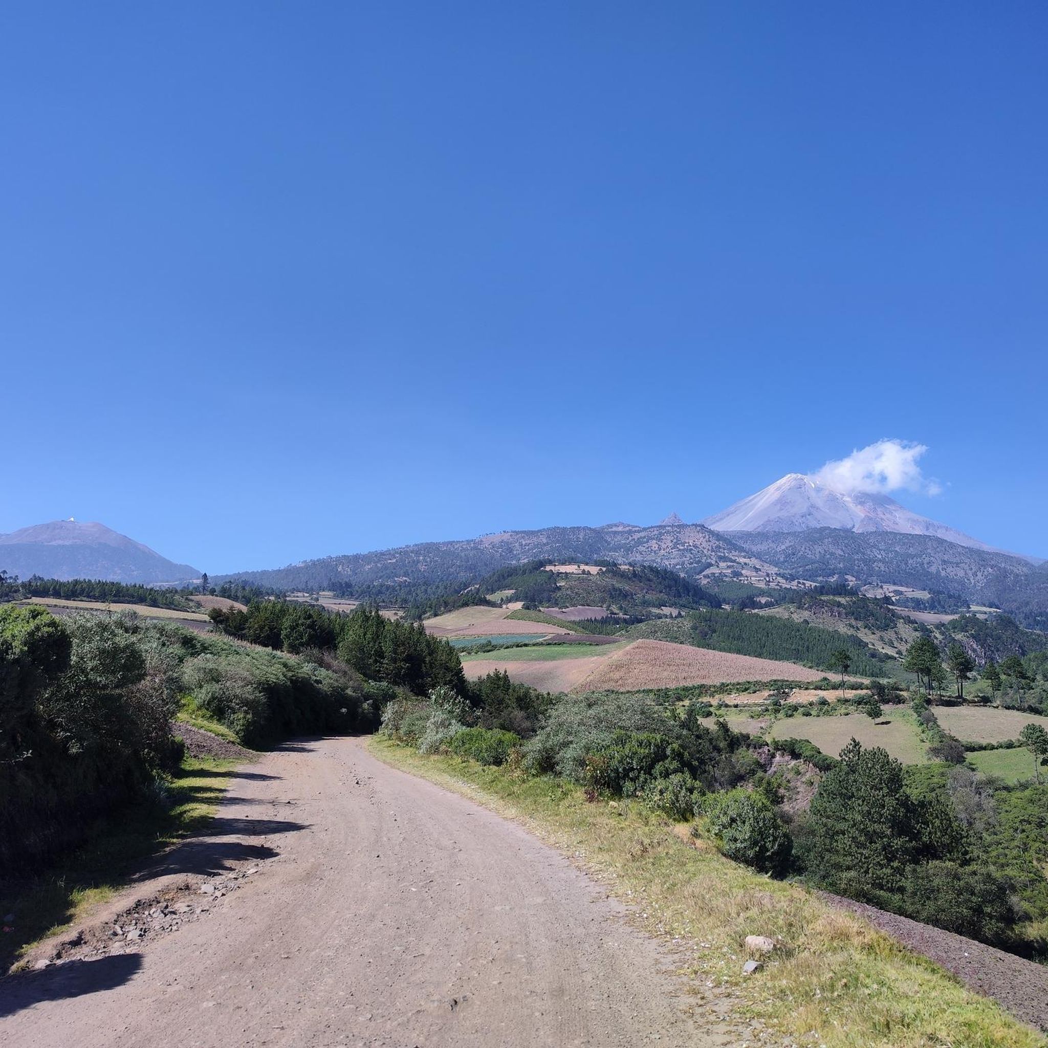
Road cycling routes in Atzacan, located in the central mountainous region of Veracruz, Mexico, offer diverse terrain for cyclists. The area is characterized by high mountains, green trails, and cultivated fields, providing varied landscapes. Its cool climate and often misty vistas contribute to a tranquil environment for outdoor activities. The region features natural springs and paved access roads, making it suitable for road cycling.
Best road cycling routes in Atzacan
- The most popular road cycling route is Pico de Orizaba…
Last updated: July 10, 2026
3
riders
68.6km
04:15
1,780m
1,780m
Hard road ride. Very good fitness required. Mostly well-paved surfaces and easy to ride.
2
riders
68.4km
04:19
1,830m
1,830m
Hard road ride. Very good fitness required. Mostly well-paved surfaces and easy to ride.

Sign up for free
5.0
(10)
5
riders
24.6km
01:03
130m
130m
Easy road ride. Great for any fitness level. Mostly well-paved surfaces and easy to ride.
3
riders
44.2km
02:00
470m
470m
Moderate road ride. Good fitness required. Mostly well-paved surfaces and easy to ride.
5.0
(1)
2
riders
40.0km
02:00
660m
660m
Moderate road ride. Good fitness required. Mostly well-paved surfaces and easy to ride.
Our route recommendations are based on thousands of hikes, rides, and runs completed by other people on komoot.
Start today with a free account
Your next adventure awaits.
Login or Signup
Popular around Atzacan



Tips from the Community

Frequently Asked Questions
What kind of terrain can I expect when road cycling in Atzacan?
Atzacan, nestled in the central mountainous region of Veracruz, offers a diverse and challenging landscape for road cyclists. You'll encounter high mountains, green trails, and cultivated fields, providing varied scenery and significant ascents and descents. The region's 'serrana' geography ensures a rewarding physical challenge with panoramic views.
Are there road cycling routes suitable for beginners in Atzacan?
Yes, Atzacan offers routes for various skill levels. For beginners, an easy option is the Pico de Orizaba loop from Orizaba, which is about 15.3 miles (24.6 km) long and typically takes just over an hour to complete, featuring manageable elevation changes.
What are some popular longer or more challenging road cycling routes in the area?
For those seeking a significant challenge, the Pico de Orizaba – Zimpoleo loop from Orizaba is a difficult route spanning 42.7 miles (68.6 km) with substantial ascents and panoramic mountain views. Another demanding option is the Pico de Orizaba loop from Orizaba, also difficult, covering 42.5 miles (68.4 km).
Are there any moderate road cycling routes available?
Yes, a popular moderate route is the Mercado El Parián loop from Fraccionamiento Virginia. This path is 27.4 miles (44.2 km) and winds through varied landscapes, offering a balanced mix of terrain and challenge.
What natural attractions or viewpoints can I expect to see along the routes?
Atzacan's mountainous setting provides abundant panoramic views. You can expect routes that wind through lush vegetation, offering glimpses of natural springs and potentially small waterfalls, as the name 'Atzacan' means 'place of water on the surface.' The region's cool climate often creates misty vistas, adding to the serene atmosphere.
What is the best time of year to go road cycling in Atzacan?
Given Atzacan's cool climate and often misty vistas, cycling is generally pleasant. While specific seasonal recommendations aren't provided, the consistent cool temperatures suggest that most times of the year would be suitable, though checking local weather forecasts for rain or heavy mist is always advisable.
Are there any circular road cycling routes in Atzacan?
Yes, many of the routes in Atzacan are designed as loops, allowing you to start and end in the same location. Examples include the Pico de Orizaba – Zimpoleo loop from Orizaba and the Mercado El Parián loop from Fraccionamiento Virginia.
What do other road cyclists say about the routes in Atzacan?
The road cycling routes in Atzacan are highly regarded by the komoot community, boasting an average score of 5.0 stars from over 10 reviews. Cyclists often praise the varied terrain, challenging ascents, and the tranquil, picturesque environment provided by the region's mountainous landscapes and natural features.
Is there parking available for cyclists near the routes?
While specific parking locations are not detailed, the main road from Orizaba to Atzacan (Carretera Orizaba-La Perla / Libramiento de Orizaba) is a paved access point into the mountainous zone. Cyclists often start their tours from nearby towns like Orizaba, where parking facilities are more readily available, and cycle into Atzacan.
Can I find places to eat or stay near the road cycling routes in Atzacan?
Atzacan offers a peaceful, rural atmosphere. While specific cafes or pubs directly on the routes are not highlighted, the nearby larger town of Orizaba, a common starting point for many routes, would provide more options for accommodation and dining. Exploring the rural communities like Huajuapan or Los Pinos might also offer authentic local experiences.
Are the road cycling routes in Atzacan suitable for families?
The region's mountainous terrain often presents significant challenges. However, the Pico de Orizaba loop from Orizaba is classified as an easy route, making it a more suitable option for families or those looking for a less strenuous ride. Always consider the fitness levels of all family members before embarking on a route.
What kind of clothing should I wear for road cycling in Atzacan?
Given the cool climate and often misty conditions in Atzacan's mountainous region, it's advisable to dress in layers. Moisture-wicking base layers, a cycling jersey, and a windproof or waterproof jacket are recommended. Gloves and appropriate eyewear will also enhance comfort and safety.
Most popular routes in Atzacan

Get inspired with the komoot mobile app


Explore more
Browse the best Road cycling routes in other regions.
