The best road cycling routes around Edingale
4.6
(138)
6,012
riders
301
rides
Road cycling around Edingale offers routes through the rural Mease Valley, characterized by productive farmland and river valleys. The landscape features gentle inclines and varied terrain, including sandy loam and heavier clay. The highest point in the civil parish is approximately 285 feet (87 meters), providing minor climbs. Routes in this area are predominantly on paved surfaces, catering to various fitness levels.
Best road cycling routes around Edingale
- The most popular road cycling route is Whittington Village – Canal Towpath…
Last updated: July 10, 2026
4.5
(2)
68
riders
24.1km
01:08
80m
80m
Moderate road ride. Great for any fitness level. Some segments of this route may be unpaved and difficult to ride.
53
riders
58.1km
02:38
290m
290m
Moderate road ride. Good fitness required. Mostly well-paved surfaces and easy to ride.

Sign up for free
22
riders
61.0km
02:32
320m
320m
Moderate road ride. Good fitness required. Mostly well-paved surfaces and easy to ride.
27
riders
53.4km
02:33
300m
300m
Moderate road ride. Good fitness required. Mostly well-paved surfaces and easy to ride.
5.0
(1)
28
riders
35.9km
01:41
180m
180m
Easy road ride. Great for any fitness level. Mostly well-paved surfaces and easy to ride.
Get access to more routes and recommendations from other explorers.
Sign up for free
Already have an account?
Our route recommendations are based on thousands of hikes, rides, and runs completed by other people on komoot.
Start today with a free account
Your next adventure awaits.
Login or Signup


Tips from the Community

Great place to stop, try the Laughing Duck Cafe for refreshments
0
0

Great little Cafe with friendly staff. Although on the main road, cyclists can take their bikes round the back of the cafe. Enter by the side of the barbers next door.
0
0

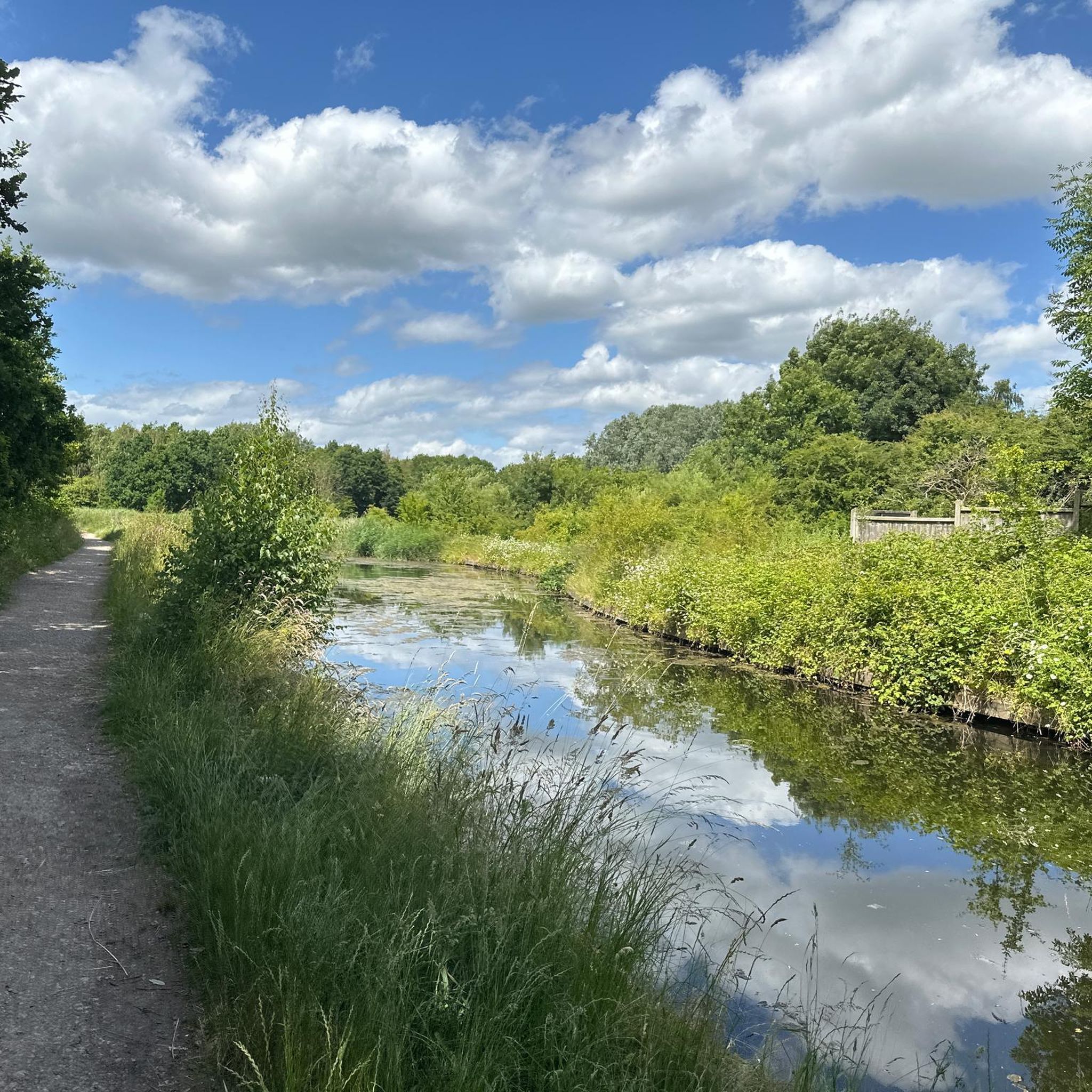
A towpath (known in German as a towpath or Leinpfad), which runs alongside the river or canal, was an essential part of the transport infrastructure in earlier times. Before ships could be propelled by motor power, horses walked along the bank, pulling the boat against the current. This activity was called "treideln" in German, and thus the "treidelpfad" got its name. Where these paths – running directly along the bank – have survived to this day, they no longer serve their original purpose, but are still popular: namely, with hikers and cyclists.
0
0

THIS PLAQUE AND BOUNDARY STONE. SPONSORED BY THE LICHFIELD BRANCH OF THE INLAND WATERWAYS ASSOCIATION AND UNVEILED AT THE BI-CENTENARY ON 22ND JULY 1990 BY ROGER HERRINGTON OF BRITISH WATERWAYS MARKS THE JOINING OF THE BIRMINGHAM AND FAZELEY AND COVENTRY CANALS AT THE WHITTINGTON BROOK IN JULY 1790
0
0
The Dog was originally a coaching inn and the building dates back about 300 years. Until quite recently the pub was a simple local; however, in 1992 the pub was extended and transformed into a cosy, attractively furnished hostelry with a popular restaurant, panelled bar and good selection of lagers and hand-pulled beers.
0
0


This stunning sandstone church, often called the most beautiful modern church in England, was built in the 1870s. It was commissioned by Emily Meynell Ingram, widow of Hugo, the first Viscount Halifax, as a tribute to him, and designed by the famous architect George Frederick Bodley.
0
0

A lovely place to go for a walk and cycle along the towpath. Just wear good shoes as it can be a bit muddy when it's wet.
1
0
Frequently Asked Questions
How many road cycling routes are available around Edingale?
There are over 300 road cycling routes available around Edingale, catering to various skill levels. This includes more than 100 easy routes, nearly 200 moderate routes, and a few more challenging options.
What kind of terrain can I expect on road cycling routes near Edingale?
The terrain around Edingale is characterized by the rural Mease Valley, featuring productive farmland and river valleys. You'll find mostly paved surfaces with gentle inclines. The landscape includes varied soil types, from sandy loam to heavier clay, and minor climbs, with the highest point in the civil parish being around 285 feet (87 meters).
Are there easy road cycling routes suitable for beginners or families in Edingale?
Yes, Edingale offers many easy road cycling routes. A great option is the Whittington Village – Canal Towpath Walk loop from Harlaston, which is 14.0 miles (22.6 km) and includes sections along a canal towpath, making it a pleasant ride for those seeking a less strenuous experience.
Can I find more challenging road cycling routes with significant elevation gain around Edingale?
While Edingale is known for its gentle inclines, some routes offer more elevation gain for those seeking a challenge. For example, the Skinny Kitten Cafe – Fradley Junction loop from Coton in the Elms is a moderate 37.9 miles (61.0 km) route with over 320 meters of ascent, providing a more demanding ride.
What natural features or scenic viewpoints can I enjoy while cycling in the Edingale area?
Road cycling routes in the Edingale area often traverse the picturesque Mease Valley and follow the River Mease, offering tranquil riverside views. You can also find routes that pass by water features like Minster Pool or offer scenic spots like Sunset View at Barton Marina, which is part of the Sunset View at Barton Marina – Trent and Mersey Canal Towpath loop from Alrewas.
Are there any historical or cultural landmarks accessible by road bike near Edingale?
Yes, several routes allow you to explore historical and cultural landmarks. You can cycle to the National Memorial Arboretum for a poignant stop, or explore routes that pass by sites like the Wall Roman Site (Letocetum). The historic city of Lichfield, with its impressive Cathedral, is also accessible via cycling routes from Edingale.
Where can I find parking for road cycling routes in Edingale?
While specific parking areas for cyclists in Edingale are not detailed, many routes start from nearby villages like Harlaston or Alrewas, where local parking options may be available. It's advisable to check local parking facilities in these starting points before your ride.
Are there any cafes or pubs along the road cycling routes in Edingale?
Edingale itself has a local pub, The Black Horse, which can serve as a convenient rest stop. Many routes also pass through charming villages or near towns where you can find cafes and other amenities. For instance, the Skinny Kitten Cafe – Fradley Junction loop suggests a cafe stop along its path.
What is the best time of year for road cycling around Edingale?
The best time for road cycling around Edingale is generally during the spring, summer, and early autumn months when the weather is milder and the rural landscapes are at their most vibrant. These seasons offer comfortable temperatures and less chance of adverse weather conditions, making for more enjoyable rides through the Mease Valley.
Are there circular road cycling routes available from Edingale?
Yes, many road cycling routes around Edingale are designed as loops, allowing you to start and finish in the same location. Examples include the Whittington Village – Canal Towpath Walk loop from Harlaston and the Sunset View at Barton Marina – Trent and Mersey Canal Towpath loop from Alrewas.
What do other cyclists say about road cycling in Edingale?
The road cycling routes around Edingale are highly rated by the komoot community, with an average score of 4.6 stars from over 100 reviews. Cyclists often praise the varied terrain, the picturesque rural scenery of the Mease Valley, and the well-maintained paved surfaces that make for enjoyable rides.
Are there specific resources for cycling in Staffordshire beyond komoot?
Yes, for broader information on cycling opportunities and networks within Staffordshire, you can consult resources like Visit Staffordshire's cycling section or the Staffordshire Cycle Map, which provide additional context on the region's cycling infrastructure.
Can I combine road cycling with visiting attractions like the National Memorial Arboretum?
Absolutely. The National Memorial Arboretum is located conveniently close to Edingale, and several cycling routes pass nearby or can be easily adapted to include a visit. This allows you to combine a scenic ride with a meaningful stop at this significant national landmark.
Most popular attractions around Edingale

Get inspired with the komoot mobile app


Explore more
Browse the best Road cycling routes in other regions.
