The best road cycling routes around Stape
4.4
(35)
1,527
riders
123
rides
Road cycling routes around Stape are situated within the North York Moors National Park, offering diverse terrain for cyclists. The region features challenging climbs, long winding roads, and rich country lanes. Elevation gains are common, providing varied experiences across well-paved and some potentially unpaved segments. The landscape is characterized by moorland, valleys, and forested areas.
Best road cycling routes around Stape
- The most popular road cycling route is Blakey Bank Summit – Hutton-le-Hole village loop from Wrelton, a 29.3…
Last updated: October 12, 2026
5.0
(4)
80
riders
47.4km
02:16
620m
620m
Moderate road ride. Good fitness required. Mostly well-paved surfaces and easy to ride.
30
riders
27.7km
01:30
450m
450m
Moderate road ride. Good fitness required. Some segments of this route may be unpaved and difficult to ride.

25
riders
24.7km
01:11
250m
250m
Easy road ride. Great for any fitness level. Mostly well-paved surfaces and easy to ride.
5.0
(1)
6
riders
22.5km
01:04
270m
270m
Easy road ride. Great for any fitness level. Mostly well-paved surfaces and easy to ride.
10
riders
Moderate road ride. Good fitness required. Mostly well-paved surfaces and easy to ride.
Get access to more routes and recommendations from other explorers.
Already have an account?
Our route recommendations are based on thousands of hikes, rides, and runs completed by other people on komoot.
Start today with a free account
Your next adventure awaits.
Tips from the Community

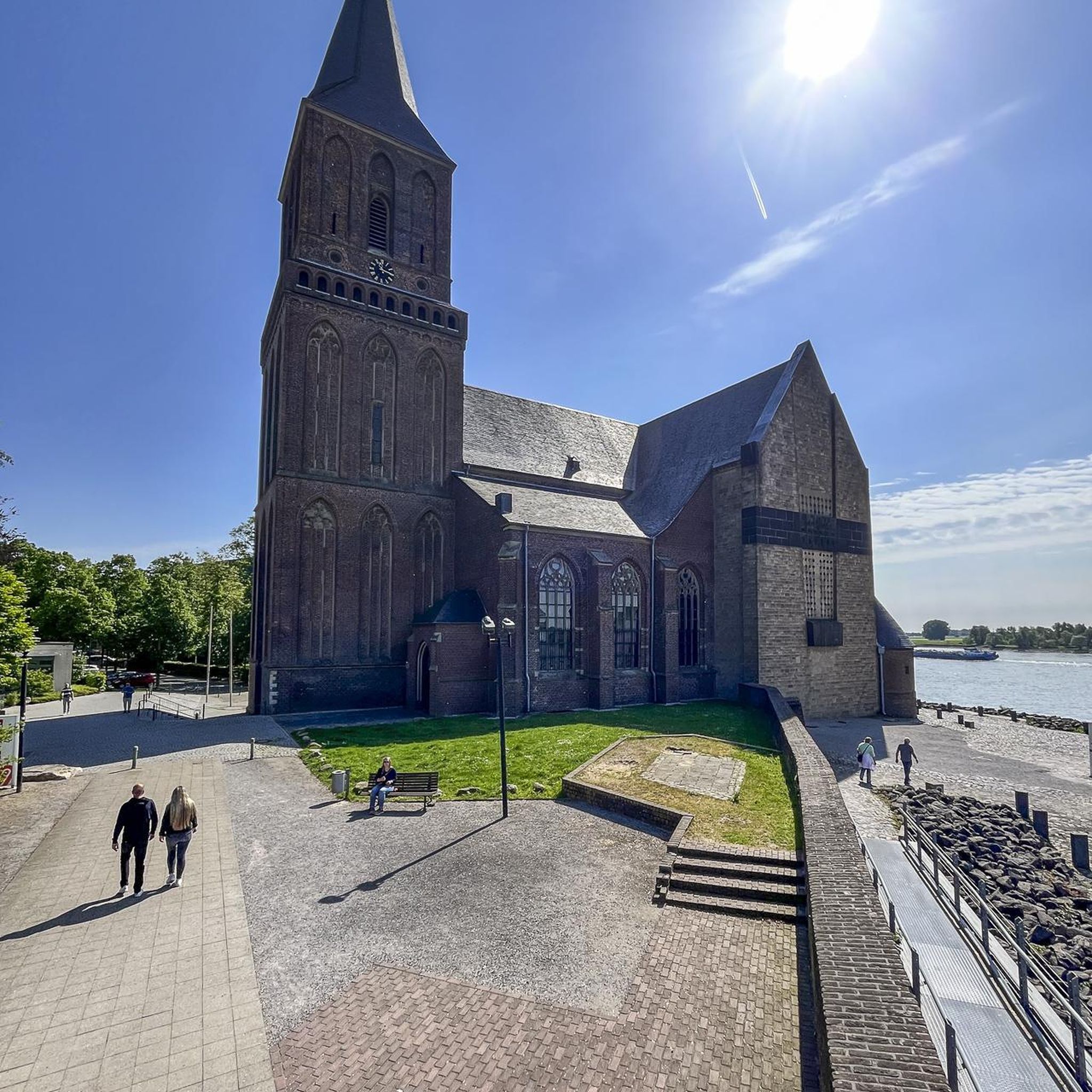
Each of the sacred monuments that you repeatedly encounter – despite all the differences in their external design – has a common concern: The cross that rises here not only wants to attract the viewer's gaze, but – and this is primarily – to make him think of God. Not only in theological books, but even in secular literature, God's voice is often represented, and this is even often the case in crime novels. For example, Ellis Peters set the series of novels about the Benedictine 'Brother Cadfael', which is set in 12th-century England, in the surroundings of a monastery. In "The Virgin in the Ice" it says: "And yet life, clinging to faith, the tenacious struggle with fate had to go on, the land had to be cultivated year in, year out. Plough and harrow must not rest, and one had to take care of sowing and harvesting the fruits of the earth as much as here, in the monastery and church, of sowing and harvesting souls." I wish the viewer here in front of the cross a good thought for his soul.
0
0

Apparently regarded by the Victorians as "ill-planned and untidy", but now quite possibly one the most picturesque Moors villages, Hutton-le-Hole is a very popular starting point for hikes. Fairly sizeable car park just on the eastern side of the village off the road to Lastingham. Lots more info available at https://en.wikipedia.org/wiki/Hutton-le-Hole, https://www.yorkshire.com/hutton-le-hole/?srsltid=AfmBOoqlQxZoMrKrxFTMhz3S7ZTijB3NKHNKMKO3WYru-vDGGmjNYk2Q, https://www.northyorkmoors.org.uk/places-to-go/hutton-le-hole-lastingham-appleton-le-moors
0
0

Graze on the Green cafe, excellent food
0
0

Steeeeeep!! Must ride in the Moors and worthy of its place on the UK 100 climbs list. Smooth road, no traffic.
0
0
Wayside crosses are one of several types of Christian cross erected during the medieval period, mostly from the 9th to 15th centuries AD. In addition to serving the function of reiterating and reinforcing the Christian faith amongst those who passed the cross and of reassuring the traveller, wayside crosses often fulfilled a role as waymarkers, especially in difficult and otherwise unmarked terrain. The crosses might be on regularly used routes linking ordinary settlements or on routes having a more specifically religious function, including those providing access to religious sites for parishioners and funeral processions, or marking long-distance routes frequented on pilgrimages. Over 350 wayside crosses are known nationally, concentrated in south west England throughout Cornwall and on Dartmoor where they form the commonest type of stone cross. A small group also occurs on the North York Moors. The wayside cross and boundary marker known as Young Ralph survive complete even though previously broken and repaired. The cross marks the highest point on the old road from Keldholme in the south of the moors to Castleton in the north. It also marks the boundary of the Wapentake of Pickering Lyth. It has been adopted as the symbol of the North York Moors National Park and has been a listed monument since 1938.
2
0

English Heritage site No cafe, or undercover seating area. Hot drinks available but not good if it's raining!
0
0

The Lion Inn on remote Blakey Ridge is a 16th Century family owned, Freehouse. Located at the highest point of the North York Moors National Park, it stands at an elevation of 1,325 feet offering breathtaking views over the valleys of Rosedale and Farndale. Steeped in history, open fires burn in the ancient stone fireplaces. The original low beamed ceilings and stone walls add to the friendly, timeless atmosphere of the Inn. Food served daily from 12 - 9pm.
0
0

Hutton Le Hole is a nice village to pass through, all the stone buildings are good to look at and they all seem to compliment each other. This is a nice tourist area which seems to present a calm atmosphere
0
0
Frequently Asked Questions
What kind of terrain can I expect on road cycling routes around Stape?
Road cycling routes around Stape are primarily within the North York Moors National Park, offering a diverse landscape. You'll encounter challenging climbs, long winding roads, and rich country lanes. While most surfaces are well-paved, some segments may be unpaved. The terrain features moorland, valleys, and forested areas, providing a 'loving adversary' with rewarding views after climbs.
Are there road cycling routes suitable for beginners or those looking for an easier ride?
Yes, Stape offers a good selection of easier road cycling routes. There are 33 easy routes available. A great option is the Hutton-le-Hole village – Low Cross Standing Stone loop from Cropton, which is 22.5 km (14.0 miles) long with around 273 meters of elevation gain, making it suitable for all fitness levels.
What are some challenging road cycling routes in the Stape area?
For those seeking a challenge, Stape has 28 difficult road cycling routes. The region is known for its significant elevation gains. A notable route is the Pry Hills Lane – Rosedale Chimney Bank Climb loop from Cropton, which is 27.7 km (17.2 miles) long and includes the demanding Rosedale Chimney Bank Climb, featuring over 449 meters of ascent.
Are there any circular road cycling routes around Stape?
Yes, many of the road cycling routes around Stape are designed as loops. For example, the popular Blakey Bank Summit – Hutton-le-Hole village loop from Wrelton is a 47.2 km (29.3 miles) circular route with over 620 meters of elevation gain. Another option is the St. Mary's Church, Lastingham – St Gregory's Church, Cropton loop from Cropton, a moderate 27.4 km (17.0 miles) loop.
What natural attractions can I see while road cycling near Stape?
The North York Moors National Park offers stunning natural beauty. While cycling, you might be near attractions like the Mallyan Spout Waterfall, the tallest waterfall in the North York Moors. The area also features dramatic gorges such as Hole of Horcum Bridleway and viewpoints like Rhumbard Snout, offering incredible vistas of the landscape.
Are there any historical landmarks or points of interest along the routes?
Yes, the region around Stape is rich in history. You can find landmarks such as Ana Cross, a historic monument, or the Simon Howe Bronze Age Cairn, offering a glimpse into ancient times. The Pickering Castle – Wooden Steps on Forest Trail loop from Newton also suggests proximity to historical sites like Pickering Castle.
What is the best time of year to go road cycling in Stape?
North Yorkshire is celebrated for its cycling opportunities throughout much of the year. While specific seasonal data isn't available, the region's long winding roads and challenging climbs are best enjoyed in milder weather to fully appreciate the stunning views. Spring, summer, and early autumn generally offer the most pleasant conditions for road cycling.
Where can I find amenities like cafes or pubs near the cycling routes?
The picturesque village of Rosedale Abbey, located near Stape, is a good place to find amenities. Other villages like Hutton-le-Hole, often featured in route names, also typically offer local cafes, pubs, or small shops where cyclists can refuel and rest.
Is there parking available for road cyclists in Stape?
While specific parking locations are not detailed for every route, villages and trailheads within the North York Moors National Park generally offer designated parking areas. It's advisable to check local information for specific starting points of your chosen route, such as Wrelton or Cropton, which are common starting points for routes in the area.
How many road cycling routes are available around Stape?
There are over 130 road cycling routes available around Stape, catering to various skill levels. This includes 33 easy, 71 moderate, and 28 difficult routes, ensuring a wide range of options for every cyclist.
What do other cyclists say about road cycling in Stape?
The road cycling routes around Stape are highly rated by the komoot community, with an average score of 4.4 stars from over 20 reviews. Cyclists often praise the challenging climbs, the beauty of the North York Moors National Park, and the variety of terrain that makes for engaging rides.
Are there any long-distance road cycling options from Stape?
While many routes are day trips, the region's extensive network allows for longer rides by combining segments or exploring further into the North York Moors. The Blakey Bank Summit – Hutton-le-Hole village loop from Wrelton, at 47.2 km (29.3 miles), is one of the longer single routes, offering a substantial ride with significant elevation.
Most popular attractions around Stape

Get inspired with the komoot mobile app


Explore more
Browse the best Road cycling routes in other regions.
