The best walks and hikes around Tholthorpe
4.3
(107)
648
hikers
47
hikes
Hiking around Tholthorpe offers a network of trails primarily characterized by gentle terrain, river valleys, and open countryside. The region features routes along the River Ure, passing through historic villages and agricultural landscapes. Elevation gains are generally low, making many trails accessible for various fitness levels. The area provides opportunities to explore rural settings and local points of interest.
Best hiking trails around Tholthorpe
- The most popular hiking route is The River Ure & Aldborough loop from Boroughbridge, a 3.7 miles (5.9 km) trail that takes 1 hour 31 minutes to complete. This route follows the River Ure and explores the historic village of Aldborough.
- Another top favourite among local hikers is Boroughbridge High Street – River Ure Riverside Rest Area loop from Boroughbridge, a moderate 7.9 miles (12.8 km) path. This trail features riverside paths and views of the surrounding countryside.
- Local hikers also love the Hiking loop from Boroughbridge, a 2.6 miles (4.2 km) trail leading through open fields and village surroundings, often completed in about 1 hour 4 minutes.
- Hiking around Tholthorpe is defined by river paths, open fields, and gentle undulations. The network offers options for different ability levels, from easy strolls to moderate excursions.
- The routes in Tholthorpe are highly rated by the komoot community with an average score of 4.3 stars from over 80 reviews. More than 500 hikers have used komoot to explore Tholthorpe's varied terrain.
Last updated: June 25, 2026
4.6
(17)
138
hikers
5.89km
01:31
30m
30m
Embark on an easy hike along The River Ure & Aldborough loop from Boroughbridge, a gentle 3.7-mile (5.9 km) route with minimal elevation gain of just 98 feet (30 metres). This accessible path follows tranquil riverside trails and open fields, offering picturesque views of the River Ure. You can expect to complete this loop in about 1 hour and 31 minutes, making it ideal for a relaxed outing. Keep an eye out for the dramatic bend in the river known as Hall Arm, where a Roman jetty once stood.
This popular route is suitable for all skill levels, including families and dog owners, thanks to its largely flat terrain and well-maintained paths. The trail is generally accessible, making it a great choice for a leisurely walk in the countryside. There are no specific warnings or access restrictions mentioned, so you can plan your visit with ease.
What makes this trail particularly special is its rich historical context, earning it the nickname "The Roman Ramble." You will pass through the historic village of Aldborough, built on the site of Isurium Brigantium, a significant Roman town. Explore the Aldborough Roman Site with its museum and preserved mosaic floors, and learn about the Battle of Boroughbridge from 1322 as you walk. Along the river, you might even spot sand martins, kingfishers, or otters.
4.2
(6)
29
hikers
Moderate hike. Good fitness required. Easily-accessible paths. Suitable for all skill levels.

Sign up for free
5.0
(1)
9
hikers
Moderate hike. Good fitness required. Easily-accessible paths. Suitable for all skill levels.
4.3
(8)
51
hikers
Easy hike. Great for any fitness level. Easily-accessible paths. Suitable for all skill levels.
14
hikers
Easy hike. Great for any fitness level. Easily-accessible paths. Suitable for all skill levels.
Get access to more routes and recommendations from other explorers.
Sign up for free
Already have an account?
Our route recommendations are based on thousands of hikes, rides, and runs completed by other people on komoot.
Start today with a free account
Your next adventure awaits.
Login or Signup

Tips from the Community

This board marks the site of the medieval ford where Thomas of Lancaster attempted to break through the Royalist line with a mounted charge. It stands beside the modern road just before the footpath that leads down to the south bank of the Ure — exactly where the ford once lay.
0
0
Milby Lock is a historic working lock on the River Ure at Boroughbridge, forming the eastern end of the Milby Cut — an 18th‑century navigation channel engineered to bypass the old Boroughbridge mill weir. It remains fully operational today, is accessible by public footpath, and sits beside one of the interpretation boards for the 1322 Battle of Boroughbridge.
0
0
A bridge at Myton has existed since the early 12th century, though the medieval versions repeatedly collapsed or were destroyed. By 1354, the medieval bridge had collapsed again, and for centuries the crossing was unreliable. The current iron bridge was commissioned by Henry Miles Stapylton of Myton Hall and completed in 1868. This was also the site of the Battle of Myton (1319), sometimes called “The White Battle,” a disastrous defeat for an English militia force led largely by clergy, overwhelmed by experienced Scottish raiders on 20 September 1319. It was fought in the meadows beside the River Swale at Myton‑on‑Swale, and its outcome forced Edward II to abandon his siege of Berwick.
0
0

Forget cafe next door - here you get all you need from a quick cafe stop: fast service, hot coffee and tasty bakes
0
0

Aldborough is the site of the Roman town of Isurium Brigantum, and it is believed that the church lies on the site of a temple to Mercury. Two churches successively occupied the site before the present building was commenced, in the early 14th century. In 1318, the building was partly destroyed by raiders from Scotland, but it was repaired,[1] with a north chantry chapel added in 1333, and the north aisle dating from about 1360. The clerestory dates from the 15th century, the roof was restored in the 16th century, and the south aisle was rebuilt in 1827. The church was Grade I listed in 1966.
0
0

You can also get a different view of the reservoir if you approach along the footpath from east of Pond Head Farm .
1
0
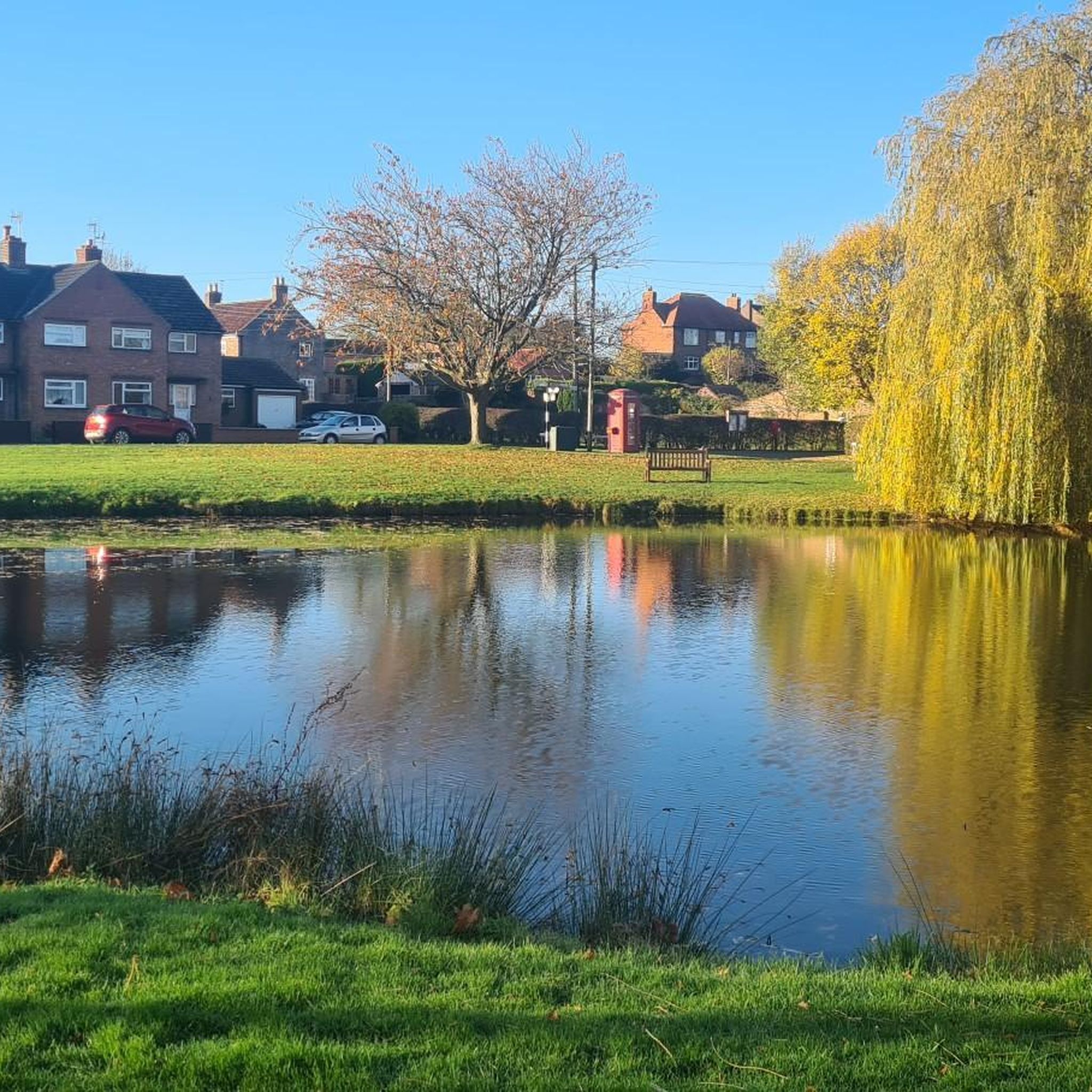
Very small sleepy hamlet dominated by the village green and mature trees, one of which is encircled by a wooden bench around the base of its trunk - ideal place for a quick pit stop.
1
0
Frequently Asked Questions
How many hiking trails are there around Tholthorpe?
There are over 50 hiking routes available around Tholthorpe, catering to various preferences. The majority, about 28, are considered easy, while 21 are moderate, and a few are more challenging.
Are there easy hiking trails suitable for beginners in Tholthorpe?
Yes, Tholthorpe offers many easy hiking trails perfect for beginners. For example, the River Ure & Aldborough loop from Boroughbridge is an easy 3.7-mile (5.9 km) path that follows the river and explores the historic village of Aldborough.
What is the typical length of hiking trails around Tholthorpe?
Hiking trails around Tholthorpe vary in length. You can find shorter walks like the Hiking loop from Boroughbridge, which is 2.6 miles (4.2 km), or longer excursions such as the View of Oulston Reservoir – Crayke Village and Castle loop from Outwood Academy Easingwold, spanning over 11 miles (18 km).
Are there family-friendly hiking options in Tholthorpe?
Many of the trails around Tholthorpe are suitable for families due to their gentle terrain and low elevation gains. Routes along the River Ure, such as the St Andrew's Church, Aldborough – The Ship Inn loop from Boroughbridge, offer pleasant, easy strolls through scenic countryside.
Can I bring my dog on hikes in Tholthorpe?
Yes, dogs are generally welcome on public footpaths and bridleways around Tholthorpe. However, please keep dogs on a lead, especially when passing through fields with livestock, and always clean up after your pet. Some areas might have specific restrictions, so always look out for local signage.
Are there circular walks available in Tholthorpe?
Most of the hiking routes around Tholthorpe are designed as circular loops, allowing you to start and end at the same point without retracing your steps. Examples include the River Ure & Aldborough loop and the Boroughbridge High Street – River Ure Riverside Rest Area loop.
What kind of scenery can I expect on hikes around Tholthorpe?
Hiking around Tholthorpe offers picturesque views of the River Ure, open agricultural fields, and charming rural landscapes. You'll encounter historic villages like Aldborough and enjoy the tranquil beauty of the North Yorkshire countryside.
What are some interesting landmarks or attractions to see while hiking near Tholthorpe?
While hiking, you can explore several local attractions. Consider visiting the historic The Devil's Arrows, a set of ancient standing stones, or the impressive Aldwark Bridge. The area also features charming settlements like Boroughbridge High Street.
Where can I find parking for hiking trails in Tholthorpe?
Parking for hiking trails in the Tholthorpe area is typically available in village car parks, designated lay-bys, or sometimes near local pubs and community halls. For routes starting in Boroughbridge, there are public car parks available. Always check local signage for any restrictions or fees.
What is the best time of year to go hiking in Tholthorpe?
The best time to hike in Tholthorpe is generally from spring through autumn (April to October). During these months, the weather is milder, the countryside is vibrant, and paths are less likely to be muddy. Winter walks are also possible, but be prepared for colder, potentially wet conditions.
Are there any pubs or places to eat near the hiking routes?
Yes, several villages along the hiking routes, such as Aldborough and Boroughbridge, offer traditional pubs and cafes where you can stop for refreshments. The Crayke Village and Castle area also has options for a post-hike meal or drink.
What do other hikers enjoy the most about hiking in Tholthorpe?
The hiking experience in Tholthorpe is highly rated by the komoot community, with an average score of 4.3 stars. Reviewers often praise the peaceful riverside paths, the gentle nature of the trails, and the opportunity to explore charming villages and historic sites.
Most popular attractions around Tholthorpe

Get inspired with the komoot mobile app


Explore more
Browse the best Hikes in other regions.
