The best running trails around Upper Allithwaite
4.6
(72)
6,300
runners
495
runs
Jogging around Upper Allithwaite offers diverse landscapes, from low hills and undulating countryside to woodlands and coastal plains. The region features varied running trails, including those around picturesque reservoirs and along lakeshores. Underlying Carboniferous Limestone outcrops form distinctive low hills, providing varied terrain for runners. This area provides a range of routes suitable for different fitness levels.
Best jogging routes around Upper Allithwaite
- The most popular jogging route is Hampsfell Hospice Viewpoint – North Shore of Coniston Water loop from…
Last updated: August 19, 2026
49
runners
Hard run. Very good fitness required. Mostly paved surfaces. Suitable for all skill levels.
5.0
(1)
40
runners
Moderate run. Good fitness required. Mostly accessible paths. Some sure footedness required.

Sign up for free
13
runners
Moderate run. Good fitness required. Mostly paved surfaces. Suitable for all skill levels.
15
runners
Moderate run. Good fitness required. Mostly paved surfaces. Suitable for all skill levels.
13
runners
9.47km
01:09
290m
290m
Moderate run. Good fitness required. Mostly paved surfaces. Suitable for all skill levels.
Get access to more routes and recommendations from other explorers.
Sign up for free
Already have an account?
Our route recommendations are based on thousands of hikes, rides, and runs completed by other people on komoot.
Start today with a free account
Your next adventure awaits.
Login or Signup

Tips from the Community


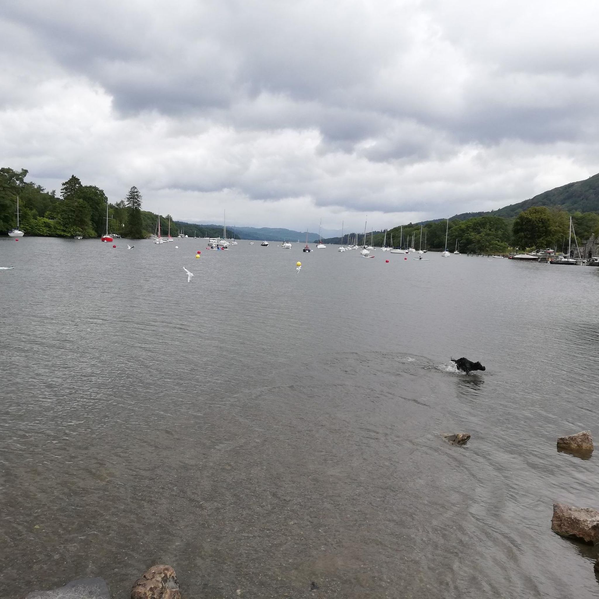
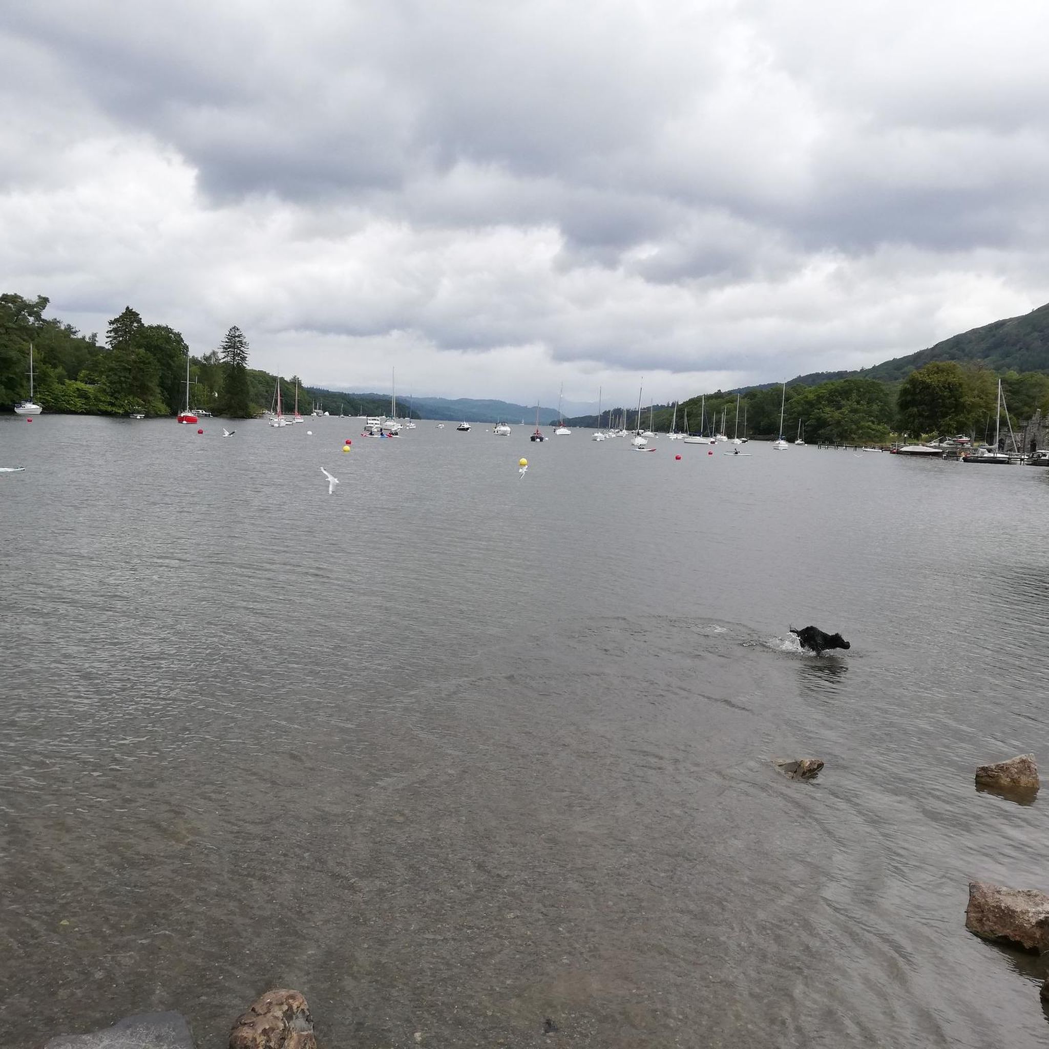
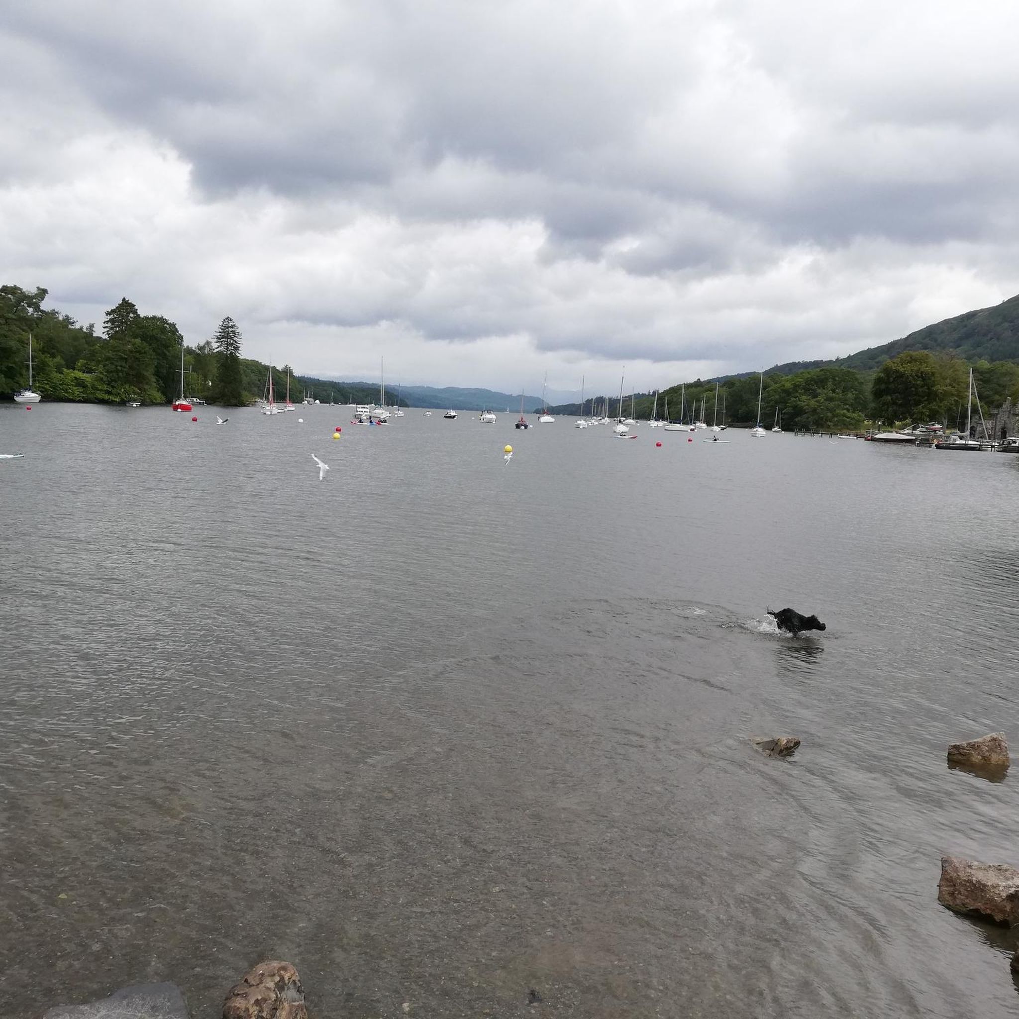
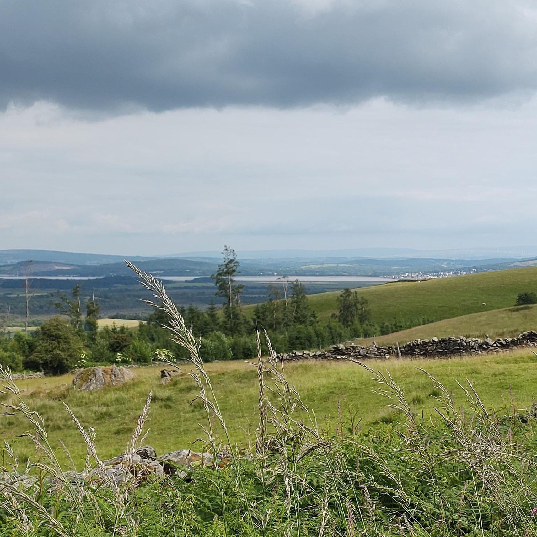
nice walk with views towards the lake
0
0

"Hampsfell Hospiz", a robust limestone tower monument, built in 1846 by the vicar of Cartmel. It offers shelter in bad weather and extensive views in better conditions. On the roof is a rough compass, allowing easy identification of nearby peaks and attractions. Hampsfell is the subject of a chapter in Wainwright's book "The Outlying Fells of Lakeland". Belongs to the Wainwright Outlying Fells https://en.wikipedia.org/wiki/List_of_Wainwrights
0
0
After similar trips, I often look for something easy online in the evening, just to relax for a while. That's how I stumbled upon https://spinmama-casino.com/cs-cz/ once and tried it out of curiosity. At first, I just watched how it all works, but gradually I started to notice the rhythm of the individual rounds. When you approach it calmly, it's quite a pleasant way to unwind after an active day.
1
0

After crossing the bay, the original tries to take you down the A590, a dual carriageway with cars doing 70 mph for 350 m to the roundabout. Not Safe or advisable!
0
0
Don’t go too fast or you may die
0
0

Good footwear required. Some of the best views of Lake Windermere to the North and South
0
0
Frequently Asked Questions
How many running routes are available in Upper Allithwaite?
Upper Allithwaite offers a wide selection of running routes, with over 490 trails available for you to explore. This includes a mix of easy, moderate, and difficult options to suit various fitness levels.
What kind of terrain can I expect on running trails in Upper Allithwaite?
The terrain in Upper Allithwaite is quite diverse. You'll find routes through low hills and undulating countryside, woodlands, and even along coastal plains. The area features underlying Carboniferous Limestone outcrops, creating varied surfaces. Some trails are mostly paved and accessible, while others are more challenging, requiring sure-footedness on natural paths.
Are there running routes suitable for beginners or those looking for an easy jog?
Yes, Upper Allithwaite has options for all skill levels. There are 44 easy running routes, perfect for beginners or those seeking a relaxed jog. These routes often feature gentler slopes and more accessible paths.
What are some of the more challenging running options in the area?
For experienced runners seeking a challenge, Upper Allithwaite offers 84 difficult routes. One notable challenging option is the Greasy Barrow Wood – Lane Park loop from Broughton East, which is 11.1 miles (17.8 km) long and features rewarding elevation gains through woodlands.
When is the best time of year for jogging in Upper Allithwaite?
Upper Allithwaite is beautiful year-round, but spring and summer are particularly vibrant. During these seasons, the mixed woodland and limestone grasslands, especially around areas like Arnside Knott, are alive with wildflowers and butterflies, enhancing the running experience. Always check local weather conditions before heading out.
Are there any circular running routes in Upper Allithwaite?
Yes, many of the running routes in Upper Allithwaite are circular, allowing you to start and finish in the same location. An example is the Simpson Ground Reservoir – Simpson Ground Reservoir loop from Staveley-in-Cartmel, which offers picturesque waterside scenery.
What scenic views or natural features can I see while running?
Upper Allithwaite boasts stunning natural beauty. Many routes offer panoramic views, such as those from Gummer's How over Windermere, the Coniston fells, and Morecambe Bay. You can also run along the North Shore of Coniston Water, around Tarn Hows, or through ancient woodlands and past picturesque reservoirs like Simpson Ground Reservoir. The landscape is also characterized by ancient hedgerows and limestone outcrops.
Are there any notable landmarks or attractions along the running routes?
Yes, several routes pass by or offer views of interesting landmarks. You might encounter prominent natural features like Gummer's How, known for its magnificent views, or Arnside Knott. Other attractions in the wider area include Sizergh Castle and Gardens, Cartmel Village, and various lakes such as Hawes Water and High Dam Lake.
What do other runners say about the trails in Upper Allithwaite?
The running routes in Upper Allithwaite are highly regarded by the komoot community, with an average rating of 4.5 stars from over 60 reviews. More than 5,200 runners have used komoot to explore the varied terrain, often praising the diverse landscapes, from quiet woodlands to rewarding hilly sections with extensive views.
Can I bring my dog on the running trails in Upper Allithwaite?
Many trails in Upper Allithwaite are dog-friendly, allowing you to enjoy a run with your canine companion. However, it's always advisable to keep dogs on a lead, especially when passing through farmland with livestock or nature reserves to protect local wildlife. Please check specific route details for any restrictions.
Are there family-friendly running routes in Upper Allithwaite?
Yes, there are numerous routes suitable for families, particularly among the 44 easy trails available. These often feature gentler gradients and more accessible paths, making them enjoyable for all ages. Look for routes that avoid significant elevation gains or very rugged terrain.
Is public transport available to access running routes in Upper Allithwaite?
While some routes might be accessible via local bus services, public transport options can be limited in rural areas like Upper Allithwaite. It's recommended to check local bus schedules and routes in advance if you plan to rely on public transport to reach specific trailheads.
Are there any running routes that pass by a pub or cafe?
While specific route data for pubs and cafes isn't always available, the region around Upper Allithwaite, including nearby villages like Cartmel, offers various establishments. Many runners plan their routes to finish near a local pub or cafe for refreshments. You might find options in or around settlements close to the trailheads.
Most popular routes around Upper Allithwaite
Most popular attractions around Upper Allithwaite

Get inspired with the komoot mobile app


Explore more
Browse the best Running Trails & Routes in other regions.
