The best cycling routes around Springboig And Barlanark
4.3
(750)
10,237
riders
478
rides
Touring cycling routes around Springboig And Barlanark are integrated into extensive natural parklands, offering diverse landscapes for cyclists. The area is characterized by its connection to the Seven Lochs Wetland Park, featuring lochs, nature reserves, and woodland trails. Developing cycle infrastructure, such as sections of the East City Way, enhances connectivity and accessibility for touring cyclists. The terrain includes well-surfaced lochside paths, some road sections, and urban green spaces.
Best touring cycling routes around Springboig And Barlanark
- The most popular…
Last updated: July 5, 2026
5.0
(5)
38
riders
28.5km
01:46
210m
210m
Moderate bike ride. Good fitness required. Mostly paved surfaces. Suitable for all skill levels.
5.0
(2)
22
riders
21.4km
01:20
150m
150m
Easy bike ride. Great for any fitness level. Mostly paved surfaces. Suitable for all skill levels.

Sign up for free
5.0
(1)
16
riders
30.6km
02:15
200m
200m
Moderate bike ride. Good fitness required. Mostly paved surfaces. Suitable for all skill levels.
11
riders
29.1km
01:47
190m
190m
Moderate bike ride. Good fitness required. Mostly paved surfaces. Suitable for all skill levels.
5
riders
14.2km
00:52
70m
70m
Easy bike ride. Great for any fitness level. Mostly paved surfaces. Suitable for all skill levels.
Get access to more routes and recommendations from other explorers.
Sign up for free
Already have an account?
Our route recommendations are based on thousands of hikes, rides, and runs completed by other people on komoot.
Start today with a free account
Your next adventure awaits.
Login or Signup
Tips from the Community

Always great pictures, beautiful impressions, or amazing panoramic shots... A worthwhile ✅🚲—tour around the loch (lake)😅😅
0
0


The Orion Bridge in Cambuslang was built to connect Cambuslang to Tollcross. It was designed by Crouch and Hogg and features steel lattice trusses supported by masonry piers. It was initially linked to the nearby Clydebridge Steel Works. Though bypassed in the 1970s due to increasing traffic loads, it still serves local traffic today.
1
0

Is this possible to visit as in no security or huge fences etc I'm kind of new to this sort of thing so any help would be appreciated cheers
0
0


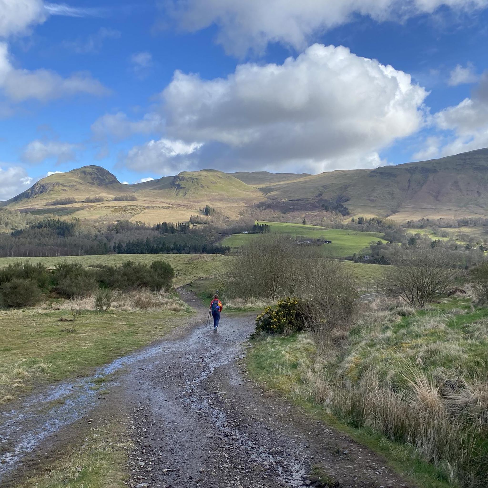
Climb the wee hill and shoot down the drop on the right🔝➡️⬇️. Repeat until fun stops🚵🔁. Then you can look at the view 😊🌳
0
0

Westburn Viaduct, also known as Carmyle Viaduct, is a disused railway bridge over the River Clyde between Carmyle in Glasgow (north side) and Westburn (Cambuslang) in South Lanarkshire (south side). It is constructed of a steel lattice frame with sandstone pillars and has three main spans over the water. The bridge was constructed in 1897 as part of the Glasgow Central Railway between Carmyle and Newton stations and linked to the Rutherglen and Coatbridge Railway. Fencing blocking off the bridge from the south bank (before the most recent effective fortifications were added) A further connection towards Kirkhill on the Lanarkshire and Ayrshire Railway was made in 1904. The passenger train services using the bridge ended in 1964, although freight services, mostly serving Clydebridge Steelworks and Clyde Iron Works, continued until 1983 when those facilities ceased operating. The bridge was officially closed and fenced-off, although for some years it was still accessible to pedestrians determined enough to overcome the barriers. After gang disorder involving youths from Westburn and Carmyle escalated into serious violence in 2012, the barriers were further reinforced to prevent the bridge being used by the youths to approach their rivals’ territory. Between 2013 and 2015 a project to add illumination to the bridge developed with input by pupils from local schools (Bannerman HS, Trinity HS and Cathkin HS) in an effort to build bonds between the communities on either side of the bridge. In early 2021, Sustrans Scotland announced a project to refurbish the bridge as a walking and cycling route across the river, inviting consultation from locals (with some residents on both sides objecting to the plans due to the recent history of violence associated with the route being accessible to rival youths).
1
0
Gartloch Hospital was a mental health facility located on the Gartloch Road near the village of Gartcosh in Glasgow, Scotland. It opened in 1896 and was officially closed in 1996. It was managed by NHS Greater Glasgow. In January 1889 the City of Glasgow acquired the Gartloch Estate for the purpose of building a hospital. A foundation stone for the hospital, which was designed by Thomson and Sandilands, was laid in November 1892. It accepted its first patients in 1896 and was officially opened as the Gartloch District Asylum in June 1897. A nurses' home was completed in June 1900 and a tuberculosis sanatorium opened in December 1902. Bed capacity reached a peak of 830 in 1904. It served as an emergency hospital using hutted accommodation during the Second World War and joined the National Health Service in 1948. Robin Farquharson was an inmate at the hospital at the time he joined the Scottish Union of Mental Patients in the early 1970s. After the introduction of Care in the Community in the early 1980s, the hospital went into a period of decline and closed in 1996. Many of the surrounding buildings were subsequently converted into homes or demolished to create Gartloch Village but the Category A listed administration building remains intact but derelict. source: https://en.wikipedia.org/wiki/Gartloch_Hospital
0
0
Frequently Asked Questions
How many touring cycling routes are available in Springboig and Barlanark?
There are over 490 touring cycling routes available around Springboig and Barlanark. These routes cater to various skill levels, with approximately 230 easy, 170 moderate, and 90 difficult options to explore.
What kind of terrain can I expect on touring cycling routes in Springboig and Barlanark?
The terrain for touring cycling in Springboig and Barlanark is quite varied. You'll find well-surfaced lochside paths, woodland trails, and sections through urban green spaces. The area is integrated into extensive natural parklands, particularly the Seven Lochs Wetland Park, which offers diverse landscapes. Some routes may include short stretches on roads.
Are there any family-friendly cycling routes in the area?
Yes, Springboig and Barlanark offer several family-friendly cycling options, especially within the Seven Lochs Wetland Park. The Orion Bridge, Cambuslang – View of the Weir loop from Shettleston is an easy 11.2-mile route that is often completed in just over an hour, making it suitable for families. The park's 50 kilometers of paths, including the 10-kilometer Seven Lochs Trail, are generally suitable for various ages and abilities.
Where can I find parking for cycling routes in Springboig and Barlanark?
For routes within the Seven Lochs Wetland Park, designated parking areas are available at key access points. For other routes, you can often find parking near the starting points of tours, such as the one for Bike loop from Easterhouse or Bike loop from Carntyne. It's always advisable to check specific route details on komoot for recommended parking locations.
What natural features or landmarks can I see along the cycling routes?
Cycling routes in Springboig and Barlanark offer views of diverse natural features and access to landmarks. Within the Seven Lochs Wetland Park, you can enjoy lochside views, ancient woodlands, peatlands, and wildflower meadows. Historic sites like Provan Hall are also accessible. Further afield, you might encounter highlights such as Strathclyde Loch, Hogganfield Loch, and Bishop Loch. The Forth and Clyde Canal Towpath also offers scenic stretches.
Are there any circular cycling routes available?
Yes, many of the touring cycling routes in Springboig and Barlanark are designed as loops, offering circular journeys. Examples include the popular Bike loop from Easterhouse, the Bike loop from Carntyne, and the Orion Bridge, Cambuslang – View of the Weir loop from Shettleston. The Seven Lochs Trail within the Wetland Park is also a prominent 10-kilometer signposted circular route.
What is the best time of year to go touring cycling in this region?
The best time to go touring cycling in Springboig and Barlanark is generally from spring through autumn. During winter and early spring, the lochs in the Seven Lochs Wetland Park attract waterbirds like whooper swans and goldeneye ducks, offering unique wildlife viewing opportunities, but paths might be wetter. The region's varied habitats are enjoyable across seasons, but warmer, drier months typically provide the most comfortable cycling conditions.
What do other touring cyclists enjoy most about cycling in Springboig and Barlanark?
The area is highly rated by the komoot community, with an average score of 4.4 stars from over 700 reviews. Cyclists often praise the diverse landscapes, from lochside paths to woodland trails, and the developing infrastructure like sections of the East City Way. The accessibility to natural parklands and urban green spaces, along with the variety of routes for different skill levels, are frequently highlighted.
Are there any longer or more challenging touring cycling routes?
For those seeking a longer and more challenging ride, the Glasgow Green – Bell's Bridge loop from Shettleston is a difficult 64.9-mile (104.4 km) trail with significant elevation gain, typically taking over 6 hours to complete. Another demanding option is the David Livingstone Bridge – Strathclyde Loch loop from Baillieston, a difficult 42.1-mile (67.8 km) route.
Can I reach the cycling trails using public transport?
Yes, the Springboig and Barlanark area, being part of Glasgow's East End, benefits from public transport links. You can often reach trailheads and access points for routes, including those within the Seven Lochs Wetland Park, via local bus services or nearby train stations. It's recommended to check local transport schedules for the most convenient access to your chosen starting point.
Are there cafes or pubs near the cycling routes for a break?
Yes, as you cycle through Springboig and Barlanark and the wider East End of Glasgow, you'll find various options for refreshment. There are cafes and pubs in the urban areas and near parks like Tollcross Park, which can be accessed via local cycling routes. For routes within the Seven Lochs Wetland Park, it's advisable to plan your stops in nearby communities or bring your own refreshments, as facilities might be less frequent directly on the trails.
Most popular routes around Springboig And Barlanark
Most popular attractions around Springboig And Barlanark

Get inspired with the komoot mobile app


Explore more
Browse the best Cycling routes in other regions.
