The best walks and hikes in Wrentham State Forest
4.2
(5)
72
hikers
43
hikes
If you've ever tried to plan hiking in Wrentham State Forest, you know how quickly the sheer number of trails can feel overwhelming. It’s tough to tell which routes are genuinely worth your time and effort, and which are just filler. That's where komoot comes in. Our community has explored, mapped, and reviewed these routes, so we’ve done the legwork to bring you a curated shortlist of the very best, saving you the guesswork.
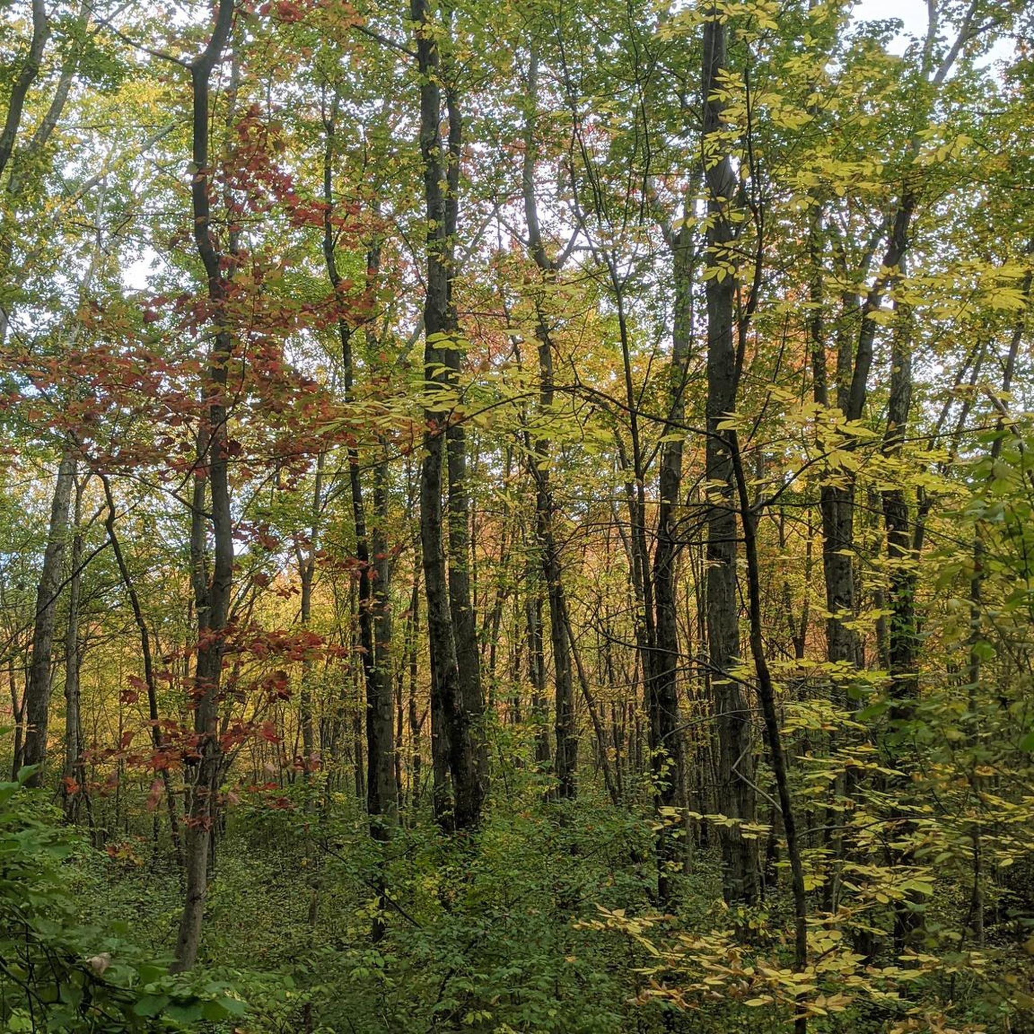
Wrentham State Forest is a true local gem, offering over 1,000 acres of minimally developed woodlands right in Norfolk County. Expect moderately hilly terrain, intriguing granite bedrock outcroppings, and peaceful ponds that make for a wonderfully immersive experience. The trails here are generally easy to moderate, making it accessible for most, and it truly shines in autumn with vibrant foliage.
For a fantastic introduction to the area, we'd start with the Pinnacle Trail, an easy 2.5-mile (4.0 km) route that gives you a real feel for the forest's character. If you're looking for something a bit different, the Knuckup Hill (Sweatt Hill) and Trout Pond trail, at 1.7 miles (2.7 km), offers a lovely mix of woodland and water features. With more than 70 visitors already using komoot to explore, you’re in good company. Dive in and discover your next favorite hike!
Last updated: May 10, 2026
2
hikers
4.00km
01:05
60m
40m
If you're looking for a straightforward and enjoyable walk, the Pinnacle Trail delivers. This easy 2.5-mile (4.0 km) hiking route offers a gentle journey through natural surroundings, perfect for a relaxed outing. With only 181 feet (55 metres) of elevation gain, the trail is suitable for all ages and fitness levels, providing a refreshing escape without demanding too much effort. You can expect a pleasant, undemanding path that allows you to soak in the atmosphere at your own pace.
Planning your visit to the Pinnacle Trail is simple, as its easy difficulty level means it's generally accessible throughout the day. The estimated time to complete the hike is just 1 hour and 4 minutes, making it an ideal choice for a quick outdoor break. While specific parking details aren't provided, trailheads for routes of this nature are usually easy to find. It's a great option for those wondering how long does it take to hike Pinnacle Trail without committing to a full day.
The Pinnacle Trail stands out as a family-friendly option, offering a low-impact way to enjoy the outdoors together. Its minimal elevation gain and short distance make it an excellent choice for beginners or those with young children. This trail is a testament to the fact that not every memorable hike needs to be a strenuous climb; sometimes, the best trails are the ones that offer simple, accessible beauty.
3.85km
01:02
40m
40m
If you're seeking a tranquil forest walk without a strenuous climb, the Red Fox Trail Loop is an excellent option. This easy 2.4-mile (3.9 km) hike, with a modest 136 feet (41 metres) of elevation gain, guides you through serene wooded areas, offering a refreshing escape into nature. Expect natural ground surfaces and a peaceful atmosphere, perfect for unwinding or a gentle trail run.
Planning your visit is straightforward for this accessible loop. As a popular spot for dog walking and pre- or post-work runs, you'll likely find convenient trailhead parking. The trail's gentle nature means it's enjoyable throughout the day, making it a flexible choice for a quick outdoor activity.
This loop is notable for its family-friendly and dog-friendly options, making it a versatile choice for many outdoor enthusiasts. Its multi-use character means you might share the path with trail runners or bird watchers, all enjoying the quiet beauty of the forest. It's a great way to experience the natural environment of Norfolk County, Massachusetts, without committing to a long or challenging excursion.

Sign up for free
2.73km
00:45
40m
40m
Explore the diverse landscapes of Knuckup Hill (Sweatt Hill) and Trout Pond on this easy 1.7-mile (2.7 km) hike, featuring just 135 feet (41 metres) of elevation gain and taking around 44 minutes. The trail winds through lush forests, along old fire roads, and around the scenic Trout Pond, where you'll find vibrant autumn colors and peaceful water views. As you climb Knuckup Hill, you'll be treated to sweeping vistas towards Wrentham Town Center, making this a rewarding short outing for nearly everyone.
This trail system in Wrentham, Massachusetts, is accessible year-round, offering options for hiking in warmer months and snowshoeing in winter. While no specific parking information is detailed, the trailhead is generally easy to reach. Autumn is a particularly beautiful time to visit, with the foliage around Trout Pond reaching its peak. No permits are needed to enjoy these popular trails.
Beyond its natural beauty, Knuckup Hill holds a fascinating history as a former community ski area. You can still spot remnants of the old J-Bar lift, lodge fireplaces, and even night skiing lighting towers along the route. Don't miss the "Spot the Trout" game, where ten painted wooden trout are hidden along the trails for hikers to find, adding a fun, family-friendly element to your adventure.
1
hikers
6.74km
01:47
70m
70m
The Warner Trail offers a delightful, easy hiking experience, guiding you through a varied New England landscape. You'll encounter hilly and occasionally rugged terrain, with metamorphic rock ledges and granite underfoot, alongside passages through oak-hickory forests. Keep an eye out for scenic views of brooks and reservoirs as you make your way along the path, which includes sections of old woods roads.
This 4.2-mile (6.7 km) route, with its 216 feet (66 metres) of elevation gain, typically takes around 1 hour and 47 minutes to complete. While specific parking information for this trailhead isn't detailed, the trail is well-marked with white blazes. It's a great option for beginner hiking Warner Trail, but always be prepared for potential deer ticks and poison ivy, especially when visiting during warmer seasons.
The Warner Trail is part of a much longer, historic route connecting Massachusetts to Rhode Island, envisioned by the Appalachian Mountain Club before WWII. It passes through significant conservation lands and state forests, offering a glimpse into the region's natural beauty. This segment provides a taste of the trail's diverse terrain and natural features, making it a popular choice for a shorter, accessible outing.
2.86km
00:45
20m
20m
The John Bowmar Memorial Trail offers a pleasant 1.8-mile (2.9 km) hike through varied terrain, taking about 44 minutes to complete with an easy difficulty rating and just 56 feet (17 metres) of elevation gain. You'll find yourself on a singletrack path, crossing Old Mill Brook and eventually reaching a ridgeline with views towards Turnpike Lake. Expect some gentle hills and occasional wet spots, but nothing too strenuous.
Planning your visit is straightforward, with trailhead access near the ball fields along Everett Skinner Road. This trail is a moderately popular spot, and it's completely dog-friendly, so feel free to bring your leashed companion along. If you're looking for a longer outing, you can easily extend your hike by doing the route as an out-and-back, totaling approximately 2.6 miles.
Beyond being a great standalone walk, the John Bowmar Memorial Trail serves as a convenient connector to other trails within the Plainville Conservation Land. Its varied terrain, from narrow paths to ridgeline views, makes it an engaging option for beginners or anyone seeking a quick, accessible nature escape in the area.
Get access to more routes and recommendations from other explorers.
Sign up for free
Already have an account?
Our route recommendations are based on thousands of hikes, rides, and runs completed by other people on komoot.
Start today with a free account
Your next adventure awaits.
Login or Signup



Tips from the Community

The Warner Trail stretches over 30 miles from Sharon, Massachusetts, to Diamond Hill State Park in Cumberland, Rhode Island, passing through Sharon, Foxboro, Wrentham, Plainville, and Cumberland. This particular stretch of trail passes through the Wrentham State Forest past the Pinnacle and Pinnacle Hill, a 375-foot hill with rocky open outcroppings. This is a great section of trail to hike as you explore the Wrentham State Forest.
0
0
From the top of Knuckup Hill you get nice views over Sweatt Fields where you can look out over the center of Wrentham. This hill was the community ski slope from about 1960 to 1980. You can see some of the old ski lift and old fireplaces around the hill along the trails.
0
0
Frequently Asked Questions
Are dogs allowed in Wrentham State Forest?
Yes, dogs are generally welcome in Wrentham State Forest, but they must be kept on a leash and under your control at all times. Please be sure to clean up after your pet to help keep the trails enjoyable for everyone.
Is there parking available at Wrentham State Forest?
Wrentham State Forest has informal parking areas, but they are not officially marked or maintained. Trailheads, such as the one for Pinnacle Hill near Madison Street, can be unmarked. It's advisable to arrive early, especially on weekends, to find a spot.
Are there any easy, family-friendly hikes in the forest?
Yes, the forest offers several easier trails suitable for a family outing. A good option is the Lind Farm loop from Mirror Lake Ave. It's a relatively short 2.4-mile (3.9 km) walk through the woodlands with minimal elevation change, making it accessible for most ages.
What is the terrain like for hiking in Wrentham State Forest?
The terrain is a mix of dirt roads and woodland paths that can be quite rocky and uneven in sections, with numerous granite and bedrock outcroppings. The landscape is moderately hilly, so while most trails are not exceptionally steep, proper hiking footwear is recommended for stability.
Can I see views of Boston from the trails?
Yes, on a clear day, you can get some impressive views from the summit of Pinnacle Hill. The vista can include the Boston skyline, the Blue Hills, and even Gillette Stadium. The Pinnacle Hill loop — Wrentham State Forest is the best route for reaching this viewpoint.
How many hiking trails are in Wrentham State Forest?
There are over 20 hiking routes to explore throughout Wrentham State Forest. The network consists of a mix of easy and moderate trails, offering plenty of options for different fitness levels and for return visits.
Are there any circular or loop hikes available?
The forest has several loop trails, which are great for exploring without having to backtrack. A pleasant, mostly flat option is the Lind Farm loop — Norfolk, a 3.9-mile (6.3 km) circuit that takes you through the quieter parts of the woods.
What do other hikers think of the trails in Wrentham State Forest?
The trails are rated with an average of 4.0 stars by the komoot community. Hikers often enjoy the natural, rustic feel of the forest and the interesting rock formations. However, some note that trails can be rocky and are shared with motorized vehicles, so it's important to stay aware of your surroundings.
Are there other activities besides hiking in the forest?
Yes, Wrentham State Forest is a multi-use area. The network of trails and dirt roads is also open to mountain biking, horseback riding, and, in designated areas, off-road motorcycling. During winter, the trails are suitable for cross-country skiing.
How do the trails here compare to F. Gilbert Hills State Forest?
Wrentham State Forest offers a more rustic and less developed experience with rocky, multi-use trails. F. Gilbert Hills State Forest, by contrast, has a more extensive and well-marked trail system primarily for hiking and mountain biking, like the moderate Explore the Tupelo Trail Loop and beyond – F. Gilbert Hills State Forest, and often feels more secluded from vehicle noise.
Are the trails well-marked?
Trail marking can be inconsistent throughout Wrentham State Forest. While some paths like the white-blazed Pinnacle Hill trail are clearer, many of the intersecting dirt roads and paths are unmarked. Using a GPS app like komoot is highly recommended to navigate the trail network confidently.
Is there a longer hiking trail in the area?
For those seeking a longer trek, Wrentham State Forest provides access to a section of the Warner Trail. This is a 30-mile hiking path that runs through Norfolk County. You can pick up a portion of it within the state forest to extend your hike.
Most popular routes in Wrentham State Forest

Get inspired with the komoot mobile app


Explore more
Browse the best Hikes in other regions.
