The best road cycling routes in Parco Comunelli
2.7
(8)
47
riders
10
rides
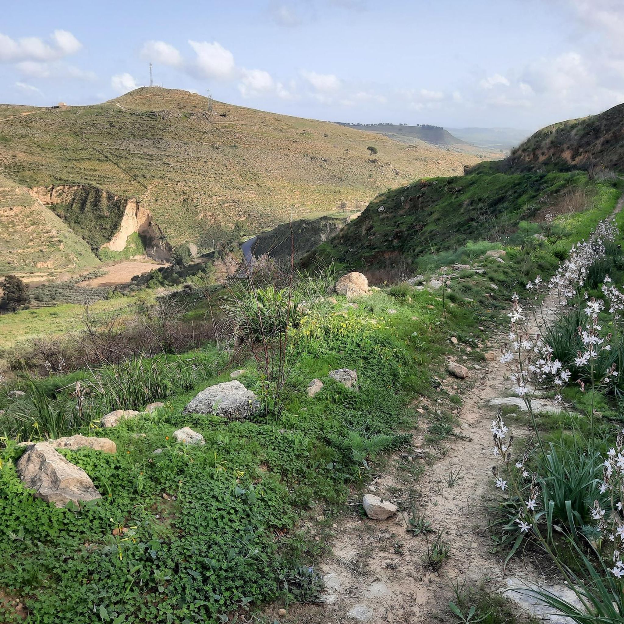
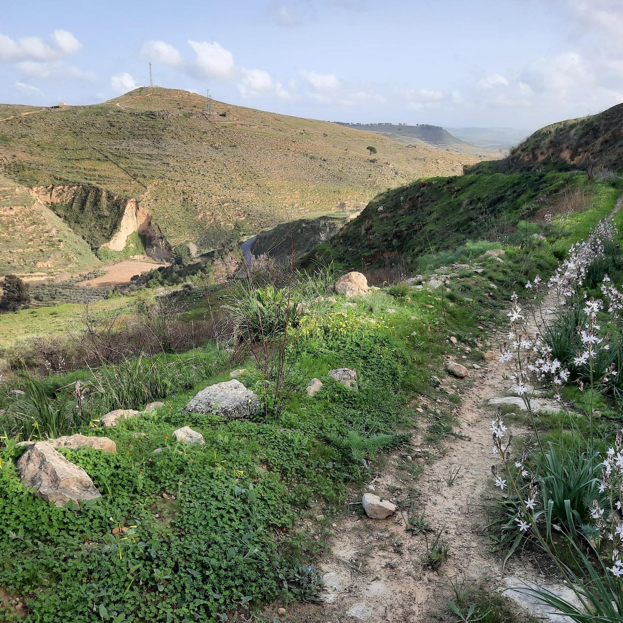
Road cycling routes in Parco Comunelli are situated in an area characterized by a wooded landscape, primarily featuring eucalyptus and Mediterranean pines. The region is located at an altitude of approximately 300 meters, offering views of the Comunelli Dam. While the park itself is an equipped area with paths, the road cycling routes listed often extend beyond its immediate vicinity, traversing the surrounding terrain. This allows for varied road cycling experiences in the broader area of Parco Comunelli.
Best road…
Last updated: July 4, 2026
4.3
(3)
10
riders
60.5km
02:51
760m
760m
Moderate road ride. Good fitness required. Mostly well-paved surfaces and easy to ride.
2.0
(2)
3
riders
49.2km
02:24
660m
660m
Moderate road ride. Good fitness required. Mostly well-paved surfaces and easy to ride.

Sign up for free
2
riders
51.8km
02:32
720m
720m
Moderate road ride. Good fitness required. Mostly well-paved surfaces and easy to ride.
11
riders
Moderate road ride. Great for any fitness level. Some segments of this route may be unpaved and difficult to ride.
1.7
(3)
2
riders
57.0km
02:48
760m
760m
Moderate road ride. Good fitness required. Mostly well-paved surfaces and easy to ride.
Get access to more routes and recommendations from other explorers.
Sign up for free
Already have an account?
Our route recommendations are based on thousands of hikes, rides, and runs completed by other people on komoot.
Start today with a free account
Your next adventure awaits.
Login or Signup
Popular around Parco Comunelli
Tips from the Community

This modern church that recalls the typical thrust of the Gothic style was built in the 50s where once stood the ancient medieval church dedicated to San Giacomo Maggiore. Today it is located in the center of the western neighborhoods of Gela.
0
0

Difficult crossing by bike...
0
1

Small hamlet rich in history with a characteristic church and a small Arab-Norman castle. Worth a visit!
0
0
Small lake formed by an old dam, it is located in the Parco Comunelli area which is an equipped area and worth a visit.
0
0

A place where you can relax, enjoy some shade and have a cool drink.
2
0
City on the sea overlooking the Gulf of Gela. The plain develops around it and some hills rise. Pass by Piazza Umberto I to admire the Mother Church (church of Santa Maria Assunta)
2
0

The mother church of Gela or church of Santa Maria Assunta, derived from the primitive church of Santa Maria de 'Platea, is an example of neoclassical that stands out in the historic center of the town on the gulf. The external façade appears interesting as well as the interior rich in works of art The mother church was built in 1760, in front of the main town square (Piazza Umberto I, formerly of the Duomo), replacing the fourteenth-century church of Santa Maria de 'Platea and was completed with the construction in 1844 of the neoclassical facade in sandstone and with the 'raising of the bell tower in 1837 on a project by Emanuele Di Bartolo. For its construction, the boulders of the old church were probably exploited, which in turn came from the temples and monuments of the ancient Greek city. The facade has two orders of Doric and Ionic columns and two groups of statues. There are the main entrance and two secondary side entrances, with inscribed tombstones on them. At the top of the facade is a large window. The imposing facade is preceded by a staircase on the square. The southern side has an entrance and several large windows in the shape of semicircles; on the northern side there is a side entrance, the parish garden, the bell tower and the old parish house. Once on Largo Matrice (south) there was a small parish cemetery.
1
0
Frequently Asked Questions
How many road cycling routes are available in Parco Comunelli?
There are 12 road cycling routes available in the broader Parco Comunelli area. These routes offer a variety of experiences, with 8 categorized as moderate and 4 as difficult.
What kind of terrain can I expect on road cycling routes in Parco Comunelli?
The road cycling routes in the Parco Comunelli area are characterized by rolling hills and varied topography. You'll encounter both moderate climbs and descents, with routes often extending beyond the immediate park vicinity into the surrounding Sicilian landscape, known for its hilly and mountainous inland areas.
Are there routes suitable for beginners or advanced road cyclists?
While there are no routes specifically classified as 'easy', the area offers a good selection of moderate and difficult routes. Experienced cyclists will find challenging options like the Lake Comunelli – Butera Historic Hilltop Town loop from Riesi, which features over 1000 meters of elevation gain. Moderate routes are suitable for those with some cycling experience.
What are some notable landmarks or natural features to see along the routes?
Many routes offer views of the Comunelli Dam and traverse areas around the historic hilltop town of Butera. The broader region of Sicily provides diverse scenery, from ancient olive and carob groves to vineyards. You might also encounter cultural sites, castles, and small villages, offering a rich tapestry of natural and historical points of interest.
When is the best time of year to go road cycling in Parco Comunelli?
The region of Sicily generally offers pleasant cycling conditions during spring and autumn, when temperatures are milder. Summer can be quite hot, especially in the inland areas, while winter might bring cooler, wetter weather. Spring often showcases the landscape in full bloom.
Are there any family-friendly road cycling options in the area?
The road cycling routes in Parco Comunelli are primarily moderate to difficult, featuring significant elevation changes. While the immediate Parco Comunelli is an equipped recreational area, the road cycling routes are generally not designed for young children or absolute beginners due to the terrain and distances involved. Families with older, experienced cycling teens might find some moderate routes suitable.
Where can I park my car when starting a road cycling tour?
Many routes start from towns like Butera or Manfria. You can typically find parking in these towns, which serve as common starting points for exploring the surrounding areas. Specific parking information for individual trailheads is often detailed on the respective route pages on komoot.
Are there any circular road cycling routes available?
Yes, many of the road cycling routes in the Parco Comunelli area are designed as loops. Examples include the Butera Historic Hilltop Town – Butera Castle loop from Butera and the Butera Castle – Lake Comunelli loop from Butera, allowing you to start and finish in the same location.
What do other road cyclists say about the routes in Parco Comunelli?
The road cycling routes in the Parco Comunelli area are highly rated by the komoot community, with an average score of 2.25 stars from over 9 reviews. Cyclists often appreciate the rolling hills, the views of the Comunelli Dam, and the routes that connect local towns, offering varied terrain for exploration.
Can I find cafes or places to stop for refreshments along the routes?
The routes often connect or pass through local towns such as Butera, Manfria, or Riesi. These towns provide opportunities to stop for refreshments, find cafes, or resupply during your ride. Planning your route with these towns in mind can help ensure you have access to amenities.
What is the typical elevation gain on road cycling routes here?
The road cycling routes in the Parco Comunelli area feature significant elevation gains, reflecting the hilly nature of the region. Moderate routes typically have elevation gains ranging from 300 to over 700 meters, while difficult routes can exceed 1000 meters, such as the Lake Comunelli – Butera Historic Hilltop Town loop from Riesi with 1024 meters of ascent.
How does the region of Parco Comunelli cater to road cyclists beyond the immediate park area?
While Parco Comunelli itself is an equipped recreational area, the surrounding region of Sicily, particularly around Butera, offers a compelling destination for road cyclists. The varied topography, including hilly and mountainous landscapes, provides challenging and rewarding routes with panoramic views. The area's network of roads connects scenic natural features with historic towns, making it ideal for exploration.
Most popular routes in Parco Comunelli

Get inspired with the komoot mobile app


Explore more
Browse the best Road cycling routes in other regions.
