The best MTB trails in Forêt D'Avaise
4.9
(8)
18
riders
6
rides
Mountain biking in Forêt D'Avaise offers routes through a natural area near Saint-Étienne, France, characterized by its history as a former mining site now reclaimed by nature. The forest is a Natura 2000 site, highlighting its rich biodiversity and diverse ecosystems. While the broader Saint-Étienne region is known for mountain biking, Forêt D'Avaise itself provides forested paths and varied terrain suitable for exploration. The area connects to the nearby Pilat massif, contributing to its ecological significance.
Best mountain bike trails…
Last updated: June 27, 2026
1
riders
16.4km
01:03
150m
150m
Easy mountain bike ride. Great for any fitness level. Suitable for all skill levels.
2
riders
24.5km
01:54
400m
400m
Moderate mountain bike ride. Good fitness required. Suitable for all skill levels.

Sign up for free
5
riders
43.5km
03:07
550m
560m
Moderate mountain bike ride. Good fitness required. Suitable for all skill levels.
5.0
(2)
4
riders
40.2km
03:48
990m
990m
Hard mountain bike ride. Very good fitness required. Suitable for all skill levels.
32.6km
03:07
800m
800m
Moderate mountain bike ride. Good fitness required. Suitable for all skill levels.
Our route recommendations are based on thousands of hikes, rides, and runs completed by other people on komoot.
Start today with a free account
Your next adventure awaits.
Login or Signup



Tips from the Community

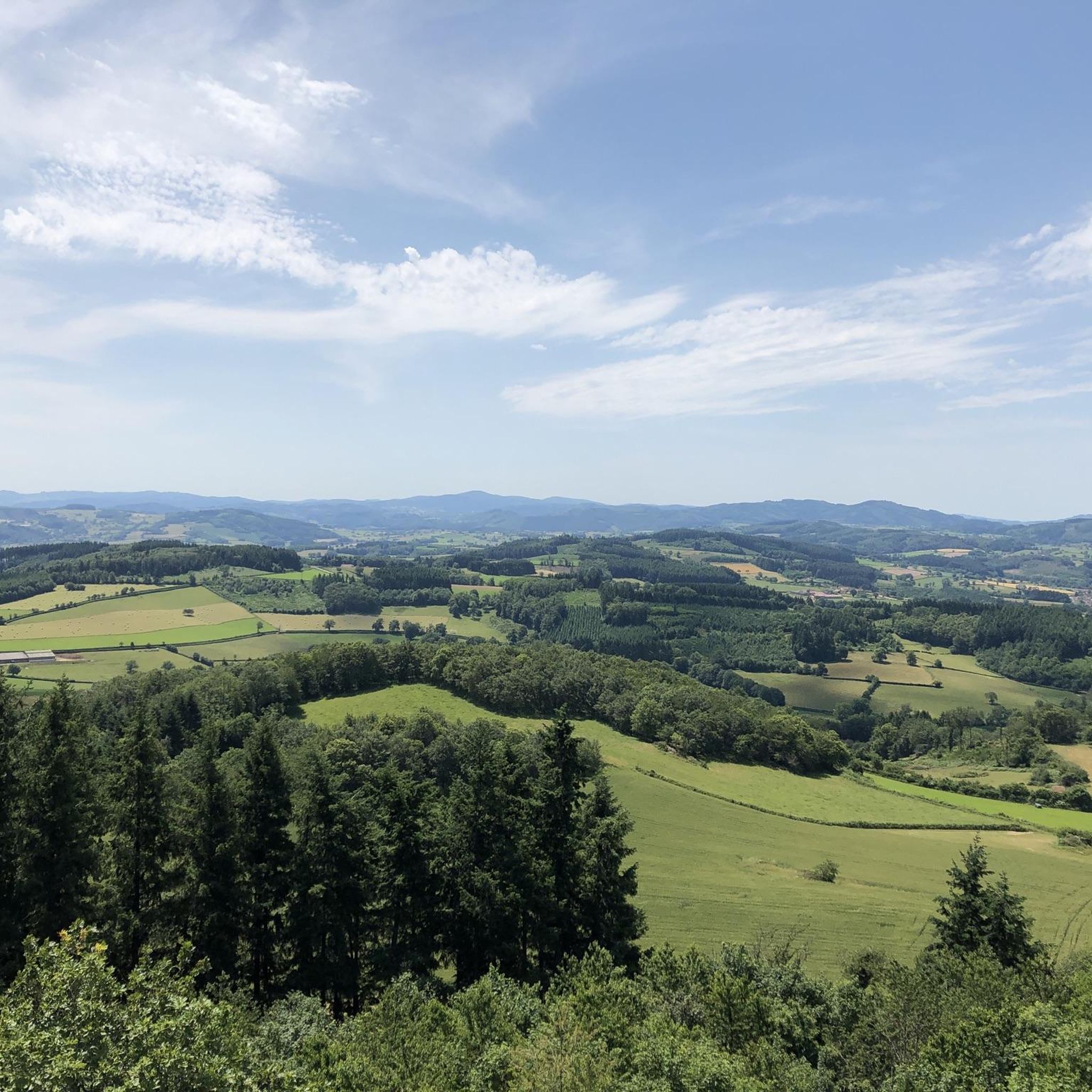
Mont Saint-Cyr is located in southern Burgundy (Département Saône-et-Loire) in the municipality of Montmelard and, at 771 meters, is the highest point in the Mâconnais mountains. From the summit, there is a wide panoramic view of the surrounding landscapes of Charolais, Brionnais, and Clunisois. In very clear weather, the view to the east even extends to Mont Blanc in the Alps. On the mountain are the historical remains of a 10th-century monastery that was destroyed during the Huguenot Wars. There is a picnic area in the forest, as well as orientation panels that are helpful in identifying the surrounding peaks and valleys.
0
0
Mont Saint-Cyr is located in southern Burgundy (Saône-et-Loire department) in the municipality of Montmelard and, at 771 meters, is the highest point of the Mâconnais mountains. From the summit, there is a wide panoramic view of the surrounding landscapes of Charolais, Brionnais, and Clunisois. In very clear weather, the view extends eastwards to Mont Blanc in the Alps. On the mountain are the historical remains of a 10th-century monastery, which was destroyed during the Huguenot Wars. There is a picnic area in the forest as well as orientation panels that are helpful in identifying the surrounding peaks and valleys.
0
0

Impressive views over southern Burgundy and Haut-Beaujolais
1
0

Do not miss
0
0
Beautiful walk in the forest and path
0
0

The Bois de Morphée is a small wood. It is a quiet road that avoids the main road.
1
0

A very steep climb from Montmelard, not much fun by bike. View is good, best very early or in the evening.
1
0

Mont Saint-Cyr, with its 771 m, is the highest point of the Mâconnais mountains. From its summit, you can enjoy a 360° view of the surroundings and even of the Alps when the weather allows it.
3
0
Frequently Asked Questions
How many mountain bike trails are available in Forêt D'Avaise?
There are several mountain bike trails in Forêt D'Avaise, with komoot featuring 6 distinct routes. These routes offer a variety of experiences, from easy loops to more challenging rides through the reclaimed mining landscapes and diverse ecosystems.
What is the best time of year to go mountain biking in Forêt D'Avaise?
Forêt D'Avaise is accessible year-round. However, spring and autumn generally offer the most pleasant conditions for mountain biking, with milder temperatures and vibrant natural scenery. During these seasons, the forest's rich biodiversity is often at its most visible. Summer can also be enjoyable, especially in the shaded forest paths, but be mindful of potential heat.
Are there any family-friendly mountain bike trails in Forêt D'Avaise?
Yes, Forêt D'Avaise offers options suitable for families. An easy route like the Étang de Batte Bourdeau – Bois de Roche loop from Mornay provides gentle gradients through natural forest settings, making it a good choice for a family outing. The forest also features picnic and play areas, enhancing its family appeal.
What kind of terrain and elevation can I expect on the mountain bike trails?
The terrain in Forêt D'Avaise is varied, reflecting its history as a reclaimed mining site and its connection to the Pilat massif. You'll find forested paths and diverse landscapes. Routes range from easy with minimal elevation gain, such as the Étang de Batte Bourdeau – Bois de Roche loop from Mornay (155m elevation gain), to more challenging trails like the Mount St. Cyr – Mount Saint-Cyr loop from Verosvres, which features nearly 1000m of ascent.
Are there any circular mountain bike routes in Forêt D'Avaise?
Yes, many of the mountain bike trails in Forêt D'Avaise are designed as circular routes, allowing you to start and end at the same point. Examples include the moderate Site of the Old Stones – Morpheus Woods loop from Saint-Bonnet-de-Joux, which navigates through varied forest terrain, and the longer Bois des Trembles – Château de Commune loop from Martigny-le-Comte.
What are the difficulty levels of mountain bike trails in Forêt D'Avaise?
The trails in Forêt D'Avaise cater to various skill levels. You can find easy routes, such as the Étang de Batte Bourdeau – Bois de Roche loop from Mornay, as well as several moderate options like the Montagne Saint-Cyr – Mount St. Cyr loop from Mont. There is also a difficult trail, the Mount St. Cyr – Mount Saint-Cyr loop from Verosvres, for experienced riders seeking a greater challenge.
What do other mountain bikers say about the trails in Forêt D'Avaise?
The mountain bike trails in Forêt D'Avaise are highly rated by the komoot community, with an average score of 4.9 stars from over 8 reviews. Mountain bikers often praise the diverse forested landscapes and the opportunity to explore an area rich in natural reclamation and ecological significance.
Are dogs allowed on the mountain bike trails in Forêt D'Avaise?
Forêt D'Avaise is a natural area that welcomes visitors. While specific regulations for dogs on mountain bike trails are not detailed, it is generally expected that dogs are kept on a leash to protect the local wildlife and ensure a pleasant experience for all users, especially given its status as a Natura 2000 site.
Are there any historical or natural landmarks to see while mountain biking?
Forêt D'Avaise itself is a significant natural and historical landmark. It was once an active mining site, and nature has since reclaimed the area, creating a unique landscape. It's also a Natura 2000 site, highlighting its rich biodiversity. Geologically, it's known for its exposed Stephanian layer. While there aren't specific 'attractions' listed along the routes, the forest itself offers a journey through natural reclamation and ecological importance.
Is there parking available for mountain bikers in Forêt D'Avaise?
As a publicly accessible natural area, Forêt D'Avaise generally offers parking options at various entry points. While specific parking lots for mountain bikers are not detailed, visitors typically find suitable places to park near trailheads or designated access points for the forest. It's advisable to check local signage upon arrival.
Can I reach Forêt D'Avaise by public transport for mountain biking?
Forêt D'Avaise is located near Saint-Étienne, France. While the forest is easily accessible by car, public transport options directly to specific trailheads within the forest might be limited. It's recommended to check local bus or train services to Saint-Étienne and then consider a short taxi ride or cycling the remaining distance to your desired starting point.
Most popular routes in Forêt D'Avaise

Get inspired with the komoot mobile app


Explore more
Browse the best MTB trails in other regions.
