The best mountain hikes in Kogelwald
4.8
(12)
182
hikers
9
hikes
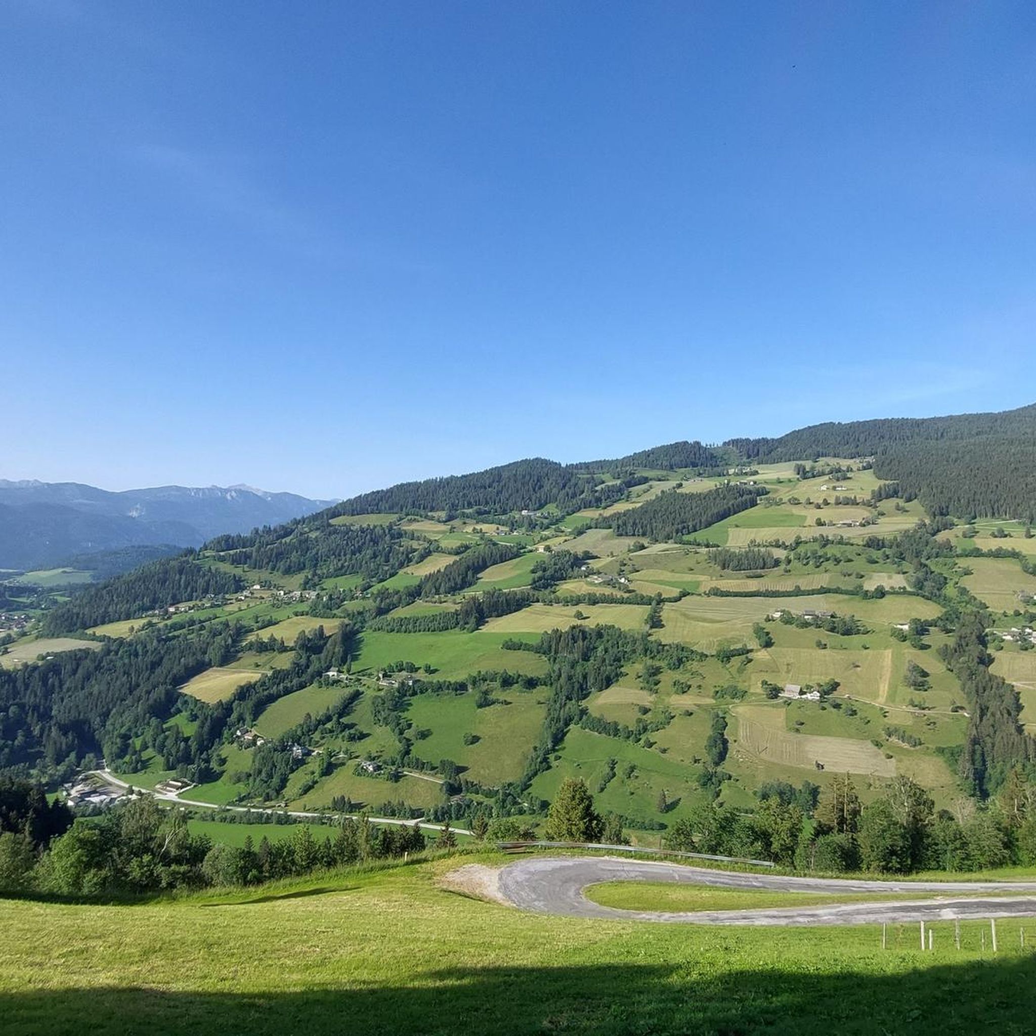
Mountaineering in Kogelwald, a region within Styria, Austria, offers diverse terrain for outdoor enthusiasts. The landscape is characterized by a mix of rolling hills, dense forests, and more rugged alpine features, typical of the broader Styrian Alps. While Kogelwald itself may be a localized area, it is part of a larger region known for its varied mountain ranges and extensive network of trails. The area provides opportunities for ascents with significant elevation gains, catering to those seeking challenging mountain experiences.
…Last updated: June 26, 2026
9
hikers
6.67km
04:32
780m
780m
Hard mountaineering route. Good fitness required. Sure-footedness, sturdy shoes and alpine experience required.
5.0
(5)
35
hikers
Moderate mountaineering route. Good fitness required. Mostly accessible paths. Sure-footedness required.

Sign up for free
29
hikers
12.6km
05:33
930m
930m
Hard mountaineering route. Very good fitness required. Sure-footedness, sturdy shoes and alpine experience required.
17
hikers
Hard mountaineering route. Good fitness required. Sure-footedness, sturdy shoes and alpine experience required.
9
hikers
Hard mountaineering route. Great for any fitness level. Sure-footedness, sturdy shoes and alpine experience required.
Get access to more routes and recommendations from other explorers.
Sign up for free
Already have an account?
Our route recommendations are based on thousands of hikes, rides, and runs completed by other people on komoot.
Start today with a free account
Your next adventure awaits.
Login or Signup
Tips from the Community

also a beautiful ski touring destination in winter
0
0
also a rewarding ski touring destination in winter due to the toboggan run with excellent refreshments
0
0

After a strenuous climb (from Donnersbachwald) you are rewarded with a sensational panoramic view.
2
0
A very charming mountain hut – good food, excellent service. The perfect place for a final refreshment before continuing the climb.
2
0

Trautenfels Castle is a castle in the municipality of Stainach-Pürgg in the Liezen district of Styria. It is situated on a rocky promontory at the foot of the Grimming mountain, at an elevation of 673 meters above sea level, overlooking the Enns River. The castle was first documented in 1260/62 as belonging to the Archbishopric of Salzburg. It was located at the intersection of the salt road and the route through the Enns Valley and served as a dam. (Wikipedia)
0
0
"St. Georg Pürgg" refers to the parish church of St. George in the village of Pürgg. The Romanesque three-aisled basilica was consecrated as early as 1130, is a listed historical monument, and is famous for its western portal with wrought-iron spirals, which are said to ward off evil spirits. The church, along with the nearby St. John's Chapel, is an important cultural attraction that draws many visitors each year.
0
0


The waterfall can be found about 200 meters further uphill...
0
0
Frequently Asked Questions
What kind of mountaineering routes can I find in Kogelwald?
Kogelwald, located within Styria, Austria, offers a diverse range of mountaineering experiences. You'll find a mix of routes traversing rolling hills, dense forests, and more rugged alpine features. The area is known for ascents with significant elevation gains, catering to those seeking challenging mountain experiences. The routes vary in difficulty, with options for both moderate and difficult trails, requiring good fitness and sure-footedness.
Are there any circular mountaineering routes available in Kogelwald?
Yes, Kogelwald features several excellent circular mountaineering routes. For instance, you could explore the challenging Mölbegg Summit Cross loop from Donnersbacher Klamm, which leads to a summit cross. Another popular option is the moderate Grimming Hut – Tressenstein Summit (1,196 m) loop from Schloss Trautenfels, offering great views. For a longer adventure, consider the Gstemmerscharte – Wild Descent Trail loop from Donnersbachwald, which takes you through varied alpine terrain.
How many mountaineering routes are there in Kogelwald?
There are 10 mountaineering routes documented in Kogelwald, providing a good selection for various skill levels. Eight of these routes are classified as difficult, while two are moderate, ensuring options for both seasoned mountaineers and those looking for a challenging day out.
What are the typical durations and distances for mountaineering routes in Kogelwald?
The routes in Kogelwald vary significantly in duration and distance. For example, the Mölbegg Summit Cross loop from Donnersbacher Klamm is about 6.7 km (4.1 miles) and takes around 4 hours 32 minutes. A longer option like the Gstemmerscharte – Wild Descent Trail loop from Donnersbachwald covers 12.8 km (7.9 miles) and typically requires about 5 hours 35 minutes. There are also shorter, challenging routes such as the Parish Church of St. George in Pürgg – Krenn Grocery loop from Ennstal zwischen Liezen und Niederstuttern, which is 2.5 km (1.6 miles) and takes about 1 hour 20 minutes.
What kind of views or landmarks can I expect to see on these routes?
Mountaineering routes in Kogelwald offer diverse scenery. Many trails lead to summit crosses, providing panoramic views of the surrounding Styrian landscape. For instance, the Grimming Hut – Tressenstein Summit (1,196 m) loop from Schloss Trautenfels offers views from Tressenstein Summit and passes by the Grimming Hut. The region's dense woodlands and alpine peaks ensure picturesque backdrops throughout your journey.
How well-regarded are the mountaineering routes in Kogelwald by other users?
The mountaineering routes in Kogelwald are highly rated by the komoot community, with an impressive average score of 4.9 stars from more than 10 reviews. Over 200 mountaineers have used komoot to explore Kogelwald's varied terrain, often praising the challenging ascents and the natural beauty of the Styrian landscape.
Are there any routes that pass by mountain huts or shelters?
Yes, some routes in Kogelwald offer the opportunity to pass by or visit mountain huts. The Grimming Hut – Tressenstein Summit (1,196 m) loop from Schloss Trautenfels, for example, includes the Grimming Hut along its path. Another route, the Tressenstein Summit (1,196 m) – Grimming Hut loop from Ennstal zwischen Liezen und Niederstuttern, also features the Grimming Hut, providing a potential stop for rest or refreshments.
What is the general character of the Kogelwald region for outdoor activities?
Kogelwald is part of Styria, often called 'the green heart of Austria,' which is renowned for its diverse outdoor opportunities. The region features a varied topography, from rolling hills to rugged alpine peaks. It's characterized by lush forests, river valleys, and extensive hiking and climbing routes. While Kogelwald itself is a localized area, it embodies the broader Styrian appeal for mountain sports, offering both moderate and challenging experiences.
What level of fitness and experience is recommended for mountaineering in Kogelwald?
Mountaineering in Kogelwald generally requires good fitness and sure-footedness. Many routes are classified as 'difficult' and involve significant elevation gains. While there are moderate options, even these can be demanding. It's advisable to have sturdy shoes and some alpine experience, especially for the more challenging trails, to safely enjoy the varied terrain.
Are there any shorter, yet still challenging, mountaineering options in Kogelwald?
Yes, for those seeking a challenging experience without committing to a full-day trek, there are shorter options. The Parish Church of St. George in Pürgg – Krenn Grocery loop from Ennstal zwischen Liezen und Niederstuttern is a difficult route that covers about 2.5 km (1.6 miles) and can be completed in approximately 1 hour 20 minutes, offering a concentrated mountaineering experience.
What makes Styria, the region Kogelwald is part of, a good destination for mountaineering?
Styria is an excellent destination for mountaineering due to its diverse mountain ranges, including parts of the Northern Styrian Alps, Hochschwab, and the Haller Mauern. It offers a wide array of trails, from accessible paths to demanding alpine routes with significant technical difficulty. The region's natural beauty, characterized by lush forests and picturesque valleys, provides stunning backdrops for outdoor adventures, making it a versatile choice for all levels of mountaineers.
Most popular routes in Kogelwald

Get inspired with the komoot mobile app


Explore more
Browse the best Mountain Hikes & Routes in other regions.
