Routes

Planner

Features

Updates

App

Login or Signup

Get the App

Login or Signup

Routes
Hikes
United States
Wisconsin
Waukesha County

Kettle Moraine State Forest - Lapham Peak Unit
Routes
Hikes
United States
Wisconsin
Waukesha County

Kettle Moraine State Forest - Lapham Peak Unit
The best walks and hikes in Kettle Moraine State Forest - Lapham Peak Unit
4.8

(19)

297

hikers

22

hikes

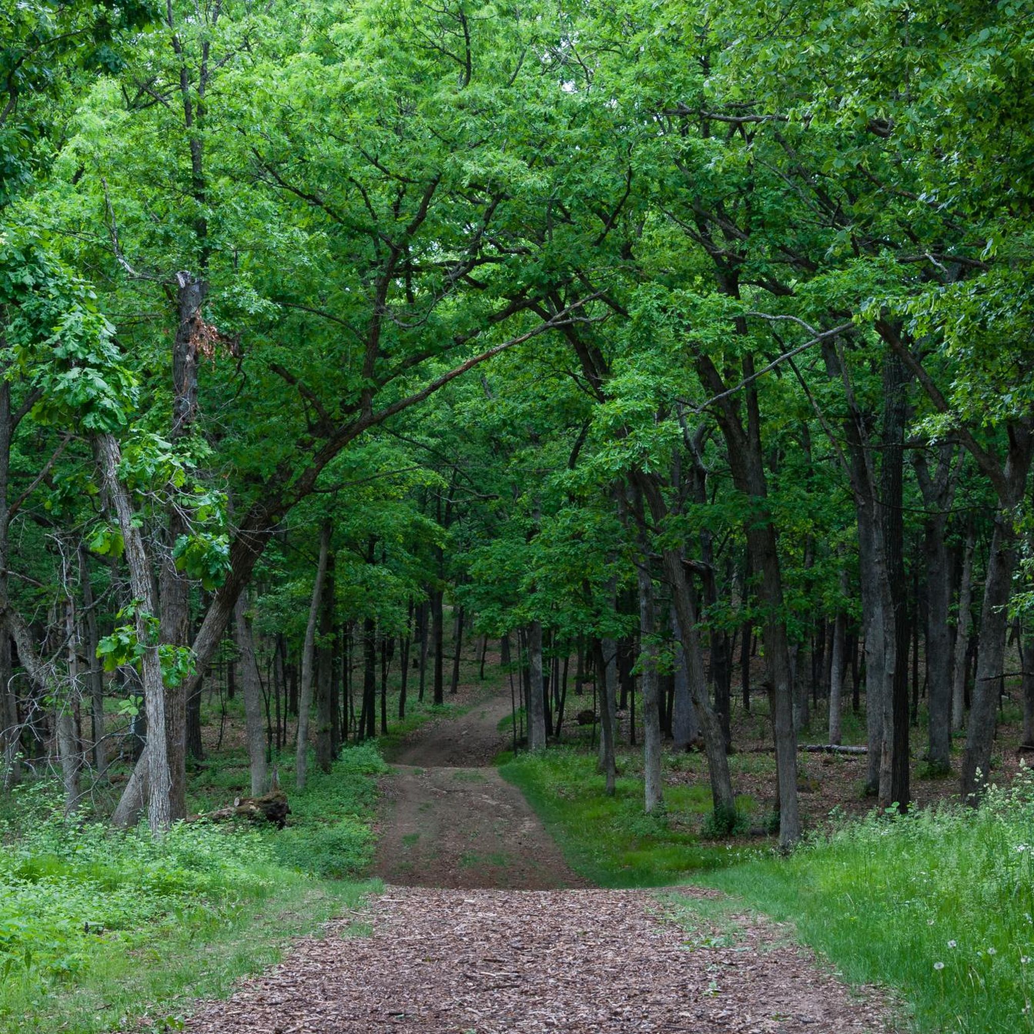
Hiking in Kettle Moraine State Forest - Lapham Peak Unit is characterized by a glaciated landscape featuring rolling hills, wooded ridges, and glacial kettles. Lapham Peak, at 1,233 feet, is the highest point in Waukesha County. The area encompasses over 1,000 acres of hilly terrain, offering varied topography for hikers. Diverse habitats, including dense woodlands, restored prairies, and wetlands, contribute to the natural environment.

Best hiking trails in Kettle Moraine State Forest - Lapham Peak Unit

  • The most popular hiking route is Lapham Peak Observation Tower loop from Kettle Moraine State Forest - Lapham Peak Unit, a 2.9 miles (4.7 km) trail that takes 1 hour 18 minutes to complete. This route features a climb to the 45-foot observation tower.
  • Another top favourite among local hikers is Ice Age Trail to Lapham Peak, an easy 2.7 miles (4.4 km) path. The trail follows a combination of wide and singletrack paths through the forest.
  • Local hikers also love the Kame Terrace Trail, a 2.3 miles (3.7 km) trail leading through wooded areas, often completed in about 59 minutes.
  • Hiking in Kettle Moraine State Forest - Lapham Peak Unit is defined by its glacial moraines, rolling hills, and dense woodlands. The trail system provides options for different ability levels, from short, easy loops to longer, more challenging hikes.
  • The routes in Kettle Moraine State Forest - Lapham Peak Unit are highly rated by the komoot community with an average score of 4.7 stars from more than 15 reviews. More than 250 hikers have used komoot to explore Kettle Moraine State Forest - Lapham Peak Unit's varied terrain.

Last updated: July 7, 2026

4.3

(3)

17

hikers

#1.

Kame Terrace Trail

3.66km

00:59

50m

30m

The Kame Terrace Trail offers a delightful journey through Wisconsin's unique glacial landscape, winding through diverse ecosystems of prairies, woodlands, and oak savannas. You'll encounter fascinating glacial landforms like kames and kettles, remnants of the last Ice Age, and can even spot a charming Butterfly Garden along the way. This easy 2.3-mile (3.7 km) hike, with a gentle 153 feet (47 metres) of elevation gain, is perfect for a quick escape into nature, typically taking just under an hour, around 58 minutes, to complete.

Planning your visit is straightforward, with parking available at the trailhead within the Kettle Moraine State Forest – Lapham Peak Unit. While the trail is generally accessible, it's worth noting that it's not stroller-friendly due to its unpaved, dirt terrain; a baby carrier is a better option for families with very young children. Spring through fall are ideal for hiking, but the trail also offers winter hiking conditions and transforms into a cross-country skiing route when snow falls.

What makes the Kame Terrace Trail truly notable is its direct connection to the Ice Age National Scenic Trail and its excellent showcase of glacial topography. It's a fantastic option for beginners or families looking for a rewarding outdoor experience without a strenuous climb. The area is rich in abundant bird life and other wildlife, making it a great spot for nature observation and a peaceful retreat from urban life.

Navigate with device

Send to Phone

Save

Easy

5.0

(1)

13

hikers

The Ice Age Trail to Lapham Peak offers a delightful escape into Wisconsin's glacial landscape, providing varied scenery and rewarding views for an easy 2.8-mile (4.4 km) hike. You'll traverse through oak savannas, dense hardwood forests, and restored prairies, with the path changing from singletrack to paved sections and boardwalks. The highlight is undoubtedly the climb to the Lapham Peak Observation Tower, where you can soak in expansive 360-degree vistas of the surrounding Kettle Moraine State Forest and beyond.

Planning your visit is straightforward, as the trail is well-equipped with amenities like restrooms and a 24-hour water station near the tower. While the 352 feet (107 metres) of elevation gain includes some athletic sections, the overall 1 hour and 15 minutes duration makes it a perfect choice for a quick, accessible outing. It's a popular spot, so consider an early start to enjoy the tranquility and secure parking.

This segment of the Ice Age Trail is a fantastic showcase of Wisconsin's unique glacial topography, featuring distinct kames and kettles left behind by the last continental glacier. Lapham Peak itself holds historical significance as the site of the first national weather forecast. It's a great option for families and dog owners, offering a blend of natural beauty and historical intrigue within the Kettle Moraine State Forest.

Easy
guide_signup
Let us show you the way with the komoot mobile app
With a free komoot account, you can easily find, customize, and navigate endless outdoor adventures.

Sign up for free

12

hikers

6.20km

01:37

40m

40m

The Prairie Path offers a delightful and easy hiking experience, guiding you along a former railway line with a comfortable crushed limestone surface. You'll wander through charming prairie restorations, where native grasses sway, and pass by peaceful woodlands, occasionally catching glimpses of the Fox River. It's a flat and accessible route, making it an ideal choice for a relaxed outing.

Planning your visit is straightforward, as the Prairie Path is known for its numerous access points along its extensive network. This multi-use trail is family-friendly and generally well-maintained, making it a good option for a casual walk any time of year, though spring and fall offer particularly scenic views. You'll find it's one of the more popular trails for those seeking an easy, accessible hike.

This trail holds a special place in history as the first successful "rail-to-trail" conversion in the United States, inspiring a national movement. Spanning approximately 61 miles (98 km) across several counties, it's a testament to dedicated volunteer efforts in preserving natural spaces and creating accessible recreational opportunities. It's a fantastic example of how historical infrastructure can be repurposed for public enjoyment.

Easy

The Lapham Peak Observation Tower loop is an easy 3.3-mile (5.2 km) hike that offers a delightful journey through Wisconsin's unique glacial landscape. You'll traverse rolling hills, wooded sections, and restored prairie, all while gaining 322 feet (98 metres) in elevation over approximately 1 hour and 27 minutes. The highlight is undoubtedly the 45-foot observation tower, providing expansive panoramic views of the Kettle Moraine and even the Milwaukee skyline on clear days.

This trail is accessible year-round, making it a versatile option for any season. Parking is available at the Kettle Moraine State Forest - Lapham Peak Unit, and the trail is well-suited for families and hikers of all abilities. Consider visiting during spring for wildflowers or autumn for vibrant foliage, though the tower views are always a treat.

Lapham Peak holds the distinction of being the highest natural point in Waukesha County, offering a unique perspective on the region's distinctive glacial topography. Segments of the Ice Age National Scenic Trail also pass through the park, providing opportunities for longer explorations if you wish to extend your adventure beyond this loop.

Easy

5.0

(1)

10

hikers

Easy hike. Great for any fitness level. Easily-accessible paths. Suitable for all skill levels.

Easy
Sign up for free to see 18 more hikes in Kettle Moraine State Forest - Lapham Peak Unit.

Get access to more routes and recommendations from other explorers.

Sign up for free

Already have an account?

Our route recommendations are based on thousands of hikes, rides, and runs completed by other people on komoot.

Start today with a free account

Your next adventure awaits.

Login or Signup

Popular around Kettle Moraine State Forest - Lapham Peak Unit

Road Cycling Routes in Kettle Moraine State Forest - Lapham Peak Unit

Running Trails in Kettle Moraine State Forest - Lapham Peak Unit

Cycling in Kettle Moraine State Forest - Lapham Peak Unit

Tips from the Community

Daniel Krueger
November 17, 2023, Lapham Peak Observation Tower

The Lapham Peak Observation Tower is located in the Kettle Moraine State Forest - Lapham Peak Unit and surrounded by multiple nice hiking trails. The 45-foot tower provides stunning views of the surrounding forest!

0

0

Ten thousand years ago, a glacier covered this part of Wisconsin. Kettle Moraine State Forest is a mark of its passage — a combination of terrain gouged out by the glacier's passage, and rocky moraine that the glacier dropped as it passed by and melted. There are lots of great hiking trails here, many of them lighted.

1

0

Amy
September 28, 2022, Lapham Peak

Lapham Peak formed over 10,000 years ago when a glacier covered vast swathes of Wisconsin. It's a perfect destination for hiking and cross-country skiing. Located in Kettle Moraine State Forest, it's open from dawn until dusk daily.

0

0

Lapham Peak is the highest point in Waukesha County. You bike up a moderately steep park road which goes almost all the way to the summit. On top is a wooden observation tower with great views of downtown Milwaukee, Holy Hill, and the Kettle Moraine.

0

0

Frequently Asked Questions

Are dogs allowed in the Kettle Moraine State Forest - Lapham Peak Unit?

Yes, dogs are welcome at Lapham Peak but they must be on a leash no longer than 8 feet at all times. Please be aware that pets are not permitted in the picnic areas, on the paved accessible trail, or inside any of the buildings, including the observation tower.

What is the terrain like on the hiking trails?

The trails at Lapham Peak navigate a distinctive glaciated landscape. You can expect to encounter rolling hills, wooded ridges, and other glacial features like moraines and kettles. This provides a varied hiking experience with some moderate climbs and beautiful scenery.

Are there any easy, family-friendly hikes available?

Absolutely. The park offers several easier trails suitable for families. For a very gentle walk, the 1.8-mile paved Pine Grove Path is an accessible interpretive trail through prairie and woods. For a slightly longer but still easy dirt path, consider the Timms Woods loop from Steeple Point, which is a relatively flat 4-mile (6.4 km) hike.

Is there an entrance fee for the park?

Yes, a Wisconsin State Park vehicle admission sticker is required for all vehicles entering the park. You can purchase daily or annual passes upon arrival or in advance. For the most current fee information, it's best to check the official Wisconsin DNR website.

How high is the observation tower and what can you see from it?

The wooden observation tower at Lapham Peak is 45 feet tall. From the top, you get panoramic views of the surrounding Lake Country landscape. On a clear day, it's possible to see all the way to the northern edge of Illinois.

How many hiking trails are in the Lapham Peak Unit?

There are over 25 miles of trails within the park, which are configured into more than 15 distinct hiking routes on Komoot. These range from short, easy loops to longer, more challenging treks through the forest.

Can I go hiking at night?

Yes, night hiking is possible. During the winter season, over 2.5 miles of trails are lit for evening cross-country skiing, and these can also be used for hiking. Always bring a headlamp or flashlight for unlit sections and be aware of your surroundings.

Are there any paved trails suitable for strollers or wheelchairs?

Yes, the park features the Pine Grove Path, a 1.8-mile paved trail that is accessible to people with disabilities, as well as visitors with strollers. This interpretive trail winds through prairie and wooded areas.

What do other hikers enjoy most about the Lapham Peak Unit?

The area is highly rated by the Komoot community. Hikers often praise the well-maintained trail system, the beautiful rolling hills of the glacial terrain, and the rewarding views from the observation tower. The mix of dense forest and open prairie is also a frequently mentioned highlight.

Can I combine different loops to create a longer hike?

Yes, the trail system at Lapham Peak is well-connected, making it easy to combine different colored loops to customize the length and difficulty of your hike. Trail maps are available at the park entrance to help you plan a route that suits your preferences.

Are there opportunities for backpacking or camping in the park?

The Lapham Peak Unit is designated for day-use activities only and does not offer backpacking or overnight camping facilities. However, other units within the Kettle Moraine State Forest do have campgrounds available.

Most popular routes in Kettle Moraine State Forest - Lapham Peak Unit

Easy hikes in Kettle Moraine State Forest - Lapham Peak Unit

Store rating

Get inspired with the komoot mobile app

With a free komoot account, you can easily find, customize, and navigate endless outdoor adventures.

or

Join komoot Now

Store rating

Explore more

Browse the best Hikes in other regions.

New BerlinChenequaBrookfieldNorth PrairieEagleButlerMenomonee FallsDelafieldNashotahPewaukeeVillage of WaukeshaElm GroveHartlandOkauchee LakeWalesWaukeshaOconomowocSummitPewaukeeOconomowoc LakeKettle Moraine State Forest-Mukwonago River UnitDousmanMuskegoSussexLannonMertonNorth LakeVillage of VernonBig BendMukwonago

Nearby adventure guides

Things to Do around Delafield

background

Get ready to conquer new peaks

Sign up for Free

Explore
RoutesRoute plannerFeaturesHikesMTB TrailsRoad cycling routesBikepackingSitemap
Download the app
Follow Us on Socials

© komoot GmbH

Privacy Policy

