The best MTB trails around Jodłownik
4.6
(81)
466
riders
62
rides
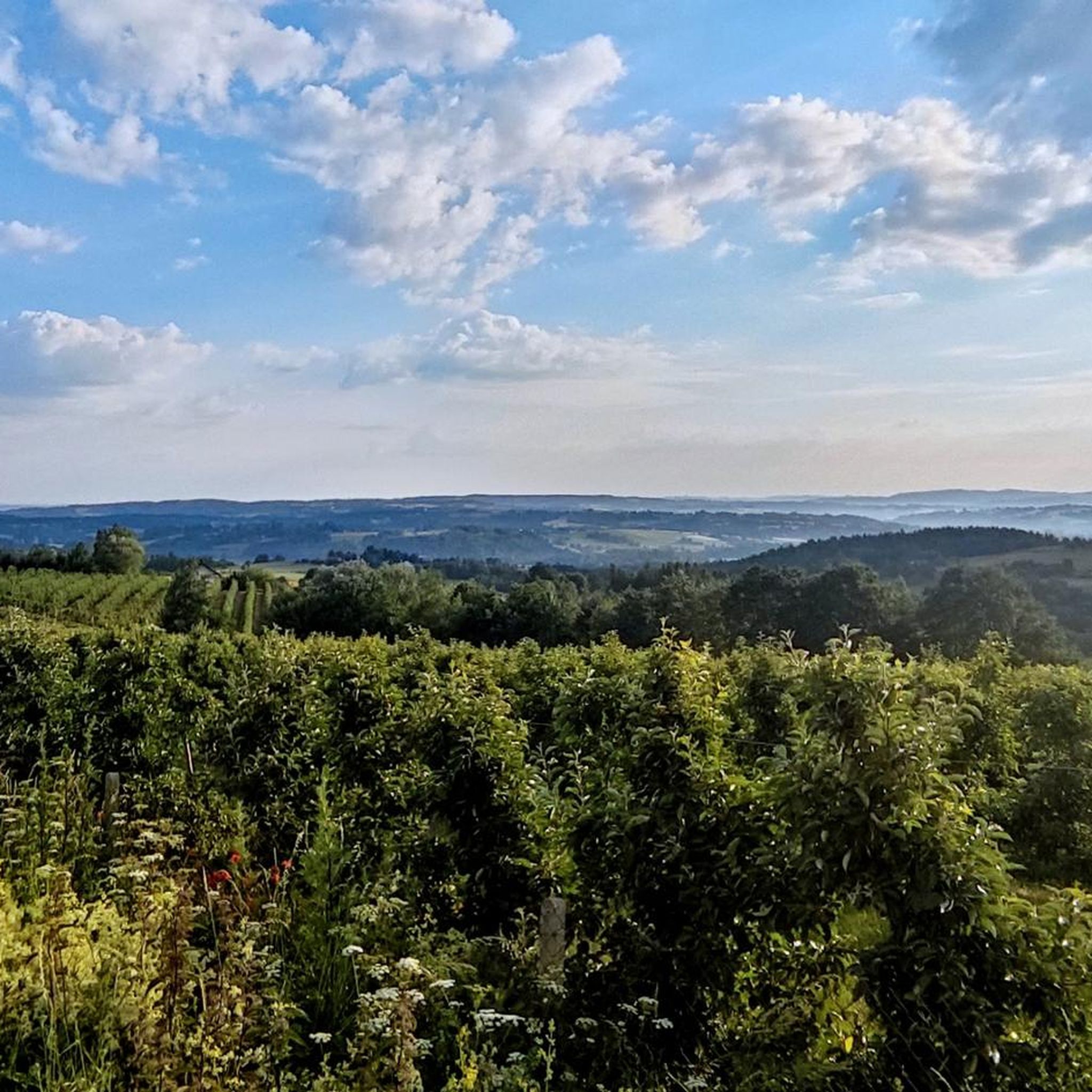
Mountain biking around Jodłownik offers diverse landscapes within the scenic Beskid Wyspowy and Beskid Makowski mountain ranges. The region features significant elevation changes, with peaks like Mogielnica (1170m) and Lubomir (804m) providing challenging climbs and panoramic views. Riders can expect a mix of unpaved, natural trails, dense forests, and picturesque valleys, catering to various skill levels.
Best mountain bike trails in Jodłownik
- The most popular mountain bike trail is Stumorgowa Glade loop from Tymbark, a 25.4 miles (40.9 km)…
Last updated: October 13, 2026
5.0
(1)
15
riders
40.8km
03:13
870m
870m
Hard mountain bike ride. Good fitness required. Advanced riding skills necessary. Some portions of the route may require you to push your bike.
5.0
(2)
11
riders
30.6km
02:40
710m
710m
Moderate mountain bike ride. Good fitness required. Advanced riding skills necessary.

5.0
(2)
9
riders
19.4km
01:52
600m
600m
Moderate mountain bike ride. Good fitness required. Advanced riding skills necessary.
4
riders
30.8km
03:27
1,110m
1,110m
Hard mountain bike ride. Very good fitness required. Advanced riding skills necessary. Some portions of the route may require you to push your bike.
6
riders
14.5km
01:34
460m
460m
Moderate mountain bike ride. Good fitness required. Suitable for all skill levels.
Get access to more routes and recommendations from other explorers.
Already have an account?
Our route recommendations are based on thousands of hikes, rides, and runs completed by other people on komoot.
Start today with a free account
Your next adventure awaits.

Tips from the Community

Trail to Mogielica
0
0

I recommend following the signs to the viewing point - paragliders often take off from there.
0
0


Possibility of accommodation and meals
2
0

The upper station of the lift, from which you can set off (your legs are itching) on the bike paths in the bike park - it is also a lift for skiers in winter. Before you start pedaling, take a look at the views from here, because they are really good.
1
0
This pass is often the starting point for trips to Mogielnica south of here. At an altitude of 694m above sea level, there is a chapel, a stone obelisk from 1938 and a cross commemorating the battles of the Polish Legions. Great views of the Gorce, Babia Góra, Ćwilin and Śnieżnica.
2
0

Stumorgowa Polana is a picturesque clearing located in the Mogielica region, one of the best viewing spots in the Beskid Wyspowy. In good weather, you can admire the panorama of the Tatras, Gorce and nearby peaks. The clearing is located on popular hiking trails, so it is great for a break during a hike, especially since there are benches and a place to rest. In the winter season, cross-country skiing trails run through here, so the area is attractive all year round. It is worth taking a blanket or sleeping mat with you if you are planning a longer stop, because the views really encourage relaxation.
1
0

Getting to Śnieżnica shouldn't be a problem for anyone, for example, by the green trail from Gruszowiec. The forested peak with a cross, map, bench and summit plaque doesn't offer any views, but 3 minutes to the west, a steep marked descent takes you to a paragliding launch site, from where there is a view of Lubomir and Ćwilin, among others.
0
0
Frequently Asked Questions
What is the overall difficulty level of mountain biking trails around Jodłownik?
Jodłownik offers a diverse range of mountain biking trails suitable for various skill levels. Out of 38 available routes, you'll find 1 easy trail, 18 moderate trails, and 19 difficult trails. This variety ensures options for both beginners and experienced riders seeking a challenge.
Are there any family-friendly mountain bike trails in Jodłownik?
Yes, Jodłownik has options for families. While many trails involve significant climbs, there is at least one easy trail available. Additionally, the region research mentions that some routes, like the "Trasa Niebieska 'Blue Cooler'" at Kasina Bike Park, are described as easy and suitable for all fitness levels. The Sucha Pass Memorial and Meadow is also noted as ideal for family picnics, suggesting areas with gentler terrain.
Can I bring my dog on the mountain bike trails in Jodłownik?
While specific regulations for dogs on mountain bike trails in Jodłownik are not detailed, generally, dogs are welcome on trails in Poland's natural areas, provided they are kept on a leash and owners clean up after them. It's always best to check local signage at trailheads for any specific restrictions in protected areas.
Are there circular mountain bike routes available in Jodłownik?
Yes, many of the mountain bike routes around Jodłownik are designed as loops. For example, the difficult Stumorgowa Glade loop from Tymbark and the moderate Ćwilin Summit (1072 m) – Ascent from Wilczyce to Ćwilin loop from gmina Dobra are popular circular options, allowing you to start and finish at the same point.
What is the best time of year for mountain biking in Jodłownik?
The best time for mountain biking in Jodłownik is typically from spring through autumn, when the weather is mild and trails are dry. The region's mountainous terrain can be challenging in winter due to snow and ice, though some dedicated riders may still venture out. Always check local weather and trail conditions before heading out.
Where can I find parking for mountain biking in Jodłownik?
Parking availability often depends on the specific trailhead you choose. Many routes start from villages or designated parking areas near popular attractions. For instance, routes like the Śnieżnica Summit – "Blue Cooler" route loop start from locations like Cmentarz wojenny nr 364 – Kasina Wielka, which likely have parking facilities. It's advisable to check the starting point of your chosen route on komoot for specific parking information.
What interesting landmarks or natural features can I see along the mountain bike trails?
The Jodłownik region is rich in natural beauty and cultural sites. You can encounter impressive peaks like Śnieżnica Summit and Lubomir (804 m). Other notable spots include the Sucha Pass Memorial and Meadow, the Papal Cross Viewpoint near Mogielica, and unique natural monuments like a Rock mushroom. The area also features historic wooden churches and the Szczyrzyc Cistercian Abbey.
Are there places to eat or rest along the mountain bike routes?
Yes, the region offers several spots for refreshments and rest. The Kudłacze PTTK Mountain Hut provides a comfortable resting spot with food. The Szczyrzyc Cistercian Abbey also hosts a craft brewery with a restaurant. Additionally, many villages along the routes will have local eateries or cafes where you can refuel.
What do other mountain bikers enjoy most about mountain biking in Jodłownik?
The mountain biking experience in Jodłownik is highly rated by the komoot community, with an average score of 4.6 stars from over 10 reviews. Riders often praise the region's impressive mountain peaks, picturesque valleys, and dense forests, which offer a mix of challenging climbs and rewarding panoramic views. The variety of trails catering to different skill levels is also a significant draw.
Are there any specific permits required for mountain biking in Jodłownik?
Generally, no specific permits are required for mountain biking on public trails in the Jodłownik area. However, it's always good practice to respect private property, stay on marked trails, and be aware of any local regulations, especially if riding through nature reserves or protected areas. There are no indications of special permits being needed for the trails listed.
How long are the mountain bike trails near Jodłownik?
The mountain bike trails near Jodłownik vary significantly in length. For example, the Stumorgowa Glade loop from Tymbark is a longer route at 25.4 miles (40.9 km), while the Ćwilin Summit (1072 m) – Ascent from Wilczyce to Ćwilin loop is 12.1 miles (19.5 km). You can find routes ranging from shorter, moderate rides to longer, more challenging expeditions.
Can I reach the mountain biking trails in Jodłownik using public transport?
While Jodłownik is in a mountainous region, public transport options like local buses may connect to some of the larger towns or villages near trailheads. However, direct access to all starting points by public transport might be limited. It's recommended to check local bus schedules for specific routes or consider combining public transport with a short taxi ride or cycling to the trailhead.
Most popular routes around Jodłownik
Most popular attractions around Jodłownik

Get inspired with the komoot mobile app


Explore more
Browse the best MTB trails in other regions.
