The best road cycling routes around Anjos
4.6
(13)
420
riders
29
rides
Road cycling routes around Anjos offer a diverse terrain, characterized by rolling hills and varied landscapes. The region provides a network of paths suitable for different skill levels, from moderate climbs to more challenging ascents. Cyclists can expect routes that traverse rural areas, often featuring elevation changes and scenic views of the surrounding countryside. The area's topography supports both endurance rides and shorter, more intense cycling experiences.
Best road cycling routes around Anjos
- The most popular road cycling route is Church of Saint Peter – Valdosende Parish Church loop from Vieira do Minho, a 46.8 miles (75.3 km) trail that takes 3 hours 49 minutes to complete. This difficult route features significant elevation gain, challenging cyclists with its sustained climbs.
- Another top favourite among local road cyclists is View of the Caniçada Dam – Cascata de Várzeas loop from Vieira do Minho, a difficult 32.2 miles (51.8 km) path. This route offers views of the Caniçada Dam and Cascata de Várzeas, with considerable elevation changes.
- Local road cyclists also love the Praia da Rola loop from Rossas 1, a 31.6 miles (50.9 km) trail leading through varied terrain, often completed in about 2 hours 41 minutes. This difficult route includes challenging ascents and descents.
- Road cycling around Anjos is defined by its rolling hills, rural landscapes, and significant elevation changes. The network offers options for different ability levels, including 1 easy, 9 moderate, and 21 difficult road cycling routes.
- The routes in Anjos are highly rated by the komoot community with an average score of 4.6 stars from over 12 reviews. More than 380 road cyclists have used komoot to explore Anjos's varied terrain.
Last updated: July 12, 2026
4.3
(6)
97
riders
75.3km
03:49
1,250m
1,250m
Hard road ride. Very good fitness required. Mostly well-paved surfaces and easy to ride.
3.5
(2)
91
riders
51.5km
03:00
1,210m
1,210m
Hard road ride. Very good fitness required. Mostly well-paved surfaces and easy to ride.

Sign up for free
5.0
(1)
17
riders
50.9km
02:41
950m
960m
Hard road ride. Very good fitness required. Mostly well-paved surfaces and easy to ride.
22
riders
34.5km
01:57
760m
760m
Moderate road ride. Good fitness required. Mostly well-paved surfaces and easy to ride.
16
riders
64.9km
03:10
950m
950m
Hard road ride. Very good fitness required. Mostly well-paved surfaces and easy to ride.
Get access to more routes and recommendations from other explorers.
Sign up for free
Already have an account?
Our route recommendations are based on thousands of hikes, rides, and runs completed by other people on komoot.
Start today with a free account
Your next adventure awaits.
Login or Signup

Tips from the Community

Attention, this is an extremely dangerous place. You can never be too careful.
0
0

Impressive waterfalls with several pools, accessible with a bit of climbing. Some climbing aids have been anchored into the rock. However, since the waterfall is located near a road, you're rarely alone here. And there have been fatalities here, as the climb down to the lagoons is not without its dangers.
1
0

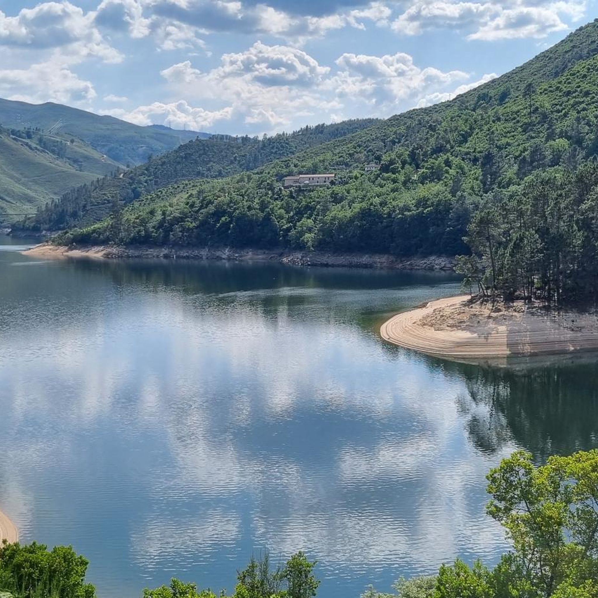
Dam with a fantastic view, and also provides quick access to both banks...
0
0


The Caniçada Dam (Portuguese: Barragem da Caniçada) is located in the Northern region of Portugal in the Braga district near the municipality of Caniçada. It dams up the Cávado River and its tributary Rio Gerês to form a four-armed reservoir (port. Albufeira (da Barragem) da Caniçada). In the middle of the reservoir, near the point where the Rio Gerês originally flowed into the Rio Cávado, the lake is bridged by two bridges. To the north of the reservoir is the Peneda-Gerês National Park and part of the lake area belongs to the national park. The city of Braga is located about 15 km southwest of the Caniçada dam. Upstream, the next hydroelectric power station on the Cávado is the Salamonde dam.
2
0

An impressive build! Built in 1955, it has a height of 76m and a crown length of 246m. The hydroelectric power station located there produces an average of 346 GWh per year.
0
0

Great spot to relax and enjoy the view, right on the water.
0
0

Frequently Asked Questions
What kind of terrain can I expect when road cycling around Anjos?
Road cycling routes around Anjos are characterized by rolling hills and varied landscapes. You can expect routes that traverse rural areas, often featuring significant elevation changes and scenic views of the surrounding countryside. The topography supports both endurance rides and shorter, more intense cycling experiences.
Are there road cycling routes suitable for beginners in Anjos?
While many routes in Anjos feature challenging climbs, there is at least 1 easy road cycling route available. These routes offer a gentler introduction to the region's beautiful scenery for those new to road cycling.
What options are there for experienced road cyclists seeking a challenge in Anjos?
Experienced road cyclists will find plenty of challenging options in Anjos, with 21 difficult routes available. These routes often feature sustained climbs and considerable elevation gain, such as the Church of Saint Peter – Valdosende Parish Church loop from Vieira do Minho, which covers 46.8 miles (75.3 km) with over 1,250 meters of ascent.
Are there any unique natural features to see while cycling in Anjos?
Yes, the area is famous for the iconic Cascata dos Anjos (Angels Waterfall) in Madeira, where water cascades directly onto an old coastal road. This section of the ER101 is now closed to cars, making it accessible for cyclists to ride directly under the waterfall, offering a truly unique and memorable experience amidst lush surroundings and ocean views.
What landmarks or viewpoints can I discover on road cycling routes in Anjos?
While cycling in Anjos, you can discover several interesting landmarks and viewpoints. Notable attractions include the Fafião Viewpoint, offering panoramic vistas, and the Traditional Hórreos and Stone Walls of Ermida, which provide a glimpse into local heritage.
Are there any waterfalls accessible by road bike in Anjos?
Absolutely. Besides the famous Cascata dos Anjos, you can find other beautiful waterfalls. The View of the Caniçada Dam – Cascata de Várzeas loop from Vieira do Minho offers views of the Cascata de Várzeas. Additionally, the Fecha de Barjas Waterfall (Tahiti) and Tahiti Waterfall are also nearby attractions.
Can I find long-distance road cycling routes in Anjos?
Yes, Anjos offers several long-distance road cycling routes. For example, the Church of Saint Peter – Valdosende Parish Church loop from Vieira do Minho is a substantial 46.8 miles (75.3 km) ride, and the View of the National Park – Venda Nova Dam loop from Vieira do Minho covers 40.3 miles (64.9 km).
Are there any loop trails for road cycling in Anjos?
Many of the road cycling routes in Anjos are designed as loops, allowing you to start and finish in the same location. Examples include the Praia da Rola loop from Rossas 1 and the Caniçada Reservoir – Caniçada Dam loop from Vieira do Minho.
How do other cyclists rate the road cycling experience in Anjos?
The road cycling experience in Anjos is highly rated by the komoot community, with an average score of 4.6 stars from over 12 reviews. More than 380 road cyclists have used komoot to explore the varied terrain, often praising the scenic views and challenging ascents.
What is the best time of year for road cycling in Anjos?
While specific data for Anjos isn't provided, the region, being part of Madeira, generally offers pleasant cycling conditions for much of the year. Spring and autumn typically provide mild temperatures and less rainfall, making them ideal for exploring the coastal roads and terraced landscapes.
Are there routes that offer views of dams or reservoirs?
Yes, several routes provide stunning views of local dams and reservoirs. The View of the Caniçada Dam – Cascata de Várzeas loop from Vieira do Minho and the Caniçada Reservoir – Caniçada Dam loop from Vieira do Minho are excellent choices for this, showcasing the impressive water features of the area.
Most popular routes around Anjos
Most popular attractions around Anjos

Get inspired with the komoot mobile app


Explore more
Browse the best Road cycling routes in other regions.
