The best walks and hikes around Cicouro
4.8
(3)
13
hikers
3
hikes
Hiking around Cicouro features a landscape shaped by river valleys and greenways, offering accessible paths for exploration. The terrain includes gentle elevations and open areas, with routes often following waterways. Hikers can expect a mix of natural paths and established trails, providing opportunities to experience the local environment.
Best hiking trails around Cicouro
- The most popular hiking route is The Rivera de los Molinos de Brandilanes — circular from Castro de Alcañices, a 5.4 miles (8.6 km) moderate trail…
Last updated: October 7, 2026
5.0
(1)
9
hikers
Moderate hike. Good fitness required. Easily-accessible paths. Suitable for all skill levels.
1
hikers
10.1km
02:44
140m
130m
Moderate hike. Good fitness required. Easily-accessible paths. Suitable for all skill levels.

11.2km
02:59
130m
130m
Hike the moderate 6.9-mile Rabanales Trail in Zamora, Spain, exploring riverside paths and traditional stone architecture.
4.5
(2)
2
hikers
10.1km
02:43
120m
120m
Moderate hike. Good fitness required. Easily-accessible paths. Suitable for all skill levels.
1
hikers
9.37km
02:31
120m
120m
Moderate hike. Good fitness required. Easily-accessible paths. Suitable for all skill levels.
Our route recommendations are based on thousands of hikes, rides, and runs completed by other people on komoot.

Tips from the Community

Typical kiln used to fire ceramic pieces for the pottery families of the "Las Vegas" neighborhood. It was used until 1985.
0
0
One of the kilns used in Moveros to fire the town's traditional pottery. Families from the lower part of town used to fire their pieces in it.
0
0

Rabanales is known in the Aliste region for preserving a historic center with abundant examples of traditional stone architecture, a hallmark of western Zamora. This architecture is characterized by its robustness, its integration with the landscape, and the use of local materials. The traditional houses and buildings are constructed primarily with local stone, especially granite, which provides solidity and a distinctive rustic aesthetic.
2
0
Peña el Pingón is a prominent natural landmark on the hiking trails of Alcañices. Located in a spectacular setting, it is one of the most highly recommended spots by both local and visiting hikers. At the base of Peña el Pingón, or in its immediate vicinity, lies a cave, seamlessly integrated into the surrounding rocky landscape. It adds to the area's charm and is a popular stopping point on hiking routes.
2
0
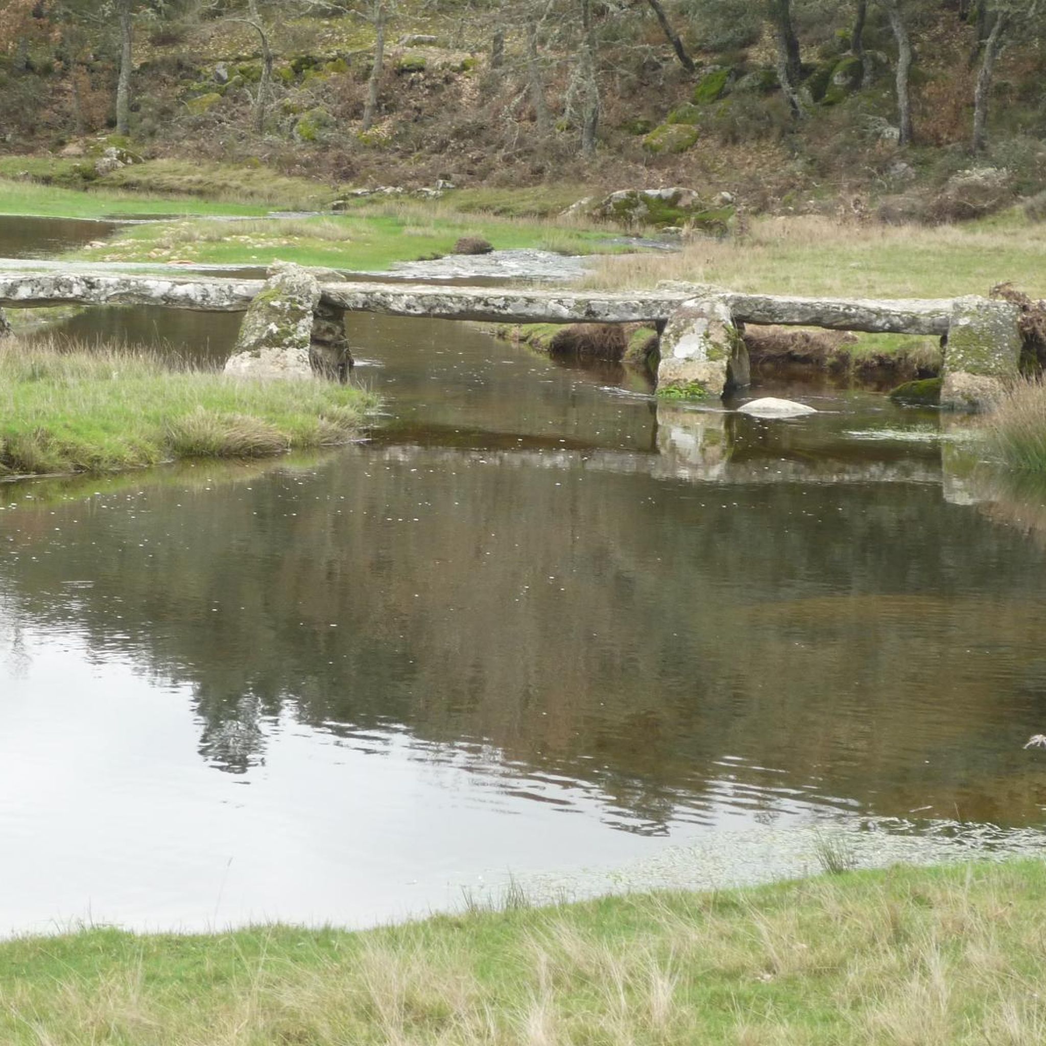
The La Ribera Stream Bridge in Fonfría is a picturesque spot perfect for hiking and nature lovers. It's a stone bridge that allows you to cross the La Ribera Stream. The area offers several scenic trails to enjoy the nature and scenery.
5
0
The Molino de los Carbajos is an old mill located in the Aliste region, near Fonfría, in the province of Zamora. This mill is a popular point of interest for hiking and nature lovers. It is located on a marked trail that runs from Brandilanes to Castro, following the white and yellow signs. The Molino de los Carbajos is perfect for a short excursion and to enjoy the natural beauty of Aliste.
5
0
The Molino de los Tejeros is located on the hiking route that goes from Castro de Alcañices to Brandilanes, in the Aliste region, Zamora. This route, known as the Rivera de los Molinos, is famous for its natural beauty and its ethnological heritage, since along the route you can see several old water mills.
8
0

Moveros is one of those towns that have been on the border since time immemorial in this area where pottery has been one of the key points in the municipality.
0
0
Frequently Asked Questions
What is the typical difficulty and distance of hiking trails around Cicouro?
The hiking trails around Cicouro are generally moderate in difficulty. Distances vary, with routes like The Rivera de los Molinos de Brandilanes — circular from Castro de Alcañices covering about 5.4 miles (8.6 km), and Via verde del rio Angueira — circular desde Alcanices extending to 6.3 miles (10.1 km).
Are there any circular walks available in Cicouro?
Yes, Cicouro offers several appealing circular walks. Popular options include The Rivera de los Molinos de Brandilanes — circular from Castro de Alcañices and Via verde del rio Angueira — circular desde Alcanices, both designed to bring you back to your starting point.
What kind of natural features or landmarks can I expect to see along the trails?
Hiking around Cicouro often features river valleys and greenways. You can explore historical mill sites along routes like The Rivera de los Molinos de Brandilanes. The area is also characterized by gentle elevations and open landscapes.
What do other hikers enjoy most about hiking in Cicouro?
The komoot community highly rates the trails in Cicouro, with an average score of 4.8 stars. Hikers often praise the scenic river paths and the varied terrain that offers a good mix of natural beauty and accessible routes.
Are there any family-friendly hiking options in Cicouro?
While specific 'easy' routes aren't highlighted, the moderate trails in Cicouro, characterized by river valleys and greenways, can be suitable for families with some hiking experience. Routes like Via verde del rio Angueira offer a pleasant greenway experience.
What are some interesting places to explore near the hiking trails?
Near the hiking trails, you can discover several points of interest. Consider visiting the Traditional Stone Architecture of Rabanales, the unique Peña el Pingón Cave and Bridge, or the historic Clock Tower of Alcañices.
What is the best season for hiking in Cicouro?
Given the landscape of river valleys and greenways, spring and autumn are generally ideal for hiking in Cicouro, offering pleasant temperatures and vibrant scenery. Summer can also be enjoyable, especially along shaded river paths.
Are there any long-distance trails or multi-day hiking opportunities around Cicouro?
The guide focuses on day hikes, with the longest route being Rabanales Trail at approximately 6.9 miles (11.2 km). For multi-day adventures, you would need to combine several routes or explore connecting regional paths.
What should I bring for a summer hike in Cicouro?
For summer hikes in Cicouro, it's advisable to bring plenty of water, sun protection (hat, sunscreen), and lightweight, breathable clothing. Comfortable hiking shoes are essential, and a map or GPS device is always recommended.
Are there any cafes or places to eat near the trailheads in Cicouro?
While specific cafes aren't listed for each trailhead, the routes often start or pass near villages like Castro de Alcañices or Alcanices, where you can typically find local establishments for refreshments after your hike.
Are there any hidden gem hiking trails in Cicouro?
While the listed routes are well-regarded, exploring the less-trafficked sections of the river valleys and greenways can reveal quieter spots. The Miradouro da Senhora da Luz loop from Constantim e Cicouro offers varied terrain that might feel more off the beaten path.
Is public transport available to reach the hiking routes in Cicouro?
Information on specific public transport links directly to trailheads is not detailed in the guide. It's generally recommended to check local bus schedules for connections to the villages where the trails begin, such as Castro de Alcañices or Alcanices.
Most popular routes around Cicouro
Most popular attractions around Cicouro

Get inspired with the komoot mobile app


Explore more
Browse the best Hikes in other regions.
