The best road cycling routes around Monfortinho
24
riders
6
rides
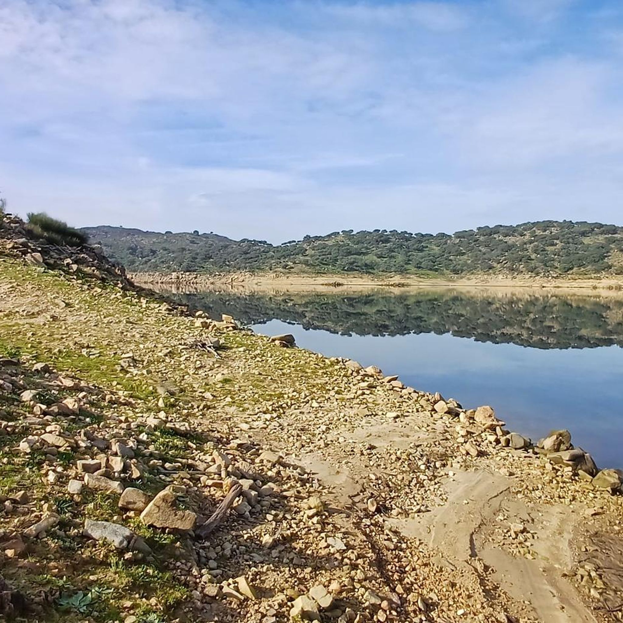
Road cycling around Monfortinho, located in Portugal's Castelo Branco district, offers diverse terrain ranging from gentle slopes in border areas to demanding uphill sections through pine forests. The region is characterized by a network of quiet roads, often with smooth asphalt, allowing for immersive rides through scenic landscapes. Cyclists can expect a blend of cork oaks, olive trees, vineyards, and the Erges River, contributing to the area's natural beauty. The varied topography provides options for different fitness levels.
Best road…
Last updated: October 14, 2026
4
riders
Hard road ride. Very good fitness required. Mostly well-paved surfaces and easy to ride.
6
riders
111km
05:36
1,730m
1,730m
Hard road ride. Very good fitness required. Mostly well-paved surfaces and easy to ride.

5
riders
95.9km
04:20
940m
940m
Hard road ride. Very good fitness required. Some segments of this route may be unpaved and difficult to ride.
5
riders
92.3km
04:25
1,020m
1,020m
Hard road ride. Very good fitness required. Some segments of this route may be unpaved and difficult to ride.
3
riders
88.8km
04:11
830m
830m
Moderate road ride. Good fitness required. Mostly well-paved surfaces and easy to ride.
Our route recommendations are based on thousands of hikes, rides, and runs completed by other people on komoot.
Start today with a free account
Your next adventure awaits.
Popular around Monfortinho
Tips from the Community

Nice bakery full of local breads, on typical village of Beira Baixa. There's also a small grocery shop.
0
0

Proença-a-Velha was born with the nation itself, linked to the repopulation promoted by King Afonso Henriques and, later, to the Templar charter of 1218. A fertile land with vast olive groves, its greatest treasure is olive oil, celebrated at the Olive Oil Museum and the Olive Oil and Smoked Meat Festival. But the tradition doesn't stop there: Proença-a-Velha is also the capital of soups, where every year over a hundred recipes warm bodies and souls at the Traditional Soup Festival.
2
0

On the Spanish side, the bridge is located in the municipality of Alcántara in the province of Cáceres. It is reached via the regional highway EX-207 from the nearby town of Piedras Albas. On the Portuguese side, it connects with a local road to reach the town of Segura, from which this bridge takes its name. It was built in the Roman province of Lusitania to give continuity to the Roman road that connected Norba Caesarina (on the Via de la Plata) with the civitas Egitania (Idanha-a-Velha, Portugal) and with Bracara Augusta (Braga, Portugal), in order to save the Erjas river. This river marks the border line between Spain and Portugal, and the bridge serves as an international crossing between both countries.
9
0
San Martín de Trevejo is a Spanish municipality in the province of Cáceres, in the autonomous community of Extremadura. It is located in the extreme northwest, in the Sierra de Gata region, very close to the Portuguese border and the province of Salamanca. It is located in a valley at the foot of Mount Jálama. Its inhabitants are mañegas and mañegus, and their peculiar speech or “A Fala” is called “Mañegu”. It has been listed as One of the Most Beautiful Towns in Spain since 2019.
2
0
Zarza la Mayor is a Spanish town and municipality, located in the province of Cáceres, in the autonomous community of Extremadura. It belongs to the judicial district of Cáceres and is the westernmost town in the community of Rivera de Fresnedosa. Furthermore, it is the only municipality in said community that has a border with Portugal, located four kilometers in a straight line from Salvaterra do Extremo.
10
0

Paradise with lots of unevenness, keep an eye on the heat in the valleys at midday
0
1

Border bridge over the Erjas river near the town of Segura.
2
0
At the west end of the city, the Plaza Mayor is worth visiting as you head out of town on your walk to admire the Church of San Andrés Apóstol and the council building.
4
0
Frequently Asked Questions
How many road cycling routes are available around Monfortinho?
There are 7 road cycling routes around Monfortinho featured in this guide, offering a variety of experiences for different fitness levels.
What kind of terrain can I expect on road cycling routes in Monfortinho?
The Monfortinho region offers diverse terrain, from gentle slopes in border areas to demanding uphill sections through pine forests. You'll encounter a mix of cork oaks, olive trees, vineyards, and the scenic Erges River. The road network is generally quiet with smooth asphalt, though some inland and mountain roads may be rougher in places.
Are there any challenging road cycling routes for experienced cyclists?
Yes, Monfortinho offers several challenging routes. For instance, the Penha Garcia from Moraleja – circular through the Reserva Natural de Sierra de Malcata route is 77.9 miles (125.4 km) with significant elevation gain, featuring challenging climbs and diverse landscapes.
What natural features or landmarks can I see along the road cycling routes?
Many routes offer views of the Erges River and traverse landscapes rich with cork oaks, olive trees, and vineyards. You can also find attractions like the Penha Garcia Natural Swimming Pool and Waterfall, which provides a refreshing stop, and the Termas de Monfortinho for relaxation.
Are there any routes that pass through historic villages or sites?
Yes, some routes incorporate historic villages. The San Martín de Trevejo – Penha Garcia Dam loop from Castelo de Monsanto, for example, includes challenging climbs to historic villages like Monsanto and offers scenic views of the Penha Garcia Dam. You might also pass by the Old Miller's Village.
What is the best time of year for road cycling in Monfortinho?
The region generally enjoys a pleasant climate, making it suitable for cycling for much of the year. Spring and autumn typically offer the most comfortable conditions with milder temperatures, while summer can be warm but still enjoyable, especially in the mornings.
Are there any moderate difficulty road cycling routes?
Yes, there are 3 moderate difficulty routes available. An example is the Açude de Salvaterra – Miradouro do Canhão do Erges loop from Salvaterra do Extremo, which is 26.6 miles (42.9 km) long and takes about 2 hours 20 minutes to complete.
Can I find loop routes starting from Monfortinho?
Many of the routes in the region are designed as loops, allowing you to start and finish in the same location. For instance, the Gas Station – Proença-a-Velha loop from Penha Garcia is a 59.6 miles (95.9 km) circular trail.
What is the road quality like for cycling in Monfortinho?
Portugal has invested in its road infrastructure, so most major cycling routes feature smooth asphalt with minimal potholes. While some inland and mountain roads might be rougher in places, the general quality supports enjoyable road cycling, often on practically empty networks.
Are there any viewpoints along the road cycling routes?
Yes, the varied topography of Monfortinho means many routes offer scenic viewpoints. The Açude de Salvaterra – Miradouro do Canhão do Erges loop from Salvaterra do Extremo, for example, includes a viewpoint over the Erges Canyon.
What is the longest road cycling route in this guide?
The longest route featured is Penha Garcia from Moraleja – circular through the Reserva Natural de Sierra de Malcata, covering 77.9 miles (125.4 km) and typically taking around 5 hours 48 minutes to complete.
Are there routes suitable for exploring the broader Beira Baixa region?
Absolutely. Routes like the Penha Garcia Dam – Proença-a-Velha loop from Idanha-a-Nova, which is 57.3 miles (92.3 km), lead through the Beira Baixa region, allowing you to experience its characteristic landscapes of cork oaks, olive trees, and vineyards.
Most popular routes around Monfortinho
Most popular attractions around Monfortinho

Get inspired with the komoot mobile app


Explore more
Browse the best Road cycling routes in other regions.
