The best cycling routes around Carvalho De Rei
4.2
(65)
615
riders
29
rides
Touring cycling around Carvalho De Rei is characterized by its diverse landscapes within the Serra da Aboboreira region, shaped by the Ovil and Fornelo rivers. The area features traditional granite villages, natural forests of chestnut and oak, and archaeological sites. Elevations in the Serra da Aboboreira can reach up to 1,000 meters, providing varied terrain for cyclists.
Best touring cycling routes around Carvalho De Rei
- The most popular touring cycling route is Tâmega Line Greenway Loop, a 16.3 miles…
Last updated: July 9, 2026
1.0
(1)
4
riders
26.2km
01:53
470m
470m
This difficult 16.3-mile (26.2 km) touring cycling route along the Ecopista da Linha do Tâmega features 1543 feet (470 metres) of elevation
2
riders
11.6km
00:51
210m
200m
Moderate bike ride. Good fitness required. Mostly paved surfaces. Suitable for all skill levels.

Sign up for free
4.7
(31)
272
riders
63.2km
04:14
880m
880m
Hard bike ride. Very good fitness required. Mostly paved surfaces. Suitable for all skill levels.
19
riders
68.7km
05:14
1,270m
1,270m
Hard bike ride. Very good fitness required. Mostly paved surfaces. Suitable for all skill levels.
5.0
(1)
13
riders
12.2km
00:49
170m
170m
Moderate bike ride. Good fitness required. Mostly paved surfaces. Suitable for all skill levels.
Get access to more routes and recommendations from other explorers.
Sign up for free
Already have an account?
Our route recommendations are based on thousands of hikes, rides, and runs completed by other people on komoot.
Start today with a free account
Your next adventure awaits.
Login or Signup



Tips from the Community

Fantastic trail, with excellent views
0
0

A bridge with a horizontal deck over three unequal round arches, the central one being the largest. The pillars have triangular buttresses upstream and downstream. The parapet protecting the bridge deck rests on a carved tubular cornice. Crowning the buttresses, four semicircular balconies with stone benches open onto the deck. At each end, the bridge boasts two pairs of faceted Baroque spires resting on small spheres.
2
0

Relatively flat. Very pleasant.
1
0

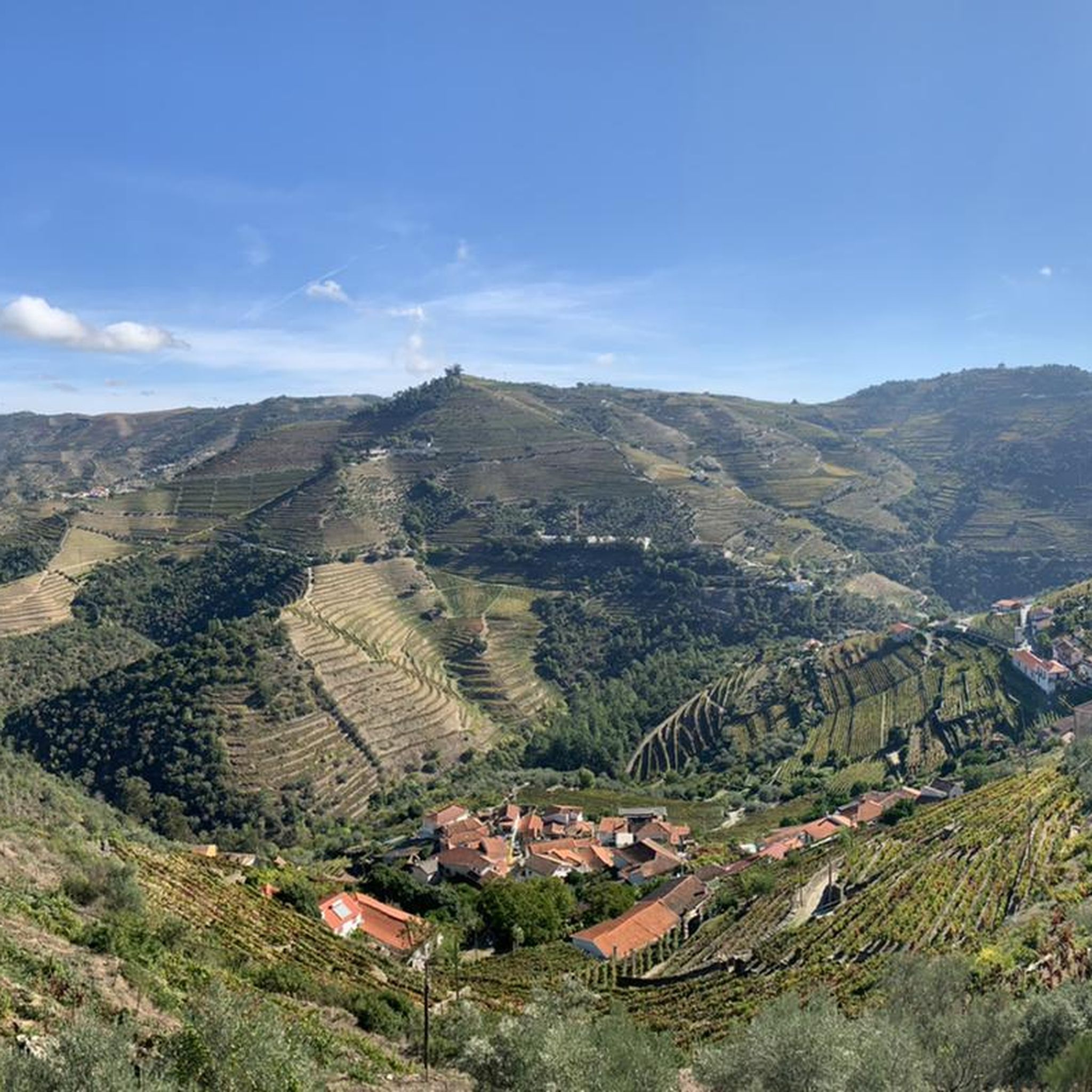
View across the vineyards toward the mountain
0
0

Tâmega eco-track, bridge over the Levairo river
0
0
Frequently Asked Questions
How many touring cycling routes are available around Carvalho De Rei?
There are over 30 touring cycling routes available in the Carvalho De Rei area, catering to various skill levels. While some are moderate, the majority, around 26, are considered difficult, offering a challenge for experienced cyclists.
What kind of terrain can I expect on touring cycling routes in Carvalho De Rei?
The terrain around Carvalho De Rei is diverse, characterized by the slopes of the Serra da Aboboreira, which can reach altitudes of up to 1,000 meters. You'll encounter river valleys, traditional granite villages, and natural forests of chestnut and oak. Routes often feature significant elevation changes, providing varied and engaging cycling experiences.
Are there any family-friendly touring cycling routes in the area?
Yes, while many routes are challenging, there are options suitable for families. The region's dedicated cycling network includes paths of varying difficulty. For a moderate option, consider the Around Amarante — circular route, which is 11.6 km long and offers scenic views without extreme difficulty. The Tâmega Ecopista, while not directly in Carvalho de Rei, is also a great accessible option in the broader Amarante region, built on a decommissioned railway line.
What natural features or landmarks can I see along the touring cycling routes?
The routes offer a rich blend of natural beauty and historical sites. You can explore traditional granite villages like Castelo, part of the typical villages route, and discover ancient megalithic monuments such as the Meninas do Crasto Dolmen. The region is also shaped by the Ovil and Fornelo rivers, with natural forests of chestnut and oak. In the wider Amarante area, you might encounter highlights like the St. Gonçalo Bridge and the Church and Bridge of São Gonçalo in Amarante.
Are there any circular touring cycling routes available?
Yes, the region offers several circular touring cycling routes. For example, the Around Amarante — circular route is a moderate 11.6 km loop. Another option is the Gatão Station – Tâmega Line Greenway loop from Amarante, which is 12.2 km and also considered moderate. These routes allow you to start and end at the same point, making logistics easier.
What is the best time of year to go touring cycling in Carvalho De Rei?
Carvalho De Rei, being in Portugal, generally offers pleasant cycling conditions for much of the year. Spring and autumn are often ideal, with milder temperatures and lush landscapes. Summers can be warm, especially at lower elevations, but the higher altitudes of the Serra da Aboboreira may offer some respite. Always check local weather forecasts before your ride.
What do other touring cyclists enjoy most about cycling in Carvalho De Rei?
The area is highly rated by the komoot community, with an average score of 4.2 stars from over 50 reviews. Reviewers often praise the diverse landscapes, the blend of natural beauty with traditional villages, and the challenging yet rewarding terrain that the Serra da Aboboreira offers.
Are there any routes that follow old railway lines?
Yes, the region is home to the Tâmega Ecopista, a significant cycling attraction built on a decommissioned railway line. This 39-kilometer path connects Amarante to Arco de Baúlhe, offering a scenic tour through forests, agricultural fields, and along the Tâmega River. Routes like the Tâmega Line Greenway – Celorico de Basto Ecotrail loop from Amarante incorporate sections of this ecopista.
Can I find places to eat or stay near the cycling routes?
Carvalho De Rei and the surrounding villages maintain a strong rural character, offering opportunities to experience traditional Portuguese culture. While specific cafes or pubs directly on every trail might be limited, the municipality of Amarante, where Carvalho De Rei is located, provides more options for accommodation, restaurants, and cafes. Exploring the traditional villages themselves can also lead to local eateries.
Is there public transport available to access the cycling routes?
While Carvalho De Rei itself is a charming village, public transport options directly to the trailheads might be limited due to its rural setting. However, Amarante, the larger municipality, serves as a hub and starting point for many routes, including those on the Tâmega Ecopista. From Amarante, you may find local transport or taxi services to reach specific starting points. Planning your journey in advance is recommended.
Are there any routes with significant elevation changes for a challenging ride?
Absolutely. The Serra da Aboboreira, where Carvalho De Rei is situated, is known for its mountainous terrain with elevations reaching up to 1,000 meters. Many of the routes, such as the Tâmega Line Greenway – Celorico de Basto Ecotrail loop from Amarante, feature substantial elevation gains, making them suitable for cyclists looking for a demanding and rewarding experience.
Most popular attractions around Carvalho De Rei

Get inspired with the komoot mobile app


Explore more
Browse the best Cycling routes in other regions.
