The best road cycling routes around Vila Moreira
3.9
(12)
618
riders
68
rides
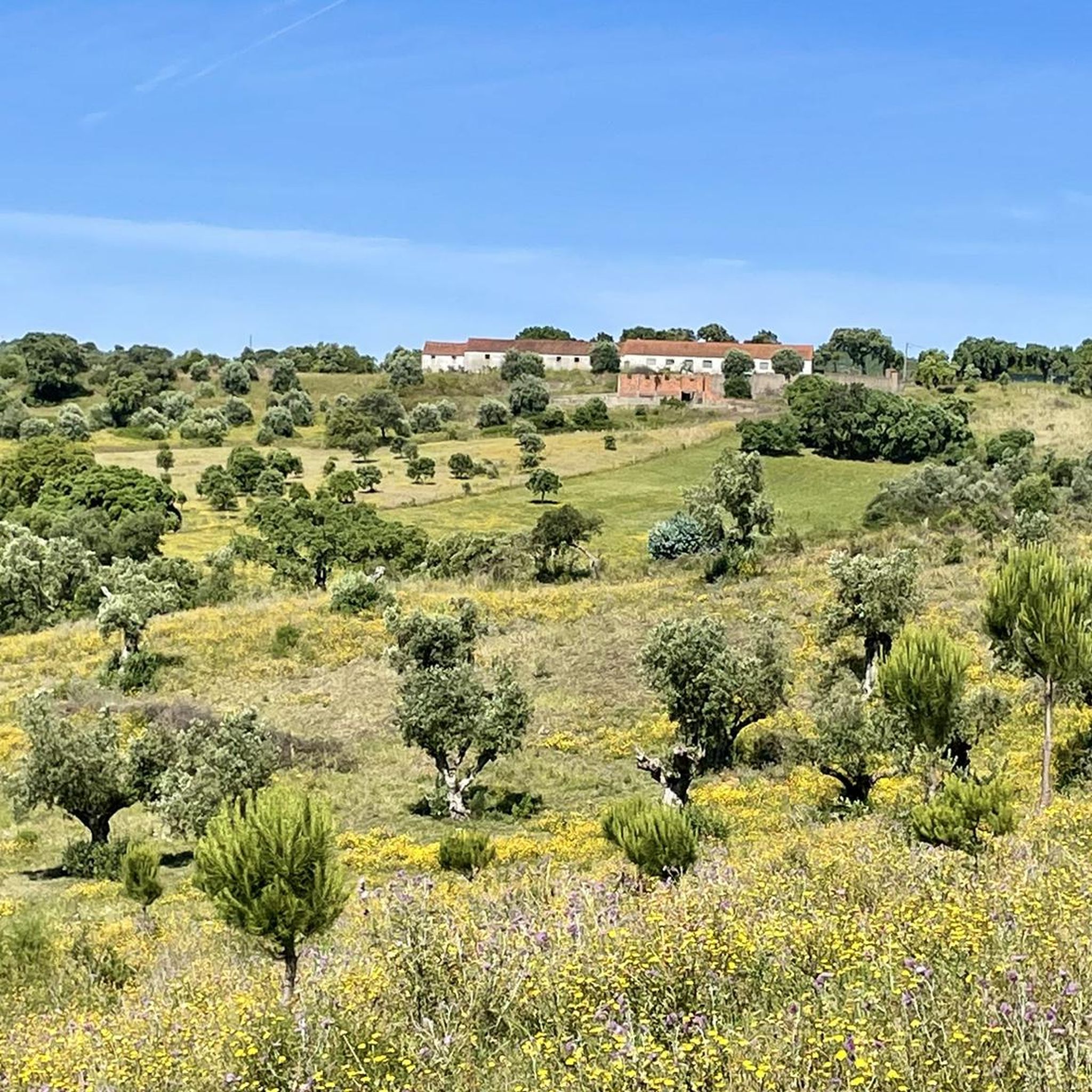
Road cycling around Vila Moreira, located in Portugal's Santarém district, offers diverse terrain for outdoor enthusiasts. The region is characterized by rugged limestone landscapes, karstic geological formations, and eroded valleys, providing a scenic backdrop for cycling. Situated between the Serra de Aire and Serra dos Candeeiros mountain ranges, the area features varied elevation profiles and mostly well-paved surfaces suitable for road bikes.
Best road cycling routes around Vila Moreira
- The most popular road cycling route is Golegã – Carlos Relvas…
Last updated: October 12, 2026
63
riders
117km
04:58
890m
890m
Moderate road ride. Good fitness required. Some segments of this route may be unpaved and difficult to ride.
36
riders
90.6km
03:47
580m
580m
Moderate road ride. Good fitness required. Mostly well-paved surfaces and easy to ride.

28
riders
46.2km
02:06
430m
430m
Moderate road ride. Good fitness required. Mostly well-paved surfaces and easy to ride.
21
riders
67.1km
03:00
640m
640m
Moderate road ride. Good fitness required. Mostly well-paved surfaces and easy to ride.
17
riders
31.4km
01:22
260m
260m
Easy road ride. Great for any fitness level. Mostly well-paved surfaces and easy to ride.
Get access to more routes and recommendations from other explorers.
Already have an account?
Our route recommendations are based on thousands of hikes, rides, and runs completed by other people on komoot.
Start today with a free account
Your next adventure awaits.



Tips from the Community

Bus stop built with the same material as the Chamusca bridge
16
0
The Golegã National Horse Fair, also known as the São Martinho Fair, is an event with historical roots dating back to 1571, when it was established as an annual fair. Over the centuries, the fair has evolved and established itself as an important center for the exhibition and sale of the Lusitano horse, attracting breeders, riders and enthusiasts from all over the country and abroad.
13
0
Tribute to the former professional cyclist from Riachos
15
0

Malhou owes its name to the rhythmic sound of hammers and the shine of forges: in times past, this parish was famous for the talent of its blacksmiths, masters in the art of shaping iron with skill and strength. It was this craft that marked the identity of the land and gave it its name.
1
0

Hydration and protection
0
0

In addition to the carriageways, there is no space left on the bridge. Watch out for tangents from people who can't slow down behind a cyclist.
2
0
Frequently Asked Questions
How many road cycling routes are available around Vila Moreira?
There are over 75 road cycling routes around Vila Moreira, catering to various skill levels. This includes 4 easy routes, 58 moderate routes, and 15 difficult routes, ensuring options for every cyclist.
What kind of terrain can I expect on road cycling routes in Vila Moreira?
The region around Vila Moreira is characterized by rugged limestone landscapes, karstic geological formations, and eroded valleys. You'll find diverse terrain with varied elevation profiles, situated between the Serra de Aire and Serra dos Candeeiros mountain ranges. Most surfaces are well-paved, making them suitable for road bikes.
Are there any particularly challenging road cycling routes for experienced cyclists?
Yes, for experienced cyclists seeking a challenge, there are 15 difficult routes around Vila Moreira. These routes often feature substantial elevation gain within the Serra de Aire and Serra dos Candeeiros Natural Park, providing a vigorous and rewarding experience.
What natural attractions can I see while road cycling near Vila Moreira?
Road cycling routes in the area offer access to several natural attractions. You can visit the beautiful Peão Fountain - Monsanto, explore the Grutas de Mira de Aire (caves), or enjoy panoramic views from the Geodetic Vertex of Serra de Aire. The Source of the Alviela River (Olhos de Água) is also a significant natural landmark.
Are there any historical or cultural landmarks along the road cycling routes?
While cycling, you might encounter historical sites such as Porto de Mós Castle, Grutas de Santo António, Alcobaça Castle, and Batalha Monastery, which offer cultural enrichment alongside your ride. Specific routes like the Valley Near Pedrogão – Castelo De Torres Novas loop from Alcanena pass by notable landmarks like Castelo De Torres Novas.
What do other road cyclists say about the routes in Vila Moreira?
The road cycling routes around Vila Moreira are highly rated by the komoot community, with an average score of 3.75 stars from over 10 reviews. More than 600 road cyclists have already used komoot to explore the varied terrain, often praising the scenic backdrop and diverse options.
Are there any routes that pass by waterfalls or significant water features?
Yes, one notable route is the Olhos d'Água Waterfall – Weir in Portugal loop from Alcanena. This moderate 66.9 km route allows you to experience the beauty of the Olhos d'Água Waterfall and other water features in the region.
What is the best time of year for road cycling in Vila Moreira?
Given Portugal's climate and the region's natural beauty, spring (April-May) and autumn (September-October) are generally ideal for road cycling around Vila Moreira. The weather is typically mild, and the landscapes are vibrant, making for a pleasant riding experience.
Are there any long-distance road cycling routes for endurance training?
Absolutely. For those looking for longer rides, routes like the Golegã – Carlos Relvas House-Studio loop from Alcanena cover 117.2 km with significant elevation gain, taking nearly 5 hours to complete. Another option is the Golegã – Ponte D. Luís I of Santarém loop from Alcanena, a moderate 90.3 km path.
Can I find circular road cycling routes in the Vila Moreira area?
Many of the road cycling routes around Vila Moreira are designed as loops, offering convenient circular journeys. Examples include the Golegã – Carlos Relvas House-Studio loop from Alcanena and the Valley Near Pedrogão – Castelo De Torres Novas loop from Alcanena, allowing you to start and finish at the same point.
Are there any viewpoints along the road cycling routes in Vila Moreira?
Yes, the region offers several stunning viewpoints. Cabeço de Santa Marta, located within Vila Moreira, provides breathtaking panoramic vistas across the Alcanena municipality. Additionally, the View of the Polje de Minde is another notable viewpoint within the Serra de Aire e Candeeiros Natural Park that cyclists can explore.
Are there any road cycling routes that pass through the Serra de Aire e Candeeiros Natural Park?
Many road cycling routes in the Vila Moreira region traverse the Serra de Aire e Candeeiros Natural Park. This protected area offers a vigorous landscape with panoramic mountain views, native Portuguese and evergreen oak trees, and mostly well-paved surfaces ideal for road bikes.
Most popular routes around Vila Moreira
Most popular attractions around Vila Moreira

Get inspired with the komoot mobile app


Explore more
Browse the best Road cycling routes in other regions.
