The best road cycling routes around Pombalinho
4.5
(5)
230
riders
15
rides
Road cycling routes around Pombalinho traverse the fertile Lezíria do Tejo, an area characterized by flat, open agricultural lands along the Tagus River. The region offers routes with minimal elevation gain, suitable for relaxed rides through rural landscapes. While predominantly flat, the broader vicinity includes rolling hills and varied terrain, providing options for more challenging road cycling experiences.
Best road cycling routes around Pombalinho
- The most popular road cycling route is Ponte D. Luís I of Santarém – Golegã loop…
Last updated: October 11, 2026
37
riders
86.0km
03:34
530m
530m
Moderate road ride. Good fitness required. Mostly well-paved surfaces and easy to ride.
5.0
(1)
41
riders
83.3km
03:42
390m
390m
Moderate road ride. Good fitness required. Mostly well-paved surfaces and easy to ride.

34
riders
Moderate road ride. Good fitness required. Mostly well-paved surfaces and easy to ride.
9
riders
64.4km
02:37
290m
290m
Moderate road ride. Good fitness required. Some segments of this route may be unpaved and difficult to ride.
5
riders
Easy road ride. Great for any fitness level. Mostly well-paved surfaces and easy to ride.
Get access to more routes and recommendations from other explorers.
Already have an account?
Our route recommendations are based on thousands of hikes, rides, and runs completed by other people on komoot.


Tips from the Community

The club had 4 designations over the years, starting as Alpiarça Futebol Clube "Os Águias". Between the 50s and 60s, it became widely known for the 13 victories of the club's cyclists in the Volta a Portugal. Currently, besides football and maintaining a strong connection to the community, it focuses on promoting sport and culture.
8
0

The house where José Saramago was born is located in the village of Azinhaga, in the municipality of Golegã, district of Santarém, Portugal. The Azinhaga House Location: The house is located on Rua da Igreja, in Azinhaga, a typical village in Ribatejo, known for its landscape of fertile fields and its proximity to the Tagus River. Foundation: Currently, the childhood home houses the José Saramago Foundation Delegation in Azinhaga, a space of memory that recreates the environment of the writer's childhood and houses a library and an auditorium. Visits: The place is open to visitors who wish to learn about the roots of the only Nobel Prize winner in Literature in the Portuguese language. The Lanzarote House Although he was born in Azinhaga, the writer's most emblematic residence is "The House" in Tías, on the island of Lanzarote, Spain. It was there that he lived for much of his adult life, and where his vast personal library is located; today it functions as the José Saramago House-Museum and is open to the public.
2
0
Pombalinho is a town in the district of Santarém, Portugal, known for being frequently affected by floods. This reputation is due to its strategic location on the right bank of the Tagus River and near the Alviela stream, in a floodplain area. Why do floods occur? Proximity to the Tagus River: The main cause of the floods is the town's location near the Tagus Riverbed. During rainy winters, the river overflows and floods the surrounding areas, which are alluvial plains. Increased flow rates: Heavy rainfall in Portugal, along with discharges from upstream Spanish dams, cause a significant increase in water levels and flow rates of the Tagus, resulting in floods in the Lower Tagus. Affected communication routes: Floods frequently submerge local and national roads, such as the EN 365 at Ponte do Alviela, temporarily isolating Reguengo do Alviela and other neighboring towns. Impact and Local Resilience Historical Events: Pombalinho has a history of major floods, with notable events recorded in 1964 and 1979. Adaptation of Residents: Local residents accept, to some extent, these periodic floods as part of life in the region, although abnormally high floods cause damage and concern. Alert and Prevention: Civil protection authorities issue warnings to the population during critical periods, asking them to take the necessary actions to protect themselves, their families, and property.
2
0
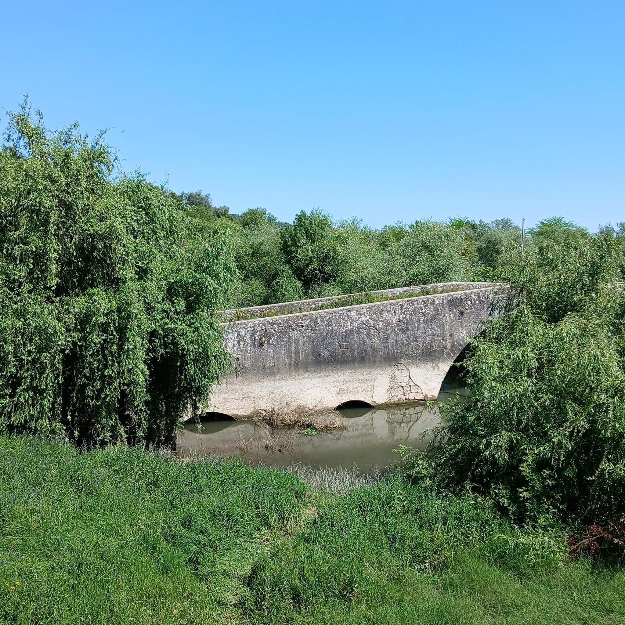
The Roman Bridge of Reguengo (or Reguengo Bridge) is an ancient bridge, probably of medieval origin with a Roman base, located between the towns of Vale de Figueira and Pombalinho, in the district of Santarém, Portugal. It crosses the Ribeira do Alviela, a tributary of the Tagus River. About the Bridge Location: The bridge is situated in a rural area and access to it is via a road that passes in front of the site. State of conservation: The bridge is described as an old and abandoned structure, and some visitors have noted a lack of signage or historical indications at the site. Access: The site is frequented by fishermen, and visitors should be discreet and careful, as the area is not ideal for carelessness, especially with children. Current use: The bridge is not used for regular road traffic, as a new bridge was built further downstream (downstream means towards the mouth of the river, further down) for the current road. Location Approximate address: Between Vale de Figueira and Pombalinho, Santarém, Portugal. GPS: 39°27'36.2" N 8°51'25.9" W (approximate coordinates for the area).
1
0
Bus stop built with the same material as the Chamusca bridge
16
0
The Golegã National Horse Fair, also known as the São Martinho Fair, is an event with historical roots dating back to 1571, when it was established as an annual fair. Over the centuries, the fair has evolved and established itself as an important center for the exhibition and sale of the Lusitano horse, attracting breeders, riders and enthusiasts from all over the country and abroad.
13
0
Frequently Asked Questions
How many road cycling routes are available around Pombalinho?
There are over 15 road cycling routes available around Pombalinho, catering to various skill levels. The komoot community has explored these routes extensively, with more than 219 road cyclists using komoot to discover the area's diverse terrain.
Are there easy road cycling routes suitable for beginners in Pombalinho?
Yes, Pombalinho offers several easy road cycling routes perfect for beginners or those seeking a relaxed ride. For example, the The house of Jose Saramago – Pombalinho, land of floods loop from Azinhaga is an easy 27.6 km route with minimal elevation gain, ideal for enjoying the flat agricultural plains.
What are the options for more challenging road cycling routes near Pombalinho?
For experienced road cyclists looking for a challenge, the broader vicinity of Pombalinho offers routes with more significant elevation changes. While the immediate area is largely flat, routes extending towards natural parks like the Ecological Park Serra da Lousã (approx. 13.9 km away) can provide demanding climbs and descents. Within the guide, there is at least one route categorized as difficult, offering a more strenuous experience.
Are there any family-friendly road cycling routes in Pombalinho?
The flat, open agricultural lands of the Lezíria do Tejo, which characterize much of Pombalinho, are ideal for family-friendly road cycling. Routes with minimal elevation gain, such as the easy options mentioned, provide a safe and enjoyable environment for families to cycle together through rural landscapes.
Are the road cycling routes around Pombalinho typically circular?
Many of the road cycling routes around Pombalinho are designed as loops, allowing you to start and finish at the same point. Examples include the Ponte D. Luís I of Santarém – Golegã loop from Alpiarça and the Almourol Castle – Carlos Relvas House-Studio loop from Alpiarça, both offering comprehensive circular experiences.
What kind of scenic viewpoints can I expect on road cycling routes in Pombalinho?
Road cycling routes in Pombalinho offer beautiful scenic viewpoints, particularly along the Tagus River. You can enjoy panoramic views over the river and vast stretches of the fertile Lezíria do Tejo, characterized by open agricultural fields. Some routes may also pass by natural features like the Cascata da Pedra da Ferida (waterfall) or interesting geological formations like the Buracas do Casmilo.
What is the best time of year for road cycling in Pombalinho?
The region around Pombalinho is generally pleasant for road cycling for much of the year. Spring and autumn offer mild temperatures, making them ideal. While summer can be warm, early mornings or late afternoons can still provide enjoyable riding conditions, especially on routes through the open plains where breezes can be felt.
Are there places to eat or cafes along the road cycling routes in Pombalinho?
Yes, some routes pass through or near villages where you can find local cafes and restaurants. For instance, the Restaurant "O Moco" – "Estou no trabalho" cafe ("I'm at work" cafe!) loop from Vale de Cavalos explicitly mentions cafes, and you can find places like Valdoce, a cafe highlight, in the area for a refreshing stop.
What historical or cultural landmarks can I see while road cycling in Pombalinho?
Pombalinho and its surroundings are rich in history. You can cycle past significant landmarks such as the The house of Jose Saramago, a notable historical site. Other routes might take you near ancient Roman pavement discoveries, reflecting the village's deep historical roots, or offer views of castles like the Castle of Penela (7 km away) in the broader region.
What do other road cyclists enjoy most about road cycling in Pombalinho?
The area is highly rated by the komoot community, with an average score of 4.5 stars from 5 reviews. Reviewers often praise the diverse terrain, from flat agricultural plains along the Tagus River to more varied landscapes, and the opportunity to connect with cultural landmarks while enjoying well-maintained routes.
Are there any bridges or unique architectural features to see on the routes?
Yes, several routes feature interesting bridges. You might encounter the Ponte João Joaquim Isidro dos Reis or the Roman Bridge of Reguengo do Alviela, offering glimpses into the region's infrastructure and history.
Is there public transport access to the road cycling trailheads in Pombalinho?
While specific public transport connections directly to all trailheads might vary, Pombalinho is a civil parish within the municipality of Golegã. Local bus services connect towns and villages in the region. It's advisable to check local transport schedules for connections to specific starting points, such as the 'Ponte da Chamusca Bus Stop' mentioned in some routes.
Where can I find parking for road cycling routes in Pombalinho?
Many road cycling routes around Pombalinho start from towns or villages like Alpiarça or Vale de Cavalos. These locations typically offer public parking facilities. When planning your ride, check the starting point of your chosen route on komoot for specific parking recommendations or look for available parking in the nearest village.
Most popular routes around Pombalinho
Most popular attractions around Pombalinho

Get inspired with the komoot mobile app


Explore more
Browse the best Road cycling routes in other regions.
