The best walks and hikes around Aldeias
4.1
(220)
1,169
hikers
27
hikes
Hiking around Aldeias offers diverse landscapes characterized by lush forests, rocky terrain, and imposing mountain ranges, including the Lousã mountain range and Serra da Estrela. The region features a network of traditional schist villages integrated into the natural environment, providing unique architectural backdrops for trails. River valleys and waterfalls are common natural features, with routes often following waterways.
Best hiking trails around Aldeias
- The most popular hiking route is Marco Pombalino – View of the Douro Valley loop from Covelinhas…
Last updated: June 24, 2026
4.5
(45)
147
hikers
13.4km
04:22
590m
590m
Moderate hike. Good fitness required. Easily-accessible paths. Suitable for all skill levels.
4.9
(14)
66
hikers
7.59km
02:17
230m
230m
Moderate hike. Good fitness required. Easily-accessible paths. Suitable for all skill levels.

Sign up for free
4.3
(7)
36
hikers
Easy hike. Great for any fitness level. Easily-accessible paths. Suitable for all skill levels.
3.1
(9)
23
hikers
11.0km
03:09
250m
250m
Moderate hike. Good fitness required. Easily-accessible paths. Suitable for all skill levels.
4.3
(7)
24
hikers
13.9km
04:22
550m
550m
Moderate hike. Good fitness required. Easily-accessible paths. Suitable for all skill levels.
Get access to more routes and recommendations from other explorers.
Sign up for free
Already have an account?
Our route recommendations are based on thousands of hikes, rides, and runs completed by other people on komoot.
Start today with a free account
Your next adventure awaits.
Login or Signup

Tips from the Community

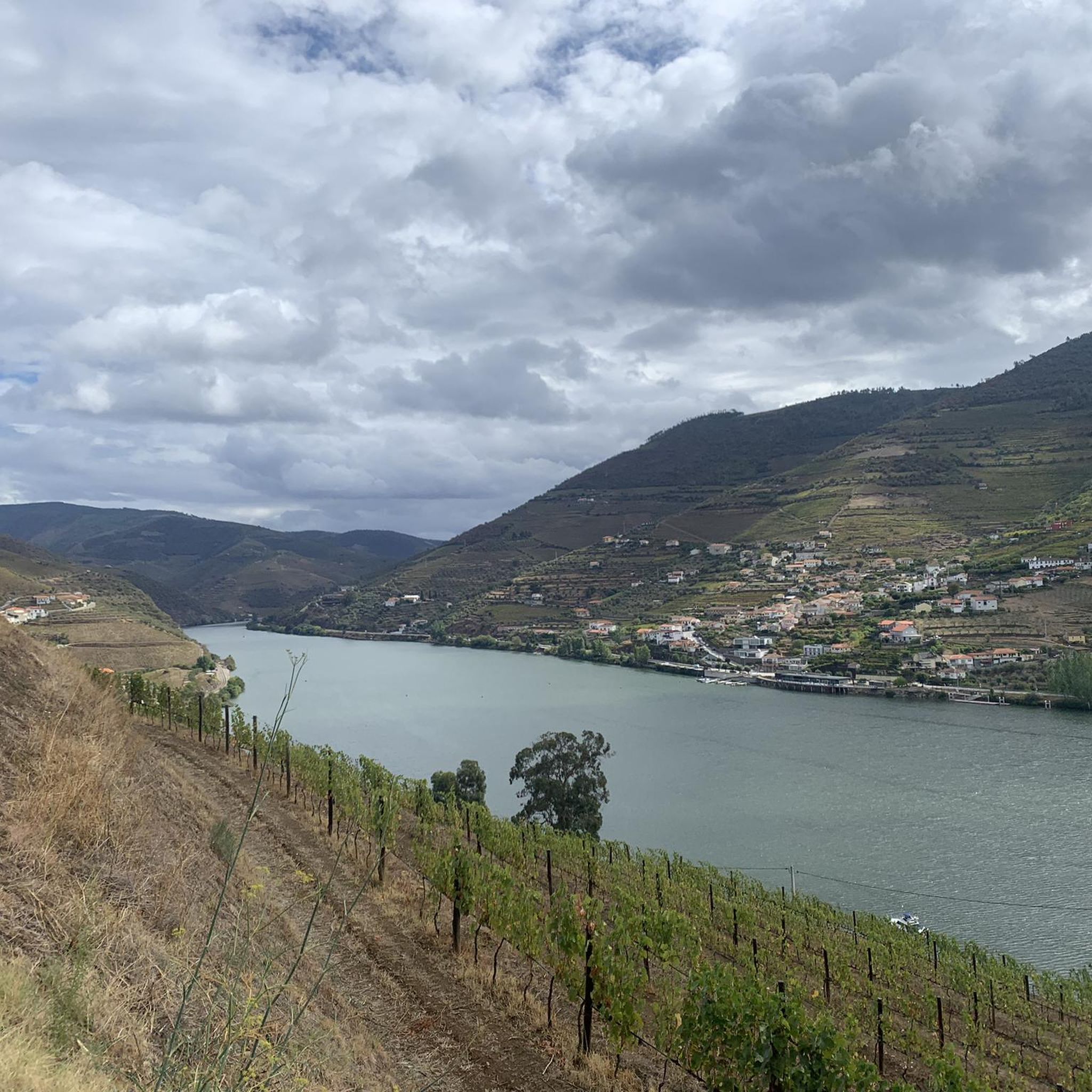
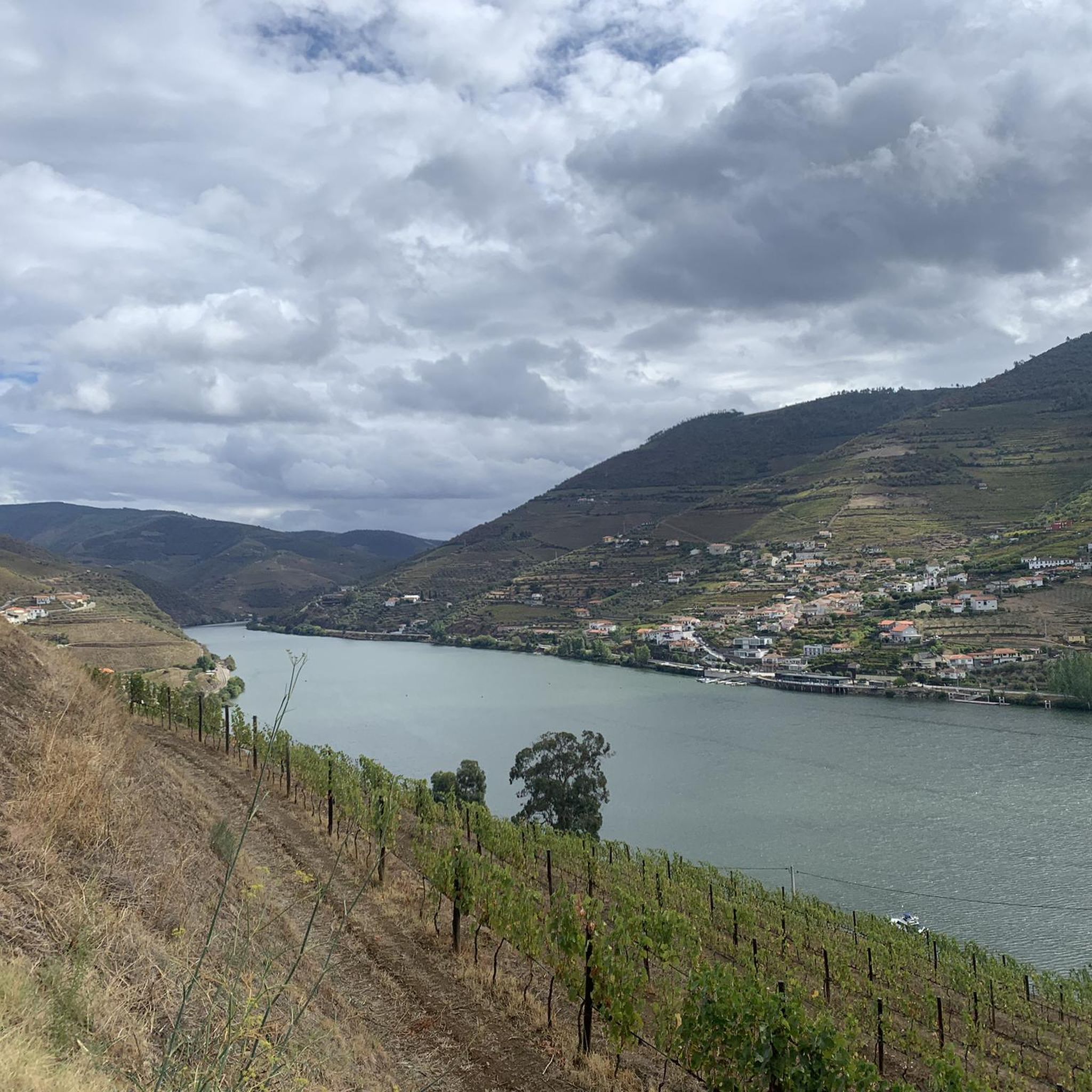
Particularly from the terrace of the nice restaurant, there are beautiful views of the Douro River, the village of Covelinhas and the village of Folgosa lying on the slope on the other side of the river.
1
0

The São Leonardo de Galafura viewpoint is one of the most emblematic and beautiful observation points in the Douro Valley, Portugal. Located at the highest point of Monte de São Leonardo, in the parish of Galafura, it offers an unparalleled view over the Douro landscape, classified as a World Heritage Site by UNESCO. Highlights and Information Panoramic View: From the viewpoint, it is possible to see the confluence of the Pêgo River with the Douro River in a curve that resembles a comma, a beautiful spot and perfect for watching an unforgettable sunset. Poetic Inspiration: The place served as inspiration for the Portuguese writer Miguel Torga, who described it poetically, highlighting the "excess of nature" in the landscape. Chapel: At the highest point of the viewpoint is the Chapel of São Leonardo, which complements the natural and historical scenery of the place. Activities: The area is suitable for hiking, and there are trails nearby that can be explored, such as those listed on Wikiloc. Location Address: Estrada São Leonardo - Galafura, Peso da Régua, 5050-044 Portugal. Access: Access is by road, and the viewpoint is a common stopping point on tours and excursions through the Douro region. For more details about the region and other attractions, you can consult the Douro Itinerary.
2
0

The parking area for motorhomes directly on the Douro River
1
0

The station is so run-down that it's almost in working order again. Old railway vehicles (burned-out steam locomotives and old wagons) are scattered around the large grounds. There are also many disused tracks, including turntables. At the end of the station, the former storage sheds have been converted into wine shops and restaurants.
2
0
A worthwhile museum, which scores points despite/or because of its very minimalist presentation of the subject matter. At the end, enjoy a port wine on the terrace of the museum's café.
1
0

A beautiful church, both inside and out. The courtyard is also worth seeing 😃
2
0
A magnificent building with a beautiful courtyard. Unfortunately, I couldn't see the inside.
1
0
The Casa do Douro was established in 1932 as the Douro Winemakers' Union Federation. Its headquarters, dating from 1944, with its exterior clad in polished granite, was designed by Portuguese architect José Porto. Inside, noteworthy are the stained-glass window by painter Lino António and the grand hall, with three central crystal chandeliers, shaped like clusters and weighing over a ton, as well as the Pombaline marker identified with the number 1. When the Douro region was first demarcated, 331 granite markers were placed. The Pombaline markers (so named because the demarcation was designed by the Marquis of Pombal) are all different and share the word Feitoria (vinho de feitoria, synonymous with better-quality wine) and the year (1758 or 1761). At the time, wines were classified according to their quality and destination. The best wine, known as Vinho de Feitoria, was sent to England; Vinho de Embarque was exported to Brazil; and Vinho de Ramo was sold in Portugal. The stained glass window of the Casa do Douro, by painter Lino António, encapsulates the entire dynamic of the Douro Demarcated Region. It covers an area of 50m2 and forms a triptych. In the center panel, we see three large figures. The central figure represents the Casa do Douro and holds a scroll that reads "... Casa do Douro, decree 21,883, November 1932." This means that the government, through the aforementioned Decree-Law, created the Union Federation of Winegrowers of the Douro Region in November 1932, now known as Casa do Douro.
1
0
Frequently Asked Questions
What kind of terrain can I expect on hiking trails in Aldeias?
Hiking in Aldeias offers a diverse landscape, from lush forests and rocky terrain to imposing mountain ranges like the Lousã and Serra da Estrela. Many trails also follow river valleys and pass by waterfalls, particularly within the Aldeias do Xisto (Schist Villages) region. You'll encounter traditional villages built from dark stone, providing a unique cultural backdrop to the natural environment.
Are there easy hiking trails suitable for beginners or families in Aldeias?
Yes, Aldeias offers a good selection of easy trails. Approximately 17 of the 31 available routes are classified as easy, making them suitable for beginners or families. An example of an easy route is the Régua and the Douro River – Régua Riverside Promenade loop from Peso da Régua, which is about 3.5 km long.
What natural features or landmarks can I see along the hiking trails in Aldeias?
The trails in Aldeias are rich with natural beauty and historical landmarks. You can expect to see picturesque schist villages, river valleys, and impressive waterfalls like the Fisgas de Ermelo in Alvão Natural Park. Highlights include the Marco Pombalino, Lamego Castle, and the Douro River itself. Many routes offer stunning panoramic views, especially in the mountain ranges.
Are there any circular hiking routes in Aldeias?
Yes, the region features numerous circular routes, many of which start and end in the charming schist villages. These loops allow you to explore the diverse landscapes and return to your starting point conveniently. For example, the Marco Pombalino – View of the Douro Valley loop from Covelinhas is a popular circular option.
What is the best time of year to go hiking in Aldeias?
Aldeias is a great destination for hiking throughout much of the year. Spring and autumn generally offer the most pleasant weather for hiking, with mild temperatures and vibrant natural colors. Summer can be warm, especially in river valleys, but higher elevations provide cooler conditions. Winter hiking is possible, particularly in lower areas, but mountain trails may be more challenging due to weather.
Are there long-distance hiking routes available in the Aldeias region?
Yes, the Aldeias region is part of several significant long-distance routes. These include the Grande Rota do Zêzere (GRZ), which connects various natural and cultural sites, and the GR22, also known as the Great Route of the Historic Villages of Portugal, which traverses historical passages and old Roman roads. The Grande Rota do Mondego also offers an extensive journey through the landscape.
What do other hikers say about the trails in Aldeias?
The hiking trails in Aldeias are highly regarded by the komoot community, with an average rating of 4.0 stars from nearly 200 reviews. Hikers often praise the unique blend of natural beauty, the charm of the traditional schist villages, and the well-maintained paths that offer a sense of cultural immersion.
Are there options for public transport to reach hiking trailheads in Aldeias?
While specific public transport options to every trailhead can vary, the region is working towards better accessibility. Some of the larger villages within the Aldeias do Xisto network may have bus connections. For detailed planning, it's advisable to check local transport schedules or consider intermodal routes like the Grande Rota do Zêzere, which is designed with public transport connections in mind.
Can I find places to eat or stay near the hiking trails?
Yes, many of the traditional schist villages integrated into the hiking network offer amenities such as cafés, restaurants, and rustic accommodation options. These villages provide excellent opportunities to experience local cuisine and hospitality, making them ideal stopping points or bases for your hiking adventures.
Are there any specific permits required for hiking in Aldeias?
Generally, no specific permits are required for hiking on the established trails in Aldeias. However, if you plan to hike in protected natural parks or reserves, it's always a good idea to check for any specific regulations or guidelines that might apply to those areas. For more information on natural parks and reserves in Portugal, you can visit visitportugal.com.
How many hiking trails are available in the Aldeias region?
There are over 30 hiking trails available in the Aldeias region, catering to various skill levels. This includes a mix of easy, moderate, and challenging routes, ensuring there's something for every hiker.
What kind of historical sites can be explored while hiking in Aldeias?
Hiking in Aldeias offers a journey through history. You can explore ancient Roman roads, pass through charming historic villages, and discover castles like Lamego Castle. The region's unique schist villages themselves are living museums, providing a glimpse into traditional Portuguese life and architecture.
Most popular routes around Aldeias
Most popular attractions around Aldeias

Get inspired with the komoot mobile app


Explore more
Browse the best Hikes in other regions.
