The best walks and hikes in Buffalo Peaks Wilderness
4.8
(6)
411
hikers
26
hikes
Hiking in Buffalo Peaks Wilderness offers diverse landscapes centered around its namesake twin volcanic peaks, East and West Buffalo Peaks. The region features high alpine meadows, rich forest environments, and numerous creeks, including unique high-altitude riparian areas with beaver ponds. This wilderness provides varied terrain for hikers, from challenging ascents to more gentle paths through meadows and forests.
Best hiking trails in Buffalo Peaks Wilderness
- The most popular hiking route is Rich Creek & Tumble Creek Trail loop — Buffalo Peaks Wilderness, an 11.7 miles (18.8 km) trail that takes about 7 hours to complete. This difficult route traverses high alpine meadows known for vibrant wildflower displays.
- Another top favourite among local hikers is Tumble Creek Trail — Buffalo Peaks Wilderness, a moderate 6.3 miles (10.2 km) path. This trail is known for its consistent presence of ponds and seasonal pools at high elevations.
- Local hikers also love the East & West Buffalo Peaks loop — Buffalo Peaks Wilderness, an 11.0 miles (17.8 km) trail leading through challenging volcanic terrain, often completed in about 9 hours 25 minutes.
- Hiking in Buffalo Peaks Wilderness is defined by twin volcanic peaks, high alpine meadows, and diverse forest environments. The network offers options for various ability levels, including 1 easy, 9 moderate, and 8 difficult routes.
- The routes in Buffalo Peaks Wilderness are highly rated by the komoot community with an average score of 4.9 stars from over 8 reviews. More than 400 hikers have used komoot to explore Buffalo Peaks Wilderness's varied terrain.
Last updated: July 7, 2026
4
hikers
4.50km
01:50
340m
0m
Embark on the Rich Creek Trail, a moderate hiking route that spans 2.8 miles (4.5 km) and features a significant elevation gain of 1118 feet (341 metres). You will navigate through dense spruce and aspen forests, experiencing steady climbs before the path opens into expansive meadows. Here, you can admire wildflowers, willows, and beaver dams, all while Rich Creek winds peacefully alongside you, offering a serene immersion into Colorado's diverse natural landscapes over approximately 1 hour and 50 minutes.
For your visit, parking is typically available at the Tumble Creek Trailhead, ensuring easy access to the route. The trail welcomes dogs, so feel free to bring your furry friend along. While water sources are generally found along the creek, it is always wise to carry enough water for your personal needs. Be prepared for some marshy sections along the way; waterproof boots are highly recommended to keep your feet dry and comfortable.
This trail offers a unique opportunity to observe diverse ecosystems, even without focusing on 'big mountain views.' Keep an eye out for local wildlife, as moose and elk are known to frequent the area. The journey provides a peaceful escape, allowing you to connect with nature and appreciate the varied terrain and natural beauty of the Buffalo Peaks Wilderness.
7
hikers
18.8km
07:00
590m
580m
Embark on the Rich Creek and Tumble Creek Loop, a challenging hike that spans 11.7 miles (18.8 km) and climbs 1924 feet (586 metres) over an estimated 6 hours and 59 minutes. This difficult route guides you through varied Colorado landscapes, from dense forests to open valleys. You will traverse a gentle alpine pass before descending into the expansive Buffalo Meadows, where you can enjoy views of the West and East Buffalo Peaks.
When planning your visit, consider hiking the loop counter-clockwise; many find this approach offers more gradual inclines for the majority of the 2,000 feet of elevation gain. Be prepared for potentially marshy areas, especially around the beaver ponds along Rough and Tumbling Creek, so waterproof boots are a good idea. The trail is generally considered a moderate hike despite its difficult rating, making it a rewarding day out for experienced hikers.
This loop is notable for its rich natural environment, offering glimpses of abundant wildflowers and wildlife such as deer and elk. As you follow Rough and Tumbling Creek, keep an eye out for numerous beaver dams and lodges, which are a prominent feature of the landscape. The trail provides a deep immersion into the Buffalo Peaks Wilderness, showcasing its diverse ecosystems and scenic beauty.

Sign up for free
1
hikers
10.2km
04:08
430m
430m
Embark on the Tumble Creek Trail, a moderate hiking route that spans 6.3 miles (10.2 km) and involves a climb of 1427 feet (435 metres). You can expect to complete this journey in about 4 hours and 8 minutes, winding through diverse landscapes. As you hike, you will pass through lush forests, shimmering aspens, and shaded pine groves, eventually reaching expansive open meadows where you might spot late-season wildflowers, especially near the junction with the Buffalo Peaks trail. The route follows Tumble Creek, offering manageable water crossings and a chance to see wildlife.
When planning your visit, be aware that the access road to the trailhead can be steep and bumpy, so a four-wheel-drive or all-wheel-drive vehicle is often recommended to reach the starting point. This trail is known for its solitude, providing a peaceful escape from crowds, and you will find numerous water sources along the way, which is helpful for longer hikes. Consider starting early to make the most of the day and enjoy the tranquility.
The Tumble Creek Trail offers more than just a workout; it provides stunning views of the Collegiate Peaks and the two Buffalo Peaks, making it a memorable experience. Keep an eye out for wildlife, such as moose, often seen near the stream. This route stands out for its combination of varied terrain and opportunities for quiet contemplation in the heart of the Buffalo Peaks Wilderness.
5
hikers
11.1km
03:59
850m
0m
The Rainbow Lake via Pine Creek Trail offers a quintessential Colorado alpine adventure, leading you through diverse terrain from tranquil pine woodlands and open meadows to striking granite outcroppings. You'll follow the lively Pine Creek before tackling switchbacks that ascend to the stunning Rainbow Lake, where shimmering waters are framed by impressive peaks like Mount Harvard. This moderate hike covers 6.9 miles (11.1 km) with 2794 feet (851 metres) of elevation gain, typically taking just under 4 hours, making it a substantial day trip for those seeking a rewarding challenge.
Before you head out, be aware that a small fee is required at the trailhead as part of the route crosses private property; it's $1 for hikers and $2 if you're bringing a dog. While the trailhead offers parking, it's a popular spot, so plan to arrive early. For those considering a winter hike, microspikes and trekking poles are strongly advised for stability on potentially vertiginous sections.
This trail is celebrated for providing stunning mountain vistas and a true sense of isolation within the Collegiate Peaks Wilderness, all without requiring an overnight stay. A segment of the famous Colorado Trail (Segment 12) is also incorporated into the route. Rainbow Lake itself serves as a perfect spot to pause, enjoy lunch, and soak in the tranquil environment before your descent.
9
hikers
13.8km
04:13
480m
480m
Embark on a moderate hiking journey along the Pine Creek Trail, a route that spans 8.6 miles (13.8 km) within the scenic San Isabel National Forest. You will gain 1567 feet (478 metres) in elevation, with an estimated duration of 4 hours and 13 minutes. The trail immerses you in a classic Colorado mountain atmosphere, following the Lower Pine Creek drainage and offering varied terrain and peaceful forest surroundings.
Before you set out, it is advisable to check local forest service websites for current alerts or road conditions. Parking is typically available at the trailhead, making access convenient for hikers. Confirming any specific permit requirements beforehand will help ensure a smooth and enjoyable visit to the area.
This trail provides a wonderful opportunity to experience the natural beauty and diverse ecosystem of San Isabel National Forest. As you hike, you will encounter the characteristic flora and fauna of the region, making it a notable choice for those seeking an authentic mountain adventure. The serene environment offers a true escape into nature.
Get access to more routes and recommendations from other explorers.
Sign up for free
Already have an account?
Our route recommendations are based on thousands of hikes, rides, and runs completed by other people on komoot.
Start today with a free account
Your next adventure awaits.
Login or Signup
Popular around Buffalo Peaks Wilderness
Tips from the Community

The Tumble Creek Trail begins here. This section offers a rideable path since it's located beyond the limits of the Buffalo Peaks Wilderness area. It's a short ride but definitely worth experiencing. This route is popular among hikers so please beware of foot traffic.
0
0

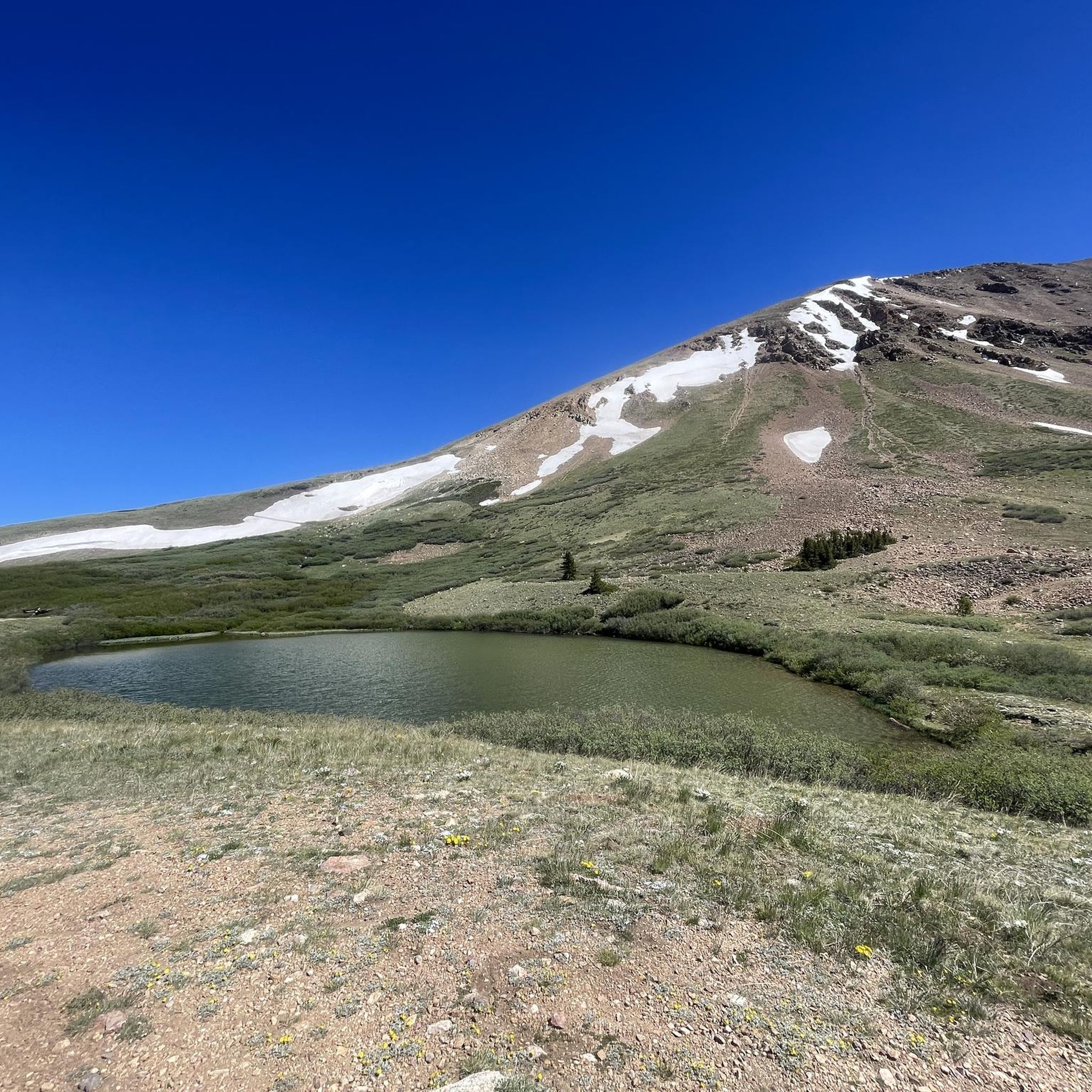
One thing that sets the Buffalo Peaks Wilderness apart from other wilderness areas is how high some of its riparian environments climb. At elevations of 10,000 feet and above, there is a multitude of streams, beaver ponds, and herds of animals. This spot on Tumble Creek Trail is known for constantly having ponds and seasonal pools. This is also a good place to refill your water if you are running with a filter bottle.
0
0
The Buffalo Peaks Wilderness encompasses over 40,000 acres and has a different "feel" from the other wilderness areas around the Sawatch and Mosquito mountain ranges. This wilderness area is much less visited than others (probably due to accessibility and proximity to larger cities), which means it offers more solitude than a lot of other outdoor spaces. Wilderness areas have different rules than other outdoor spaces (such as state parks and national forests) so it's best to be prepared for backcountry travel, and make sure to always follow LNT principles in these more fragile environments. If you want to experience the alpine wilderness without too many crowds, the Buffalo Peaks could be what you're looking for.
0
0
One thing that sets the Buffalo Peaks Wilderness apart from other wilderness areas is how high some of its riparian environments climb. At elevations of 10,000 feet and above, there is a multitude of streams, beaver ponds, and herds of animals. This spot on Tumble Creek Trail is known for constantly having ponds and seasonal pools. This is also a good place to refill your water if you are running with a filter bottle.
0
0
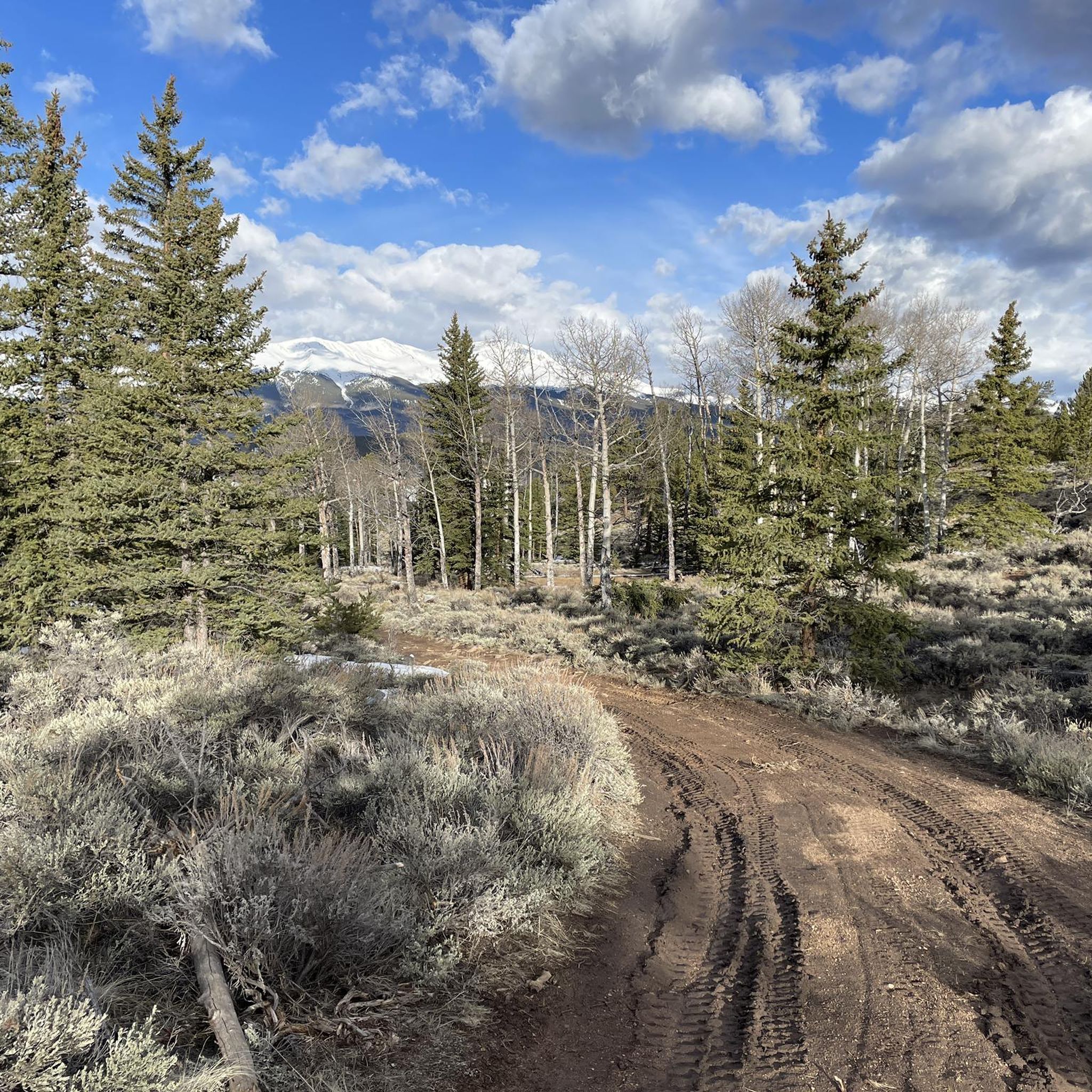
Tumble Creek Trail is a wilderness trail just outside of Buena Vista, Colorado, that spends the majority of its time in the trees as it winds between 12,000 and 13,000 foot peaks. At this spot (a little over 11,000 feet elevation), the trail breaks into an open meadow with views of the Buffalo Peaks and the Collegiate Peaks Wilderness areas. The running is spectacular through the meadows, and you can easily tie into other wilderness trails using this trail.
0
0
Pine Creek Trail is a popular out and back option for many hikers and runners, but it can also be utilized as an access trail for a number of 14ers, wilderness trails, and different loops. The trail consistently gains elevation as it creeps up the valley towards the Colorado Trail. There is lots of wildlife along the way and water near the trail the entire time. The access road, parking area, and first ~half mile of trail are on private property. There is a deposit box at the start of the trail from the landowners asking for $1 per hiker and $2 per animal/pet in order to use the trail. This fee goes into maintaining the trail and parking lot and is a small price for what this trail has to offer.
0
0
Pine Creek Trail is a popular out and back option for many hikers, but it can also be utilized as an access trail for a number of 14ers, wilderness trails, and different hiking loops. The trail consistently gains elevation as it creeps up the valley towards the Colorado Trail. There is lots of wildlife along the way and water near the trail the entire time. The access road, parking area, and first ~half mile of trail are on private property. There is a deposit box at the start of the trail from the landowners asking for $1 per hiker and $2 per animal/pet in order to use the trail. This fee goes into maintaining the trail and parking lot and is a small price for what this trail has to offer.
0
0
Tumble Creek Trail is a wilderness trail just outside of Buena Vista, Colorado, that spends the majority of its time in the trees as it winds between 12,000 and 13,000 foot peaks. At this spot (a little over 11,000 feet elevation), the trail breaks into an open meadow with views of the Buffalo Peaks and the Collegiate Peaks Wilderness areas.
0
0
Frequently Asked Questions
How many hiking trails are available in Buffalo Peaks Wilderness?
Buffalo Peaks Wilderness offers a diverse network of over 18 hiking trails. These routes cater to various skill levels, including 1 easy, 9 moderate, and 8 difficult options, ensuring there's a suitable path for almost every hiker.
What is the best time of year to hike in Buffalo Peaks Wilderness?
The Buffalo Peaks Wilderness is suitable for hiking year-round, but summer and early fall are particularly popular. During July and August, the high alpine meadows, such as Rich Creek meadow, burst with vibrant wildflower displays. Favorable weather conditions also make these seasons ideal for exploring the area.
Are there hiking options for beginners or those looking for an easy walk?
Yes, while many trails are moderate to difficult, there is at least one easy route available. For a less strenuous option, consider the Granite Overlook — San Isabel National Forest trail, which offers a gentle experience.
What kind of terrain can I expect when hiking in Buffalo Peaks Wilderness?
Hikers can expect a rich variety of terrain. The wilderness is defined by its twin volcanic peaks, West Buffalo Peak and East Buffalo Peak, which offer challenging ascents. You'll also find expansive high alpine meadows, dense forest environments, and numerous creeks, including unique high-altitude riparian areas with beaver ponds.
What natural features or landmarks can I see while hiking?
Beyond the stunning panoramic views from the twin volcanic peaks, you can explore the vibrant Rich Creek meadow, known for its wildflowers. Many trails also feature high-altitude riparian environments with consistent ponds and seasonal pools, particularly along the Tumble Creek Trail.
Is there a chance to see wildlife in Buffalo Peaks Wilderness?
Yes, Buffalo Peaks Wilderness is a haven for wildlife. It's home to Colorado's largest herd of bighorn sheep, along with elk, bears, and beavers. Keep an eye out, especially in the quieter areas and near water sources, for opportunities to spot these animals.
Are there any circular or loop hikes available?
Yes, the wilderness offers several excellent loop options. A popular choice is the Rich Creek & Tumble Creek Trail loop, an 11.7-mile difficult route. For a more challenging adventure, consider the East & West Buffalo Peaks loop, which covers 11 miles through volcanic terrain.
What do other hikers enjoy most about Buffalo Peaks Wilderness?
The area is highly rated by the komoot community, with an average score of 4.9 stars from over 8 reviews. Hikers frequently praise the incredible solitude and the true wilderness experience it offers, providing a refreshing escape from more crowded areas. The diverse landscapes, from high alpine meadows to challenging peaks, are also highly valued.
Are the trails in Buffalo Peaks Wilderness suitable for families?
While many trails are moderate to difficult, there are options that can be suitable for families, especially those with some hiking experience. The Granite Overlook — San Isabel National Forest trail is an easy option. For families seeking a moderate challenge, the Tumble Creek Trail is a good choice, known for its scenic ponds.
Can I bring my dog on the hiking trails in Buffalo Peaks Wilderness?
As part of a designated Wilderness Area, Buffalo Peaks Wilderness generally allows dogs, but they must be kept on a leash to protect wildlife and ensure a pleasant experience for all visitors. Always check current regulations before heading out, as rules can change.
Where can I find parking for trailheads in Buffalo Peaks Wilderness?
Access to the wilderness is available from several trailheads, including Fourmile Creek, Rich Creek, Salt Creek, and Tumble Creek. Be aware that some trailheads may require a 4-wheel drive vehicle for the final approach due to road conditions.
Most popular routes in Buffalo Peaks Wilderness
Most popular attractions in Buffalo Peaks Wilderness

Get inspired with the komoot mobile app


Explore more
Browse the best Hikes in other regions.
