The best walks and hikes in Agua Tibia Wilderness
4.9
(30)
207
hikers
28
hikes
If you've ever tried to plan hiking in Agua Tibia Wilderness, you know how quickly the options can feel overwhelming. With approximately 25 miles (40 km) of trails, it's tough to figure out which ones are genuinely worth your time and effort, and which are just filler. We get it; sifting through countless routes to find those true highlights can be a real pain.
That's where we come in. Our komoot community has explored, mapped, and reviewed these routes, allowing us to cut through the noise. This guide is your curated shortlist of the very best, saving you the guesswork and ensuring your legs are well-spent on trails that deliver.
Agua Tibia Wilderness is a place of rugged beauty, defined by steep, chaparral-clad mountains that rise dramatically from canyon bottoms, transitioning to forests of fir, pine, and oak at higher altitudes. It offers a true backcountry experience, with routes ranging from moderate day hikes to strenuous, long-distance challenges. Just remember, a free visitor permit is required for entry, so plan ahead.
If you're looking for a challenging day out with significant elevation gain, the Wild Horse Trail – Agua Tibia Wilderness is a local favorite, covering 10.3 miles (16.5 km) and offering a real workout. For those seeking a comprehensive experience of the wilderness, the Agua Tibia Full Loop Trail is a demanding 19.1 miles (30.7 km) that truly immerses you in the landscape. With more than 190 hikers having used komoot to explore here, you're in good company. Dive in and discover your next adventure!
Last updated: June 2, 2026
1
hikers
8.16km
02:42
530m
140m
The Wild Horse Peak Trail offers a unique blend of challenging terrain and expansive views, making it a standout hike in the Agua Tibia Wilderness. You'll navigate steep sandy sections and patches of loose, small rocks early on, but the effort pays off with stunning panoramas from Wild Horse Peak, overlooking Temecula and the Inland Empire. On clear days, you can even spot distant snowy peaks like San Gorgonio, creating a memorable backdrop to this 5.1-mile (8.2 km) adventure.
Planning your visit requires a bit of foresight for this moderate route, which typically takes around 2 hours and 42 minutes to complete. With 1746 feet (532 metres) of elevation gain, you'll want to start early, especially in warmer months, and carry plenty of water as there are no sources along the way. The Dripping Springs Trail Trailhead provides access, and spring is often recommended for cooler weather and the chance to see wildflowers.
What sets this trail apart is its ability to deliver a solitary experience despite its popularity, appealing to those who seek quiet on the trails. Dogs are welcome on a leash, and the views from the summit are particularly notable for their unobstructed vistas due to the peak's isolation. It's a rewarding hike for those ready for a good climb and seeking a peaceful escape.
1
hikers
30.7km
09:24
1,130m
1,110m
The Agua Tibia Full Loop Trail offers a deep dive into the rugged Agua Tibia Wilderness, taking you through diverse terrain from chaparral to pine and oak forests. You'll navigate boulder-strewn sections of Arroyo Seco Creek and climb to viewpoints like Eagle Crag Peak, which offers expansive views of Southern California mountains. This challenging 19.1-mile (30.7 km) hike with 3709 feet (1131 metres) of elevation gain is a true test of endurance, typically requiring 9 hours and 24 minutes to complete.
Planning your visit requires careful consideration; the trail is difficult and best tackled between November and May to avoid extreme summer heat. You should start early, carry plenty of water, and be prepared to filter additional water if needed. The route is formed by connecting the Dripping Springs Trail, Palomar-Magee Trail, and Wild Horse Trail, all starting from the Dripping Springs Trail Trailhead.
This loop provides a genuine backcountry experience in San Diego County's first and largest federally designated wilderness area. While wildflowers can be beautiful in spring, be aware of rattlesnakes during warmer periods. The trail's remote feel and significant elevation changes make it ideal for experienced hikers seeking solitude and a demanding day in nature.

Sign up for free
1
hikers
42.1km
12:54
1,510m
1,490m
The Eagle Crag via Agua Tibia Loop is a demanding journey through the rugged Agua Tibia Wilderness, offering a diverse landscape that shifts from lush chaparral and oak woodlands to higher elevation pine forests. You'll encounter challenging terrain, including steep, rocky canyons and potentially overgrown sections, especially as you climb towards the prominent Eagle Crag. The reward for your effort is panoramic views stretching across Southern California, encompassing Temecula, San Diego County, and distant mountain ranges, making it a truly memorable experience for those seeking a remote adventure.
Planning for this difficult 26.2-mile (42.1 km) hike, which involves 4949 feet (1508 metres) of elevation gain and takes nearly 13 hours, requires careful preparation. It's best tackled from late fall to early spring to avoid the intense summer heat, which can exceed 100 degrees Fahrenheit in lower areas. Be sure to bring plenty of water and wear long pants and sleeves to protect against dense brush. While there isn't a specific trailhead parking mentioned, the route often starts near the Dripping Springs Trailhead, and permits are technically required for overnight stays in the wilderness.
This loop is a true hidden gem in Southern California, providing an authentic wilderness experience far from urban crowds. The Agua Tibia Wilderness is known for its diverse ecosystems and impressive granite formations, offering a chance for solitude and wildlife sightings like deer and bobcats. It's a fantastic option for experienced hikers looking for a strenuous challenge and a deep dive into the region's natural beauty, away from more frequented trails.
8
hikers
16.5km
05:17
670m
670m
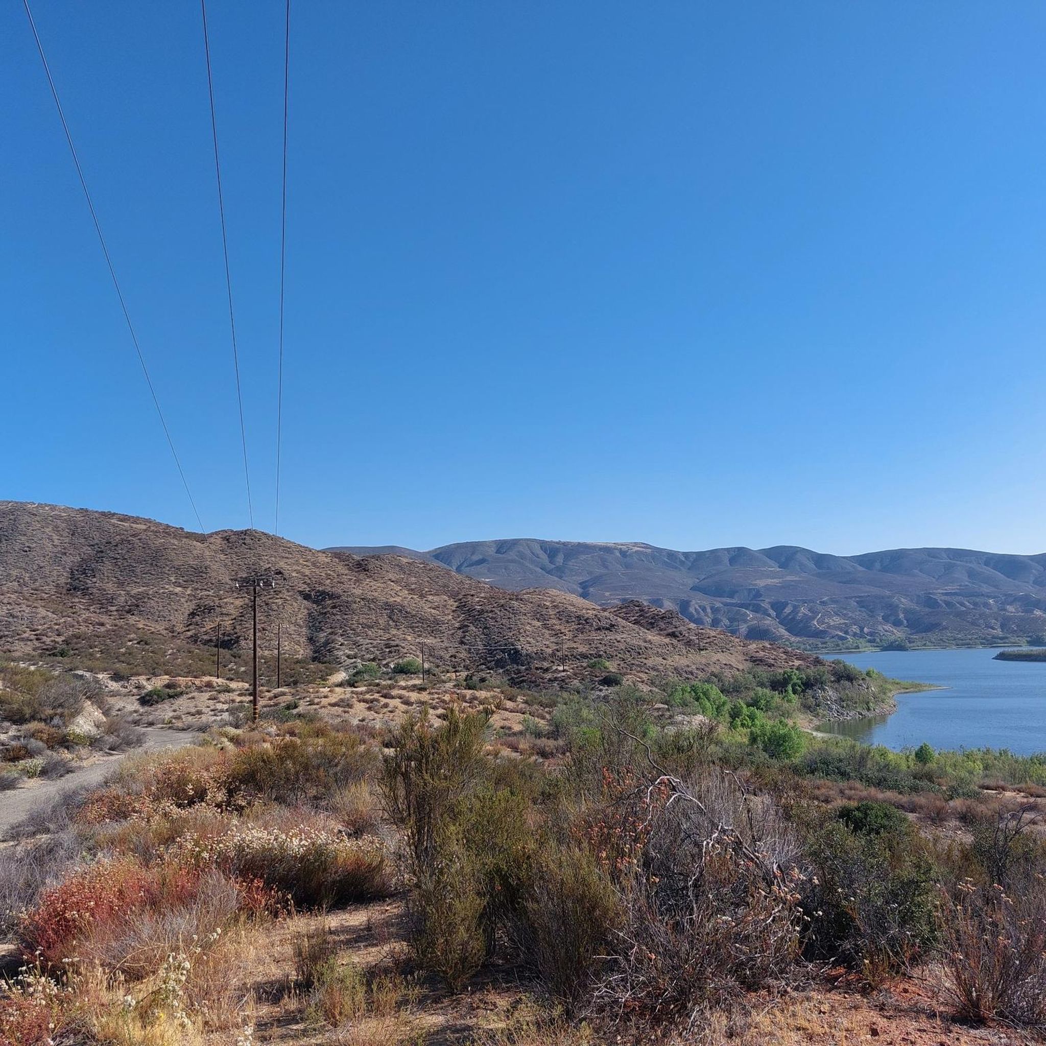
The Wild Horse Trail in the Agua Tibia Wilderness offers a rugged and scenic escape into Southern California's backcountry. You'll start by climbing through oak and sycamore-shaded canyons, then ascend into vibrant chaparral, especially colorful in spring. As you gain elevation, the trail opens up to impressive viewpoints overlooking Vail Lake, Lake Skinner, and the sprawling vineyards of the Temecula Valley, with distant peaks like Mt. San Jacinto adding to the panorama. This route provides a true wilderness experience, navigating natural paths and granite fields through a landscape of rocky peaks and large boulders.
Planning your visit to the Wild Horse Trail is crucial due to its challenging nature. This difficult hike covers 10.3 miles (16.5 km) with a significant 2201 feet (671 metres) of elevation gain, typically requiring about 5 hours and 17 minutes. It's highly recommended to tackle this trail during the cooler months, from late winter through spring, when the weather is more forgiving and the landscape is at its most beautiful. The Dripping Springs Trail Trailhead serves as your access point, and while permits aren't usually required for day hikes, always check for current conditions or advisories from the Cleveland National Forest.
What makes the Wild Horse Trail stand out is its immersion into the Agua Tibia Wilderness, offering a genuine sense of solitude and exploration. While the name might suggest encounters with wild horses, the trail's primary rewards are its diverse scenery and the challenging journey itself, rather than a specific destination. It's a fantastic option for moderately experienced hikers looking for advanced hiking trails and a deep dive into the natural beauty of the region, providing a stark contrast to more crowded local trails.
9
hikers
20.0km
06:11
760m
760m
Hard hike. Very good fitness required. Easily-accessible paths. Suitable for all skill levels.
Get access to more routes and recommendations from other explorers.
Sign up for free
Already have an account?
Our route recommendations are based on thousands of hikes, rides, and runs completed by other people on komoot.
Start today with a free account
Your next adventure awaits.
Login or Signup


Tips from the Community

Park the car just before the campground. 2 parking spots are free, and the remaining few need a 5$ self registration fee (so take cash with you).
0
0

Challenging trail up to Wild Horse Peak. In spring you hike through granite fields covered with flowers.
3
0
Frequently Asked Questions
Do I need a permit to hike in the Agua Tibia Wilderness?
Yes, two things are typically required. You will need a free visitor permit for entry into the wilderness area, which you can get from the Palomar Ranger District. Additionally, an Adventure Pass is required for vehicles parked at the trailheads. For the most current information, it's best to check with the official authorities before you go.
Are there any easy hikes for families in the Agua Tibia Wilderness?
The Agua Tibia Wilderness is known for its rugged and challenging terrain, making most trails unsuitable for casual family outings. However, for a less strenuous experience nearby, you might consider the Vail Lake loop — Temecula, California. This moderate 6-mile (9.6 km) route follows trails and gravel roads around the lake area, offering a more accessible option.
What is the wildlife like in this area?
The remote and rugged terrain provides a habitat for a variety of animals. You might encounter mule deer, bobcats, and coyotes. The area is also known for its snake population, including several species of rattlesnakes, so it's important to be cautious and aware of your surroundings, especially in warmer weather.
Are there reliable water sources on the trails?
No, water is very scarce in the Agua Tibia Wilderness, especially during the hot summer and autumn months when temperatures can exceed 100°F (38°C). Arroyo Seco Creek may have water, but it's not guaranteed. It is essential to carry all the water you will need for your entire hike.
What kind of elevation gain should I expect on a long hike?
The trails here involve significant climbing. For example, the demanding Wild Horse Trail – Agua Tibia Mountain (1454m) loop from Radec is a 16.6-mile (26.7 km) route that accumulates over 3,200 feet (998 m) of elevation gain. Always check the specifics of your chosen route and be prepared for a strenuous ascent.
What do other hikers say about the trails in Agua Tibia Wilderness?
The area is highly regarded by the komoot community, with an average rating of 4.9 stars. Hikers often praise the sense of solitude and the true backcountry experience. The challenging climbs are frequently mentioned, as are the rewarding panoramic views from the ridges and peaks.
Can I go backpacking in the Agua Tibia Wilderness?
Yes, backpacking is possible for experienced and well-prepared hikers. The 25-mile Agua Tibia Loop, which summits both Eagle Crag and Agua Tibia Mountain, is a formidable multi-day challenge. Remember to plan for scarce water and obtain the necessary visitor permit before your trip.
What is the main access trail into the wilderness?
The primary route into the heart of the wilderness is the Dripping Springs Trail. This trail provides the main access to the area's remote beauty, crossing Arroyo Seco Creek and ascending towards Agua Tibia Mountain. Many longer routes, like the Palomar-McGee Trail, connect from it.
How many hiking trails are there in the Agua Tibia Wilderness?
You can explore approximately 25 miles (40 km) of established pathways within the wilderness. On komoot, there are over 20 curated routes available, ranging from strenuous mountain ascents to more moderate loops in the surrounding area.
What is the terrain like on the trails?
Expect steep, rugged, and often overgrown trails. The landscape transitions from dense chaparral on the lower slopes, with some manzanita reaching over 20 feet high, to cooler forests of fir, pine, and oak at higher elevations. The paths are often rocky and involve significant elevation changes.
Are dogs allowed on the trails in Agua Tibia Wilderness?
Yes, dogs are generally permitted in the Agua Tibia Wilderness, but they must be on a leash at all times. However, due to the challenging terrain, high summer temperatures, lack of water, and presence of rattlesnakes, you should carefully consider if the conditions are suitable for your dog.
Most popular routes in Agua Tibia Wilderness

Get inspired with the komoot mobile app


Explore more
Browse the best Hikes in other regions.
