
The best road cycling routes in Santa Rosa Wilderness
5.0
(1)
199
riders
5
rides
Road cycling routes in Santa Rosa Wilderness traverse a diverse landscape characterized by a blend of desert and mountain environments. The region features dramatic elevation changes, transitioning from desert flora to chaparral and pine-covered ridges at higher elevations. While the interior wilderness is rugged, paved roads like the Palms to Pines Scenic Byway offer access to scenic views and varied terrain for road cyclists. These routes often follow the periphery of the wilderness, providing a mix of gradients and vistas.
…Last updated: October 16, 2026
73
riders
50.4km
02:20
400m
400m
Moderate road ride. Good fitness required. Mostly well-paved surfaces and easy to ride.
26
riders
61.9km
02:42
450m
450m
Moderate road ride. Good fitness required. Mostly well-paved surfaces and easy to ride.

17
riders
20.6km
00:56
230m
230m
Easy road ride. Great for any fitness level. Mostly well-paved surfaces and easy to ride.
17
riders
21.4km
00:55
110m
110m
Easy road ride. Great for any fitness level. Mostly well-paved surfaces and easy to ride.
20
riders
24.7km
00:59
120m
120m
Easy road ride. Great for any fitness level. Mostly well-paved surfaces and easy to ride.
Our route recommendations are based on thousands of hikes, rides, and runs completed by other people on komoot.
Start today with a free account
Your next adventure awaits.
Popular around Santa Rosa Wilderness

Tips from the Community

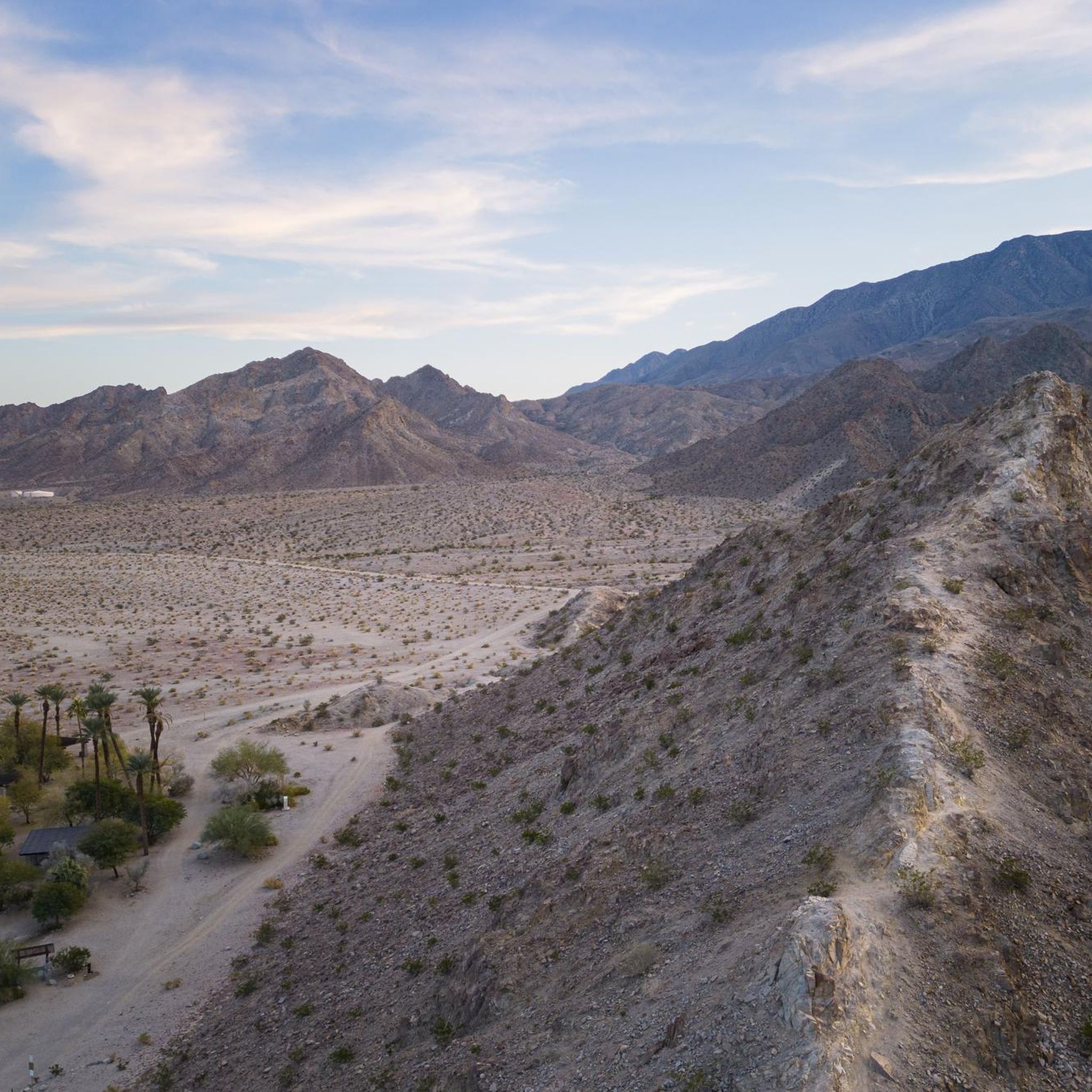
Point happy is a Palm Springs classic! In 1906, Norman “Happy” Lundbeck settled on a farm located on the eastern side of the rugged rocks that extend into the desert, near what is now the junction of Highway 111. In addition to farming, he ran a stable and a small store. This area, once known as Marshall's Cove, was eventually renamed "Point Happy" in recognition of his influence.
0
0

The Fred Wolff Nature Preserve is a 20-acre parcel — just one part of the much larger green space around you. The preserve is dedicated to hiking, but you can enjoy it —without leaving your bike — from the Bear Creek Trail which passes right beside it.
0
0
Frequently Asked Questions
What kind of terrain can I expect on road cycling routes in the Santa Rosa Wilderness area?
Road cycling routes in the Santa Rosa Wilderness area primarily traverse a diverse landscape that blends desert and mountain environments. While the interior wilderness is rugged and not suited for traditional road cycling, the routes often follow the periphery on paved roads, offering dramatic elevation changes, desert flora, and views of chaparral and pine-covered ridges at higher elevations. You'll experience a mix of gradients and scenic vistas.
How many road cycling routes are available in the Santa Rosa Wilderness area?
There are currently 7 road cycling routes available in the Santa Rosa Wilderness area, as mapped on komoot. These routes offer a variety of experiences, from easy loops to more moderate challenges.
Are there road cycling routes suitable for beginners or families?
Yes, the Santa Rosa Wilderness area offers several routes suitable for beginners and families. For example, the Roadbike loop from La Quinta is an easy 9.0-mile (14.5 km) trail that takes about 40 minutes to complete, leading through the local desert environment. Another easy option is the Roadbike loop from Villaggio at La Quinta, which is 24.7 km long.
What is the typical duration of road cycling routes here?
The duration of road cycling routes in the Santa Rosa Wilderness area varies depending on the route and your pace. Shorter, easy loops like the Roadbike loop from La Quinta can be completed in about 40 minutes. Longer, moderate routes such as the Point Happy – Living Desert Zoo loop from Art Smith Trailhead typically take around 2 hours 30 minutes.
Are there any challenging routes for experienced road cyclists?
While the Santa Rosa Wilderness area primarily features easy to moderate road cycling routes, experienced cyclists can find challenges in the longer, more undulating routes. The Point Happy loop from Art Smith Trailhead, for instance, is a moderate 38.7-mile (62.3 km) path with over 450 meters of elevation gain, offering extended stretches through the desert-mountain transition zone.
What is the best time of year for road cycling in the Santa Rosa Wilderness area?
The best time for road cycling in the Santa Rosa Wilderness area is typically during the cooler months, from late fall through spring (October to April). Summers can be extremely hot, making cycling uncomfortable and potentially unsafe. Winter offers pleasant temperatures, though occasional rain or cooler mornings should be anticipated.
Where can I find parking or access points for these road cycling routes?
Many routes, such as the Point Happy – Living Desert Zoo loop and the Point Happy loop, start from the Art Smith Trailhead, which typically offers parking. Other routes originate from towns like La Quinta, where public parking may be available near the starting points mentioned in the route descriptions.
What scenic views or landmarks can I see while road cycling?
Road cycling routes in the Santa Rosa Wilderness area offer stunning desert landscapes, mountain foothills, and scenic byways. The Palms to Pines Scenic Byway, which passes through parts of the Santa Rosa and San Jacinto Mountains National Monument, provides unique views through different life zones, from desert palms to high mountain pine forests. Routes like the Point Happy – Living Desert Zoo loop also offer views of local attractions like the Living Desert Zoo.
Is the Santa Rosa Wilderness a good destination for road cycling compared to other areas named 'Santa Rosa'?
It's important to distinguish the Santa Rosa Wilderness from Santa Rosa city in Sonoma County. While Sonoma County is renowned for extensive road cycling through vineyards and rolling hills, the Santa Rosa Wilderness itself is a rugged, mountainous area. Road cycling here is primarily limited to paved roads on its periphery, such as the Palms to Pines Scenic Byway, offering a unique desert-mountain cycling experience rather than traditional road cycling within the wilderness boundaries.
What do other road cyclists enjoy most about road cycling in the Santa Rosa Wilderness area?
The road cycling routes in the Santa Rosa Wilderness area are highly rated by the komoot community, with an average score of 5.0 stars. Cyclists often praise the unique desert landscapes, the challenging yet rewarding elevation changes on some routes, and the scenic views offered by the byways that skirt the wilderness.
Are there any specific considerations for winter road cycling in this region?
Winter is generally a favorable time for road cycling in the Santa Rosa Wilderness area due to cooler temperatures. However, be prepared for potentially chilly mornings, especially at higher elevations. While snow is rare on the cycling routes themselves, it can occur in the higher mountains, and weather conditions can change, so checking forecasts before heading out is always recommended.
Can I find cafes or places for refreshments along the road cycling routes?
The road cycling routes often start or pass near towns like La Quinta, where you can find various cafes, restaurants, and shops for refreshments. While specific cafes might not be directly on every stretch of the more remote parts of the routes, planning your stops around the urban centers or larger trailheads will ensure you have access to amenities.

Get inspired with the komoot mobile app


Explore more
Browse the best Road cycling routes in other regions.
