The best road cycling routes around Tehaleh
4.7
(15)
628
riders
21
rides
If you've ever tried to plan road cycling around Tehaleh, you know how quickly the sheer number of options can become overwhelming. It's tough to tell which road bike trails Tehaleh truly offers for a great ride versus those that are just filler. That's where we come in: our komoot community has ridden, mapped, and reviewed these cycling routes, so we've done the legwork to bring you a curated shortlist of the ones genuinely worth your time and effort.
Road cycling in Tehaleh offers a fantastic mix of terrain, from gentle rolling hills to routes with moderate elevation gain, all set against a backdrop of preserved woodlands and open spaces. What makes it special? The way the routes often follow scenic river corridors and provide glimpses of Mount Rainier, especially from the elevated plateau Tehaleh sits on. You'll find everything from easy, flat spins to more challenging climbs, making it a great destination for a range of abilities.
If you only do one ride, we'd point you towards the Foothills Trail – Rest Stop by the Carbon River loop from South Hill. This popular road bike route in Tehaleh, Washington, is a moderate 38.5 miles (61.9 km) with about 988 feet (301 m) of climbing, offering a fantastic taste of the area's river views and gentle ascents. For a slightly shorter, but equally rewarding ride, the Rest Stop by the Carbon River – Foothills Trail loop from Bonney Lake covers 34.1 miles (54.9 km) with 942 feet (287 m) of elevation, perfect for those looking for a solid moderate outing. With over 600 road cyclists having explored Tehaleh with komoot, you can trust these routes are tried and tested.
Last updated: June 4, 2026
5.0
(6)
185
riders
54.9km
02:20
290m
290m
Moderate road ride. Good fitness required. Mostly well-paved surfaces and easy to ride.
5.0
(4)
150
riders
61.9km
02:32
300m
300m
The Foothills Trail – Rest Stop by the Carbon River loop from South Hill offers a delightful road cycling experience, tracing the Carbon River through a mix of farmland and lush forests. You'll enjoy mostly paved surfaces on this rail-to-trail conversion, which means gentle gradients and smooth riding. Keep an eye out for the spectacular, unobstructed views of Mount Rainier that punctuate the journey, especially around the designated Rest Stop by the Carbon River.
This moderate 38.5-mile (61.9 km) cycling route involves about 986 feet (301 metres) of elevation gain and typically takes around 2 hours and 31 minutes to complete. The trail is a multi-use path, making it a popular choice for various activities, and its well-maintained surface is ideal for road bikes. Multiple access points along the route provide flexibility for starting and ending your ride.
Built on a historic railroad bed, the Foothills Trail offers a unique blend of natural beauty and historical context, passing by sites like the Melmont ghost town. The Rest Stop by the Carbon River itself is a notable landmark, providing a perfect spot for a break with picnic tables and even a primitive campfire. This route is a fantastic way to explore the scenic beauty of the Carbon River area near South Hill.

Sign up for free
5.0
(3)
97
riders
38.2km
01:31
160m
160m
Easy road ride. Great for any fitness level. Mostly well-paved surfaces and easy to ride.
5.0
(1)
111
riders
27.6km
01:03
60m
60m
Easy road ride. Great for any fitness level. Mostly well-paved surfaces and easy to ride.
15
riders
27.6km
01:18
180m
180m
Easy road ride. Great for any fitness level. Mostly well-paved surfaces and easy to ride.
Get access to more routes and recommendations from other explorers.
Sign up for free
Already have an account?
Our route recommendations are based on thousands of hikes, rides, and runs completed by other people on komoot.
Start today with a free account
Your next adventure awaits.
Login or Signup
Popular around Tehaleh


Tips from the Community

Just a simple bridge with Voight Creek views.
0
0
The Foothills Trail is a mostly paved 21-mile path from Puyallup toward Mount Rainier, perfect for walking, biking, and horseback riding. Enjoy views of Mount Rainier, wildlife, and historic sites like Melmont ghost town. Multiple access points make it easy to explore sections at your pace.
1
0

Love this bridge. Would love it more if the trail actually crossed over the old broken bridge just one tenth of a mile farther north...
0
0

This is a fantastic viewpoint along the river, and the paved section of trail here is easily done on a road bike.
0
0

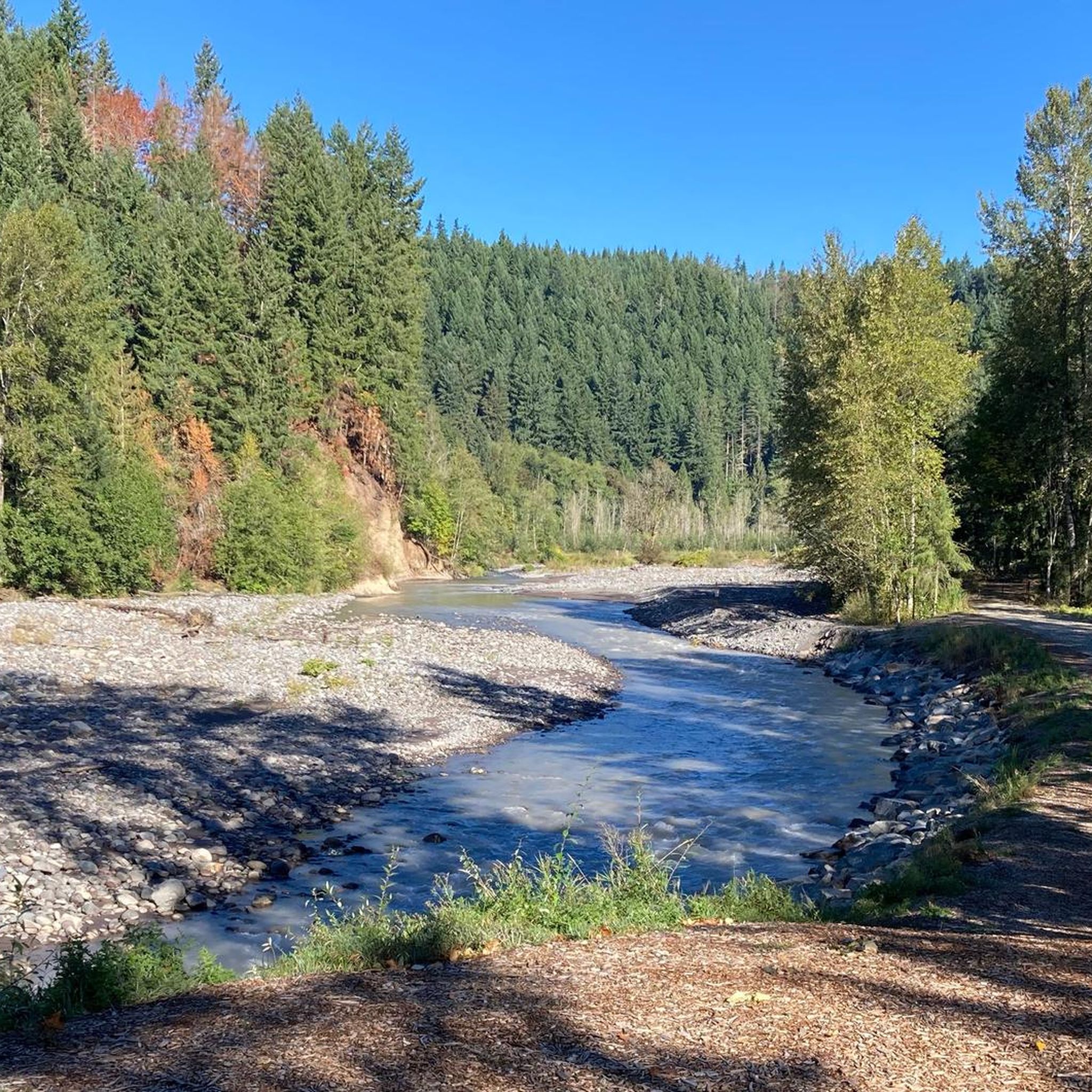
The Foothills Trail parallels the Carbon River for many miles, but your view is often obscured by foliage. Here you get a clear view of the river from the trail, as well as the verdant flora overhanging its banks.
0
0

A lovely curved wooden bridge that is just gorgeous and naturey
1
0

There is a picnic table and primitive campfire here. Great views of the river. Good spot for a snack.
0
0
Frequently Asked Questions
How many road cycling routes are available around Tehaleh?
There are over 20 road cycling routes around Tehaleh, catering to various skill levels. You'll find a good mix of easy and moderate options to explore the region.
Are there easy road cycling routes suitable for beginners in Tehaleh?
Yes, Tehaleh offers several easy road cycling routes perfect for beginners or those seeking a relaxed ride. One excellent option is the Rest Stop by the Carbon River – Foothills Trail loop from South Prairie, which is approximately 28.9 miles (46.5 km) with minimal elevation changes.
What are some challenging road cycling routes for experienced riders in Tehaleh?
For more experienced riders looking for a challenge, routes like the Foothills Trail – Long drag of a climb loop from Pierce County Airport offer a notable climb over its 34.4 miles (55.4 km) distance. Another longer option is the Foothills Trail – Rest Stop by the Carbon River loop from South Hill, which covers 38.5 miles (61.9 km) with moderate climbs.
Are there circular road cycling routes in the Tehaleh area?
Yes, many of the road cycling routes around Tehaleh are designed as loops, allowing you to start and end at the same point. A popular circular route is the Roadbike loop from Sumner, which is 27.6 miles (44.4 km) long and offers a pleasant ride.
What can I see along the road cycling routes in Tehaleh?
The routes often follow river corridors and offer scenic views. You can pass by interesting points like the Rest Stop by the Carbon River, or enjoy the View of Carbon River from Foothill Trail. Some routes also take you near Bradley Lake.
Are there family-friendly road cycling options in Tehaleh?
Many of the easy and moderate routes in Tehaleh, particularly those along the Foothills Trail, are suitable for families. These paths often feature gentle terrain and offer a safe environment for a family outing. Look for routes with minimal elevation gain.
Where can I find parking for road cycling routes in Tehaleh?
Parking availability varies by route starting point. Many routes that utilize sections of the Foothills Trail or start from towns like Sumner or South Hill will have designated parking areas nearby. It's advisable to check the specific route details on komoot for parking information at the trailhead.
Is public transport available to access road cycling trails in Tehaleh?
While direct public transport to every trailhead might be limited, some routes start or pass through towns like Sumner, which may have public transport connections. For routes originating from these towns, you might be able to use local bus services to get closer to your starting point.
Are there cafes or pubs along the road cycling routes in Tehaleh?
Routes that pass through or start from towns such as Sumner or South Hill often have access to cafes, restaurants, and pubs where you can refuel. The Rest Stop by the Carbon River is also a known facility along some routes.
What do other road cyclists enjoy most about road cycling in Tehaleh?
The road cycling experience in Tehaleh is highly rated by the komoot community, with an average score of 4.75 stars from over 18 reviews. Cyclists often praise the varied terrain, the scenic river corridors, and the well-maintained sections of the Foothills Trail.
What is the best time of year for road cycling in Tehaleh?
The spring and fall months generally offer the most pleasant conditions for road cycling in Tehaleh, with milder temperatures and beautiful scenery. Summer can also be great, but be prepared for warmer weather. Always check the local forecast before heading out.
Are there any less crowded or 'hidden gem' road cycling routes in Tehaleh?
While popular routes like those along the Foothills Trail can see more traffic, exploring some of the lesser-known loops or routes that venture further from main towns can offer a quieter experience. The Green River Trail – King County Interurban Trail loop from Sumner, while moderate, offers a different river corridor experience that might be less frequented than the Carbon River sections.
Most popular routes around Tehaleh
Most popular attractions around Tehaleh

Get inspired with the komoot mobile app


Explore more
Browse the best Road cycling routes in other regions.
