The best road cycling routes around Dallesport
5.0
(1)
116
riders
10
rides
Road cycling routes around Dallesport are situated within the Columbia River Gorge, offering diverse landscapes for cyclists. The region features a blend of arid, high desert environments with rolling hills and dramatic basaltic rock formations. Cyclists can experience panoramic views of Cascade volcanoes such as Mount Hood and Mount Adams, alongside the majestic Columbia River. The terrain includes miles of little-trafficked byways with a mix of challenging hills and flats, catering to various cycling preferences.
Best road cycling routes around Dallesport
- The most popular road cycling route is Old Highway 8 Loop, a 51.5 miles (82.9 km) trail that takes 3 hours 4 minutes to complete. This route offers varied terrain through the scenic Columbia River Gorge.
- Another top favourite among local road cyclists is Memaloose Lookout – Twin Tunnels Trail loop from Chenowith, a difficult 46.9 miles (75.4 km) path. This route provides significant climbs and expansive views of the Gorge, including sections of the Historic Columbia River Highway State Trail.
- Local road cyclists also love the Klickitat Park loop from Lyle, a 31.5 miles (50.7 km) trail leading through varied landscapes from riverbanks to rolling hills, often completed in about 2 hours 39 minutes.
- Road cycling around Dallesport is defined by the towering basalt cliffs of the Columbia River Gorge, rolling hills, and high desert environments. The network offers options for different ability levels, from easy paved paths to challenging climbs.
- The routes in Dallesport are highly rated by the komoot community with an average score of 5.0 stars from 1 review. More than 100 road cyclists have used komoot to explore Dallesport's varied terrain.
Last updated: July 9, 2026
82.9km
03:04
710m
710m
Moderate road ride. Good fitness required. Mostly well-paved surfaces and easy to ride.
5.0
(1)
74
riders
73.2km
03:59
1,140m
1,140m
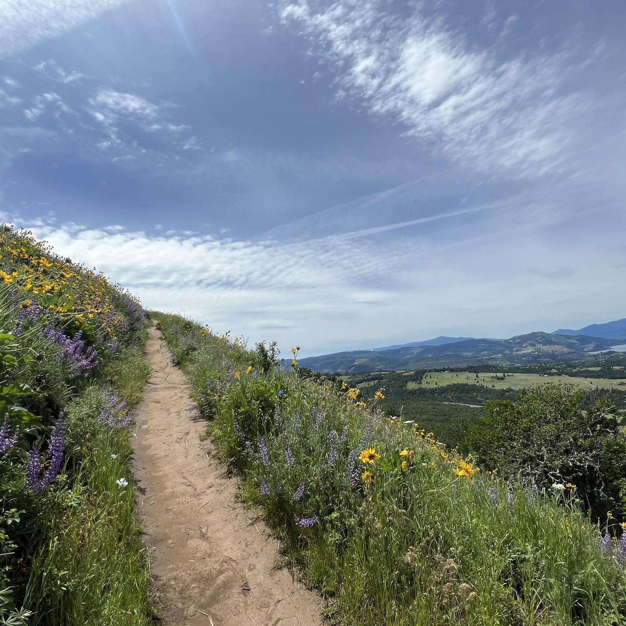
The Memaloose Lookout – Twin Tunnels Trail loop from Chenowith offers a truly immersive road cycling experience through the Columbia River Gorge. You'll pedal past dramatic basalt cliffs and through diverse forests, with the highlight being the historic Mosier Twin Tunnels, where carved windows provide unique framed views of the river. The route then climbs towards Memaloose Lookout, rewarding your effort with expansive vistas of the Memaloose Hills and the surrounding landscape, particularly stunning during the spring wildflower bloom.
This is a challenging ride, covering 45.5 miles (73.2 km) with a significant 3730 feet (1137 metres) of elevation gain, typically taking around 3 hours and 59 minutes. You'll need very good fitness for this difficult loop. While specific parking at Chenowith Road isn't detailed, you can access the Historic Columbia River Highway State Trail, which forms part of this route, from nearby towns like Mosier or Hood River. Plan to carry plenty of water, especially on warmer days.
What makes this cycling route truly special is its blend of natural beauty and historic significance. It traces a section of America's first scenic highway, the Historic Columbia River Highway, with the Twin Tunnels being a restored marvel of early 20th-century engineering. The car-free sections of the trail offer a serene and safe environment, allowing you to fully appreciate the continuous panoramic views of the Gorge without traffic concerns.

Sign up for free
9
riders
51.2km
02:44
920m
920m
Hard road ride. Very good fitness required. Some segments of this route may be unpaved and difficult to ride.
9
riders
57.1km
02:32
590m
590m
Moderate road ride. Good fitness required. Mostly well-paved surfaces and easy to ride.
10
riders
21.0km
01:06
110m
110m
Easy road ride. Great for any fitness level. Mostly well-paved surfaces and easy to ride.
Get access to more routes and recommendations from other explorers.
Sign up for free
Already have an account?
Our route recommendations are based on thousands of hikes, rides, and runs completed by other people on komoot.
Start today with a free account
Your next adventure awaits.
Login or Signup
Popular around Dallesport
Tips from the Community

Klickitat Park is a picturesque and tranquil spot nestled right along the river. It is an ideal spot for a picnic along the water or a place to cool off on a hot day. There is plenty of parking and a vault toilet; however, you'll need to bring your own drinking water.
0
0

About 50 feet off the highway, the pavement takes riders to an overlook of the Memaloose Hills, called the Memaloose Lookout. Memaloose Overlook has a viewpoint of Memaloose Island and is a great photo opportunity, especially on a clear day.
0
0
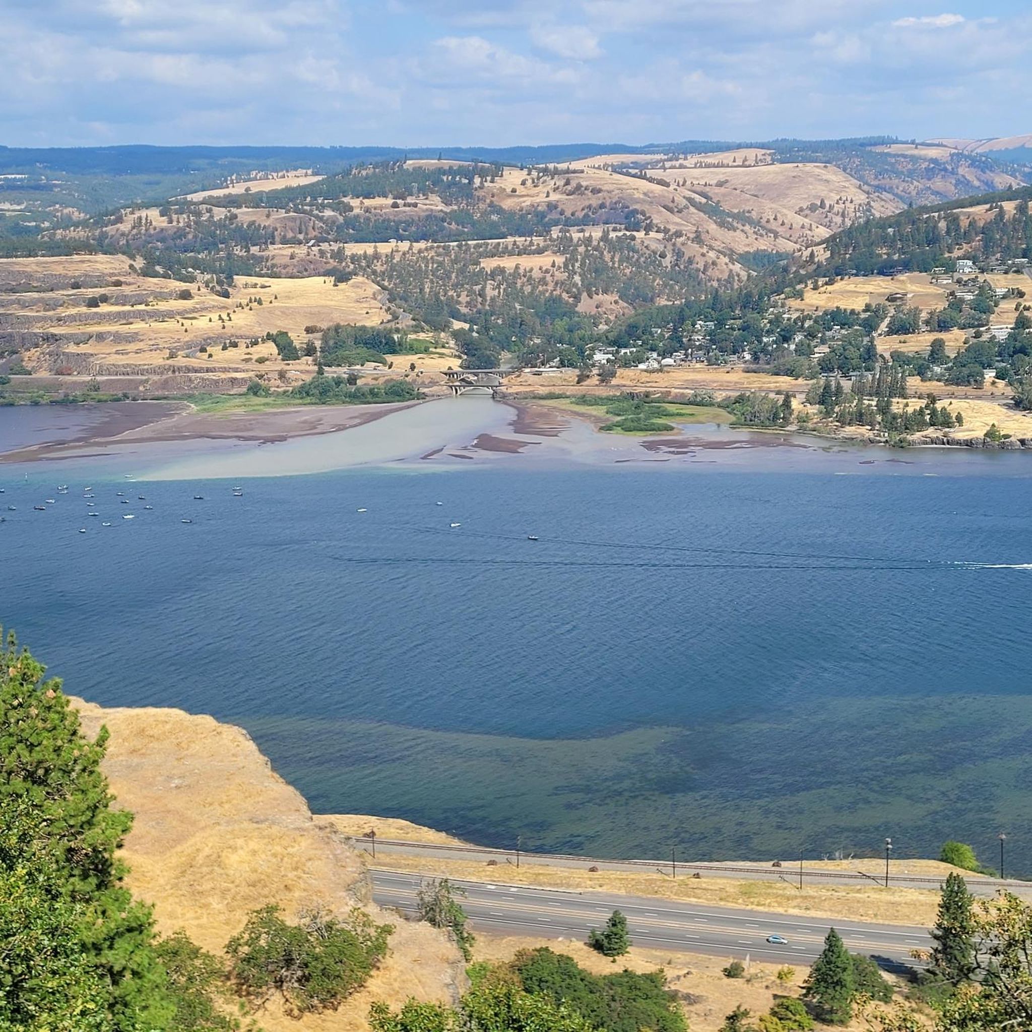
The Dalles Bridge is easy to ride across. Before the bridge was built, as early as 1854, there was a ferry service going over the Colombia River. 10 years later, bridge planning began. It did take another 85 years after the planning began for the Dalles Bridge to finally finish its construction.
0
0
Mosier is named after Jonah H. Mosier, who settled the area around 1821. Today, it is best known for apple, cherry, and prune production, and the town is only about 400 acres in size.
0
0
Look northward toward the Colombia River Gorge to see a separate lake called Tooley Lake sandwiched between the highway and the Colombia River. Tule Lake is fed by the Lost River, and at an elevation of 4,035 feet, this lake is popular for fishing.
0
0
Walk or bike through tunnels built for the original Columbia River Highway. These unique tunnels have windows and are a car-free section of the Historic Columbia River Highway State Trail. This area is great for bikers and walkers alike.
0
0
The Rowena Crest is an impressive viewpoint for cyclists and drivers and has a trailhead. On the Historic Columbia River Highway, you can look down on Mayer State Park and the Columbia River Gorge. Riders will see the iconic Rowena Loops they just came up with and can be impressed on their efforts climbing the horseshoe curves that wind up and down. On a clear day, look south to see Mt. Hood.
0
0

The Last of its kind! This section of the Columbia Historic Highway Trail is non-motorized and perfect for family trips. The view is breathtaking. However, also very hilly. Perfectly asphalted!
0
0
Frequently Asked Questions
How many road cycling routes are available around Dallesport?
There are 9 road cycling routes around Dallesport, offering a variety of experiences for different skill levels. These routes traverse the diverse landscapes of the Columbia River Gorge.
What kind of scenery can I expect while road cycling near Dallesport?
Road cycling around Dallesport offers breathtaking views of the Columbia River Gorge, characterized by towering basalt cliffs and the majestic Columbia River. You'll experience a blend of arid, high desert environments with rolling hills, dramatic basaltic rock formations, and even panoramic views of Cascade volcanoes like Mount Hood and Mount Adams. During spring, vibrant wildflower displays add extra color to the landscape.
Are there any easy or family-friendly road cycling routes in the area?
Yes, there is one easy road cycling route suitable for those looking for a less strenuous ride. The Taylor Lake loop from The Dalles is a 12.8-mile (20.6 km) path that takes approximately 1 hour 6 minutes to complete, offering a gentle introduction to the area's beauty.
What are some challenging road cycling routes in the Dallesport area?
For experienced cyclists seeking a challenge, Dallesport offers several difficult routes. The Memaloose Lookout – Twin Tunnels Trail loop from Chenowith is a demanding 46.9-mile (75.4 km) path with significant climbs and expansive views of the Gorge. Another challenging option is the Klickitat Park loop from Lyle, which covers 31.5 miles (50.7 km) through varied landscapes.
What is the best time of year to go road cycling in Dallesport?
The Dallesport area generally experiences drier weather than other parts of the Pacific Northwest, making it favorable for cycling for much of the year. Spring offers vibrant wildflower displays, while the summer and early fall provide consistent dry conditions. Always check local weather forecasts, especially for wind conditions in the Columbia River Gorge, which can vary.
Are there any notable landmarks or points of interest along the road cycling routes?
Yes, several routes offer views of significant landmarks. You can experience the The Dalles Bridge View, or enjoy panoramic vistas from Rowena Crest and Tooley Lake viewpoint. Some routes also pass through sections of the Historic Columbia River Highway State Trail, including restored tunnels.
What do other road cyclists enjoy most about road cycling in Dallesport?
The road cycling routes in Dallesport are highly rated by the komoot community, with an average score of 5.0 stars. Reviewers often praise the diverse landscapes, from high desert to riverbanks, the challenging climbs, and the stunning views of the Columbia River Gorge and Cascade volcanoes.
Are there any routes that offer a mix of terrain and scenic variety?
Absolutely. The Old Highway 8 Loop is a popular choice, covering 51.5 miles (82.9 km) with varied terrain through the scenic Columbia River Gorge. This route provides a dynamic backdrop of rolling hills and basaltic rock formations.
Can I find routes that follow historic paths or riverfronts?
Yes, the region incorporates historic elements into its cycling network. Sections of the Historic Columbia River Highway State Trail, such as the Mosier Twin Tunnels, are accessible. Additionally, the Dalles Riverfront Trail offers a paved pathway along the Columbia River, providing a scenic and easy ride.
What kind of road surfaces can I expect on Dallesport's cycling routes?
The routes around Dallesport feature a mix of surfaces. Many routes utilize 'little-trafficked byways' which are generally well-maintained for road cycling. You'll find paved sections, including dedicated trails like the Dalles Riverfront Trail, as well as roads that traverse rolling wheat fields and basalt mesas.
Are there any road cycling routes that offer views of The Dalles Dam?
Yes, the The Dalles Bridge View loop from The Dalles Dam is a moderate 35.5-mile (57.1 km) route that provides excellent views of The Dalles Dam and the surrounding area, offering a unique perspective of the Columbia River.
Most popular routes around Dallesport
Most popular attractions around Dallesport

Get inspired with the komoot mobile app


Explore more
Browse the best Road cycling routes in other regions.
