The best walks and hikes around Renton
4.8
(206)
3,196
hikers
204
hikes
Hiking trails around Renton offer diverse outdoor experiences, situated along the southeastern shore of Lake Washington and bisected by the Cedar River. The region features a variety of natural landscapes, including waterfront parks, forested habitats, and wetlands. Nearby wildland parks provide additional options for exploring extensive trail networks and varied terrains. This geographical setting provides a blend of accessible urban paths, riverside walks, and lakeside experiences.
Best hiking trails in Renton
- The most popular hiking route is De Leo Wall and Wildside Loop, a 3.4 miles (5.4 km) trail that takes 1 hour 37 minutes to complete. This easy route is known for accommodating varying fitness levels with accessible paths.
- Another top favourite among local hikers is Eastrail, an easy 4.4 miles (7.0 km) path. This trail, built on a former railroad, offers scenic views and access to natural areas.
- Local hikers also love the Soos Creek Trail, a 2.5 miles (3.9 km) trail leading through easily accessible paths, often completed in about 1 hour 1 minute.
- Hiking around Renton is defined by Lake Washington waterfronts, the Cedar River, and forested wetlands, with options ranging from flat, family-friendly trails to more challenging routes in nearby wildland parks. The network offers options for different ability levels.
- The routes in Renton are highly rated by the komoot community with an average score of 4.8 stars from over 190 reviews. More than 2900 hikers have used komoot to explore Renton's varied terrain.
Last updated: October 10, 2026
4.0
(1)
4
hikers
7.03km
01:48
30m
20m
The Eastrail offers a delightful, easygoing experience, tracing a former railroad line through King County. You'll find yourself on wide, mostly paved paths, often shaded by trees, with occasional peeks at Lake Washington and the surrounding neighborhoods, particularly as you approach Gene Coulon Memorial Beach Park. It's a wonderfully relaxed route, perfect for unwinding and enjoying some fresh air without a strenuous climb.
Planning your visit to this section of the Eastrail is straightforward, as it's designed for high accessibility and connects various communities. Its multi-use nature means you'll share the path with cyclists and strollers, making it a vibrant corridor. Public transport access points are integrated along its length, and given its easy trail conditions and minimal elevation, it's a great choice for a spontaneous outing any time of year.
This 4.4-mile (7.0 km) segment, with only 95 feet (29 metres) of elevation gain and an estimated duration of 1 hour and 48 minutes, showcases the vision of the larger Eastrail project. It's a fantastic example of how historical infrastructure can be repurposed into a modern, family-friendly trail, providing significant health and economic benefits by linking employment hubs and green spaces. It's an easy hike that serves as a vital spine in the region's trail network.
4
hikers
5.41km
01:37
210m
90m
The De Leo Wall and Wildside Loop offers a delightful escape into nature, winding through lush forests dominated by towering Douglas firs and western red cedars. As you navigate the varied terrain, which includes some steeper sections and narrow paths with exposed roots, the trail culminates at the De Leo Wall viewpoint, providing expansive views of Renton, May Valley, and Mount Rainier on clear days. This easy hiking route spans 3.4 miles (5.4 km) with 688 feet (210 metres) of elevation gain, typically completed in about 1 hours and 37 minutes.
Planning your visit is straightforward, as the trail is well-maintained and dogs are permitted on leash, making it ideal for a family outing. While navigation tools can be useful in certain spots, the path is generally clear. You'll find convenient facilities like portable toilets and picnic tables at nearby trailheads such as Red Town, ensuring a comfortable start and end to your hike.
Beyond its natural beauty, the Cougar Mountain area, where this loop is located, boasts a rich history of coal mining that lasted for a century. You might even spot remnants of this industrial past along the trails. The De Leo Wall itself is an ecologically sensitive zone, home to a diverse ecosystem supporting wildlife like bald eagles and salmon, and notable for its high density of Madrona trees.

2
hikers
3.94km
01:01
20m
30m
The Soos Creek Trail offers a wonderfully accessible and diverse natural escape, winding through lush wooded forests, tranquil wetlands, and open meadows alongside its namesake creek. You'll find yourself immersed in a peaceful environment, with opportunities to spot local wildlife like ducks and herons, and even occasional eagles. The trail's predominantly flat terrain and paved surface make it an easy 2.4-mile (3.9 km) hike, with only 53 feet (16 metres) of elevation gain, perfect for a relaxed hour-long stroll.
Planning your visit is straightforward, as the trail boasts multiple access points and parking areas, allowing you to tailor your walk. It's a multi-use path, popular with walkers, runners, and cyclists, and its accessibility makes it a great choice for families. Restrooms and picnic shelters are available at Gary Grant Park, a convenient midpoint, and the trail can be enjoyed throughout the year as the landscape shifts with the seasons.
This trail is a fantastic option for a quick nature fix in the Kent area, offering more than just a walk; it's a journey through a vibrant ecosystem. It also connects to the 9-mile unpaved Lake Youngs Trail for those seeking a longer adventure, and there are plans to extend it further north. Keep an eye out for heron rookeries in the cooler months and wildflowers in early summer, adding to the trail's charm.
5.57km
01:24
0m
10m
The Green River Trail: Tukwila Section offers a surprisingly peaceful urban oasis, following the scenic Green River through a mix of suburban and light industrial landscapes. You'll enjoy paved, flat terrain, passing by parks like Fort Dent Park and Bicentennial Park, with occasional views of Mount Rainier on clear days. This easy 3.5-mile (5.6 km) hiking route is perfect for a relaxed outing, taking about 1 hour and 24 minutes with only 16 feet (5 metres) of elevation gain.
Planning your visit is straightforward, as this section of the Green River Trail is accessible year-round and suitable for all ages and abilities. The trail is multi-use, welcoming walkers, runners, bikers, and even rollerbladers, and is considered lightly used even on weekends. You'll find amenities like restrooms and water fountains in the parks along the route, making it convenient for families and dog owners.
Despite its urban setting, the trail provides a valuable escape into nature, linking industrial zones near the Duwamish Waterway to the more open Green River Valley. It's a great option for a beginner-friendly hike or a casual stroll, and its connectivity to the Interurban Trail near Fort Dent Park allows for extended exploration if you're looking for a longer journey.
26.8km
06:44
30m
20m
Hike the challenging 16.6-mile Interurban Trail, offering diverse scenery, continuous views of the San Juan Islands, and forested paths.
Get access to more routes and recommendations from other explorers.
Already have an account?
Our route recommendations are based on thousands of hikes, rides, and runs completed by other people on komoot.
Start today with a free account
Your next adventure awaits.

Tips from the Community

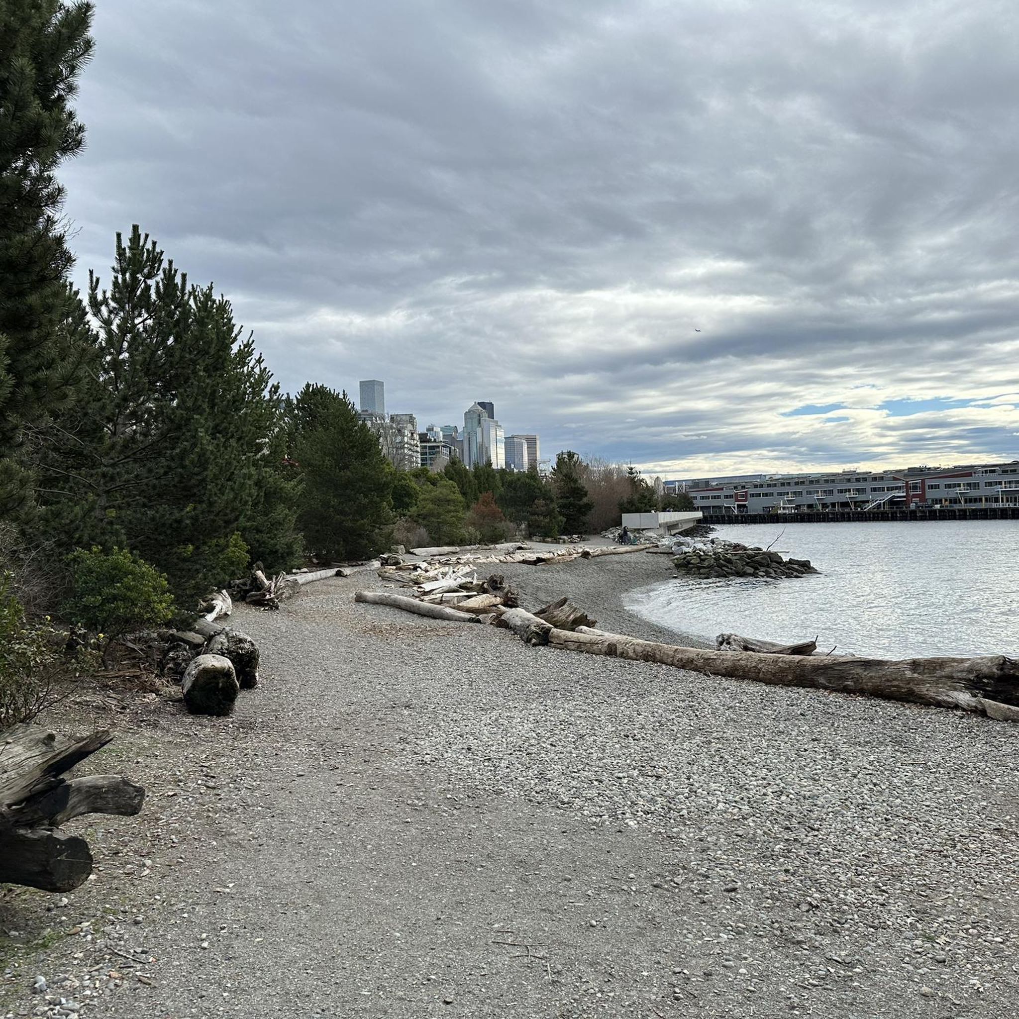
Gene Coulon Memorial Beach Park has a sandy beach, great for taking a dip, and a long pier to enjoy the beauty of Washington Lake. You can launch boats, eat at restaurants, play on courts, and enjoy the paths by the water.
0
0

The Soos Creek Trail is located in Kent and is part of the King County Trail System. The 7-mile paved route passes through marshes and farmland and connects to the Lake Youngs Track, a 9-mile dirt trail that is slightly more challenging. Expect to meet mountain bikers, horseback riders, and hikers on this multi-use trail.
0
0
The park is a little lakefront park with a beautiful outlook. The little beach has a swimming area as well as a playground. The restrooms are accessible and well-kept.
0
0

Really nice nature trail - there are even some off-road trails for MTB enthusiasts.
0
0
Frequently Asked Questions
Are there any easy, family-friendly hikes in the Renton area?
Yes, the Renton area has several options for families. The Coulon Beach Park to Newport Castle Park Beach via Eastrail trail is a great choice, offering a relatively flat, paved path along the shore of Lake Washington. For a more woodland experience, the Honey Dew Creek Trail is a shorter, quieter walk that is generally suitable for all ages.
Can I bring my dog on the hiking trails near Renton?
Many trails in the Renton area are dog-friendly, but they must be kept on a leash. Parks like Cougar Mountain Regional Wildland Park and the Cedar River Trail are popular with dog walkers. Always check the specific regulations for the park you are visiting before you go and be prepared to clean up after your pet.
Which hikes near Renton feature waterfalls?
Cougar Mountain Regional Wildland Park is the best place to find waterfalls. The Licorice Fern Trail loop is a popular route that takes you past three distinct waterfalls: Far Country Falls, Coal Creek Falls, and Doughty Falls. Keep in mind that the flow is best during the wet season, typically from fall through spring.
What are some of the more challenging hikes available?
For a more strenuous workout, the trails within Cougar Mountain and nearby Tiger Mountain offer significant elevation gain. The Licorice Fern Trail to Shy Bear loop is a demanding 8.4-mile (13.5 km) hike with over 1,600 feet (500 m) of climbing through dense forest.
Are there any paved walking trails for a gentle stroll?
Absolutely. The Cedar River Trail offers 17.4 miles of mostly paved, multi-use path that follows the river, providing a mix of urban and natural scenery. It's ideal for walking, running, or cycling. Another excellent option is the trail system within Gene Coulon Memorial Beach Park, which features paved paths with beautiful views of Lake Washington.
What kind of trails can I expect in Cougar Mountain Regional Wildland Park?
Cougar Mountain Regional Wildland Park is a vast 3,000-acre preserve with over 35 miles of trails. You'll find a true wilderness experience with routes winding through mature forests, wetlands, and past historical coal mining exhibits. The trails range from easy walks to challenging loops with significant elevation gain, making it a top-rated destination for local hikers. For more details, you can consult the park's official website at kingcounty.gov.
When is the best time of year to hike around Renton?
Hiking is possible year-round, but each season offers a different experience. Spring and summer are wonderful for wildflowers and lush green forests. Autumn provides beautiful fall colors and is the best time to see the annual salmon migration in the Cedar River. Winter hikes can be rewarding, but be prepared for muddy conditions and note that waterfalls are often at their most impressive during the wetter months.
What wildlife might I see on the trails?
The diverse habitats around Renton support a variety of wildlife. Along the Cedar River Trail and at Gene Coulon Memorial Beach Park, it's common to spot bald eagles, turtles, and various bird species. In the more forested areas like Cougar Mountain, you might encounter deer and other small mammals. The Cedar River is also famous for its annual salmon run.
How many hiking trails are there around Renton?
There are over 140 designated hiking routes in and around Renton. These range from easy lakeside strolls and moderate river walks to difficult mountain trails, offering plenty of options for every skill level.
What do other hikers say about the trails in Renton?
The area is highly regarded by the komoot community, with an average rating of 4.8 out of 5 stars. Hikers frequently praise the well-maintained trails within Cougar Mountain Regional Wildland Park, the scenic lake views from the Eastrail, and the peaceful atmosphere of the region's forests.
Are there any good circular or loop hikes?
Yes, Cougar Mountain Regional Wildland Park is particularly well-suited for loop hikes due to its extensive network of interconnected trails. A great moderate option is the Far Country Falls via Licorice Fern Trail, a 4.5-mile (7.3 km) loop that can be completed in about two hours.
What are the main features of the Cedar River Trail?
The Cedar River Trail is a 17.4-mile multi-use path that follows a historic railroad route. Its key features include scenic views of Lake Washington, downtown Renton, and the Cedar River itself. The trail passes through several parks and offers a mix of paved and unpaved sections, making it popular for walking, biking, and wildlife viewing, especially during the salmon spawning season. You can find more information at visitrentonwa.com.
Most popular attractions around Renton

Get inspired with the komoot mobile app


Explore more
Browse the best Hikes in other regions.
