The best road cycling routes around Tysons
4.7
(50)
2,094
riders
87
rides
If you’ve ever tried to plan road cycling around Tysons, you know how quickly the options can feel overwhelming. It’s hard to tell which routes are genuinely worth your time and effort, and which are just filler. That’s where we come in: komoot’s community has mapped, ridden, and reviewed countless routes here, and we’ve done the legwork to bring you a curated shortlist of the very best. We promise to save you the guesswork and point you straight to the rides that deliver.
Road cycling around Tysons offers a surprisingly diverse experience, blending urban access with natural escapes. You'll find an expanding network of dedicated bike lanes and smooth, paved rail-trails with gentle inclines, like the famous W&OD Trail, alongside urban paths connecting key areas. While the W&OD can get busy, it provides long-distance options through varied scenery, connecting to natural landscapes like those near the Potomac River. The routes here range from easy spins to more challenging long-distance rides, catering to all abilities.
If you only do one ride, we’d start with the West End Park – Military Road loop from McLean. This moderate 27.1 miles (43.7 km) route is a local favorite, offering a scenic loop that truly captures the area's character. For a longer, more challenging day out that takes you further afield, the River Bend Road – Meadowlark Botanical Gardens loop from Spring Hill is a fantastic choice at 36.4 miles (58.5 km), with some steady climbs. With over 2,000 road cyclists having explored Tysons with komoot, you’re in good company. Start exploring and find your next favorite route!
Last updated: June 9, 2026
5.0
(1)
121
riders
43.1km
02:04
500m
500m
This West End Park – Military Road loop from McLean offers a dynamic road cycling experience, blending the smooth, consistent stretches of the W&OD Trail with the rolling hills of McLean. You'll pedal through a mix of tree-lined streets, residential areas, and open spaces, with the scenery constantly shifting from urban to suburban. The route's moderate difficulty and varied terrain make it a rewarding challenge for cyclists looking to push themselves without tackling extreme climbs.
Planning your ride is straightforward, with West End Park in Falls Church providing a convenient starting point and access to the well-maintained W&OD Trail. The W&OD is known for its amenities, including water fountains and rest stops, which are helpful for this 26.8-mile (43.1 km) journey. With 1632 feet (498 metres) of elevation gain, you'll want to ensure you're well-hydrated, especially during warmer months; an early start is always a good idea to enjoy the cooler temperatures and lighter traffic.
What truly sets this route apart is its integration with the 45-mile W&OD Trail, a highly popular cycling artery in Northern Virginia. This allows for long, uninterrupted stretches of riding, complemented by the more challenging, elevated sections around Military Road. The entire loop, taking approximately 2 hours and 4 minutes, provides a comprehensive tour of the region's diverse cycling landscape, from dedicated multi-use paths to scenic suburban roads.
5.0
(2)
72
riders
17.5km
00:43
90m
90m
The West End Park loop from Vienna offers a pleasant and accessible road cycling experience, blending urban scenery with green spaces. You'll enjoy mostly paved surfaces, typical of Vienna's well-developed cycling network, making for a smooth and comfortable ride. This route is perfect for a relaxed outing, allowing you to soak in the city's atmosphere without strenuous effort.
Planning your ride is straightforward; the route is easily integrated into Vienna's extensive cycling infrastructure. While specific parking details for this exact loop aren't prominent, Vienna is very bike-friendly, so public transport is a great option to reach the starting point. It's an easy ride suitable for any time of day, though mornings might offer a more tranquil experience.
This easy 10.9-mile (17.5 km) road cycling loop, with a minimal 299 feet (91 metres) of elevation gain, can be completed in about 43 minutes. It's an excellent choice for beginner road cycling routes or for families looking for a gentle ride, showcasing Vienna's commitment to accessible urban cycling. For more challenging rides, you'd need to explore the Vienna Woods, but for a quick, enjoyable spin, this loop delivers.

Sign up for free
82
riders
17.1km
00:43
100m
100m
The Old Dominion Trail loop from Vienna offers a pleasant road cycling experience through what's known as the 'skinniest park in Virginia.' You'll pedal on a smooth asphalt surface, transitioning from suburban green spaces to more open, wooded areas, with occasional glimpses of Virginia Piedmont farmland. It's an easy 10.6-mile (17.1 km) ride with a gentle 337 feet (103 metres) of elevation gain, typically taking around 42 minutes, making it a great option for a relaxed outing.
This popular route is easily accessible from Vienna, and while there isn't a specific parking warning, the trail can get quite busy, especially on weekends, so an early start is advisable. The W&OD Trail is well-marked, and you'll find various amenities like cafes and breweries in nearby towns, making it convenient for a mid-ride stop or post-ride treat. Always be mindful of road crossings, as some can be tricky during peak times.
Following the former Washington & Old Dominion Railroad bed, this trail is rich in history, with interpretive signs and old train depots along the way. Its linear nature connects several communities, offering a unique perspective on Northern Virginia's landscape. The trail's flat profile and paved surface make it an excellent choice for beginner road cycling or a family-friendly ride, providing a consistent and enjoyable journey.
5.0
(1)
20
riders
58.5km
02:46
540m
540m
The River Bend Road – Meadowlark Botanical Gardens loop from Spring Hill offers a dynamic road cycling experience through Fairfax County's rolling hills. You'll navigate a mix of suburban landscapes and parklands, with the highlight being the scenic passage by the 95-acre Meadowlark Botanical Gardens. The route's 36.4 miles (58.5 km) include 1781 feet (543 metres) of elevation gain, making it a moderate challenge that takes about 2 hours and 45 minutes to complete. It's a great option for cyclists seeking a varied workout with picturesque views, especially when the cherry trees are in bloom.
To make the most of this ride, plan your visit for late spring to catch the cherry blossoms at Meadowlark Botanical Gardens. Starting from Spring Hill, the route is easily accessible for a morning or afternoon excursion. While mostly paved, be aware that some segments, particularly on the Meadowlark Connector Trail, might be unpaved or feature more undulating terrain, so prepare your bike accordingly.
This loop stands out for its blend of natural beauty and suburban cycling, characteristic of Northern Virginia. The Meadowlark Connector Trail provides a safe and peaceful pathway to the gardens, allowing you to avoid busier streets and enjoy views directly into the botanical gardens. It's a notable route for those looking to incorporate hill training into their rides, offering a good cardio workout amidst diverse scenery.
9
riders
33.4km
01:32
280m
280m
Easy road ride. Great for any fitness level. Mostly well-paved surfaces and easy to ride.
Get access to more routes and recommendations from other explorers.
Sign up for free
Already have an account?
Our route recommendations are based on thousands of hikes, rides, and runs completed by other people on komoot.
Start today with a free account
Your next adventure awaits.
Login or Signup

Tips from the Community

Gorgeous remote road and best access route to Riverbend Regional Park that does not pass through Great Falls NP. Be aware, in May 2026 there is resurfacing underway so half the road is rough-surfaced and uneven. Slow speed and caution recommended.
0
0

Great bike shop, coffee, and after ride refreshment. Beer and Wine.
0
0

Bike shop with service area, beer, bathrooms, energy supplies and bike pumps!
0
0
Great place for coffee and food. Usually have free water available by the W&OD trail if you need rehydration on route!
0
0

The Old Dominion Trail is officially part of the Washington & Old Dominion Railroad Regional Park and is a 45‑mile paved rail‑trail winding through Fairfax County. The trail is popular with walkers, runners, and cyclists.
0
0

West End Park sits right off the W&OD—an easy spot to roll in, catch some shade, and take a quick break. The path has a few root bumps, so slow down and enjoy the greenery. There’s also a water fountain where you can refill before getting back on the trail.
1
0

This is one of the points where the Cross County Trail crosses Difficult Run Stream. Depending on the amount of rainfall and the time of year, water levels may be elevated, so it's important to exercise caution.
0
0

There isn't a ton of traffic on this mostly straightaway road, but there also isn't a shoulder to bike on — so stay alert for vehicles.
0
0
Frequently Asked Questions
How many road cycling routes are available around Tysons?
There are over 80 road cycling routes around Tysons, offering a wide variety of options for different skill levels and preferences. The komoot community has rated these routes highly, with an average score of 4.4 stars.
What kind of terrain can I expect on road cycling routes in Tysons?
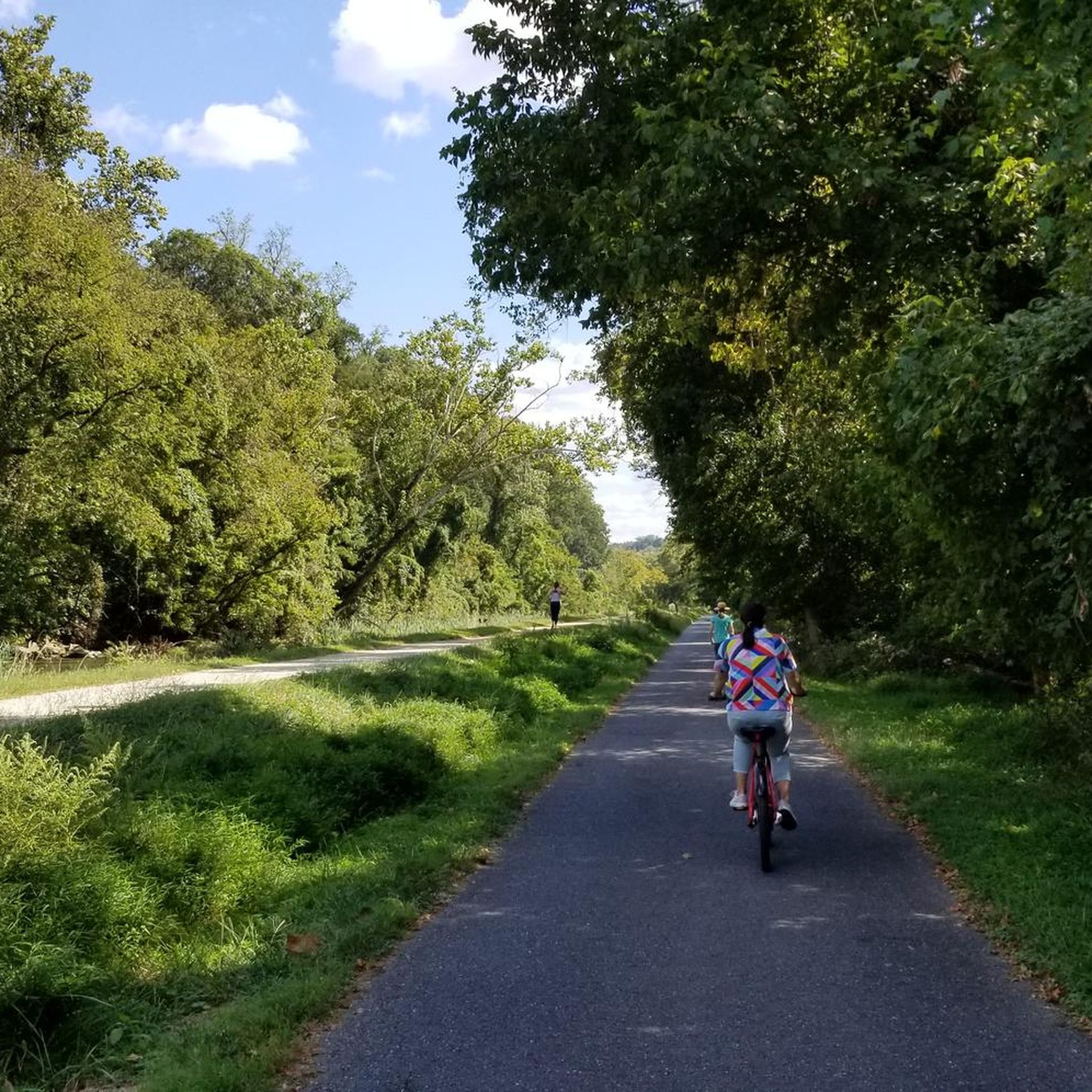
Road cycling around Tysons primarily features smooth, paved rail-trails with gentle inclines, such as the prominent Washington & Old Dominion (W&OD) Trail. You'll also find urban cycling paths connecting key areas, and routes that lead through wooded paths and suburban areas, sometimes with connections to natural landscapes like the Potomac River.
Are there any easy road cycling routes suitable for beginners or families?
Yes, Tysons offers several easy road cycling routes. For instance, the Key Bridge Boathouse – C&O Canal Mile Marker 0 loop from West Falls Church–VT is an easy 26.2-mile (42.1 km) path. The W&OD Trail, with its smooth surface and gentle inclines, is also very suitable for families and beginners, with convenient access points just a few miles from Tysons.
Where can I find scenic views or natural attractions along the routes?
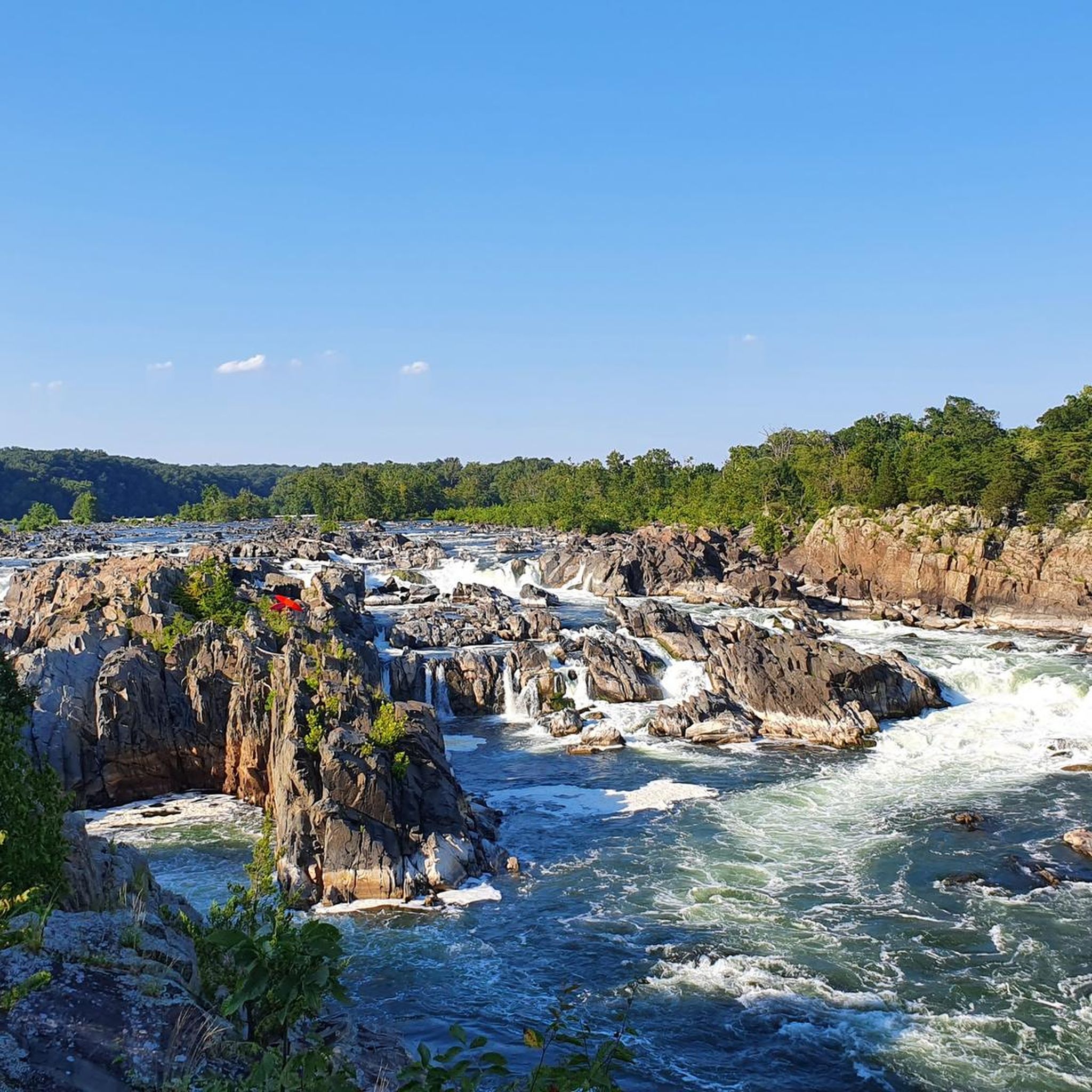
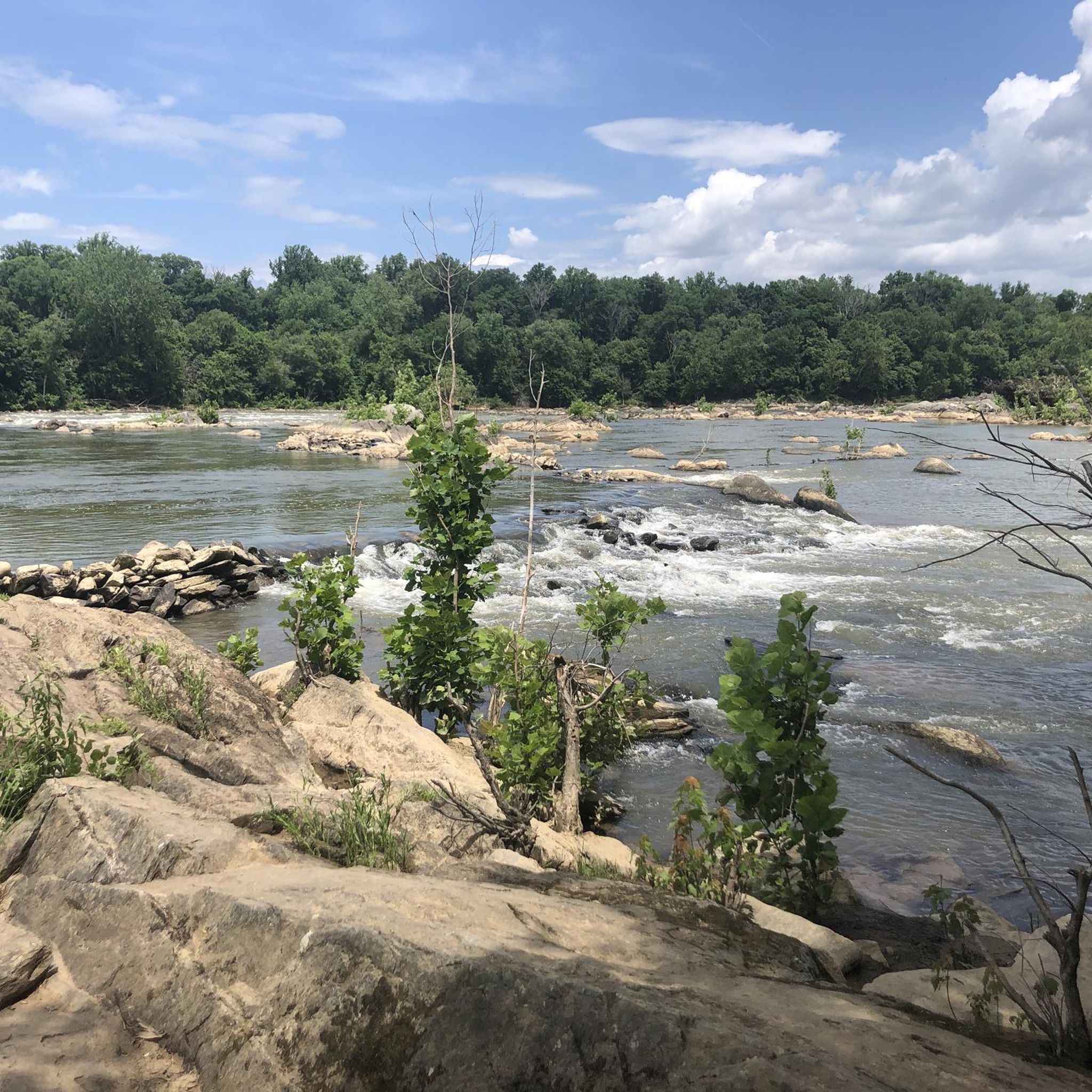
Many routes offer scenic views and access to natural attractions. You can find routes that pass near the Potomac River, offering picturesque vistas. For stunning waterfalls, consider exploring areas near Scott's Run Falls or Great Falls Overlook. The River Bend Road – Meadowlark Botanical Gardens loop from Spring Hill also takes you past the beautiful Meadowlark Botanical Gardens.
Are there any challenging routes for experienced road cyclists?
Absolutely. For experienced cyclists seeking a significant challenge, the Key Bridge Boathouse – Green Lizard Cycling, Herndon loop from Spring Hill is a difficult 95.8-mile (154.1 km) route. This extensive path connects prominent cycling hubs and offers a substantial distance and elevation gain.
How can I access the cycling trails using public transport?
Tysons is well-connected by public transport, particularly the Metrorail. The Vesper Trail, for example, links the Spring Hill Metrorail station area with Tysons Forest, improving connectivity for cyclists. Many routes, like the Key Bridge Boathouse – C&O Canal Mile Marker 0 loop, are accessible from Metrorail stations such as West Falls Church–VT.
Is parking available near the road cycling routes?
Yes, parking is generally available near many access points for cycling trails in and around Tysons. For instance, the Washington & Old Dominion (W&OD) Trail has numerous access points with parking, such as those in Vienna, which are conveniently close to Tysons. Efforts are also underway to include amenities like bike racks and Capital Bikeshare docking stations in future developments like the Tysons Community Circuit.
What is the best time of year for road cycling in Tysons?
Spring and Fall are generally considered the best seasons for road cycling in Tysons, offering pleasant temperatures and beautiful scenery. While winter cycling is possible, it's advisable to check weather conditions. Summer can be warm, so early morning or late afternoon rides are often preferred.
Can I find places to eat or drink along the cycling routes?
Yes, Tysons and its surrounding areas offer various options for refreshments. You'll find bike-friendly cafes and pubs, especially in areas connected by the trails. For example, Caboose Brewery and The Bike Lane Bicycle Shop and Brewery are notable spots that cater to cyclists.
What do other cyclists say about road cycling in Tysons?
The komoot community highly rates road cycling in Tysons, with an average score of 4.4 stars from over 50 reviews. More than 3,000 road cyclists have used komoot to explore the varied terrain, often praising the well-maintained paved trails, the accessibility to regional pathways, and the diverse landscapes that range from urban to natural settings.
Are there any notable long-distance trails accessible from Tysons?
Yes, the most prominent long-distance trail accessible from Tysons is the Washington & Old Dominion (W&OD) Trail. This 45-mile paved rail-trail, often called 'Virginia's skinniest park,' stretches from Shirlington to Purcellville, offering a smooth surface and gentle inclines ideal for road cycling. Access points are conveniently located just a few miles from Tysons.
Can I rent bikes in Tysons?
Yes, you can easily access bikes through Capital Bikeshare, which has numerous stations throughout Tysons. They offer both classic and electric bike options, making it convenient for visitors or those without their own equipment to explore the area's cycling routes.
Are there any routes that pass by specific landmarks or points of interest?
Many routes offer proximity to interesting landmarks. For example, the Military Road – Minor Hill loop from McLean offers a scenic ride through the McLean area. You might also encounter historical sites like the Bluemont Caboose or natural features like the Difficult Run Trail, depending on your chosen route.
Most popular attractions around Tysons

Get inspired with the komoot mobile app


Explore more
Browse the best Road cycling routes in other regions.
