The best road cycling routes around Old Bennington
43
riders
11
rides
Road cycling routes around Old Bennington offer varied terrain, situated between the Green Mountains and the Taconic Mountains. The region features a mix of paved and gravel roads, providing diverse options for cyclists. Routes often follow or provide views of rivers like the Walloomsac and Battenkill, with elevation changes suitable for different skill levels. Extensive wooded areas contribute to the natural cycling experience.
Best road cycling routes around Old Bennington
- The most popular road cycling route is Silk Covered Bridge…
Last updated: July 2, 2026
11
riders
53.3km
02:28
580m
580m
Moderate road ride. Good fitness required. Some segments of this route may be unpaved and difficult to ride.
9
riders
82.2km
03:53
1,100m
1,100m
Hard road ride. Very good fitness required. Mostly well-paved surfaces and easy to ride.

Sign up for free
4
riders
72.5km
03:10
580m
580m
Moderate road ride. Good fitness required. Some segments of this route may be unpaved and difficult to ride.
5
riders
72.4km
03:30
1,010m
1,010m
Hard road ride. Very good fitness required. Some segments of this route may be unpaved and difficult to ride.
4
riders
81.3km
05:06
800m
800m
Hard road ride. Very good fitness required. Some segments of this route may be unpaved and difficult to ride.
Get access to more routes and recommendations from other explorers.
Sign up for free
Already have an account?
Our route recommendations are based on thousands of hikes, rides, and runs completed by other people on komoot.
Start today with a free account
Your next adventure awaits.
Login or Signup
Popular around Old Bennington


Tips from the Community

Probably more impressive to ride/drive up through McCauley Road. You can also access it from Natural Bridge or Hudson Brook Lane Road on foot or on a bike (which is what we did). White marble natural bridges/quarries are apparently not very common in the North America. Worth the detour if you are in North Adams.
0
0

Site of the first confrontation between the Green Mountain Boys and the "Yorker" Sheriff and posse. at the Breckenridge Farm.
1
0

The 1753 House stands as a faithful reproduction of a settler's home from 1753 in The Berkshires. Situated in Field Park at Williamstown's west end, it was built by volunteers in 1953 to commemorate the town's Bicentennial. Early settlers in the Hoosac Valley, including Williamstown and North Adams, were obligated by contract to construct a house of specific dimensions and clear a designated amount of land to secure their lot. You can see the house from the roadside.
0
0
Cycling on this good quality road next to Thurber Pond is a joy with the pond directly in view. Keep your eyes peeled for the various pond life and birds that live around it.
0
0
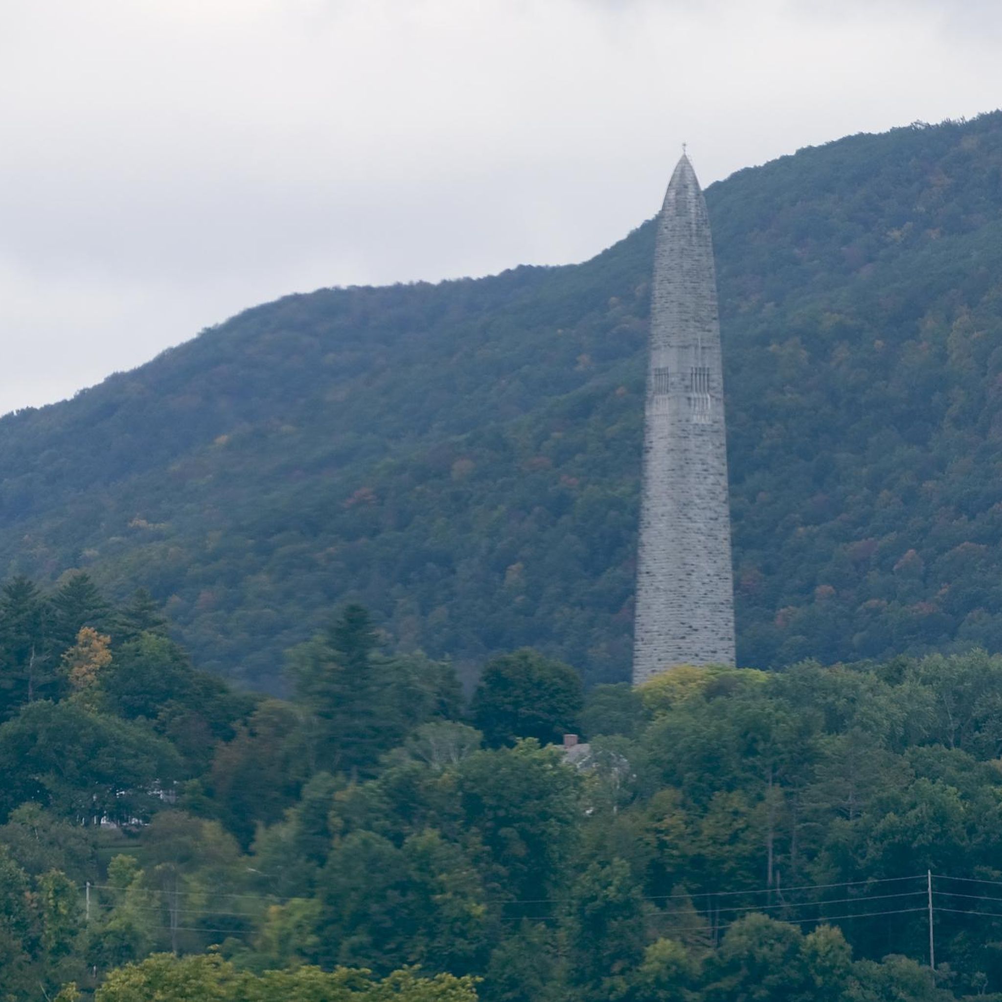
The Bennington Battle Monument, erected in 1891, commemorates the Revolutionary War's Battle of Bennington in Vermont. Standing at 306 feet, it symbolizes the victory against British forces. Funded by patriotic citizens, the monument is a testament to the community's dedication to preserving and honoring its historical legacy.
0
0
Established in 1762, The First Congregational Church of Bennington, or Old First Church, boasts a rich history in Old Bennington, Vermont. The present meeting house, erected in 1805, stands as a stellar representation of Federal period religious architecture in the state. Recognized for its historical significance, it earned a spot on the National Register of Historic Places in 1973.
0
0
The Church of the Sacred Heart and St. Francis de Sales, located in Bennington, Vermont, holds a rich history dating back to its establishment. Serving as a spiritual cornerstone, the church's architectural and cultural significance draws interest. It stands as a testament to the community's enduring faith and heritage.
0
0
The Silk Covered Bridge, part of Silk Road, spans the Walloomsac River connecting Bennington and North Bennington, Vermont. Constructed in 1840, this Town lattice truss bridge is one of three in the vicinity. Its historical significance led to its inclusion in the National Register of Historic Places in 1973.
0
0
Frequently Asked Questions
How many road cycling routes are available in Old Bennington?
There are 11 road cycling routes around Old Bennington, offering a variety of distances and difficulty levels to explore the region's diverse landscape.
What kind of terrain can I expect on road cycling routes in Old Bennington?
The terrain in Old Bennington is varied, situated between the Green Mountains and the Taconic Mountains. You'll find a mix of paved and gravel roads, with routes often following river valleys like the Walloomsac and Battenkill, and passing through extensive wooded areas. Expect elevation changes suitable for different skill levels.
Are there road cycling routes suitable for beginners or those looking for an easy ride?
Yes, there is one easy road cycling route available. Additionally, the Bennington Rail Trail is a great option for cyclists of all ages looking for a more relaxed experience.
What about challenging routes for experienced cyclists?
For experienced cyclists, Old Bennington offers 5 difficult routes with significant elevation gains. An example is the Hoosic River loop from Bennington, which is 51.1 miles long and features substantial climbing.
Are there any circular road cycling routes in Old Bennington?
Many of the road cycling routes in Old Bennington are loops, allowing you to start and end at the same point. Examples include the Silk Covered Bridge loop from North Bennington and the Bingham Hill – Silk Covered Bridge loop from Shaftsbury.
What scenic viewpoints or natural features can I see along the routes?
Road cycling routes often provide views of the Walloomsac and Battenkill rivers, and pass through extensive wooded areas. You might also encounter highlights like the Silk Covered Bridge or views towards Harmon Hill. The region's position between the Green and Taconic Mountains ensures picturesque backdrops.
Are there historical landmarks or points of interest to explore while cycling?
Yes, several routes incorporate historical landmarks. The Bennington Battle Monument is a prominent feature on routes like the Bennington Battle Monument – Cold Spring Preserve loop from Bennington. You can also find routes that take you past the area's historic covered bridges, such as the Silk Covered Bridge.
When is the best time of year for road cycling in Old Bennington?
The best time for road cycling in Old Bennington is typically from spring through fall, when the weather is mild and the natural scenery is vibrant. Summer offers lush green landscapes, while autumn provides stunning foliage. Always check local weather conditions before heading out.
Are there family-friendly road cycling options in Old Bennington?
While most listed routes are moderate to difficult, the Bennington Rail Trail is an excellent family-friendly option, welcoming cyclists of all ages for a more relaxed ride away from vehicle traffic.
Do the routes in Old Bennington feature significant elevation changes?
Yes, many routes in Old Bennington feature significant elevation changes due to the region's mountainous landscape. For example, the Bennington Battle Monument – Silk Covered Bridge loop from Bennington includes over 800 meters of ascent, providing a good workout and rewarding views.
What do other road cyclists enjoy the most about road cycling in Old Bennington?
Road cyclists using komoot often praise the varied terrain, the scenic views of rivers and wooded areas, and the presence of historic landmarks like covered bridges and the Bennington Battle Monument. The mix of moderate and challenging routes also caters to a wide range of abilities.
Are there any routes that combine historical sites with natural beauty?
Absolutely. Routes like the Bennington Battle Monument – Cold Spring Preserve loop from Bennington offer a blend of historical exploration at the Bennington Battle Monument with the natural beauty of the surrounding preserves and landscapes.
Most popular routes around Old Bennington
Most popular attractions around Old Bennington

Get inspired with the komoot mobile app


Explore more
Browse the best Road cycling routes in other regions.
