The best road cycling routes around Fruit Heights
4.4
(10)
343
riders
26
rides
Road cycling around Fruit Heights, Utah, offers access to diverse landscapes, including paved roads along the Great Salt Lake and routes through wetland management areas. The region features flat, smooth riding conditions on causeways and dikes, with some routes skirting the base of the Wasatch Range. Cyclists can find routes with minimal climbing, as well as those with moderate elevation gains, providing varied terrain for different skill levels.
Best road cycling routes around Fruit Heights
- The most popular road cycling route is Nature Preserve loop — Farmington, a 25.7 miles (41.3 km) trail that takes 1 hour 38 minutes to complete. This easy route features minimal elevation gain through a nature preserve.
- Another top favourite among local road cyclists is Layton to West Point loop via Bluff Trail, an easy 22.3 miles (35.9 km) path. This loop offers views and relatively flat terrain.
- Local road cyclists also love the Farmington loop — Layton, a 22.1 miles (35.6 km) trail leading through varied terrain with moderate elevation, often completed in about 1 hour 37 minutes.
- Road cycling around Fruit Heights is defined by paved causeways, wetland dikes, and views of the Great Salt Lake and distant mountains. The network offers options for both easy, flat rides and more challenging routes with moderate climbs.
- The routes in Fruit Heights are highly rated by the komoot community with an average score of 5.0 stars from several reviews. More than 300 road cyclists have used komoot to explore Fruit Heights's varied terrain.
Last updated: July 11, 2026
23
riders
41.3km
01:38
150m
150m
Easy road ride. Great for any fitness level. Mostly well-paved surfaces and easy to ride.
4
riders
35.9km
01:29
90m
90m
Easy road ride. Great for any fitness level. Mostly well-paved surfaces and easy to ride.

Sign up for free
2
riders
35.6km
01:37
310m
310m
Moderate road ride. Good fitness required. Mostly well-paved surfaces and easy to ride.
5.0
(6)
61
riders
49.0km
01:55
90m
90m
Easy road ride. Great for any fitness level. Mostly well-paved surfaces and easy to ride.
4.5
(2)
78
riders
Easy road ride. Great for any fitness level. Mostly well-paved surfaces and easy to ride.
Get access to more routes and recommendations from other explorers.
Sign up for free
Already have an account?
Our route recommendations are based on thousands of hikes, rides, and runs completed by other people on komoot.
Start today with a free account
Your next adventure awaits.
Login or Signup


Tips from the Community

The Legacy Nature Preserve encompasses 2,100 acres of wetlands set aside for wildlife. The preserve can only be viewed from the Legacy Parkway Trail.
0
0

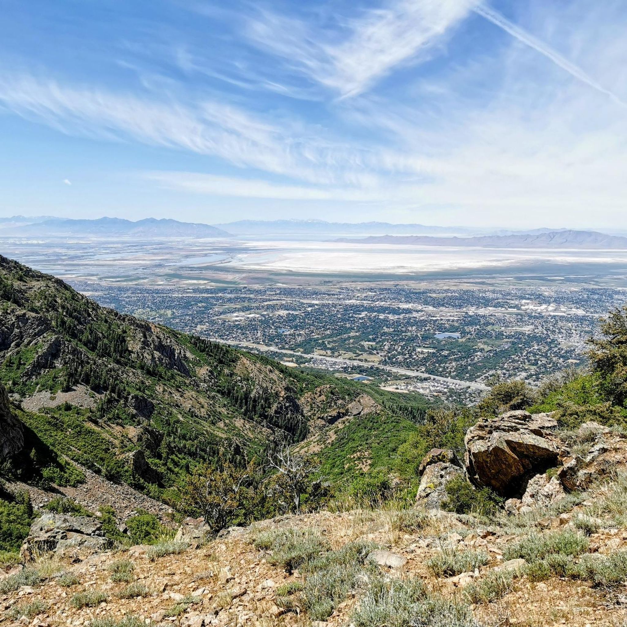
Panoramic viewpoint of the Great Salt Lake wetlands.
0
0
The Legacy Nature Preserve encompasses 2,100 acres of wetlands set aside for wildlife. The preserve can only be viewed from the Legacy Parkway Trail.
0
0
Farmington was originally settled by Mormon pioneers in 1847 and derived its name from the surrounding lush farmlands. The town offers a retail center called Station Park, the Lagoon Amusement Park, the Davis County Fairgrounds, as well as a quaint historic Main Street.
0
0

Layton sits between Clearfield and Kaysville and borders the Wasatch Mountains, which are hard to miss! From here, you have easy access to South Lake City, Ogden, and Syracuse.
0
0
Here is a nice section of paved trail separated from the main Bluff Road. Enjoy the views as you cruise along car-free.
0
0
The Denver and Rio Grande Western Rail Trail (D&RGW Rail Trail) is a 24-mile long paved path from Roy to Bountiful. This section of the trail, between West Barton Lane and Clark Lane, is rather flat and offers absolutely breathtaking views of the mountains to the east. A nice escape from the cars to really take in the scenery!
0
0
Frequently Asked Questions
How many road cycling routes are available around Fruit Heights?
There are over 25 road cycling routes around Fruit Heights, offering a variety of experiences. These include routes with minimal elevation gain through nature preserves and others with moderate climbs, catering to different preferences.
Are there road cycling routes suitable for families or beginners?
Yes, Fruit Heights offers several easy road cycling routes perfect for families and beginners. The Nature Preserve loop — Farmington is an easy 25.7-mile route with minimal elevation through a nature preserve. Another option is the Farmington Bay Waterfowl Management Area, which features broad, smooth cinder roadways atop dikes, providing a flat and easy 6.3-mile 'Short Loop' ideal for a relaxed family ride.
Where can I find road cycling routes with scenic views?
For breathtaking scenic views, consider routes that venture towards Antelope Island State Park. The 7-mile paved causeway leading to the island offers panoramic views of the Great Salt Lake. Once on the island, paved roads provide stunning vistas of the lake, the island's unique wildlife, and the distant Wasatch Range. Routes like the Layton to West Point loop via Bluff Trail also offer scenic perspectives.
Can I see wildlife while road cycling in the area?
Absolutely. Both Antelope Island State Park and the Farmington Bay Waterfowl Management Area are excellent for wildlife viewing. On Antelope Island, cyclists often spot bison, pronghorn, and various bird species. The Farmington Bay WMA is a significant birdwatching destination, where you might see ducks, herons, and even bald eagles, especially during migratory seasons.
Are there any loop road cycling routes around Fruit Heights?
Yes, many of the road cycling routes in the area are loops, providing varied scenery without retracing your path. Popular options include the Nature Preserve loop — Farmington, the Layton to West Point loop via Bluff Trail, and the Farmington loop — Layton.
What kind of terrain can I expect on road cycling routes near Fruit Heights?
The region offers diverse terrain. You'll find flat, smooth riding conditions on paved causeways and dikes, particularly around Antelope Island and the Farmington Bay WMA. Other routes, such as the Farmington loop — Layton, feature varied terrain with moderate elevation gains, skirting the base of the Wasatch Range. This variety ensures options for both easy, relaxed rides and more challenging excursions.
What do other road cyclists enjoy most about road cycling in Fruit Heights?
The area is highly rated by the komoot community, with an average score of 5.0 stars. Reviewers often praise the diverse landscapes, from the unique setting of the Great Salt Lake and Antelope Island to the peaceful wetland management areas. The well-maintained paved surfaces and the opportunity for wildlife viewing are also frequently highlighted.
Are there any waterfalls or natural landmarks to see near the cycling routes?
While directly on road cycling routes, you can find natural beauty like the Legacy Nature Preserve. For waterfalls, you might consider a short detour or a separate visit to nearby hiking areas. Highlights such as Adams Canyon Waterfall, Adam's Canyon Lower Falls, and Waterfall at Davis Creek are popular natural attractions in the broader Fruit Heights area.
What is the best season for road biking around Fruit Heights?
The spring and fall seasons generally offer the most pleasant conditions for road biking around Fruit Heights, with milder temperatures and beautiful scenery. Summer can be warm, especially in open areas like Antelope Island, so early morning or late afternoon rides are often preferred. Winter riding is possible, but cyclists should be prepared for colder temperatures and potential icy patches, especially on less-trafficked roads.
Are there any less crowded road cycling routes?
While popular routes like those to Antelope Island can see more traffic, especially on weekends, many of the routes through the Farmington Bay Waterfowl Management Area or the more rural sections of Davis County offer a quieter experience. Exploring routes during off-peak hours or weekdays can also help you find a more serene ride.
Can I access these routes using public transportation?
Public transportation options in Fruit Heights are limited for direct access to trailheads. Most cyclists typically drive to the starting points of their chosen routes. However, some routes may be accessible by connecting from larger urban centers with public transit options, requiring a longer ride to reach the specific cycling areas.
Where can I find parking for road cycling routes in Fruit Heights?
Parking is generally available at various access points for the road cycling routes. For instance, when cycling to Antelope Island, parking is available at the causeway entrance or within the park itself. For routes around Farmington and Layton, local parks or designated trailheads often provide parking facilities. It's advisable to check specific route details for recommended parking locations.
Most popular routes around Fruit Heights
Most popular attractions around Fruit Heights

Get inspired with the komoot mobile app


Explore more
Browse the best Road cycling routes in other regions.
