The best running trails around Tropic
4.4
(12)
937
runners
35
runs
Jogging around Tropic offers routes through a landscape characterized by unique geological formations, including canyons and natural amphitheaters. The region features varied terrain, from well-maintained multi-use paths to more challenging trails with significant elevation changes. Runners can expect routes that traverse rim trails, offering expansive views, and paths that descend into the canyon floor. The area provides a diverse environment for running, with options ranging from moderate to difficult.
Best jogging routes around Tropic
- The most popular jogging route is…
Last updated: July 6, 2026
186
runners
6.42km
00:55
260m
260m
Moderate run. Good fitness required. Mostly paved surfaces. Suitable for all skill levels.
5.0
(2)
125
runners
14.2km
01:55
440m
440m
Hard run. Very good fitness required. Mostly paved surfaces. Suitable for all skill levels.

Sign up for free
5.0
(1)
101
runners
17.9km
02:27
570m
570m
Hard run. Very good fitness required. Mostly paved surfaces. Suitable for all skill levels.
97
runners
10.5km
01:27
360m
360m
Hard run. Very good fitness required. Mostly paved surfaces. Suitable for all skill levels.
5.0
(2)
120
runners
12.2km
01:41
400m
400m
Hard run. Very good fitness required. Mostly paved surfaces. Suitable for all skill levels.
Get access to more routes and recommendations from other explorers.
Sign up for free
Already have an account?
Our route recommendations are based on thousands of hikes, rides, and runs completed by other people on komoot.
Start today with a free account
Your next adventure awaits.
Login or Signup
Popular around Tropic
Tips from the Community

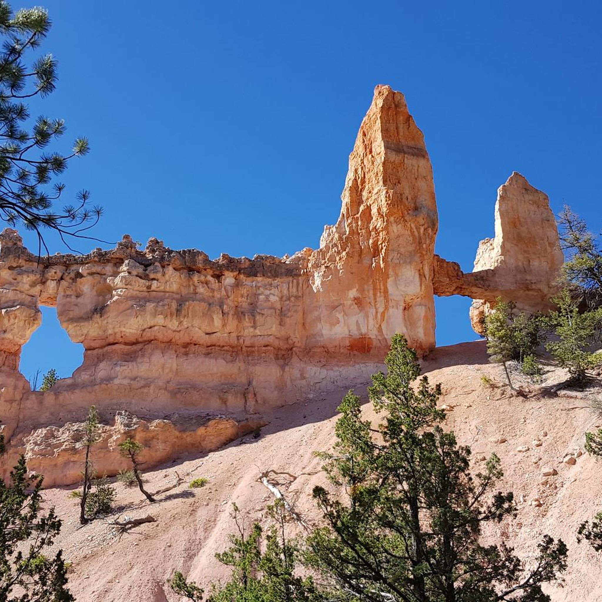
A stunningly beautiful hike in Bryce Canyon. The Navajo Peekaboo Loop is a popular and challenging hike in Bryce Canyon National Park, connecting two of the most famous trails in the Bryce Amphitheater. Impressive, narrow switchbacks lead steeply down into the canyon and past rock formations with imaginative names like Thor's Hammer and Wall Street.
0
0

Beautiful to see and to walk in
0
0

The Rim Trail encircles the Bryce Canyon Amphitheater and gives spectacular views into the canyon. The trail is 5.5 miles in length, starting at Fairyland Point in the north and extending to Bryce Point farther south in the park. There are many benches located along the path for a quick stop to enjoy a picnic while taking in some of the greatest views on this planet.
0
0

Lower Inspiration Point is a fantastic spot over Bryce Amphitheater, with views of the dense clusters of hoodoos known as the Silent City. The short, unpaved trail from the parking area leads to a fenced overlook with sweeping views to the north. It’s a quieter alternative to the park’s busier viewpoints and is especially stunning at sunrise or after dark under the starry sky.
0
0

Rim Trailhead (North) is a great starting point for a run or a walk along Bryce Canyon’s famous rim. The trail gives you wide views over the hoodoos right from the start, with a mostly flat and runnable surface if you head toward Fairyland Point. Expect big views, soft dirt underfoot, and plenty of reasons to pause and take it all in.
0
0
Peek-a-Boo Arch is a small, door-shaped arch with almost perfect geometry. It’s just a short detour if you’re running in the Sand Dunes area—a quick scramble off the main path gets you there. Worth the stop for the cool rock formation, the views through the arch, and a good spot to catch your breath or snap a photo before continuing your run or hike.
0
0

This viewpoint offers great panoramic lookouts over Bryce Canyon's characteristic hoodoos, or weathered rock spires. If you continue along the Queen's Garden Trail you'll also find Queen Victoria, a hoodoo that's said to resemble the Queen Victoria Memorial in London.
1
0

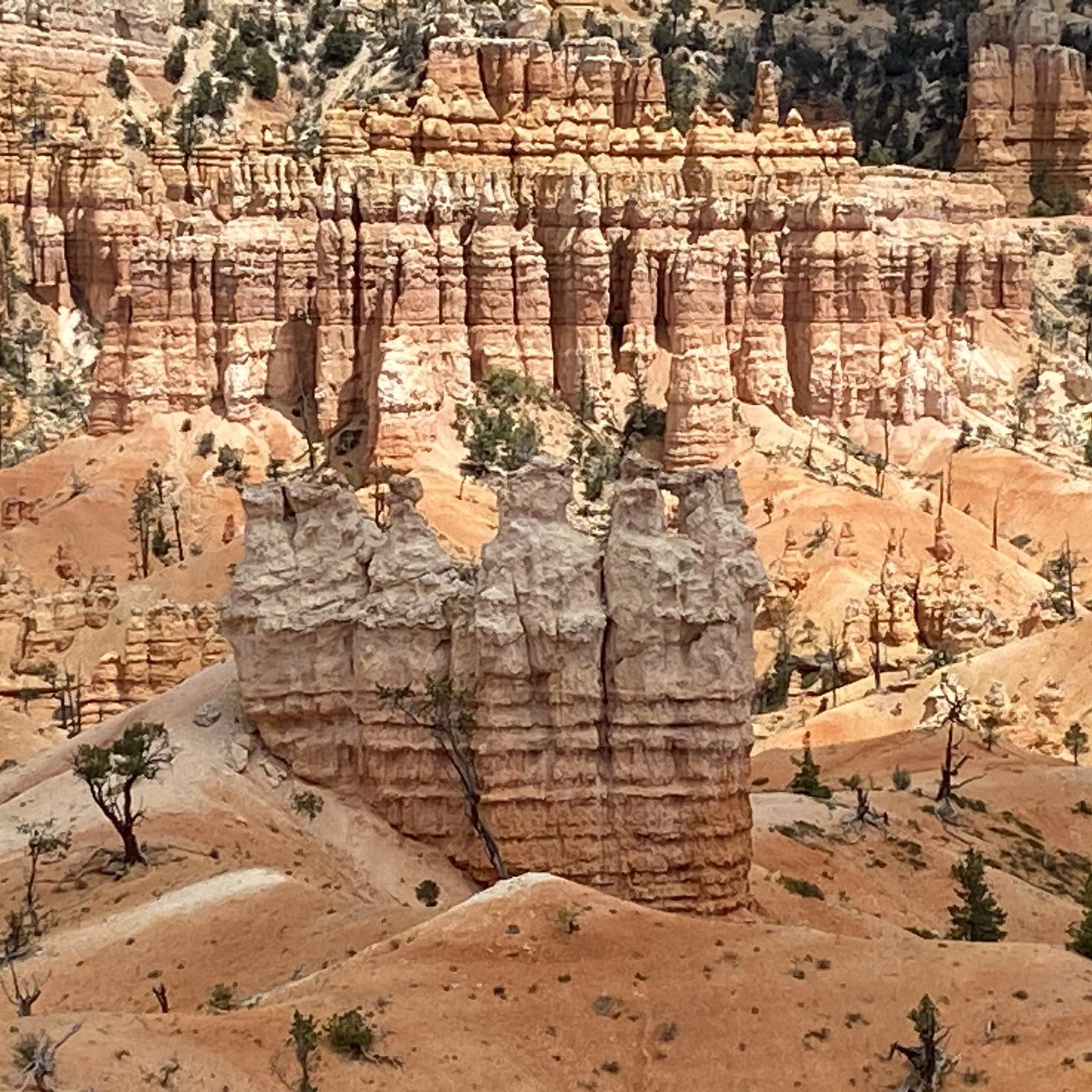
We reach the spectacular Bryce Canyon. The bizarre rock formations ("hoodoos") are just as characteristic of Bryce Canyon as its forests. The combined forces of wind, water and ice have created a landscape of rock pillars in strange shapes and sizes. These rock formations are also called hoodoos. The hoodoos create a labyrinth of constantly changing shapes and colors from bright orange to pale pink or ochre. Here we take the opportunity to descend into the canyon. The change of perspective makes us really aware of the size of the individual rock formations. We see several chipmunks that are far too quick for my camera.
2
0
Frequently Asked Questions
How many running routes are available in Tropic?
There are over 40 running routes around Tropic, offering a diverse range of experiences for joggers of all levels. These routes traverse unique geological formations, including canyons and natural amphitheaters.
Are there easy running routes suitable for beginners in Tropic?
Yes, Tropic offers several easier running options. For instance, the Bryce Canyon Multi-use Path is a moderate 8.0 miles (12.9 km) path with well-maintained surfaces, providing a less challenging experience while still offering views of the canyon landscape.
What are the typical lengths of running trails in Tropic?
Running trails in Tropic vary significantly in length. You can find shorter loops like the Queens Garden Trail – Sunset Point loop, which is 4.0 miles (6.4 km), up to longer, more challenging routes such as the Sunrise Point – Bryce Point loop, spanning nearly 11.2 miles (17.9 km).
Are there any circular running paths in Tropic?
Many of the running routes in Tropic are designed as loops, allowing you to start and finish at the same point. Examples include the popular Queens Garden Trail – Sunset Point loop and the Sunset Point – Sunrise Point loop, both offering stunning views within Bryce Canyon.
What kind of scenic viewpoints can I expect along the jogging routes?
Tropic's running routes are renowned for their dramatic canyon landscapes and expansive vistas. You'll encounter iconic viewpoints such as Sunset Point and Sunrise Point, offering panoramic views of the unique geological formations like the Bryce Amphitheater and various hoodoos, including Thor’s Hammer.
What do other runners enjoy most about jogging in Tropic?
The running experience in Tropic is highly rated by the komoot community, with an average score of 4.6 stars. Runners frequently praise the dramatic canyon landscapes, the expansive rim trails, and the unique geological features encountered along the paths. The variety of routes, from moderate loops to more challenging climbs, is also a highlight.
Are there family-friendly jogging paths in Tropic?
Yes, some paths are suitable for families, especially those looking for less strenuous options. The multi-use paths, like sections of the Bryce Canyon Multi-use Path, offer smoother surfaces and gentler gradients, making them more accessible for families with varying fitness levels.
What is the best time of year to go running in Tropic?
The best time for running in Tropic is typically during the spring (April-May) and fall (September-October) when temperatures are milder and more comfortable. Summers can be very hot, especially at lower elevations, while winters bring cold temperatures and snow, which can make some trails inaccessible or require specialized gear.
Are dogs allowed on the running trails in Tropic?
In Bryce Canyon National Park, which hosts many of these routes, dogs are generally permitted on paved trails and viewpoints, but not on unpaved hiking trails or inside public buildings. Always check the specific park regulations or trail signage for the most current rules regarding pets before heading out.
Are there less crowded jogging trails in Tropic?
While popular viewpoints and main trails can get busy, exploring routes slightly off the main tourist hubs or visiting during off-peak hours (early morning or late afternoon) can offer a more serene experience. Some of the longer, more difficult routes also tend to be less crowded.
Are there any running routes that offer views of unique natural monuments?
Absolutely. Many routes provide stunning views of the region's unique natural monuments. For example, the Queens Garden Trail itself is a highlight, leading you through an area filled with hoodoos and other distinctive rock formations. You'll also get glimpses of famous landmarks like Thor’s Hammer.
What are the elevation changes like on running routes in Tropic?
The terrain in Tropic is varied, meaning elevation changes can range from moderate to significant. Some routes, particularly those descending into the canyon, feature considerable climbs and descents. For example, the Sunrise Point – Rim Trailhead (North) loop involves over 438 meters of elevation gain and loss, making it a challenging option.
Most popular routes around Tropic
Most popular attractions around Tropic

Get inspired with the komoot mobile app


Explore more
Browse the best Running Trails & Routes in other regions.
