Attractions and Places To See around Ashaway - Top 10
Best attractions and places to see around Ashaway, a historic village in Hopkinton, Rhode Island, offers a blend of natural beauty and historical significance. Situated along the Ashaway River, the area features well-preserved 18th and 19th-century architecture within its historic district. Visitors can explore waterways, forests, and trails, alongside notable landmarks reflecting its manufacturing heritage. The region provides access to diverse outdoor activities and cultural sites.
Best attractions and places to see around Ashaway
- The most popular attractions is Watchaug…
Last updated: June 28, 2026
Misquamicut State Beach
Highlight • Beach
Tip by

Watchaug Pond
Highlight • Lake
Tip by

Sign up now to discover places like this
Get recommendations on the best single tracks, peaks, & plenty of other exciting outdoor places.
Sign up for free
Naughty Nurse Trail
Highlight • Trail
Tip by

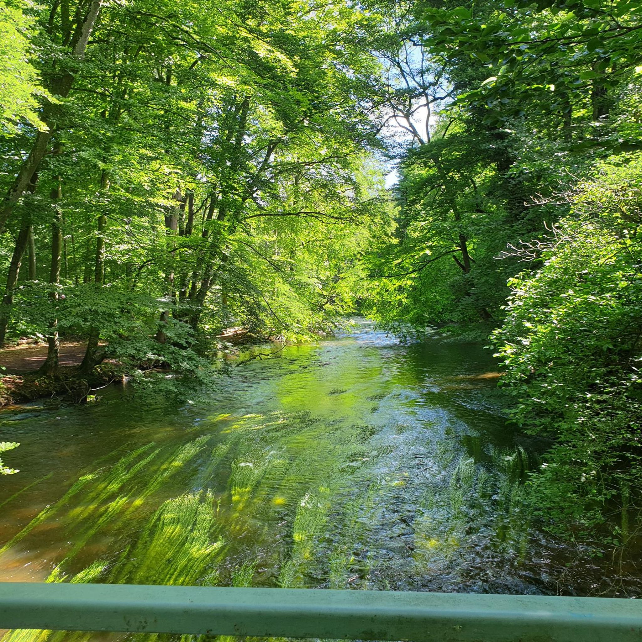
Pequot Trail tree-lined road
Highlight • Trail
Tip by

Burlingame Management Area
Highlight • Forest
Tip by

Sign up for free to discover even more attractions around Ashaway.
Sign up for free
Already have an account?
Start today with a free account
Your next adventure awaits.
Login or Signup



Tips from the Community

Misquamicut State Beach (MISS-kwahm-eh-kut[3]) is a seaside public recreation area in the town of Westerly, Rhode Island.[4] It occupies a portion of Misquamicut Beach, a 3-mile-long (4.8 km) barrier island that extends westward from Weekapaug to Watch Hill and separates Winnapaug Pond from the Atlantic Ocean.[5] The state beach covers 51 acres (21 ha) and is 2 miles long. The main beach has a large with multiple public facilities and snack bar.[4] Misquamicut State Beach is one of the most popular beaches along the Rhode Island coast and is used extensively by people in the region. https://en.wikipedia.org/wiki/Misquamicut_State_Beach
0
0
The area now known as Misquamicut Beach wasn't always so! Up until the early 1900s, the area was formally known as Pleasant View, RI. The majority of the beach area was owned by the Indians. In the 1890s, settlers purchased the beach area property from Sosoa, a Montauk Indian chief. It was then that the development of the beach area began. The Pleasant View name stuck around until 1928, when it was officially changed to Misquamicut. Misquamicut is an Indian word which means "red salmon at this place." The hurricane of 1938 brought about some major changes to the physical look and shape of the beach area. https://misquamicutbeach.com/
0
0

Burlingame State Park and Wildlife Management Area spans over 3,000 acres of forest, wetlands, and diverse wildlife. The park features a campground, a picnic area, a boat launch, and a swimming beach.
0
0

The Pequot Trail near Westerly, USA, weaves through the historical landscape once inhabited by the Pequot tribe. Tracing ancient Native American paths, the trail immerses hikers in the region's indigenous history. Visitors can explore remnants of the Pequot War era, creating a unique historical journey in this Rhode Island locale.
0
0

This beach is the most popular in the area, providing over a half-mile of beachfront to enjoy. It offers numerous features, including a playground, concessions, outdoor showers, and restrooms, making it a great stopping point.
0
0

Naughty Nurse Trail is a beginner friendly trail in the Woody Hill Management Area. You can expect lots of nice berms and exciting stone wall crossings.
1
0

Watchaug Pond is large and open and covers 573 acres. It is one of the largest freshwater lakes in Rhode Island.
0
0
Frequently Asked Questions
What historical landmarks can I explore in Ashaway?
Ashaway is rich in history. You can visit the Ashaway Village Historic District, which preserves its 18th and 19th-century character with well-maintained buildings. Another significant site is the Ashaway Line & Twine Manufacturing Company Ropewalk, a landmark reflecting the village's industrial past. The First Seventh Day Baptist Church, built in 1835, also highlights the area's early colonial settlement.
What natural features define the Ashaway area?
The village is situated along the scenic Ashaway River, which supported early industries and offers opportunities for kayaking and canoeing. Nearby, Watchaug Pond is one of Rhode Island's largest freshwater lakes, covering 573 acres. The broader area also includes Ell Pond in Hopkinton, a beautiful kettle pond surrounded by unique trees.
Are there family-friendly attractions around Ashaway?
Yes, several attractions are great for families. Misquamicut State Beach offers a half-mile of beachfront with a playground, concessions, and restrooms. Watchaug Pond is excellent for water activities. For outdoor exploration, Briggs Memorial Park and Grills Wildlife Sanctuary provide walking trails and picnic areas. The Naughty Nurse Trail is a beginner-friendly trail suitable for families.
Where can I go hiking or walking near Ashaway?
You'll find several options for hiking and walking. Briggs Memorial Park offers approximately four acres of walking trails along the Ashaway River. Grills Wildlife Sanctuary features multiple trails and access to the Tomaquag Brook. The Tomaquag Trail system also provides opportunities for hiking through wooded areas. For a beginner-friendly option, consider the Naughty Nurse Trail in the Woody Hill Management Area.
What cycling routes are available around Ashaway?
The area around Ashaway offers various cycling routes. You can find several touring bicycle routes, such as the 'Fenway Beach – Maschaug Pond loop from Westerly' or the 'Thompson Cove – View of the Pawcatuck River loop from Westerly'. For mountain biking, explore trails like the 'Woody Hill Management Area – Easy Loop' or the 'Naughty Nurse Trail – Hobbit Juice Trailhead loop from Bradford'. More details on these routes can be found in the Cycling around Ashaway and MTB Trails around Ashaway guides.
Are there any beaches near Ashaway?
Yes, Misquamicut State Beach is a popular choice, offering over a half-mile of beachfront with amenities like a playground and concessions. It's a great spot for swimming and relaxing by the ocean.
What is the best time to visit Ashaway for outdoor activities?
The spring and fall months generally offer pleasant weather for outdoor activities in Ashaway, with comfortable temperatures for hiking, cycling, and exploring natural areas. Summer is ideal for enjoying beaches and water activities like kayaking on the Ashaway River or visiting Watchaug Pond.
Can I find dog-friendly trails in the Ashaway area?
While specific dog-friendly designations can vary, many natural areas and trails in the region, such as those in Briggs Memorial Park and Grills Wildlife Sanctuary, are generally welcoming to dogs on leash. Always check local regulations for specific trails or parks before visiting.
What is the Burlingame Management Area?
The Burlingame Management Area is a large natural expanse spanning over 3,000 acres. It features forests, wetlands, and diverse wildlife, offering trails for hiking, a campground, picnic areas, and even a swimming beach and boat launch.
Are there any scenic viewpoints around Ashaway?
While specific designated viewpoints are not highlighted, the trails along the Ashaway River, particularly in Briggs Memorial Park and Grills Wildlife Sanctuary, offer scenic views of the waterways and surrounding nature. The beauty of Ell Pond also provides picturesque natural vistas.
What kind of wildlife can I spot in Ashaway?
The natural areas around Ashaway, including the Ashaway River, Grills Wildlife Sanctuary, and Burlingame Management Area, are home to diverse wildlife. You might spot various bird species, small mammals, and aquatic life, especially along the waterways and within the wooded trails.
What is the Pequot Trail?
The Pequot Trail near Westerly, which is close to Ashaway, is a tree-lined path that weaves through historical landscapes once inhabited by the Pequot tribe. It offers a unique journey into the region's indigenous history, tracing ancient Native American paths.

Get inspired with the komoot mobile app


Explore more
Still not found the Highlight you’re looking for? See guides of the top attractions in other regions:
