The best road cycling routes around Eagle
4.2
(7)
594
riders
128
rides
Road cycling around Eagle, Colorado, features varied terrain, including river valleys and rolling hills. The region offers a mix of open roads and routes passing through rural landscapes. Elevations vary, providing options for different levels of climbing.
Best road cycling routes around Eagle
- The most popular road cycling route is View from Sullivan's Bridge – National Memorial Arch loop from Uwchlan Township, a 49.7 miles (80.1 km) trail that takes 3 hours 53 minutes to complete, offering scenic views…
Last updated: July 2, 2026
6
riders
Moderate road ride. Good fitness required. Mostly well-paved surfaces and easy to ride.
7
riders
117km
05:36
1,080m
1,080m
Hard road ride. Very good fitness required. Mostly well-paved surfaces and easy to ride.

Sign up for free
6
riders
106km
05:34
1,200m
1,200m
Hard road ride. Very good fitness required. Some segments of this route may be unpaved and difficult to ride.
5
riders
99.5km
05:25
1,280m
1,280m
Hard road ride. Very good fitness required. Some segments of this route may be unpaved and difficult to ride.
4
riders
91.0km
04:47
1,170m
1,170m
Hard road ride. Very good fitness required. Some segments of this route may be unpaved and difficult to ride.
Get access to more routes and recommendations from other explorers.
Sign up for free
Already have an account?
Our route recommendations are based on thousands of hikes, rides, and runs completed by other people on komoot.
Start today with a free account
Your next adventure awaits.
Login or Signup



Tips from the Community

Rock hop across Sixpenny Creek. This creek is home to Largemouth bass, Brown trout, and Pumpkinseed.
0
0
Nicholas East House is a structure from the 1820s that can be marveled at from he outside. It is listed in the National Register of Historic Places and still stands as it did when the country was progressing towards emancipation.
0
0

This is a perfect spot to access the Schuylkill River Trail. At this trailhead, you'll find a dog park and a picnic area—an excellent place to start your journey or turn around and head back.
1
0

This memorial arch was deliberately designed to resemble a simplified version of the Arch of Titus in Rome, Italy; it commemorates the arrival of George Washington and his Continental Army to Valley Forge.
0
0

Access and parking for the Schuylkill River Trail. There are shelters and benches on the site as well, so it is a great place to stop for a break while biking the path. The park is on the banks of the Schuylkill River, so it also gives great views of the river and has a wonderful pedestrian bridge over the river.
0
0

The James Overstreet Open Space Preserve is a large nature preserve featuring large open fields surrounded by woodlands. The preserve is located on Douglass Drive in Boyertown, Pennsylvania and is a scenic spot to ride past as you explore the area.
0
0

Sullivan's Bridge is a bridge for non-motorized traffic and connects the Joseph Plumb Martin Trail and the Schuylkill River Trail. On your way across the bridge, there are great views of the Schuylkill River.
1
0

With over 3,500 acres of wildlife, history, and monuments dedicated to the memories of the Revolutionary War, there's a lot to explore in Valley Forge National Historic Park. Stopping by the visitor center (even if it's just in the middle of your ride) can help you plan the type of loop you're looking for. For more information on opening hours, you can check here: https://www.valleyforge.org/plan/visitor-center/
0
0
Frequently Asked Questions
How many road cycling routes are available around Eagle?
There are over 130 road cycling routes available around Eagle, offering a wide variety of options for different skill levels and preferences.
What kind of terrain can I expect on road cycling routes near Eagle?
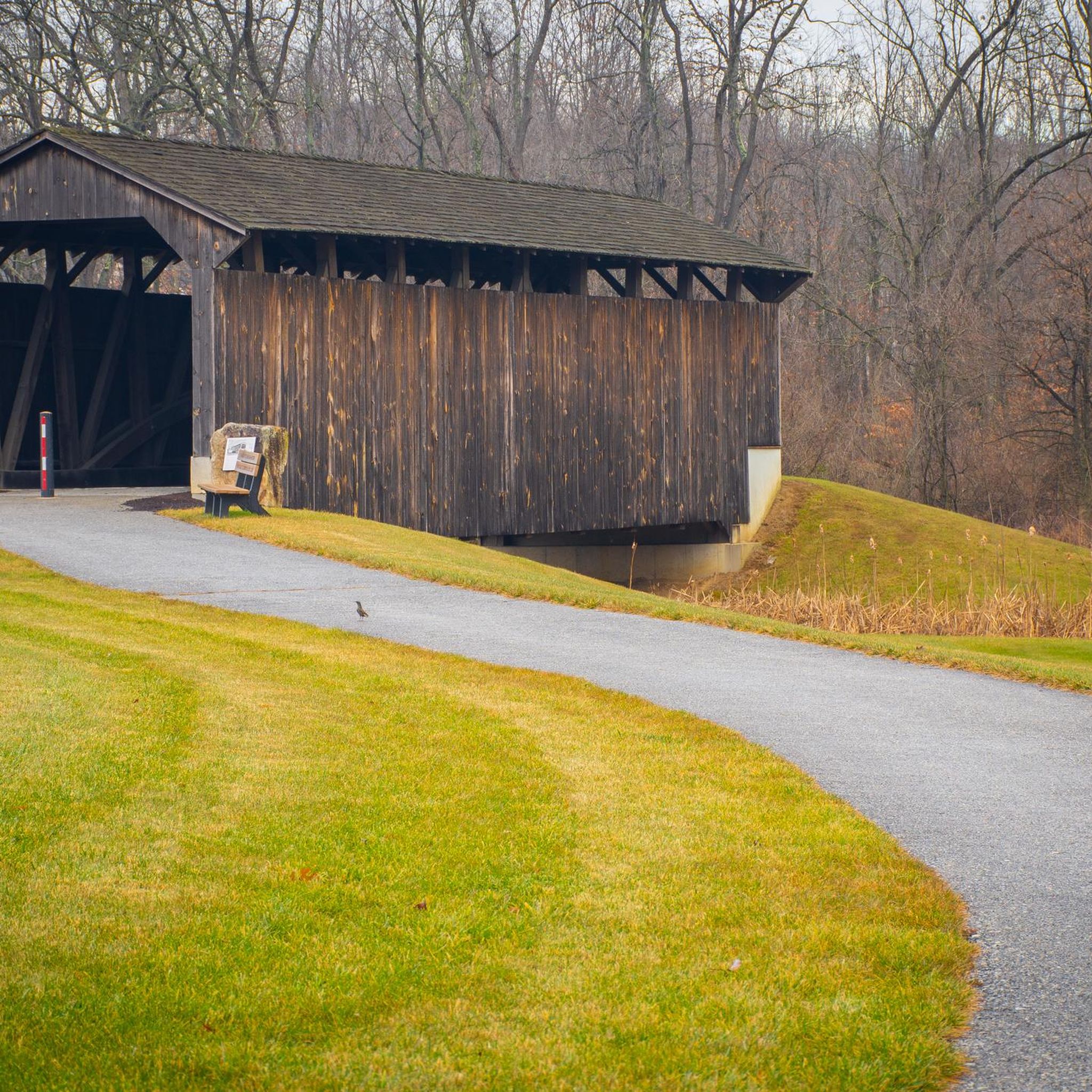
The road cycling routes around Eagle feature varied terrain, including scenic river valleys and rolling hills. You'll encounter a mix of open roads and paths winding through rural landscapes, often passing historic covered bridges.
Are there routes suitable for beginners in the Eagle area?
Yes, the Eagle area offers a selection of easier routes perfect for beginners. There are 12 easy road cycling tours available, providing a gentle introduction to the region's beautiful scenery.
Where can I find challenging road cycling routes around Eagle?
For experienced cyclists seeking a challenge, the Eagle area has 34 difficult road cycling routes. These often feature significant elevation gains, such as the Rapps Dam Covered Bridge – Larkin Covered Bridge loop from Uwchlan Township, which includes over 1,200 meters of elevation gain.
Are there any long-distance road cycling routes in this region?
Yes, the region offers several long-distance routes. For example, the Larkin Covered Bridge – Pottstown Riverfront Trailhead loop from Uwchlan Township is a challenging 118 km ride, and the Larkin Covered Bridge – Welsh Mountain loop from Uwchlan Township covers about 106 km.
What are some scenic highlights I might encounter on road cycling routes?
Many routes in the Eagle area pass through picturesque rural landscapes and feature historic covered bridges. You might also encounter natural areas like Natural Lands Binky Lee Preserve or ride alongside bodies of water near Marsh Creek State Park.
Are there any family-friendly road cycling options around Eagle?
While specific 'family-friendly' routes are not explicitly categorized, the presence of easy routes suggests options suitable for families. Consider routes that utilize dedicated trails like sections of the Chester Valley Trail for a safer, more relaxed experience.
What do other road cyclists enjoy most about cycling in Eagle?
The road cycling routes in Eagle are highly rated by the komoot community, with an average score of 4.7 stars. Cyclists often praise the varied terrain, the scenic views, and the opportunity to explore rural landscapes and historic landmarks like covered bridges.
Are there any loop routes available for road cycling?
Yes, many of the road cycling routes in the Eagle area are designed as loops, allowing you to start and finish at the same point. Examples include the View from Sullivan's Bridge – National Memorial Arch loop from Uwchlan Township and the Larkin Covered Bridge – Nicholas East House loop from Uwchlan Township.
What kind of historical landmarks can I see while cycling?
The region is known for its historic covered bridges. You can cycle past landmarks such as the Larkin Covered Bridge, which is featured on several routes, offering a glimpse into the area's heritage.
Is there parking available at trailheads for road cycling routes?
While specific parking details for each trailhead are not provided, many routes start from townships or areas with public access, suggesting parking options are generally available. It's advisable to check the starting point of your chosen route for specific parking information.
Most popular routes around Eagle
Most popular attractions around Eagle

Get inspired with the komoot mobile app


Explore more
Browse the best Road cycling routes in other regions.
