The best road cycling routes around Neahkahnie
4.5
(4)
83
riders
9
rides
Road cycling around Neahkahnie features routes that navigate the coastal landscape of the Pacific Northwest. The terrain includes varied elevations, from flat sections along the Nehalem River to climbs with significant elevation gain. Riders encounter a mix of forested areas and open stretches, characteristic of the Oregon coast. The region offers road bike trail distances suitable for various skill levels.
Best road cycling routes around Neahkahnie
- The most popular road cycling route is Nehalem Bay State Park Hwy 53 loop, a 50.6 miles (81.5 km) trail that takes 3 hours 50 minutes to complete. This challenging road bike route includes nearly 3,250 feet (990 meters) of elevation gain.
- Another top favourite among local road cyclists is Nehalem River loop from Manzanita, an easy 19.7 miles (31.6 km) path. This route follows the Nehalem River, offering a relatively flat ride with minimal elevation changes.
- Local road cyclists also love the Nehalem River – Rockaway Beach loop from Manzanita, a 35.2 miles (56.6 km) trail leading through coastal and riverside landscapes, often completed in about 2 hours 28 minutes.
- Road cycling around Neahkahnie is defined by coastal roads, river valleys, and forested climbs. The network offers options for different ability levels, from beginner road bike routes to challenging road bike trails.
- The routes in Neahkahnie are highly rated by the komoot community with an average score of 4.3 stars from a few reviews. More than 60 road cyclists have used komoot to explore Neahkahnie's varied terrain.
Last updated: July 15, 2026
5.0
(1)
11
riders
81.5km
03:51
990m
990m
The Nehalem Bay State Park Hwy 53 loop offers a challenging road cycling adventure along the Oregon Coast, taking you through diverse landscapes. You'll experience flat stretches along the bay and river, then tackle significant climbs through coastal forests, all while enjoying expansive views of the Pacific Ocean. Keep an eye out for wildlife like deer and elk, and make sure to take in the panoramas from spots like the Silver Point Interpretive Overlook, where you can see Cannon Beach and Haystack Rock.
This difficult 50.6-mile (81.5 km) route demands very good fitness, with 3250 feet (991 metres) of elevation gain and an estimated duration of 3 hours and 50 minutes. It's the most popular road cycling route in the park, known for its mostly well-paved surfaces but varied terrain. Plan to start early, especially on weekends, to make the most of your ride.
This loop stands out for its unique setting on a sand spit between the Pacific Ocean and Nehalem Bay, offering a distinct coastal cycling experience. While the Hwy 53 loop is for advanced cyclists, the park also features a shorter, paved path around an airstrip for a more relaxed ride. It's a fantastic way to explore the natural features of the Oregon Coast by bike.
5.0
(1)
13
riders
29.1km
01:12
170m
170m
Easy road ride. Great for any fitness level. Mostly well-paved surfaces and easy to ride.

Sign up for free
5.0
(1)
15
riders
59.9km
02:31
420m
420m
The Nehalem River loop from Manzanita offers a fantastic road cycling experience, guiding you from the coastal charm of Manzanita into the lush, wildlife-rich corridor of the Nehalem River. You'll pedal through varied terrain, enjoying stretches along the Pacific Ocean and the serene Nehalem River, often with Neahkahnie Mountain as a scenic backdrop. This route is a moderate 37.2 miles (59.9 km) with 1380 feet (421 metres) of elevation gain, typically taking around 2 hours and 30 minutes, making it an ideal choice for cyclists seeking a diverse and engaging ride.
Planning your ride is straightforward; traffic is generally light, though you'll share short sections of Highway 101 which usually have a good shoulder. Starting from Manzanita, you'll find it easy to access the route. This ride is best enjoyed on a clear day to fully appreciate the blend of coastal and inland scenery, and it's a great option for those looking for a solid half-day adventure.
What makes this route truly special is its journey through the Nehalem River's designated State Scenic Waterway, ensuring pristine natural beauty and abundant wildlife viewing opportunities. Keep an eye out for elk, deer, and various bird species along the way. This loop provides a dynamic cycling experience, showcasing the unique ecological diversity of the Oregon Coast, from ocean vistas to dense coastal forests.
7
riders
56.6km
02:29
390m
390m
This Nehalem River – Rockaway Beach loop from Manzanita offers a fantastic road cycling experience, blending stunning Pacific Ocean vistas with the peaceful, wildlife-rich Nehalem River valley. It's a moderate 35.2-mile (56.6 km) ride with 1268 feet (387 metres) of elevation gain, typically taking around 2 hours and 29 minutes to complete. You'll navigate well-paved roads, but be ready for varied terrain, including steady uphill grades that add to the challenge and reward.
Planning your ride requires a good level of fitness, as this is not an easy road cycling route. While much of the route is on smooth asphalt, some sections, particularly on similar loops in the region, may include short, unpaved segments that could be tricky for road bikes. It's always wise to check current road conditions before you go, especially if you're exploring popular bike routes along the Oregon Coast.
The Nehalem River itself is a major highlight, designated as a State Scenic Waterway, underscoring its natural beauty and ecological importance. Keep an eye out for diverse wildlife, including elk, black-tailed deer, river otters, beavers, and various bird species like ospreys and golden eagles, making this a truly scenic and engaging ride.
10
riders
84.3km
03:54
920m
920m
Hard road ride. Very good fitness required. Some segments of this route may be unpaved and difficult to ride.
Get access to more routes and recommendations from other explorers.
Sign up for free
Already have an account?
Our route recommendations are based on thousands of hikes, rides, and runs completed by other people on komoot.
Start today with a free account
Your next adventure awaits.
Login or Signup
Popular around Neahkahnie


Tips from the Community

The Nehalem River is a breathtaking waterway that boasts diverse wildlife, both on land and in the water, from majestic elk and black-tailed deer to playful river otters and busy beavers. Below the surface, the river is teeming with salmon and other fish. As you ride along, you might spot a northern spotted owl, an osprey, or even a golden eagle in the sky. In 2019, the river was designated a “State Scenic Waterway” to protect its corridor, wildlife, and stunning scenery.
0
0
Haystack Rock is a basalt sea stack that reaches a height of 235 feet (71.63m). From April to September, bring binoculars to view the puffins flying in and out of the crevices as they nest for the season. You can view other seabirds during spring, including murres and cormorants. During low tide, you can explore the tide pools full of sea stars, anemones, colorful nudibranchs and sea slugs at the base of the rock. Avoid going beyond the signs disallowing passage, as Haystack is part of the Oregon Islands National Wildlife Refuge.
0
0
The North Nehalem Fish Hatchery has a rich history that dates back to 1966 when it was first constructed. This hatchery was built to replace the Foley Creek Hatchery, which had been operational since 1926. Today, it's a modern facility used for adult collection, spawning, and rearing of several fish species, including Chinook, coho, steelhead, and rainbow trout. Visitors can view spawning activity from October to February and learn about the facility through an indoor display.
0
0
Haystack Rock is a basalt sea stack that reaches a height of 235 feet (71.63m). From April to September, bring binoculars to view the puffins flying in and out of the crevices as they nest for the season. Other seabirds that can be viewed during spring include murres and cormorants. During low tide, you can explore the tide pools full of sea stars, anemones, colorful nudibranchs and sea slugs at the base of the rock. Avoid going beyond the signs disallowing passage, as Haystack is part of the Oregon Islands National Wildlife Refuge.
0
0
As you travel along the picturesque Highway 101, make sure to take a moment to stop at this magnificent overlook. The stunning view of the vast Pacific Ocean from this spot is sure to take your breath away. The combination of the endless blue water and the rugged coastline is a fantastic opportunity to take some amazing and memorable photos.
0
0
Arcadia State Recreation Site is a hidden gem tucked away in a tranquil grove, just a stone's throw from the highway and a few feet from the sandy ocean beach below. It's an ideal spot to stop for a quick break on your way north or south, where you can kick off your shoes and bask in the beauty of the Oregon coast. The site features a small parking area and a well-maintained vaulted toilet.
0
0
This viewpoint offers a breathtaking view of the curved coastline, framed by the cliffs that face the ocean. From here, the capes are staggered and create a fantastic panoramic view, which is great for photos. If you look to the north, you'll catch a glimpse of Cannon Beach and Haystack Rock. To the west, you can see the vast expanse of the Pacific Ocean, with the famous Tillamook Rock Lighthouse visible in the distance, and to the south, you can see Arcadia Beach and a hint of the old road at Hug Point.
0
0
The Nehalem River is a breathtaking waterway that boasts diverse wildlife, both on land and in the water, from majestic elk and black-tailed deer to playful river otters and busy beavers. Below the surface, the river is teeming with salmon and other fish. As you ride along, you might spot a northern spotted owl, an osprey, or even a golden eagle in the sky. In 2019, the river was designated a “State Scenic Waterway” to protect its corridor, wildlife, and stunning scenery.
0
0
Frequently Asked Questions
What kind of difficulty levels can I expect on road cycling routes around Neahkahnie?
Neahkahnie offers a range of road cycling routes suitable for various skill levels. You'll find easy, relatively flat rides, such as the Nehalem River loop from Manzanita, which follows the river with minimal elevation changes. For those seeking a challenge, routes like the Nehalem Bay State Park Hwy 53 loop feature significant elevation gains, reaching nearly 3,250 feet (990 meters).
What are the typical distances for road cycling routes in Neahkahnie?
Road cycling routes in Neahkahnie vary in length to accommodate different preferences. You can find shorter, easy loops around 15 miles (24 km), such as the Nehalem River – Nehalem River loop from Nehalem Bay State Park. Longer, more challenging routes can extend up to 50 miles (81 km), like the Nehalem Bay State Park Hwy 53 loop, offering extensive rides through the coastal landscape.
Are there beginner-friendly road cycling routes in Neahkahnie?
Yes, Neahkahnie has several beginner-friendly road cycling options. Routes like the Nehalem River loop from Manzanita are classified as easy, covering about 19.7 miles (31.6 km) with minimal elevation, making them ideal for those new to road cycling or looking for a relaxed ride.
Where can I find challenging road bike trails near Neahkahnie?
For challenging road bike trails, consider routes that venture into the varied elevations of the coastal landscape. The Nehalem Bay State Park Hwy 53 loop is a difficult 50.6-mile (81.5 km) route with nearly 3,250 feet (990 meters) of climbing. Another demanding option is the Manzanita Beach – Nehalem River loop from Manzanita, which spans 51 miles (82 km) with over 2,980 feet (900 meters) of elevation gain.
Are there family-friendly road cycling routes in Neahkahnie?
While specific 'family-friendly' designations aren't always available for road cycling, routes with lower difficulty and minimal elevation are generally suitable. The Nehalem River – Nehalem River loop from Nehalem Bay State Park is an easy 14.9-mile (23.9 km) route with very little climbing, making it a good option for families or those looking for a relaxed pace.
When is the best time of year for road cycling in Neahkahnie?
The Oregon coast, including Neahkahnie, generally offers pleasant road cycling conditions from late spring through early fall (May to October). During these months, you can expect milder temperatures and less rainfall, making for more enjoyable rides. Always check local weather forecasts, as coastal conditions can change rapidly.
What scenic viewpoints or attractions can I see while road cycling in Neahkahnie?
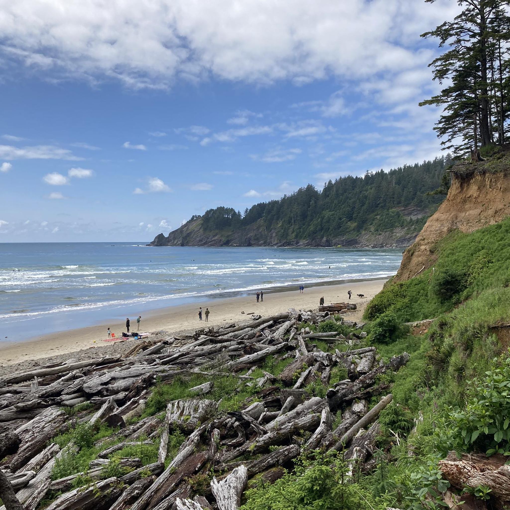
Road cycling routes around Neahkahnie offer access to stunning coastal and riverine scenery. You can pass by the Nehalem River, enjoy panoramic views from Devil's Cauldron Viewpoint and Neahkahnie Viewpoint, or even cycle near Nehalem Bay State Park and Short Sand Beach. These routes provide opportunities to experience the natural beauty of the Pacific Northwest.
Are most road cycling routes in Neahkahnie loops or point-to-point?
Many of the road cycling routes around Neahkahnie are designed as loops, offering convenient starting and ending points. Examples include the Nehalem Bay State Park Hwy 53 loop and the Nehalem River loop from Manzanita. This allows cyclists to return to their starting location without needing additional transport.
What do other road cyclists enjoy most about the routes in Neahkahnie?
The road cycling routes in Neahkahnie are highly rated by the komoot community, with an average score of 4.3 stars. Cyclists often praise the diverse terrain, which includes coastal roads, river valleys, and forested climbs, providing a varied and engaging riding experience. The blend of scenic beauty and options for different ability levels is frequently highlighted.
How many road cycling routes are available around Neahkahnie?
There are several road cycling routes available around Neahkahnie, with komoot featuring 7 distinct routes. These routes offer a variety of distances and difficulty levels, ensuring options for different preferences and fitness levels.
Are there cafes or places to refuel along the road cycling routes?
While specific cafes are not listed for every route, many routes in Neahkahnie start or pass through towns like Manzanita and Nehalem. These towns typically offer amenities such as cafes, restaurants, and convenience stores where you can refuel and take a break during your ride.
What are the conditions like for winter road biking in Neahkahnie?
Winter road biking in Neahkahnie can be challenging due to increased rainfall, cooler temperatures, and potentially strong coastal winds. While some days may be clear, wet roads and limited daylight are common. Riders should be prepared with appropriate waterproof gear, lights, and be mindful of road conditions. It's advisable to check local weather forecasts before heading out.
Most popular routes around Neahkahnie
Most popular attractions around Neahkahnie

Get inspired with the komoot mobile app


Explore more
Browse the best Road cycling routes in other regions.
