The best road cycling routes around Aloha
4.6
(41)
1,466
riders
182
rides
Road cycling routes around Aloha offer diverse landscapes within the Tualatin Valley, characterized by a mix of urban proximity and natural beauty. The region features fertile farmlands, dense forests, and rolling hills, providing varied terrain for cyclists. Dedicated infrastructure, including paved trails and scenic bikeways, supports a range of cycling experiences. This area provides routes that traverse natural habitats and offer views of the surrounding countryside.
Best road cycling routes around Aloha
- The most popular road cycling route is Bethany…
Last updated: July 2, 2026
5.0
(1)
40
riders
Moderate road ride. Good fitness required. Mostly well-paved surfaces and easy to ride.
30
riders
98.3km
06:33
2,010m
2,010m
Hard road ride. Very good fitness required. Some segments of this route may be unpaved and difficult to ride.

Sign up for free
23
riders
128km
05:22
730m
730m
Hard road ride. Very good fitness required. Some segments of this route may be unpaved and difficult to ride.
11
riders
Easy road ride. Great for any fitness level. Mostly well-paved surfaces and easy to ride.
5.0
(2)
15
riders
69.4km
03:17
870m
870m
Moderate road ride. Good fitness required. Mostly well-paved surfaces and easy to ride.
Get access to more routes and recommendations from other explorers.
Sign up for free
Already have an account?
Our route recommendations are based on thousands of hikes, rides, and runs completed by other people on komoot.
Start today with a free account
Your next adventure awaits.
Login or Signup

Tips from the Community

One of two access points for Northwest Firelane 15 Road. The fire road is a well maintained gravel road, but it is still advisable to have wider tires.
0
0

The Banks-Vernonia State Trail is Oregon's first "rails-to-trails" park, repurposing a 21-mile abandoned railroad between Banks and Vernonia. This is where the trails begins/ends in Banks. There is a parking area, a water fountain, and a restroom here. The trail features an 8-foot wide paved path for hiking and biking, alongside a 4-foot gravel equestrian trail. It is at a generally gentle grade and passes through fields, forests, and farmlands with scenic mountain views, in Washington and Columbia counties.
0
0

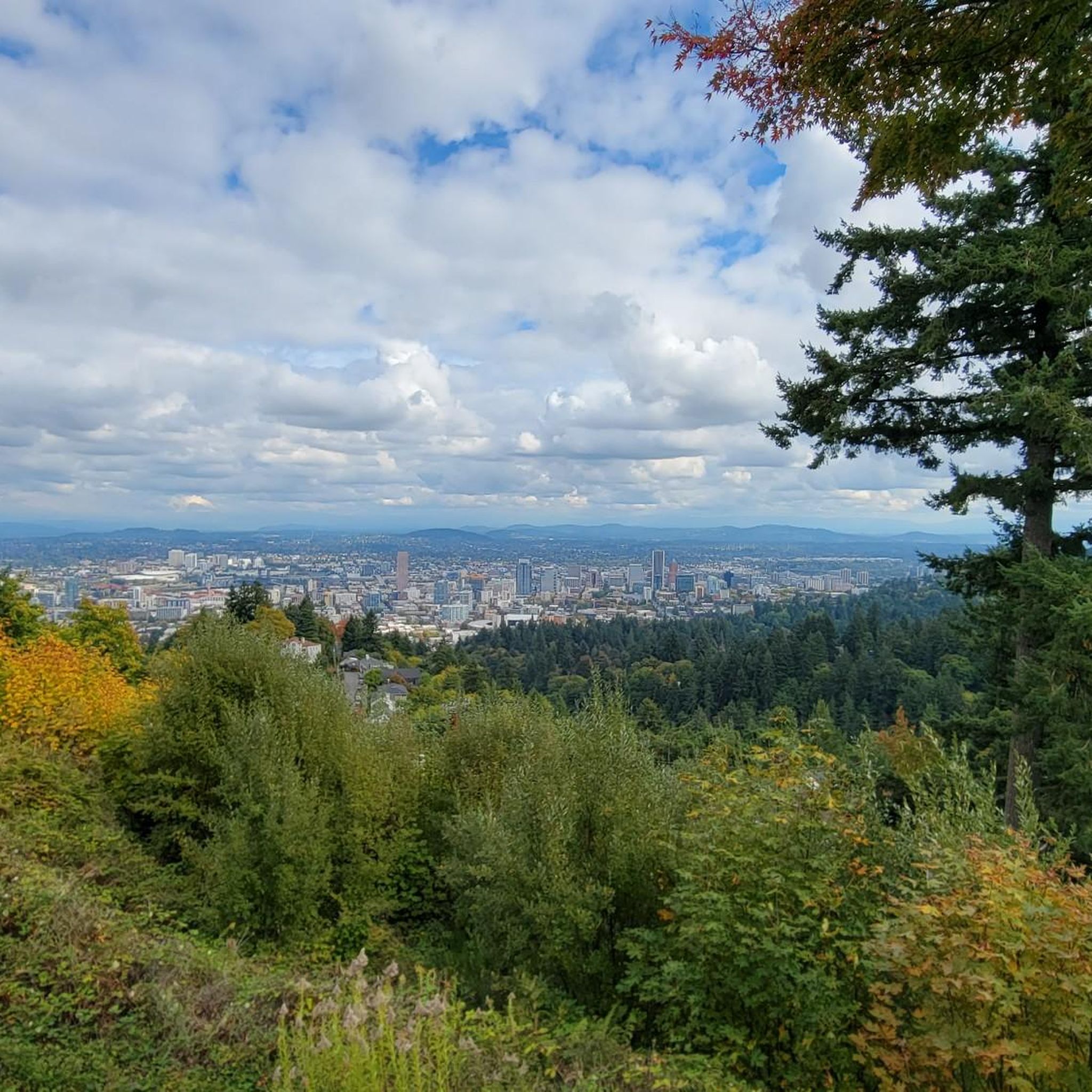
The Pittock Mansion grounds are open to the public at no cost and make a fantastic stopping point during a run. There are public restrooms, drinking water, and stunning views of Portland that you won’t want to miss. You can also park here and take the Wildwood Trail in both directions.
0
0

One hell of a climb up here from US 30 on the South end - but worth it! Great views and a decent crossing (once you climb to the bridge itself).
0
0

Built in 1910, the Hawthorne Bridge spans 3,552 feet across the Willamette River with four lanes and is a key part of the city's bike culture. The bridge gives passage to over 30,000 vehicles daily, including 800 TriMet buses, along with more than 8,000 cyclists. During rush hour, bikes can outnumber cars. The wide sidewalks offer great views of the river and skyline. As the oldest vertical-lift bridge in the U.S. and Portland's oldest highway bridge, it was added to the National Register of Historic Places in 2012.
0
0
The St. Johns Bridge is a steel suspension bridge that stretches across the Willamette River. It has a total length of 2,067 feet, and is the tallest bridge in Portland. Construction began just before the Stock Market Crash of 1929, providing crucial employment to many local residents during the Great Depression.
0
0
This is the LAST big hill and bridge before entering Portland on the STP ride. The hill up from US 30 is a slog - stop and get some water before crossing the bridge. There is no separate bike lane across, so be careful. Beautiful view of Mt. Hood and Mt. St. Helens from the bridge!
0
0

Lower Tanasbrook Reservoir is one of three reservoirs in the area, along with Middle and Upper Tanasbrook Reservoirs. Among them, Lower Tanasbrook Reservoir is the most prominently visible from the road at this point, providing you with some pleasant views as you ride past.
1
0
Frequently Asked Questions
How many road cycling routes are available around Aloha?
There are over 170 road cycling routes around Aloha, offering a wide variety of experiences. These routes are highly rated by the komoot community, with an average score of 4.6 stars.
What kind of terrain can I expect on road cycling routes around Aloha?
Road cycling around Aloha offers diverse landscapes within the Tualatin Valley. You'll find a mix of fertile farmlands, dense forests, and rolling hills. Dedicated infrastructure like the Tualatin Valley Scenic Bikeway and the paved Banks-Vernonia State Trail provide smooth riding, while other areas offer more varied terrain with elevation changes.
Are there road cycling routes suitable for beginners in Aloha?
Yes, Aloha offers many routes suitable for beginners. Nearly 50 routes are classified as easy, featuring gentle grades and paved paths. The Banks-Vernonia State Trail, for example, is known for its tranquil, car-free experience through fields and forests with gentle inclines.
Where can I find more challenging road cycling routes near Aloha?
For more challenging rides, Aloha and the surrounding Washington County area feature routes with significant elevation gain. There are 26 difficult routes available. The St. Johns Bridge – Hawthorne Bridge loop from Merlo Road/Southwest 158th Avenue is a difficult 61.5-mile path with substantial climbing, offering urban and river views.
What scenic features will I encounter on road cycling routes in Aloha?
Aloha's routes showcase the natural beauty of the Tualatin Valley. You can expect to see fertile farmlands, lush natural areas, dense forests, oak woodlands, wetlands, and prairies. Routes like the Bethany Lake – Holcomb Creek Trestle loop offer views of natural areas and the historic Holcomb Creek Trestle.
Are there any notable landmarks or attractions along Aloha's road cycling routes?
Yes, several routes pass by interesting landmarks and natural attractions. You might cycle past the Holcomb Creek Trestle, explore the trails within Tualatin Hills Nature Park, or ride near the Jackson Bottom Wetlands Preserve. Many routes also incorporate sections of the Tualatin Valley Scenic Bikeway.
Are there family-friendly road cycling routes in Aloha?
Aloha offers several family-friendly options, particularly on paved, car-free trails with gentle grades. The Banks-Vernonia State Trail is an excellent choice for families, providing a safe and scenic environment through forests and farmlands. Many easy routes are suitable for various skill levels.
What is the best time of year for road biking in Aloha?
The Tualatin Valley generally offers good cycling conditions for much of the year. Spring and fall provide pleasant temperatures and vibrant scenery. Summer is also popular, though it can be warmer. Checking local weather forecasts before your ride is always recommended.
Are there circular road bike routes available in Aloha?
Yes, many road cycling routes around Aloha are designed as loops, allowing you to start and end at the same point. Examples include the Wooden walkway (Rock Creek Trail) – Rock Creek Greenway Boardwalk loop and the Roadbike loop from Elmonica/Southwest 170th Avenue.
Where can I find parking for bike trails in Aloha, Oregon?
Many trailheads and parks in the Aloha area offer parking facilities. For instance, the Germantown Road Trailhead is a known parking location. Public transport hubs like Willow Creek/Southwest 185th Avenue Transit Center also serve as starting points for routes, often with associated parking.
What do other road cyclists enjoy the most about road cycling in Aloha?
The komoot community highly rates road cycling in Aloha, with an average score of 4.6 stars from over 40 reviews. Cyclists often praise the diverse landscapes, from fertile farmlands to dense forests, and the well-maintained dedicated cycling infrastructure like the Tualatin Valley Scenic Bikeway. The variety of routes catering to all skill levels is also a frequently mentioned positive aspect.
Most popular attractions around Aloha

Get inspired with the komoot mobile app


Explore more
Browse the best Road cycling routes in other regions.
