The best cycling routes around Montrose-Ghent
4.9
(62)
659
riders
23
rides
Touring cycling around Montrose-Ghent, Ohio, offers routes primarily through the Cuyahoga Valley National Park area, characterized by the historic Ohio & Erie Canal Towpath. The landscape features river valleys, wetlands, and forested sections, providing a mix of natural scenery. Elevation changes are generally gentle, making many routes accessible for various skill levels. The region's parks and preserves contribute to a green and varied cycling experience.
Best touring cycling routes around Montrose-Ghent
- The most popular touring cycling route is Ohio &…
Last updated: July 12, 2026
4.3
(6)
24
riders
33.5km
02:07
150m
150m
Moderate bike ride. Good fitness required. Mostly paved surfaces. Suitable for all skill levels.
5
riders
21.9km
01:18
120m
120m
Easy bike ride. Great for any fitness level. Mostly paved surfaces. Suitable for all skill levels.

Sign up for free
4.7
(14)
94
riders
29.2km
01:51
80m
80m
Easy bike ride. Great for any fitness level. Mostly paved surfaces. Suitable for all skill levels.
5.0
(2)
51
riders
18.5km
01:11
40m
40m
Easy bike ride. Great for any fitness level. Mostly paved surfaces. Suitable for all skill levels.
5.0
(1)
21
riders
36.2km
02:18
150m
150m
Moderate bike ride. Good fitness required. Mostly paved surfaces. Suitable for all skill levels.
Get access to more routes and recommendations from other explorers.
Sign up for free
Already have an account?
Our route recommendations are based on thousands of hikes, rides, and runs completed by other people on komoot.
Start today with a free account
Your next adventure awaits.
Login or Signup


Tips from the Community

Good alternative parking spot for the towpath if Peninsula lots are full
0
0
nice little farmers market. They do not accept cash, but there is an ATM on sight. Store sits right next to towpath trail
0
0

This Brewery and bistro is located close to biking and hiking trails, making it a favorite post-adventure stop with locals.
0
0


Cuyahoga Valley National Park sits between the cities of Cleveland and Akron along the Cuyahoga River. The park consists of 33,000 acres of deep forests, waterfalls, rolling hills, and farmland.
0
0

Primitive camping is available at the Big Bend trailhead. Only one night stays are allowed and fires are not permitted.
0
0

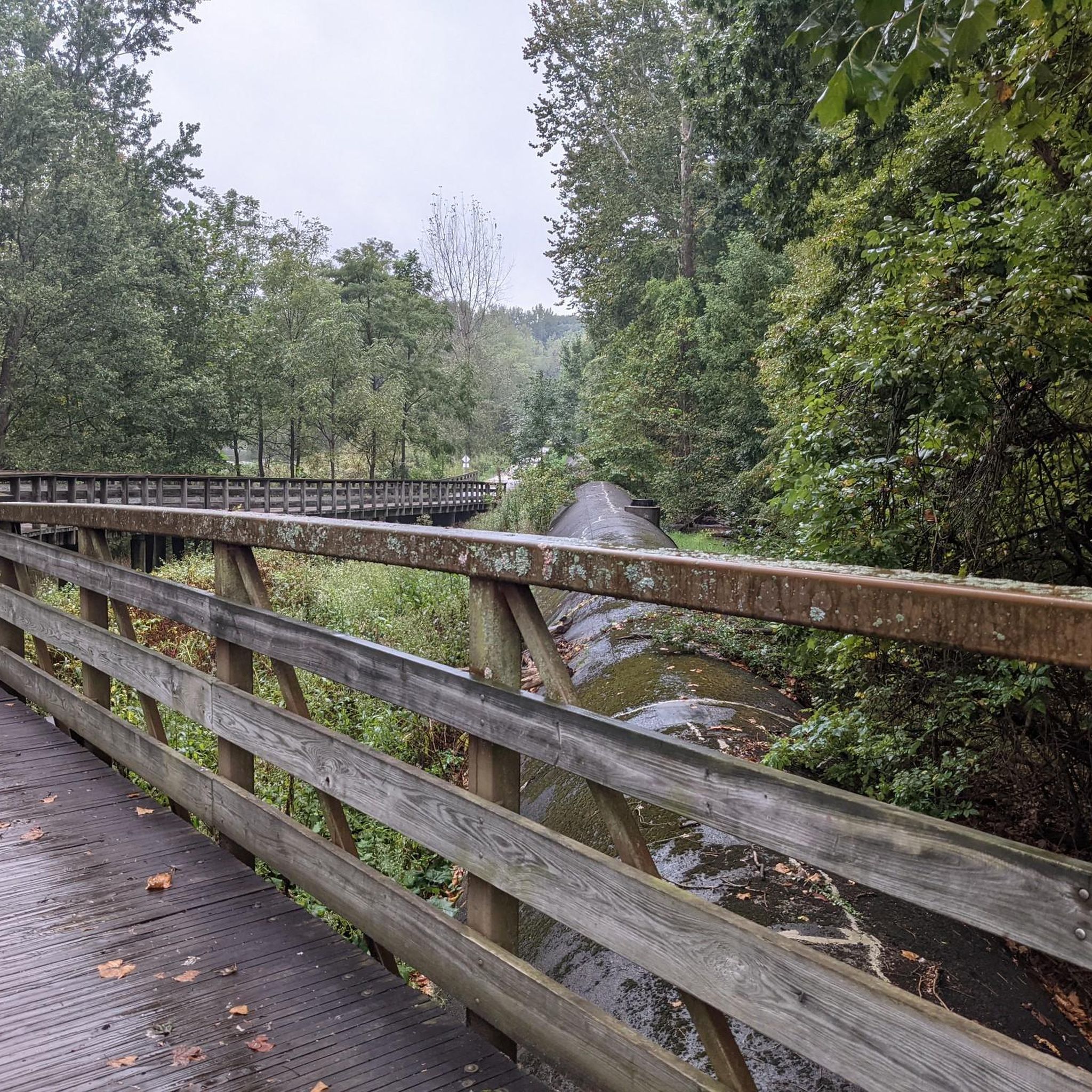
Once upon a time (but really not that long ago), mules walked this towpath as they hauled boats up and down the Ohio & Erie Canal. Nowadays, the towpath is a wonderful multi-use trail that threads alongside the canal and through the occasional bridge, like this one.
0
0

At this spot on the Ohio & Erie Canal Townpath Trail, you pass under I-80. You get a truly unique view of the underside of the highway and of the Cuyahoga River.
0
0
Frequently Asked Questions
How many touring cycling routes can I find around Montrose-Ghent?
There are over 20 touring cycling routes available around Montrose-Ghent, offering a variety of experiences for different skill levels. These routes primarily explore the Cuyahoga Valley National Park area.
Are there easy or family-friendly touring cycling routes in Montrose-Ghent?
Yes, Montrose-Ghent offers several easy and family-friendly touring cycling routes. For instance, the Ohio & Erie Canal Towpath: Peninsula Loop is an easy 13.6-mile (21.9 km) path along the historic towpath, perfect for a relaxed ride with pleasant riverside scenery. Another accessible option is the Boston Trailhead – Cuyahoga River Bridge loop from Botzum.
What kind of landscapes will I encounter on touring cycling routes in Montrose-Ghent?
Touring cycling routes in Montrose-Ghent are characterized by river valleys, wetlands, and forested sections, particularly within the Cuyahoga Valley National Park. You'll often ride along historic canal towpaths, offering a mix of natural scenery and glimpses into the region's past.
Are there any circular touring cycling routes in Montrose-Ghent?
Yes, many of the touring cycling routes in Montrose-Ghent are designed as loops. A popular option is the Ohio & Erie Canal Towpath Trail Loop, which is 20.8 miles (33.5 km) long. Another great circular route is the Lock 29 – Cuyahoga River Bridge loop from Stan Hywet Hall & Gardens, leading through river valleys and past historic sites.
What do other touring cyclists say about the routes in Montrose-Ghent?
The touring cycling routes around Montrose-Ghent are highly rated by the komoot community, with an average score of 4.6 stars from over 50 reviews. Cyclists often praise the well-maintained towpaths, the scenic views along the Ohio & Erie Canal, and the generally gentle elevation changes that make the routes enjoyable for various skill levels.
What are some notable natural attractions or viewpoints along the touring cycling routes?
Along the routes, you can discover several natural attractions. The Ledges Overlook offers scenic landscapes. You might also encounter areas like Kendall Lake or Chestnut Pond. The region's parks, such as Hampton Hills Metro Park and O'Neil Woods Metro Park, also provide accessible paths and natural beauty.
Are there any routes that feature historic sites or unique landmarks?
Many routes follow the historic Ohio & Erie Canal Towpath, offering glimpses into the region's past. The Lock 29 – Cuyahoga River Bridge loop from Stan Hywet Hall & Gardens specifically passes by historic sites. You can also find the Deep Lock Quarry Metro Park, which is a unique man-made landmark related to the canal's history.
What is the typical duration for touring cycling routes in Montrose-Ghent?
The duration varies depending on the route and your pace. For example, the moderate Ohio & Erie Canal Towpath Trail Loop, at 20.8 miles (33.5 km), typically takes around 2 hours and 6 minutes. Shorter, easy routes like the Ohio & Erie Canal Towpath: Peninsula Loop can be completed in about 1 hour and 15 minutes.
Are there any routes that pass through parks or nature preserves?
Yes, many routes are integrated with the region's parks and nature preserves. The area is rich with green spaces like Hampton Hills Metro Park, O'Neil Woods Metro Park, and the F.A. Seiberling Nature Realm (though cycling is limited to parking lots there). The Cascade Valley Metropark – Nice covered bridge loop from Indigo Lake is a great example of a route that takes you through a metropark.
What is the best time of year for touring cycling in Montrose-Ghent?
The spring, summer, and fall months generally offer the most pleasant conditions for touring cycling in Montrose-Ghent. Spring brings blooming flora, summer provides warm weather, and fall showcases beautiful foliage. While some may cycle in winter, conditions can be challenging due to snow and ice, especially on unpaved towpath sections.
Are there options for more challenging touring cycling routes?
While many routes are easy to moderate, there are options for those seeking a bit more challenge. The region features a few routes classified as difficult, often involving longer distances or slightly more varied terrain, though elevation changes generally remain gentle due to the nature of the towpaths and river valleys. You can find one difficult route among the 22 available.
Most popular attractions around Montrose-Ghent

Get inspired with the komoot mobile app


Explore more
Browse the best Cycling routes in other regions.
