The best running trails around Hillsborough
3.0
(1)
159
runners
11
runs
If you've ever tried to plan jogging around Hillsborough, you know how overwhelming the options can be. With so many trails and paths, it's tough to figure out which ones are genuinely worth your time and effort, and which are just filler. We get it – you want the good stuff, not endless guesswork.
That's where we come in. Our komoot community has mapped, run, and reviewed these routes, so we've done the legwork to bring you a curated shortlist of the best jogging routes Hillsborough has to offer. This guide isn't a recycled list; it's a collection of routes that our community truly loves, designed to save you the hassle and get you straight to the good trails.
Jogging in Hillsborough is all about embracing the river paths and green spaces. You'll find a mix of accessible paved trails and more natural, varied terrain, often following the scenic Eno River. The routes here range from easy, flat loops perfect for a quick run to moderate paths with some elevation gain, offering something for every fitness level.
If you only do one route, make it the Riverwalk Bridge loop from Orange. At 6.3 miles (10.2 km), it's a local favorite for a reason, offering a beautiful riverside run with a moderate challenge. For something a bit easier but still incredibly scenic, the Panther Cave loop from Orange is a fantastic choice at 4.1 miles (6.6 km), perfect for a relaxed jog. Ready to lace up? More than 150 visitors have already explored Hillsborough's trails with komoot, and we think you'll love them too.
Last updated: May 28, 2026
9
runners
5.26km
00:39
30m
30m
The Laurel Bluffs and Eno Quarry Trail Loop offers a captivating run through varied landscapes, from lush hardwood forests to cultivated pine sections. You'll trace the winding Eno River, traversing bluffs and descending into rocky draws, with continuous scenic views. The highlight is undoubtedly the historic Eno River Quarry, now a serene lake, and you might even spot the Eno River Waterfall along the way.
This moderate 3.3-mile (5.3 km) loop, with 114 feet (35 metres) of elevation gain, is typically completed in about 38 minutes. It's a popular route within Eno River State Park, so consider an early start to secure parking. The mixed terrain, including roots and rocky sections, requires good footing, making it ideal for joggers seeking a dynamic and engaging workout.
Part of the larger Mountains-to-Sea Trail, this route is rich in both natural beauty and historical intrigue. Beyond the quarry, you can discover remnants of old homesteads and the Guess Mill Dam, adding layers of discovery to your jog. Keep an eye out for local wildlife, including various bird species and deer, especially in the quieter hours.
1
runners
3.64km
00:28
60m
60m
The Cabe Lands and Eno Quarry Trail Loop offers a refreshing jog through diverse natural scenery, blending shaded hardwood forests with picturesque views of the Eno River. You'll encounter natural surfaces like dirt and roots, with some rocky sections along the riverbank, leading to the visually striking Eno Quarry with its distinctive dark green waters. This easy 2.3-mile (3.6 km) route, with just 206 feet (63 metres) of elevation gain, can be completed in about 27 minutes, making it an ideal choice for a quick, scenic run.
Planning your visit is straightforward, as the trail is easily accessible within Eno River State Park, a short distance from Durham. While generally easy, be mindful that the trail can get muddy after rain, so appropriate footwear with good traction is recommended. There are no permits required, and it's a great option for a morning or afternoon outing when you need a dose of nature.
Beyond its natural beauty, the trail is rich in history, traversing lands once owned by Barnaby Cabe before the American Revolution and passing the site of the old Cabe Mill. You might also discover remnants of Guess Mill Dam, adding a layer of historical intrigue to your run. Keep an eye out for fresh water mussel shells along the river and interesting quartz stones, highlighting the unique geology of the area.

Sign up for free
31
runners
10.1km
01:03
40m
40m
The Riverwalk Bridge loop from Orange offers a consistent and enjoyable jogging experience, following a river and featuring a bridge crossing that defines the route. You can expect a generally flat or gently rolling terrain, making it ideal for maintaining a steady pace. While specific scenic highlights aren't detailed, the presence of a river suggests a refreshing natural setting for your run.
Planning your visit to the Riverwalk Bridge loop from Orange should include checking local information for trailhead access and parking, as these details are not specified. This moderate 6.3 miles (10.1 km) jogging route, with its 142 feet (43 metres) of elevation gain and estimated 1 hour and 2 minutes duration, is well-suited for a regular workout. Consider visiting during cooler parts of the day or in milder seasons for the most comfortable experience.
This Riverwalk Bridge loop in Orange County, North Carolina, provides a reliable option for those seeking a moderate jogging trail. Its design as a loop around a river with a bridge crossing implies a well-defined path, making it easy to navigate. The relatively low elevation gain means it's accessible to a wide range of fitness levels, offering a pleasant outdoor activity without demanding technical skills.
3.0
(1)
13
runners
7.08km
00:48
70m
70m
Moderate run. Good fitness required. Mostly paved surfaces. Suitable for all skill levels.
10
runners
4.12km
00:32
80m
90m
The Panther Cave loop from Orange offers a delightful and accessible jogging experience through the varied terrain of Middlesex Fells. You'll wind through pleasant wooded areas, encountering small hills and potentially uneven ground that add a touch of adventure to this easy route. The standout feature is Panther Cave itself, a fascinating rock formation that provides a unique landmark along your journey, making it a memorable outing for its natural beauty and interesting geology.
Planning your visit to the Panther Cave loop is straightforward, as it's an easy 2.6-mile (4.1 km) jogging route with 279 feet (85 metres) of elevation gain, typically taking about 31 minutes. Parking is generally available at various trailheads within the Middlesex Fells Reservation. This route is enjoyable in most seasons, but spring and autumn are particularly pleasant. Always check for current trail conditions, especially after wet weather, as some parts can get muddy.
This specific Panther Cave loop is a great way to experience the natural charm of Middlesex Fells without committing to the longer, more difficult trails the reservation is known for. The Fells are characterized by their expansive wooded landscape and rocky outcrops, offering a natural escape close to urban areas. The presence of unique rock formations like Panther Cave and the varied scenery make this an excellent choice for a quick, rewarding jog.
Get access to more routes and recommendations from other explorers.
Sign up for free
Already have an account?
Our route recommendations are based on thousands of hikes, rides, and runs completed by other people on komoot.
Start today with a free account
Your next adventure awaits.
Login or Signup

Tips from the Community

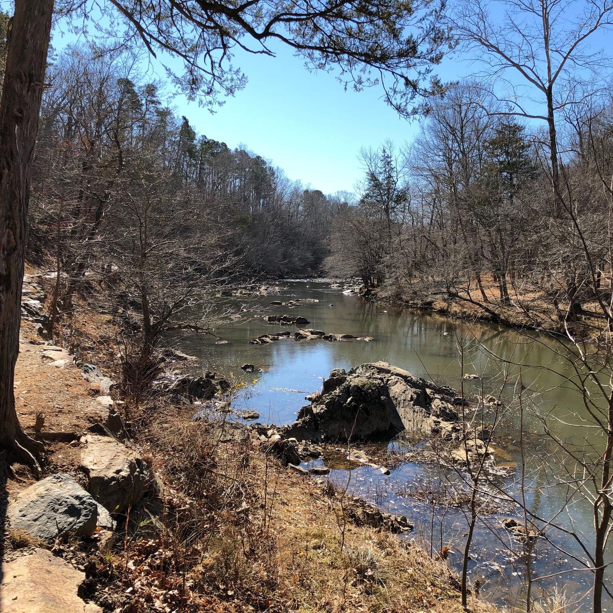
The beautiful Eno River flows through Durham County for 33 miles before eventually ending up in Falls Lake on the eastern edge of the county. It is the fulcrum attraction of Eno State Park which offers great access for Durham residents to enjoy a variety of outdoor activities just a stone's throw from downtown Durham.
0
0

The Eno River Quarry is a small reservoir along the Eno River. The Mountains-to-Sea Trail hugs the southern bank of the quarry, while the Eno Quarry Trail circles around the entire reservoir.
0
0
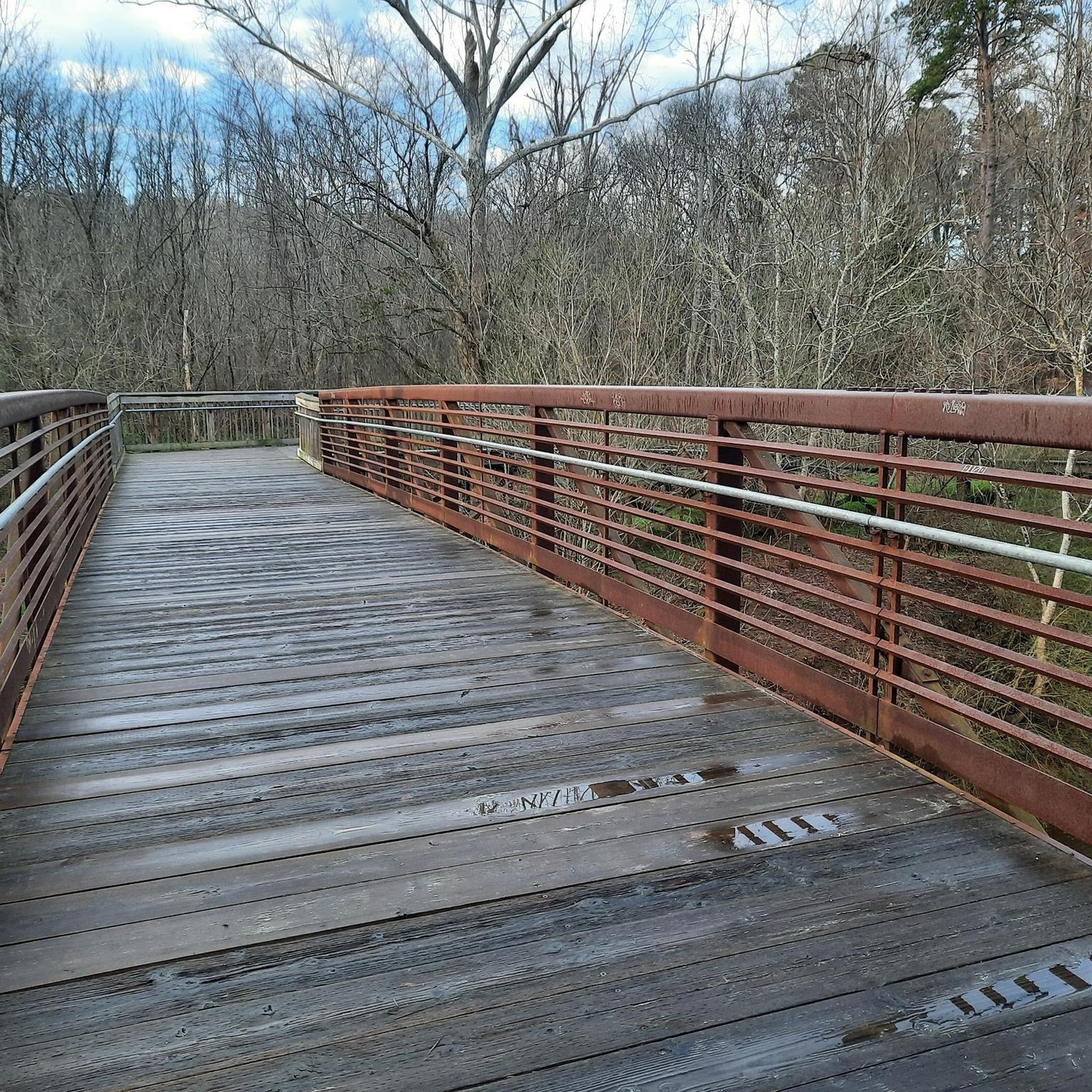
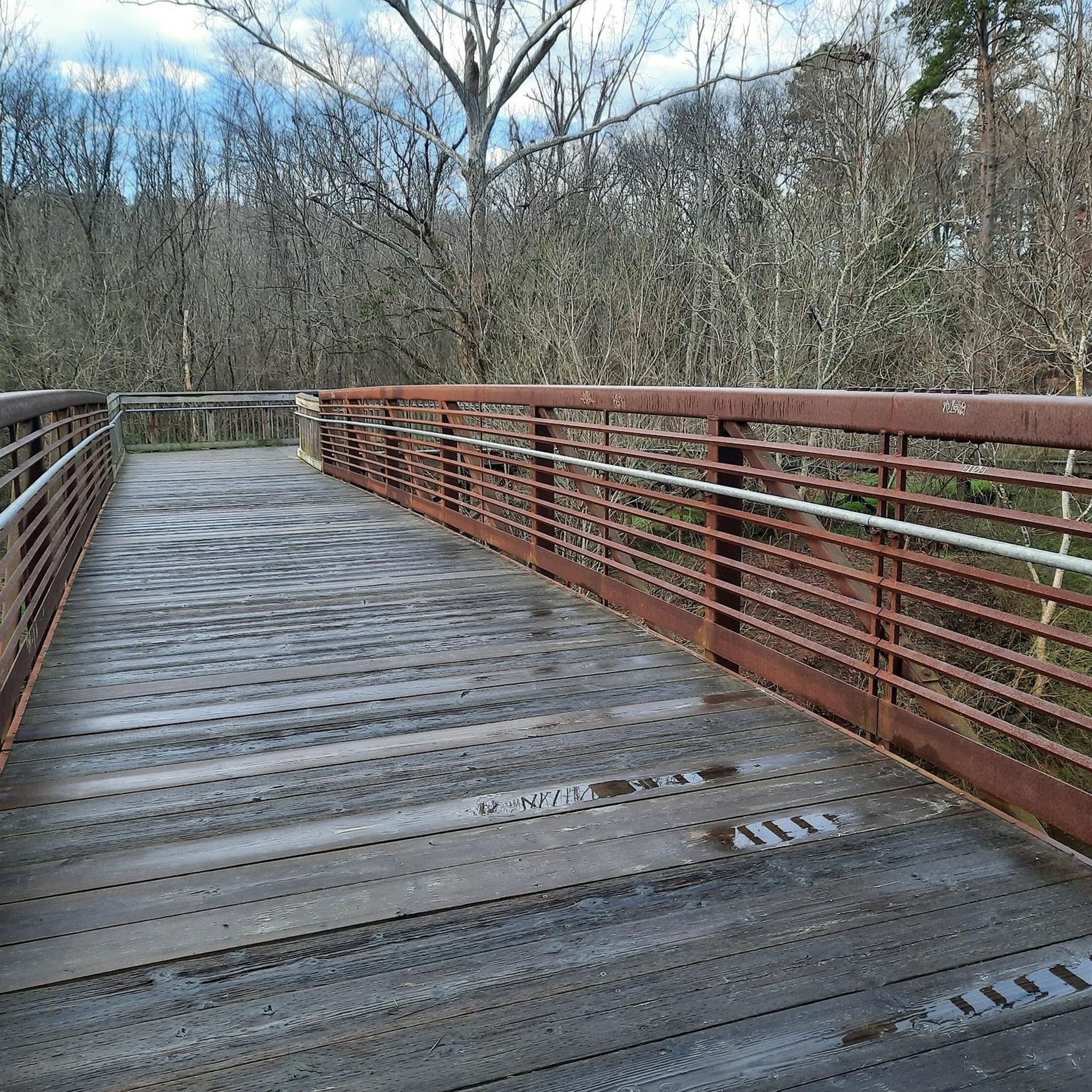
This is a beautiful little pedestrian bridge that is very wide and accommodating. It is a great little place to stop on your bike in order to take some time out to look out over the river.
0
0
The Eno River Quarry is a small reservoir along the Eno River. The Mountains-to-Sea Trail hugs the southern bank of the quarry, while the Eno Quarry Trail circles around the entire reservoir.
0
0
Frequently Asked Questions
How many running routes are available around Hillsborough?
There are over 20 running routes around Hillsborough, offering a diverse range of options for runners. These include easy, moderate, and more challenging trails to suit various fitness levels.
Are there any easy jogging routes in Hillsborough for beginners?
Yes, Hillsborough offers several easy jogging routes suitable for beginners. There are 4 routes specifically categorized as easy, providing gentle terrain for those new to running or looking for a relaxed pace.
Can I find running trails around Hillsborough that are suitable for families?
Many of the riverwalks and park loops in Hillsborough are well-suited for families, offering accessible terrain and generally moderate distances. These paths often provide a pleasant environment for a family run or walk.
Are there any circular running routes in Hillsborough?
Yes, many of the running routes in Hillsborough are circular, allowing you to start and finish at the same point. For example, the Riverwalk Bridge loop from Orange County is a popular circular option.
What kind of scenery can I expect on Hillsborough's running trails?
Hillsborough's running trails primarily feature river paths and parkland. You'll often find yourself alongside the Eno River, enjoying natural landscapes. Some routes also offer varied terrain with moderate elevation changes, providing a mix of views.
Are there any running routes in Hillsborough that are dog-friendly?
Many of the outdoor trails and park areas in Hillsborough are dog-friendly, provided your pet is kept on a leash. It's always a good idea to check specific park regulations, but generally, the riverwalks and open park loops are welcoming for runners with dogs.
Are there any challenging running trails around Hillsborough?
Yes, for those seeking a greater challenge, Hillsborough has 6 routes categorized as difficult. An example is the Gold Park – Riverwalk Bridge loop from Orange County, which covers over 15 km with significant elevation gain.
What are some points of interest or attractions I might see along the running routes?
While running in Hillsborough, you might encounter natural attractions like the Eno River itself, or the Brumley Forest Pond. Some trails also offer views like the Overlook of the Abandoned Quarry, adding visual interest to your run.
Are there running routes around Hillsborough that are approximately 5k in length?
While specific 5k routes aren't explicitly listed, many of the shorter park loops and segments of the riverwalk can be combined or run as out-and-back sections to achieve a 5k distance. The #44 Racecar loop from Historic Occoneechee Speedway is just over 8.5 km, offering a slightly longer option.
What do other runners enjoy most about jogging in Hillsborough?
The running routes in Hillsborough are highly rated by the komoot community, with an average score of 4.5 stars from 4 reviews. Runners often praise the accessible riverwalks and varied parkland, noting the options for different ability levels and the pleasant natural surroundings.
Are there running routes in Hillsborough with good parking access?
Many of the popular running routes around Hillsborough, especially those starting from parks or established trailheads like the Historic Occoneechee Speedway, typically offer convenient parking facilities. It's advisable to check the specific route details for parking information.
Can I access Hillsborough's running trails using public transport?
Hillsborough has some public transport options, and certain routes may be accessible via bus stops within the town. For routes further afield, a combination of public transport and a short walk or cycle might be necessary to reach the trailhead.
Most popular routes around Hillsborough
Most popular attractions around Hillsborough

Get inspired with the komoot mobile app


Explore more
Browse the best Running Trails & Routes in other regions.
