The best walks and hikes around Ellhofen
4.4
(231)
2,826
hikers
31
hikes
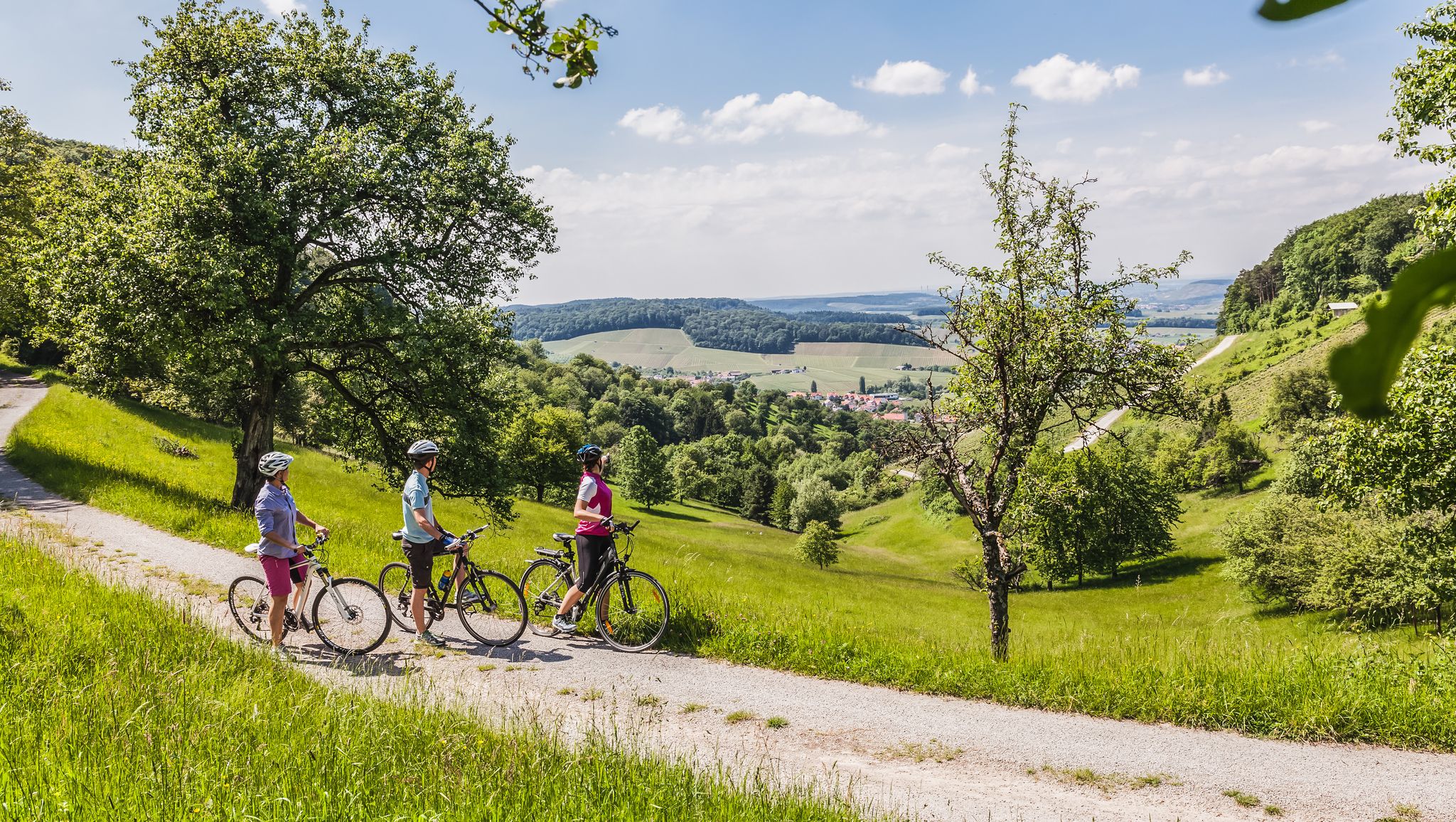
Hiking trails around Ellhofen Germany are situated at the base of the Löwenstein within the Swabian-Franconian Forest Nature Park. The region is characterized by rolling hills, extensive vineyards, and the Sulmtal river valley. Elevated areas such as the Löwenstein and Ketzersberg provide panoramic views across the landscape. This distinctive terrain offers varied hiking experiences.
Best hiking trails around Ellhofen
- The most popular hiking route is Ellhofen Evangelical Church – Weibertreu Castle loop from Ellhofen, a 3.3 miles (5.3 km)…
Last updated: October 11, 2026
4.4
(7)
32
hikers
Easy hike. Great for any fitness level. Easily-accessible paths. Suitable for all skill levels.
5.0
(1)
14
hikers
9.84km
02:38
110m
110m
Moderate hike. Good fitness required. Easily-accessible paths. Suitable for all skill levels.

5.0
(2)
22
hikers
Easy hike. Great for any fitness level. Easily-accessible paths. Suitable for all skill levels.
4.8
(4)
16
hikers
4.72km
01:16
60m
60m
Easy hike. Great for any fitness level. Easily-accessible paths. Suitable for all skill levels.
4.0
(2)
16
hikers
4.30km
01:07
30m
30m
Easy hike. Great for any fitness level. Easily-accessible paths. Suitable for all skill levels.
Get access to more routes and recommendations from other explorers.
Already have an account?
Our route recommendations are based on thousands of hikes, rides, and runs completed by other people on komoot.
Start today with a free account
Your next adventure awaits.



Other adventures around Ellhofen

Tips from the Community

A gem that is easily overlooked.
0
0

Worth seeing for anyone who likes old buildings, Weibertreu Castle has a great history.
0
0

On a house here is the coat of arms of Michael Beheim, installed as a spolium in 1912. Beheim lived from 1416 to 1474 and was a Meistersinger, chronicler, soldier, and mayor. The coat of arms, dating from 1472, depicts a crowned mermaid holding her two fish tails in her hands. Michael Beheim was likely murdered by highwaymen in 1474. A corresponding penitential cross stands on the southern wall of St. Kilian's Church in Sülzbach.
0
0
St. Kilian's Church in Sülzbach was built around the year 800 and is thus considered the mother church of the Weinsberg Valley. Originally, it was a fortified church, as the tower dates back to around 1200, when it also served as a defensive tower. The nave, however, was built between 1616 and 1619. Inside, the ceiling is a coffered design, with each of the 210 panels featuring a different motif. In the churchyard, against the southern wall, stands a replica of the penitential cross erected by Michael Beheim. Beheim, born in 1416, was the mayor of Sülzbach, a Meistersinger (a type of singer), a chronicler, and a soldier. He was likely murdered by highwaymen around 1474 on the road to Lehrensteinsfeld.
0
0
The Schöntal Monastery built a wine press here in Sülzbach in 1790. It served various owners as a wine press until 1993.
0
0


In the Obersulm district of Sülzbach there are some beautiful half-timbered houses. Obersulm is one of the excellent wine-growing towns in the south.
0
0

is marked as a cycle path church, offers toilets, water and electricity and food for the soul
1
0
Frequently Asked Questions
How many hiking trails are there in Ellhofen?
Ellhofen offers a diverse network of nearly 30 hiking trails. These routes cater to various preferences, with the majority, over 20, being classified as easy, and 6 as moderate, ensuring options for different fitness levels.
What is the best time of year to go hiking in Ellhofen?
The most favorable seasons for hiking in Ellhofen are spring and autumn. During these times, the weather is mild, and the natural scenery is particularly vibrant. The late summer grape harvest season also provides a unique cultural experience for visitors.
What kind of terrain can I expect on hikes around Ellhofen?
Hikes around Ellhofen feature a characteristic landscape of rolling hills, extensive vineyards, and the picturesque Sulmtal river valley, all set within the Swabian-Franconian Forest Nature Park. Elevated areas like the Löwenstein and Ketzersberg offer panoramic views, while other routes traverse fertile fields and orchards.
Are there family-friendly hiking trails in Ellhofen?
Yes, Ellhofen offers several routes suitable for families. The region's gentle terrain, particularly along the Sulm river, is ideal for relaxed walks. The Ellhofen Evangelical Church – Saubachsee in the city park loop from Ellhofen, for example, is an easy 4.2-mile (6.7 km) trail that passes through a city park and by Saubachsee lake, making it a pleasant option for all ages.
Are dogs allowed on the hiking trails in Ellhofen?
Generally, dogs are welcome on hiking trails in the Ellhofen region. It is always recommended to keep dogs on a leash, especially when passing through vineyards, agricultural areas, or nature reserves, to protect wildlife and ensure a pleasant experience for all hikers.
Are there circular hiking routes available in Ellhofen?
Yes, many of the hiking routes around Ellhofen are circular, allowing you to start and end at the same point. Examples include the Ellhofen Evangelical Church – Weibertreu Castle loop from Ellhofen, which connects historical sites, and the Brühltalsee Weinsberg – Hubertus Ruhe Rest Area loop from Ellhofen, leading to a lake and rest area.
What natural features or landmarks can I see while hiking near Ellhofen?
The Ellhofen area, often called 'Swabian Tuscany,' is rich in natural beauty and historical sites. You can explore the vineyards and rolling hills, the Sulmtal river valley, and the Swabian-Franconian Forest Nature Park. Notable landmarks include the 12th-century St. Stephen's Church and Ellhofen Castle. For specific viewpoints, consider visiting the Schweinsberg Tower or the View of Neckarsulm and Heilbronn from the Scheuerberg.
What is the typical difficulty level of hikes in Ellhofen?
The hikes in Ellhofen are predominantly easy to moderate. Out of nearly 30 routes, 23 are rated as easy, and 6 as moderate. There are no difficult trails, making the area accessible for most hikers, including beginners and families.
How long do hikes around Ellhofen usually take?
The duration of hikes in Ellhofen varies depending on the route and your pace. For example, the easy Ellhofen Evangelical Church – Weibertreu Castle loop from Ellhofen typically takes about 1 hour 21 minutes to complete its 3.3 miles (5.3 km). A longer, moderate route like the Brühltalsee Weinsberg – Hubertus Ruhe Rest Area loop from Ellhofen, spanning 6.1 miles (9.8 km), usually takes around 2 hours 37 minutes.
Is there parking available at the trailheads in Ellhofen?
Yes, parking is generally available in and around Ellhofen, particularly near popular starting points for hiking trails. Many villages in the Swabian-Franconian Forest Nature Park are well-equipped for visitors, often providing designated parking areas close to trailheads. It's advisable to check local signage for any specific parking regulations.
Can I reach hiking trails in Ellhofen using public transport?
Ellhofen is part of a well-connected region in Germany, and public transport options, including regional buses and trains, can often get you close to hiking areas. While some trailheads might require a short walk from the nearest stop, it is generally possible to access the region's hiking network without a car. Check local transport schedules for specific routes.
Are there places to eat or stay overnight near the hiking trails in Ellhofen?
Yes, Ellhofen and its surrounding villages offer various options for dining and accommodation. You'll find traditional inns, restaurants, and cafes where you can enjoy local Swabian cuisine and regional wines. For overnight stays, there are guesthouses and hotels available, providing a comfortable base for exploring the hiking trails.
What do other hikers enjoy the most about hiking in Ellhofen?
The hiking experience in Ellhofen is highly rated by the komoot community, with an average score of 4.6 stars from over 60 reviews. Hikers often praise the region's diverse landscape, which includes picturesque vineyards, rolling hills, and the tranquil Sulmtal river valley. The well-maintained trails and the panoramic views from elevated points like the Löwenstein are also frequently highlighted as favorite aspects.
Most popular routes around Ellhofen
Most popular attractions around Ellhofen

Get inspired with the komoot mobile app


Explore more
Browse the best Hikes in other regions.
