The best road cycling routes around Tijeras
4.5
(9)
394
riders
7
rides
Road cycling routes around Tijeras, New Mexico, traverse a diverse landscape situated between the Sandia and Manzano Mountains. The terrain features challenging mountain ascents, scenic canyon rides through Tijeras Canyon, and access to the Cibola National Forest. Roads often include well-paved surfaces, such as sections of Old Route 66 (NM 333), providing varied elevation profiles for cyclists.
Best road cycling routes around Tijeras
- The most popular road cycling route is Pa-ako ruins loop from Tijeras, a 46.7 miles (75.2 km) trail that takes 3 hours 20 minutes to complete. This moderate route offers a substantial distance for experienced cyclists.
- Another top favourite among local road cyclists is Cienega Canyon Pond loop from Sandia Park, a moderate 36.0 miles (57.9 km) path. This route provides a scenic ride through the Cienega Canyon area.
- Local road cyclists also love the Sandia Crest Overlook – Sunset View from Sandia Crest loop from Cañoncito, a 32.2 miles (51.8 km) trail leading through the Sandia Mountains, often completed in about 3 hours 8 minutes.
- Road cycling around Tijeras is defined by mountain ascents, scenic canyons, and high-desert environments. The network offers options for different ability levels, from moderate loops to challenging climbs.
- The routes in Tijeras are highly rated by the komoot community with an average score of 5.0 stars from more than 1 review. More than 250 road cyclists have used komoot to explore Tijeras's varied terrain.
Last updated: July 10, 2026
68
riders
79.2km
03:29
850m
850m
Moderate road ride. Good fitness required. Mostly well-paved surfaces and easy to ride.
55
riders
57.9km
02:41
660m
660m
Moderate road ride. Good fitness required. Some segments of this route may be unpaved and difficult to ride.

Sign up for free
5.0
(1)
54
riders
51.8km
03:08
1,380m
1,380m
Hard road ride. Very good fitness required. Mostly well-paved surfaces and easy to ride.
10
riders
26.1km
01:13
340m
340m
Moderate road ride. Good fitness required. Mostly well-paved surfaces and easy to ride.
8
riders
28.6km
01:21
370m
370m
Moderate road ride. Good fitness required. Mostly well-paved surfaces and easy to ride.
Get access to more routes and recommendations from other explorers.
Sign up for free
Already have an account?
Our route recommendations are based on thousands of hikes, rides, and runs completed by other people on komoot.
Start today with a free account
Your next adventure awaits.
Login or Signup


Tips from the Community

Climbing the Sandia Crest Scenic Byway near Albuquerque is a long, high-altitude ascent offering spectacular panoramic views over the Rio Grande Valley. Prepare for a sustained approximately 13.4 mile climb gaining nearly 4,800ft to the summit lookout at 10,678ft. The climb stays true at a gradient averaging around 5.5%, with maximum ramps near 9-10%, winding steadily upwards through beautiful pine and aspen forests. This iconic New Mexico climb is the hardest and highest.
1
0


Sandia Crest mountains are just south of the end of the Rocky mountains, and in the Sandia-Manzano Mountain range. Sandia Crest Peak reaches a height of 10,678 feet (3,255 m) above sea level. It is known to get windy up here, and it is much colder due to the elevation and exposure. Right here at the top, there is also the Sandia Crest House Gift Shop.
0
0

The trees in this little recreation area in Cibola National Forest provides welcome shade for those pedaling the challenging Sandia Crest Road. There are lots of scattered picnic tables and grills, so if you want to take a break with a semblance of privacy, this is a good place to do it.
0
0

At an elevation of 10,678 feet, Sandia Crest is the highest in the Sandia Mountains. What sets this mountain range apart is there's no true summit; instead, it features a ridge line. During sunset, the vibrant colors in the sky explain why this area earned its name, which means "watermelon" in Spanish.
0
0

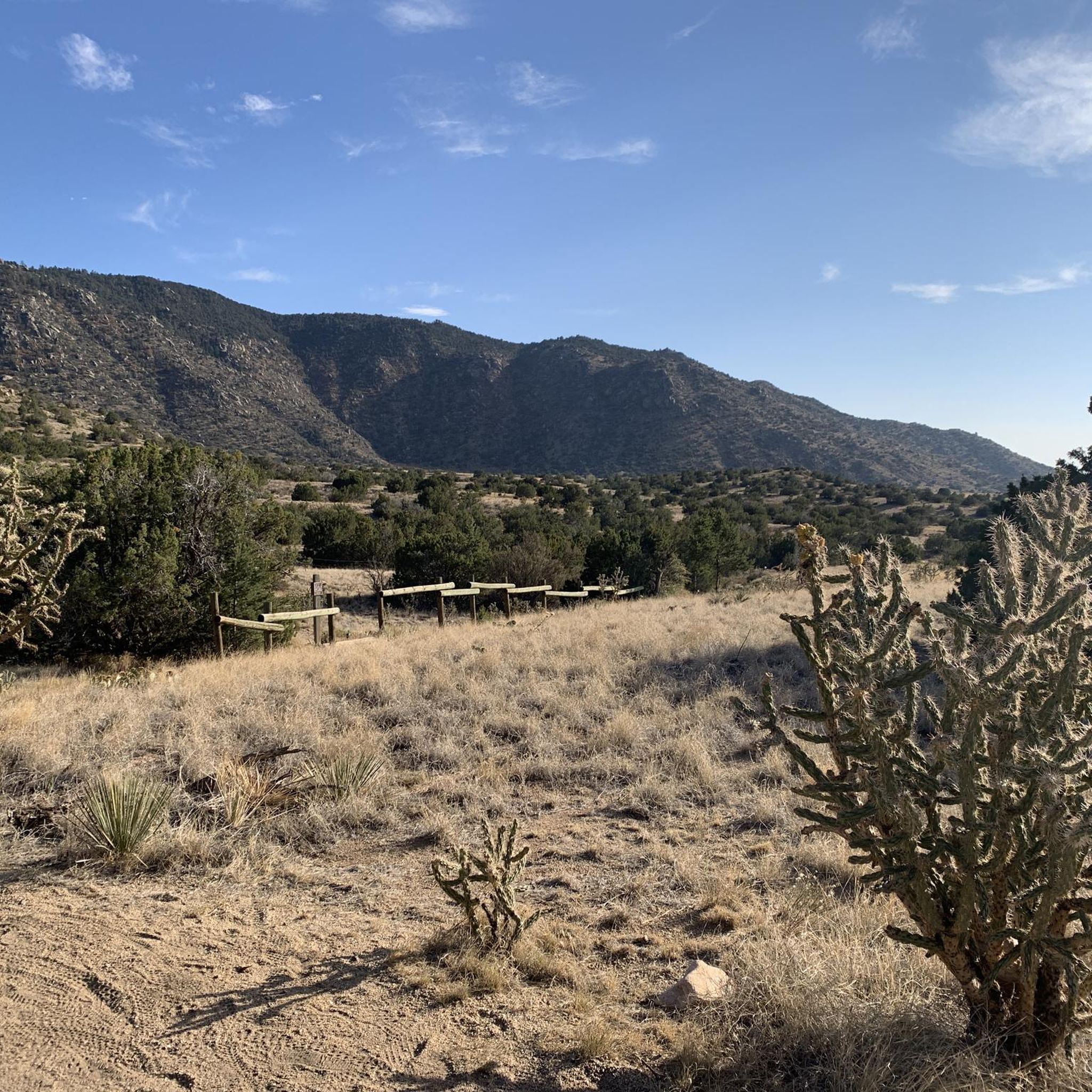
The North Sandia Peak Trail offers great views of the canyons, pine tree forests, and the impressive rock formations of the Sandia Mountains.
0
1
Frequently Asked Questions
How many road cycling routes are available around Tijeras?
There are over 7 road cycling routes available around Tijeras, New Mexico, catering to various skill levels. These routes offer diverse experiences, from moderate loops to challenging mountain ascents.
What kind of terrain can I expect on road cycling routes around Tijeras?
Road cycling around Tijeras features a varied landscape, including challenging mountain ascents in the Sandia and Manzano Mountains, scenic canyon rides through Tijeras Canyon, and access to the Cibola National Forest. Many routes benefit from well-paved surfaces, such as sections of Old Route 66 (NM 333), offering diverse elevation profiles.
What is the best season for road biking in Tijeras?
The area around Tijeras offers excellent road cycling opportunities for much of the year. The Cibola National Forest provides cooler temperatures and shade at higher elevations, which can be particularly welcome during warmer months. For specific winter conditions, it's always best to check local weather forecasts, especially for higher mountain passes.
Are there challenging road bike climbs in Tijeras?
Yes, Tijeras offers challenging climbs, particularly routes that incorporate the Sandia Crest Road. For instance, the Sandia Crest Overlook – Sunset View from Sandia Crest loop from Cañoncito is a difficult 32.2-mile (51.8 km) trail with significant elevation gain, ideal for experienced cyclists seeking a demanding ride.
Are there any easy or beginner-friendly road cycling routes in Tijeras?
While many routes in Tijeras are moderate to difficult, the region offers options for varying abilities. For a moderate ride that's not overly long, consider the Roadbike loop from Sandia Knolls, which covers 17.7 miles (28.5 km) with a manageable elevation gain.
Can I find loop road bike trails in Tijeras?
Yes, many road cycling routes around Tijeras are designed as loops. Popular options include the Pa-ako ruins loop from Tijeras, a 46.7-mile (75.2 km) moderate route, and the Cienega Canyon Pond loop from Sandia Park, a scenic 36.0-mile (57.9 km) ride.
What natural features or landmarks can I see along road cycling routes in Tijeras?
Road cycling routes in Tijeras often pass through or near significant natural features. You might encounter the dramatic landscapes of the Sandia and Manzano Mountains, the historic Tijeras Canyon, and parts of the Cibola National Forest. Notable highlights in the area include Travertine Falls and the U-Mound Rock Formation.
Are there any historical sites near the road cycling routes?
Yes, the Tijeras area is rich in history. You can cycle along sections of Old Route 66 (NM 333) through Tijeras Canyon, a historical path used for thousands of years. The Tijeras Pueblo Archaeological Site, with ruins of a 14th-century pueblo, is also located nearby. The Tijeras Cultural Corridor, which includes the canyon, offers a glimpse into the region's living history. More information can be found on the City of Albuquerque website.
Are there options for parking near road cycling routes in Tijeras?
While specific parking areas for each route are not detailed, Tijeras serves as a gateway to many cycling opportunities. Cyclists often find parking in or around the village before starting their rides into the surrounding mountains and canyons. It's advisable to check local regulations for parking availability at trailheads or starting points.
What do other road cyclists enjoy most about road cycling in Tijeras?
The road cycling routes around Tijeras are highly rated by the komoot community, with an average score of 5.0 stars. Cyclists often praise the diverse terrain, from challenging mountain ascents to scenic canyon rides, and the well-paved surfaces on many routes, including sections of Old Route 66. The unique high-desert environment and access to the Cibola National Forest also contribute to a memorable experience.
Are there scenic road bike routes with less traffic in Tijeras?
For a scenic ride with potentially less traffic, consider routes that utilize Old Route 66 (now NM 333) through Tijeras Canyon. This section offers a smooth, often recently repaved surface with a wide shoulder, quickly transitioning from urban fringe to countryside. It's a sweet side road for cycling that provides continuous scenic beauty.
Are there any long-distance road cycling routes in Tijeras?
Yes, Tijeras offers several long-distance road cycling options. The Pa-ako ruins loop from Tijeras is a substantial 46.7-mile (75.2 km) route, providing a significant distance for experienced cyclists looking for a longer ride.
Are there family-friendly road bike trails in Tijeras?
While many routes in Tijeras involve significant elevation changes, some sections or shorter loops might be suitable for families with older, more experienced children. For example, the Cienega Canyon Pond loop from Tijeras is a moderate 19.9-mile (32.0 km) route that offers a scenic ride through Cienega Canyon, which could be an option for active families.
Most popular routes around Tijeras
Most popular attractions around Tijeras

Get inspired with the komoot mobile app


Explore more
Browse the best Road cycling routes in other regions.
