The best road cycling routes around Budd Lake
4.4
(10)
251
riders
80
rides
Road cycling routes around Budd Lake offer diverse terrain, from lakeside paths to routes with significant elevation gains. The region is characterized by the large natural Budd Lake, expansive parks like Turkey Brook Park, and wooded landscapes such as Stephens State Park. Well-paved surfaces and varied topography provide options for different skill levels, including routes with notable climbs. This area combines serene natural beauty with active recreational opportunities for road cyclists.
Best road cycling routes around Budd Lake
- The most popular road cycling route is High Point to Cape May Bike Route: Andover Loop, a 48.7 miles (78.4 km) trail that takes 3 hours 34 minutes to complete. This moderate route features scenic New Jersey terrain with a 740m elevation gain.
- Another top favourite among local road cyclists is Lake Musconetcong – Lake Musconetcong loop from Netcong, a moderate 22.5 miles (36.2 km) path. This route offers a loop around Lake Musconetcong with a 340m elevation gain.
- Local road cyclists also love the Whittemore Wildlife Sanctuary loop from Flanders, a 41.3 miles (66.5 km) trail leading through varied landscapes, often completed in about 3 hours 14 minutes.
- Road cycling around Budd Lake is defined by its large natural lake, expansive parks, and wooded landscapes, offering varied terrain and elevation. The network provides options for easy, moderate, and difficult ability levels.
- The routes in Budd Lake are highly rated by the komoot community with an average score of 4.1 stars from 9 reviews. More than 150 road cyclists have used komoot to explore Budd Lake's varied terrain.
Last updated: July 16, 2026
4.5
(2)
3
riders
78.4km
03:34
740m
740m
The High Point to Cape May Bike Route: Andover Loop offers a moderate road cycling adventure through Northern New Jersey's varied landscape. You'll traverse diverse terrain, from rolling Appalachian foothills to peaceful farm valleys, passing through remote state preservation lands and catching views of quiet streams and the scenic Lake Musconetcong. This 48.7-mile (78.4 km) route features 2424 feet (739 metres) of elevation gain, making it a good challenge for cyclists in about 3 hours and 34 minutes.
While the overall High Point to Cape May route is largely paved, be aware that some local segments within the Andover area might include unpaved sections. These could be particularly challenging for road bikes, especially after rain, so checking current conditions is a smart move before you start. The broader route also benefits from public transportation options at various points, which can be useful for planning or emergencies.
This Andover Loop is a fantastic way to experience the distinct ecological zones of Northern New Jersey, from higher Appalachian elevations to serene agricultural valleys. It's part of the larger High Point to Cape May Bike Route, which is a significant end-to-end journey showcasing the state's diverse beauty and historical sites. It's a notable route for those seeking a varied and engaging ride.
4.5
(2)
21
riders
36.1km
01:45
340m
340m
The Lake Musconetcong – Hopatcong State Park loop from Netcong offers a moderate road cycling experience through northern New Jersey's picturesque landscape. You'll pedal past quiet streams and through wooded areas, eventually opening up to gorgeous views of Lake Musconetcong and the expansive Lake Hopatcong. This 22.5 miles (36.1 km) route, with 1123 feet (342 metres) of elevation gain, provides a varied terrain of gentle gradients and some climbs, making for an engaging ride that typically takes around 1 hours and 44 minutes.
To make the most of your ride, plan your visit during pleasant weather, as the route is primarily on mostly well-paved surfaces. While no specific parking details are provided for the start in Netcong, the area around Hopatcong State Park is well-established for recreation. This moderate route requires good fitness levels, so be prepared for a decent challenge, especially if you're looking for Hopatcong State Park cycling opportunities.
This loop is notable for its journey around Lake Musconetcong, a 329-acre reservoir, and its proximity to Lake Hopatcong, New Jersey's largest freshwater lake. Beyond the natural beauty, the region also holds historical significance, with remnants of the Morris Canal and the Lake Hopatcong Historical Museum nearby. This combination of natural scenery and historical elements makes the Lake Musconetcong Hopatcong State Park loop Netcong road cycling route a unique experience.

Sign up for free
8
riders
67.1km
03:13
740m
740m
Moderate road ride. Good fitness required. Some segments of this route may be unpaved and difficult to ride.
10
riders
72.7km
03:17
540m
540m
Moderate road ride. Good fitness required. Mostly well-paved surfaces and easy to ride.
10
riders
72.5km
03:24
570m
570m
Moderate road ride. Good fitness required. Some segments of this route may be unpaved and difficult to ride.
Get access to more routes and recommendations from other explorers.
Sign up for free
Already have an account?
Our route recommendations are based on thousands of hikes, rides, and runs completed by other people on komoot.
Start today with a free account
Your next adventure awaits.
Login or Signup

Tips from the Community

The old train station was built in the late 1800s for the Central Railroad of New Jersey. Today, it serves as a hub for the Califon Historical Society and access point for the Columbia Rail Trail. Supposedly, the name Califon comes from a shortening of "California", since the painter creating the station map didn't leave enough room for the original title.
0
0
A packed dirt road takes you along the Raritan River at the sheltered base of the gorge. There are plenty of spots to park as you head in from Readingsburg, but most of the road is closed to vehicle traffic and makes for the perfect bike route. You are right next to the water and can bike along both sides of the gorge.
0
0

Clinton Mills Dam, located on the South Branch Raritan River, holds historical significance as a former industrial site powering the Clinton Mills. Today, it captivates visitors with its scenic beauty and offers recreational opportunities such as fishing and birdwatching, preserving its legacy amidst natural splendor.
0
0

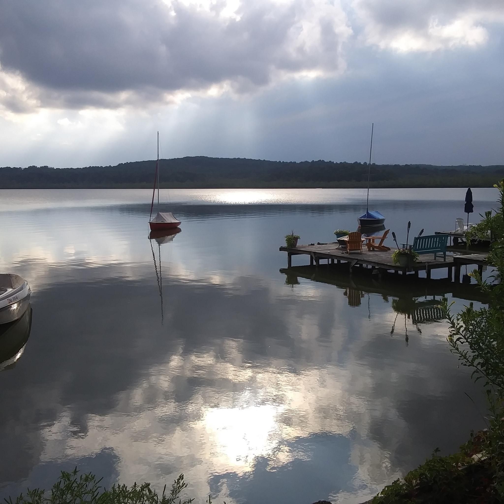
Brady Bridge on Lake Hopatcong connects Brady Marina with Prospect Point. The views out over the lake with its tree-lined residential shores, complete with its jetties of boats, make this crossing a bit special, as the views are simply stunning.
1
0

The Columbia Trail is a gorgeous Greenway along the South Branch Raritan River from this trail head to High Bridge, almost 15.5 miles to the south. Absolutely incredible views all the way through, autumn could be the best time to enjoy the trail. This parking at the northern trailhead isn't very big, but a couple of cars can fit in it.
0
0

Explore the captivating Ken Lockwood Gorge within the 500-acre Ken Lockwood Wildlife Management Area. This picturesque landscape, adorned with towering hemlocks along steep walls, creates an isolated and serene atmosphere. Immerse yourself in the beauty of the 2.5-mile stretch of the South Branch of the Raritan River, featuring cascading waters, small waterfalls, and tranquil pools—an enchanting experience, especially in the vibrant spring season.
0
0

Walk, bike, or jog along the park's trails, soaking in the panoramic views of the lake and surrounding woodlands. Take a break at one of the picnic areas and savor a delicious lunch with a breathtaking backdrop.
0
0
Explore the captivating Ken Lockwood Gorge within the 500-acre Ken Lockwood Wildlife Management Area. This picturesque landscape, adorned with towering hemlocks along steep walls, creates an isolated and serene atmosphere. Immerse yourself in the beauty of the 2.5-mile stretch of the South Branch of the Raritan River, featuring cascading waters, small waterfalls, and tranquil pools—an enchanting experience, especially in the vibrant spring season.
0
0
Frequently Asked Questions
How many road cycling routes are available around Budd Lake?
There are over 80 road cycling routes around Budd Lake listed on komoot, offering a wide range of options for different skill levels and preferences. You'll find everything from easy rides to challenging climbs.
What kind of terrain can I expect on road cycling routes in the Budd Lake area?
The Budd Lake area offers diverse road cycling terrain. You can expect well-paved surfaces with varied topography, ranging from mostly flat paths around the lake to routes with significant elevation gains. The region's landscapes include serene lakeside views, expansive parks, and wooded areas.
Are there any easy or family-friendly road cycling routes near Budd Lake?
Yes, there are 12 easy road cycling routes around Budd Lake. While specific family-friendly paved road cycling routes are not detailed, the area's diverse terrain includes options suitable for those seeking a more leisurely experience. Always check the route details for distance and elevation to ensure it matches your family's comfort level.
What are some challenging road cycling routes in the Budd Lake region?
For those seeking a challenge, the Budd Lake area offers 10 difficult road cycling routes. An example is the Heaters Pond – Thomas Edison Monument loop from Lake Hopatcong, which covers nearly 98 km with over 1270 meters of elevation gain, providing a demanding ride through varied landscapes.
What landmarks or natural features can I see along the road cycling routes?
Road cycling routes around Budd Lake offer opportunities to see various natural features and landmarks. You might encounter the largest natural lake in New Jersey, Budd Lake itself, or pass by Lake Musconetcong. Other notable attractions include the Sussex Branch Trail and the Highlands Trail. Some routes may also offer views of Schooley's Mountain and its waterfalls, such as the View of Schooley's Mountain and the waterfall highlight.
Where can I find parking for road cycling routes around Budd Lake?
Parking availability varies by route. For instance, if you plan to cycle the Lake Musconetcong loop from Netcong, you would typically look for parking near Netcong. For routes like the High Point to Cape May Bike Route: Andover Loop, starting points in Andover would be ideal for parking. It's always recommended to check specific route details for suggested parking locations.
What is the best time of year for road cycling in Budd Lake?
The Budd Lake area is generally excellent for road cycling during spring, summer, and autumn. The autumn months are particularly stunning, with the Columbia Trail (a multi-use trail that may have suitable sections for road cyclists) offering incredible views as the foliage changes. Always check local weather conditions before heading out.
Are there any cafes or pubs along the road cycling routes in Budd Lake?
While specific cafes or pubs directly on the road cycling routes are not detailed, the Budd Lake area, being a popular recreational destination, has various establishments in nearby towns. You'll find options for refreshments and meals in communities like Netcong, Flanders, and Andover, which are common starting or passing points for many routes.
What do other road cyclists enjoy most about cycling in Budd Lake?
The komoot community highly rates road cycling in Budd Lake, with an average score of 4.1 stars from 9 reviews. Cyclists often praise the diverse terrain, which caters to various skill levels, and the serene natural beauty of the area, including the large natural lake and expansive parks. The well-paved surfaces and varied topography are frequently highlighted as positive aspects.
Are there any circular road cycling routes in the Budd Lake area?
Yes, many road cycling routes around Budd Lake are designed as loops, allowing you to start and end in the same location. Examples include the Lake Musconetcong – Lake Musconetcong loop from Netcong and the Whittemore Wildlife Sanctuary loop from Flanders, both offering scenic circular rides.
Can I bring my dog on road cycling routes in Budd Lake?
While many outdoor areas are dog-friendly, specific rules for dogs on road cycling routes can vary. Generally, dogs are not permitted to run alongside cyclists on paved roads for safety reasons. If you plan to cycle with your dog, it's best to check local regulations for specific trails or parks, and consider multi-use trails where leashed dogs might be allowed, though these may not be ideal for road bikes.
Are there any fully paved road cycling routes around Budd Lake?
Yes, the road cycling routes in the Budd Lake area are characterized by their well-paved surfaces. While some multi-use trails in the broader region might have unpaved sections, the routes specifically designated for road cycling are generally fully paved to provide a smooth riding experience.
Most popular attractions around Budd Lake

Get inspired with the komoot mobile app


Explore more
Browse the best Road cycling routes in other regions.
