The best MTB trails around Winnemucca
6
rides
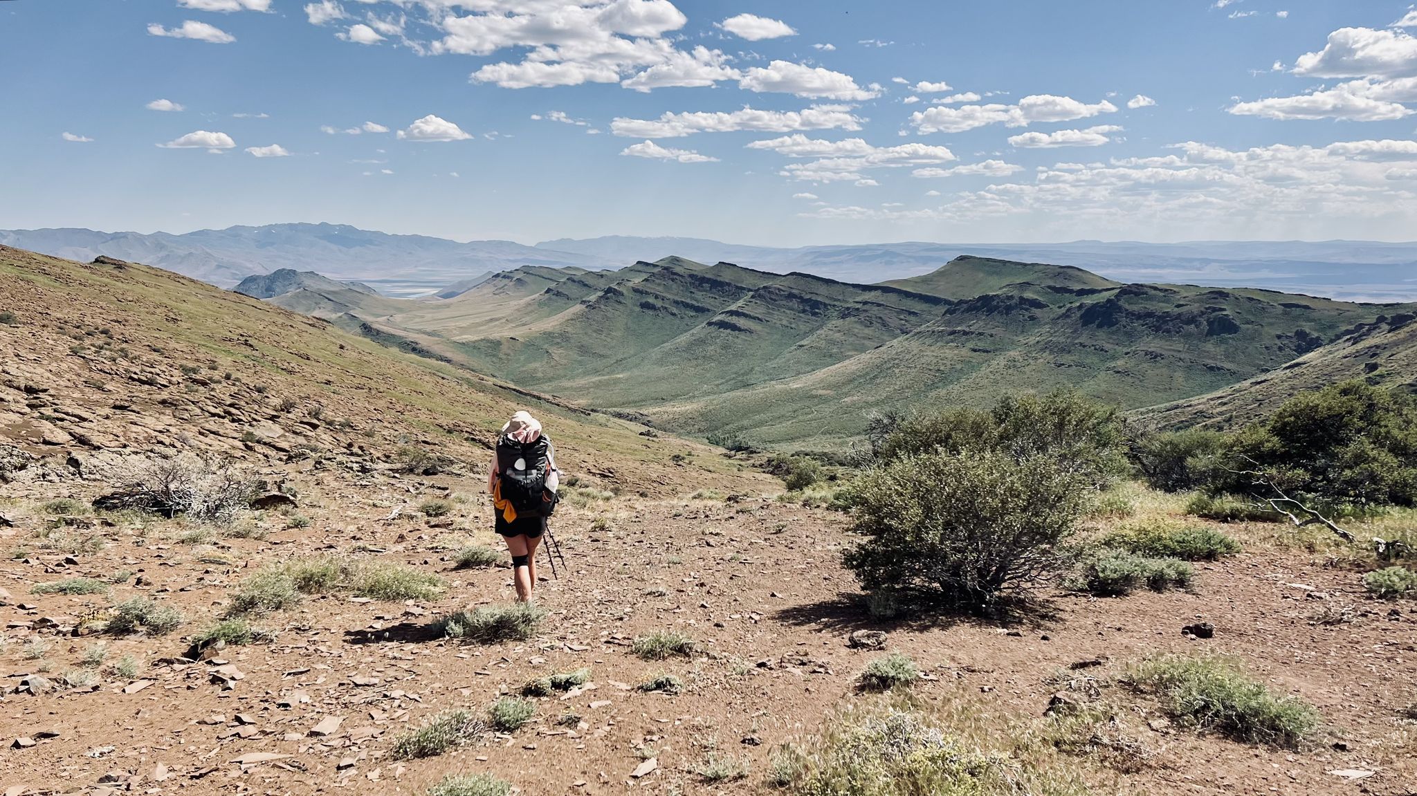
Mountain biking around Winnemucca offers routes through a landscape characterized by arid terrain, canyons, and rolling hills. The region features varied elevations, including some higher points like Sonoma Crest, providing diverse riding experiences. Trails often navigate through dry washes and open country, with occasional pockets of denser vegetation as suggested by names like "Lost Forest Loop." This area provides a mix of natural surfaces suitable for mountain biking.
Best mountain bike trails around Winnemucca
- The most popular mountain bike trail is Water Canyon Trail, a 7.2 miles (11.7 km) trail that takes 1 hour 28 minutes to complete. This route features varied terrain through a natural canyon environment.
- Another top favourite among local mountain bikers is Giants Grave loop - Winnemucca, a moderate 13.1 miles (21.2 km) path. This loop explores open landscapes and offers views of the surrounding area.
- Local mountain bikers also love the Feel the Burn and Lost Forest Loop, a 5.5 miles (8.9 km) trail leading through varied terrain including a section named "Lost Forest," often completed in about 55 minutes.
- Mountain biking around Winnemucca is defined by canyons, arid hills, and open country, with routes offering options for different ability levels.
- The guide includes highly-rated routes that showcase the best of the region's landscape.
Last updated: October 10, 2026
11.7km
01:28
490m
490m
Get ready for a solid mountain biking workout on the Water Canyon Trail. This moderate route spans 7.2 miles (11.7 km) and challenges you with 1618 feet (493 metres) of elevation gain, typically taking around 1 hour and 27 minutes to complete. As you ride, you'll encounter varied terrain, offering an engaging experience through the natural landscape. Keep an eye out for historical glimpses near the Moose Head Mine Trail and the distinctive Water Canyon Yurt along your journey.
Before heading out, it's always a good idea to check local conditions to ensure the trail is open and safe for mountain biking. You'll typically find parking available directly at the trailhead, making it convenient to begin your adventure. While no specific permits are usually required for this route, it's wise to confirm with local authorities before your visit, especially during peak seasons. Plan your ride for daylight hours to fully enjoy the scenery and ensure a safe return.
The Water Canyon Trail is a notable mountain biking destination within the Water Canyon Recreation Area, offering more than just a ride; it's an exploration of the region's natural and historical elements. The route provides a good mix of challenges and rewards, making it a popular choice for those seeking an active outdoor experience. Its integration with features like the Moose Head Mine Trail adds a layer of interest beyond just the physical exertion.
21.2km
02:00
340m
340m
Embark on the Giants Grave loop, a moderate mountain biking route spanning 13.2 miles (21.2 km) with an elevation gain of 1128 feet (344 metres). You can expect to complete this ride in about 2 hours, navigating a rugged, rocky desert landscape. The trail features prominent rock formations, including a notable drop between two rocks and a challenging climb through large rock formations, providing unique visual anchors throughout your ride.
This route is not recommended for beginners due to its challenging nature and technical terrain. While you will find options to bypass the most difficult sections, be prepared for tricky, uneven ground, steep sections, rocks, and switchbacks. Successfully navigating these technical parts, like the Giant Slalom Descent, offers a great sense of accomplishment for experienced mountain bikers.
The Giants Grave loop is a highlight within the larger Bloody Shins trail system, known for its demanding yet rewarding rides. Local mountain bikers cleared and made the trail easier to follow in late 2018, ensuring a well-maintained path. This dedication to trail upkeep contributes to a unique and engaging experience in this advanced mountain biking area.

8.88km
00:55
200m
200m
Embark on the Feel the Burn and Lost Forest Loop, a moderate mountain biking route spanning 5.5 miles (8.9 km) with a total elevation gain of 662 feet (202 metres). You can expect to complete this ride in about 54 minutes. The trail offers a dynamic experience, taking you through areas that show signs of past wildfires, providing open views and a glimpse into nature's recovery. As you climb, you will reach the High Point of Feel the Burn, which offers expansive vistas before you descend into dense forest sections with varied ground cover.
Before you head out, be aware that trails in burn zones can have altered conditions, such as erosion or fine ash, especially after recent fires. The forest sections might also be wet or present technical features, so prepare accordingly. Always check local conditions before your visit and ensure you have the appropriate gear for varied terrain to make your ride enjoyable and safe.
This loop is situated within the Water Canyon Recreation Area, offering a unique contrast between recovering burn areas and lush, dense forest. The journey through these distinct environments highlights the resilience of nature and provides a diverse riding experience. You will appreciate the varied scenery and the sense of immersion as you navigate through both the open, recovering landscapes and the more secluded, wooded paths.
8.20km
01:13
560m
560m
Embark on a moderate mountain biking adventure along Dry Canyon Road to Unnamed Peak, a route that spans 5.1 miles (8.2 km) and climbs 1828 feet (557 metres). You can expect to complete this ride in about 1 hour and 12 minutes. The trail begins with a steady incline, soon transitioning to steeper, rockier sections that offer technical challenges. As you ascend, the scenery shifts from shaded forested areas to expansive open meadows, leading you towards the summit of Unnamed Peak. From the top, you are rewarded with sweeping 360-degree panoramic views of the surrounding canyons and valleys.
This route is known for its consistent and significant climb, making it a good physical test. While there are no specific warnings about snow, closures, or permits, be aware that the footing can be unstable in several spots due to loose rocks and steep grades. To avoid overgrown foliage and enjoy the best conditions, consider planning your ride for early summer or late spring. Always check local conditions before you head out.
The journey to Unnamed Peak offers a diverse and engaging experience, particularly for those who appreciate a rewarding workout amidst changing landscapes. The trail's progression from wooded paths to open vistas, culminating in a broad summit view, makes it a notable ride in the Sonoma Range. It provides a clear sense of accomplishment as you conquer the elevation and take in the vastness of the region from above.
14.5km
02:06
860m
860m
Get ready for a moderate mountain biking adventure on the Water Canyon and Sonoma Crest Loop, a 9.0 miles (14.5 km) route that promises a dynamic ride. You'll tackle a significant 2823 feet (861 metres) of elevation gain, pushing towards the Water Canyon Overlook for expansive views. The trail offers diverse terrain, from fire roads to potential singletrack sections, ensuring a varied experience over an estimated 2 hours and 6 minutes. Expect a rewarding mix of challenging uphill climbs and thrilling descents as you explore the Humboldt County landscape.
Before you head out, remember that the Water Canyon and Sonoma Crest Loop is situated within the Water Canyon Recreation Area. It's always a good idea to check local conditions for any trail changes or closures before your visit. Make sure to carry plenty of water, especially if you plan to ride during warmer months, as some sections of the trail may be exposed to the sun. Planning your start time to avoid the midday heat can also enhance your experience.
This route stands out for its exploration of the Water Canyon Recreation Area in Humboldt County, Nevada. It provides a robust mountain biking experience, characterized by its substantial elevation gain and varied terrain. The trail is ideal if you are looking for a ride that combines physical challenge with scenic rewards, offering a true taste of the region's outdoor opportunities.
Our route recommendations are based on thousands of hikes, rides, and runs completed by other people on komoot.
Start today with a free account
Your next adventure awaits.
Popular around Winnemucca
Other adventures around Winnemucca

Tips from the Community

The climbing pays off at the Water Canyon Overlook. Although you won't find any shade here, the view makes it a good spot for a quick break if weather permits.
0
0
Water Canyon Yurt is managed by the BLM-Humboldt River Field Office. It's open from November through May and could provide an enjoyable night's sleep for 4 to 5 people, though you'll want to bring the same equipment you'd require to sleep inside a tent.
0
0
Depending on what kind of out and back or loop you're riding, this intersection could be your best chance to snap photos of the Giants Grave or to grab a snack and water break.
0
0
This is as near the summit of Giants Grave as you can ride, and underneath this rock outcropping, you've earned multiple options for your descent. Giant Slalom takes a windy route down the fall line, while The Giants Grave (trail) spreads out the feet gained or lost over greater distance.
0
0
If you're being stung by lactic acid at this highest point on Feel the Burn, then you're doing it right! Nice views over Winemucca and the trail system here as well.
0
0
Moose Head Mine Trail is not a climb for everyone—with 1,400 feet of gain in 1.8 miles. But if you want to test your legs, the first section winds through shady aspens, while the second section emerges into full sun and switchbacks.
0
0
You know you're traveling in remote country when you can summit an unnamed peak, and the views from this point will reward your efforts on the climb as well.
0
0
Frequently Asked Questions
How many mountain bike trails are available around Winnemucca?
There are 6 mountain bike trails detailed in this guide for the Winnemucca area, offering a range of experiences through arid terrain, canyons, and rolling hills.
Are there easy mountain bike trails suitable for beginners in Winnemucca?
Yes, there is one easy mountain bike trail available in the Winnemucca area. While most routes are moderate, beginners can still find suitable options to enjoy the landscape.
Are there any family-friendly mountain bike trails in Winnemucca?
For families looking for a less strenuous ride, the easy trail mentioned in the guide is a good starting point. It allows for a gentle introduction to mountain biking in the region's unique environment.
What kind of terrain can I expect on mountain bike trails around Winnemucca?
The mountain bike trails around Winnemucca are characterized by arid terrain, natural canyons, and rolling hills. You'll often navigate through dry washes and open country, with varied elevations including some higher points like Sonoma Crest.
Are there any loop trails for mountain biking in Winnemucca?
Yes, several routes are designed as loops. For example, the Giants Grave loop - Winnemucca is a moderate 13.1-mile path exploring open landscapes, and the Feel the Burn and Lost Forest Loop offers a 5.5-mile ride through varied terrain.
What is the best time of year for mountain biking in Winnemucca?
Given Winnemucca's high desert climate, spring and fall generally offer the most pleasant conditions for mountain biking, with milder temperatures. Summers can be very hot, and winters may bring cold temperatures and occasional snow, especially at higher elevations.
Are dogs allowed on the mountain bike trails in Winnemucca?
While specific regulations can vary by trail, many outdoor areas in the Winnemucca region are dog-friendly. It's always best to check local signage or the specific trail's guidelines before heading out with your dog, and ensure they are on a leash.
Are there any advanced mountain bike trails in Winnemucca?
While this guide features primarily moderate trails, routes like Water Canyon and Sonoma Crest Loop, with its significant elevation gain of over 860 meters, offer a more challenging experience for advanced riders seeking a workout and scenic views.
What are some notable natural features or landmarks along the mountain bike trails?
The trails often traverse natural canyons, such as those found on the Water Canyon Trail. You'll also encounter rolling hills and open country, with views of the Sonoma Crest providing a prominent backdrop to many rides.
Are there any permits required for mountain biking in Winnemucca?
Generally, no specific permits are required for mountain biking on the public trails around Winnemucca. However, it's always advisable to respect private property boundaries and check for any updated local regulations before your ride.
What are the typical weather conditions for mountain biking in Winnemucca?
Winnemucca experiences a high desert climate, meaning conditions can be dry and sunny. Temperatures can fluctuate significantly between day and night, and strong winds are possible. Always check the forecast before your ride and carry enough water, especially during warmer months.
Where can I find parking for mountain bike trails in Winnemucca?
Parking availability varies by trailhead. Many trails in the Winnemucca area are accessible from established recreation sites or public land access points where parking is typically available. It's recommended to check the specific route details on komoot for trailhead information.

Get inspired with the komoot mobile app


Explore more
Browse the best MTB trails in other regions.
