The best MTB trails around Echternacherbrück
4.4
(1616)
7,936
riders
14
rides
Mountain bike trails around Echternacherbrück are set within the Mullerthal Region, known for its varied landscapes. The area features striking sandstone cliffs, dense forests, and picturesque streams, providing diverse terrain for mountain biking. Riders can find routes with impressive rock formations, steep ascents, and fast descents. This region offers an extensive network of trails catering to various skill levels, from moderate to difficult.
Best mountain bike trails around Echternacherbrück
- The most popular mountain bike trail is Hop Plantation Holsthum –…
Last updated: October 4, 2026
4.6
(77)
221
riders
50.9km
02:52
400m
400m
Moderate mountain bike ride. Good fitness required. Advanced riding skills necessary.
4.2
(9)
49
riders
47.0km
04:32
1,050m
1,050m
Hard mountain bike ride. Very good fitness required. Advanced riding skills necessary. Some portions of the route may require you to push your bike.

4.3
(16)
65
riders
Moderate mountain bike ride. Good fitness required. Advanced riding skills necessary.
5.0
(1)
19
riders
14.7km
01:07
240m
240m
Moderate mountain bike ride. Great for any fitness level. Advanced riding skills necessary.
4.8
(5)
19
riders
26.2km
02:23
400m
400m
Hard mountain bike ride. Good fitness required. Advanced riding skills necessary. Some portions of the route may require you to push your bike.
Get access to more routes and recommendations from other explorers.
Already have an account?
Our route recommendations are based on thousands of hikes, rides, and runs completed by other people on komoot.
Start today with a free account
Your next adventure awaits.

Tips from the Community

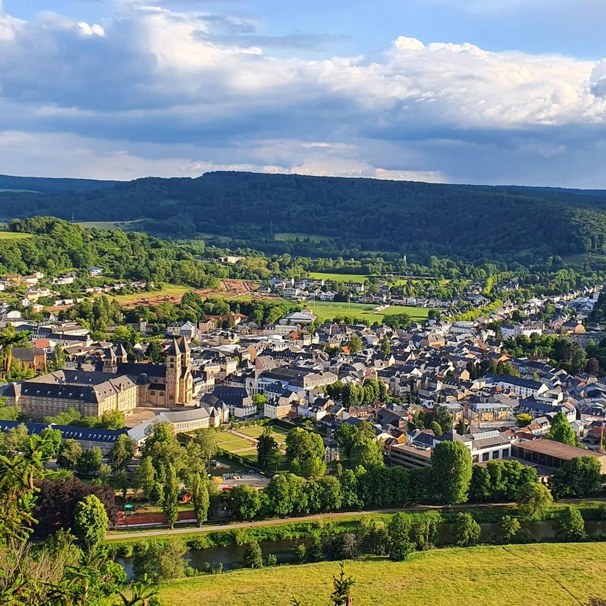
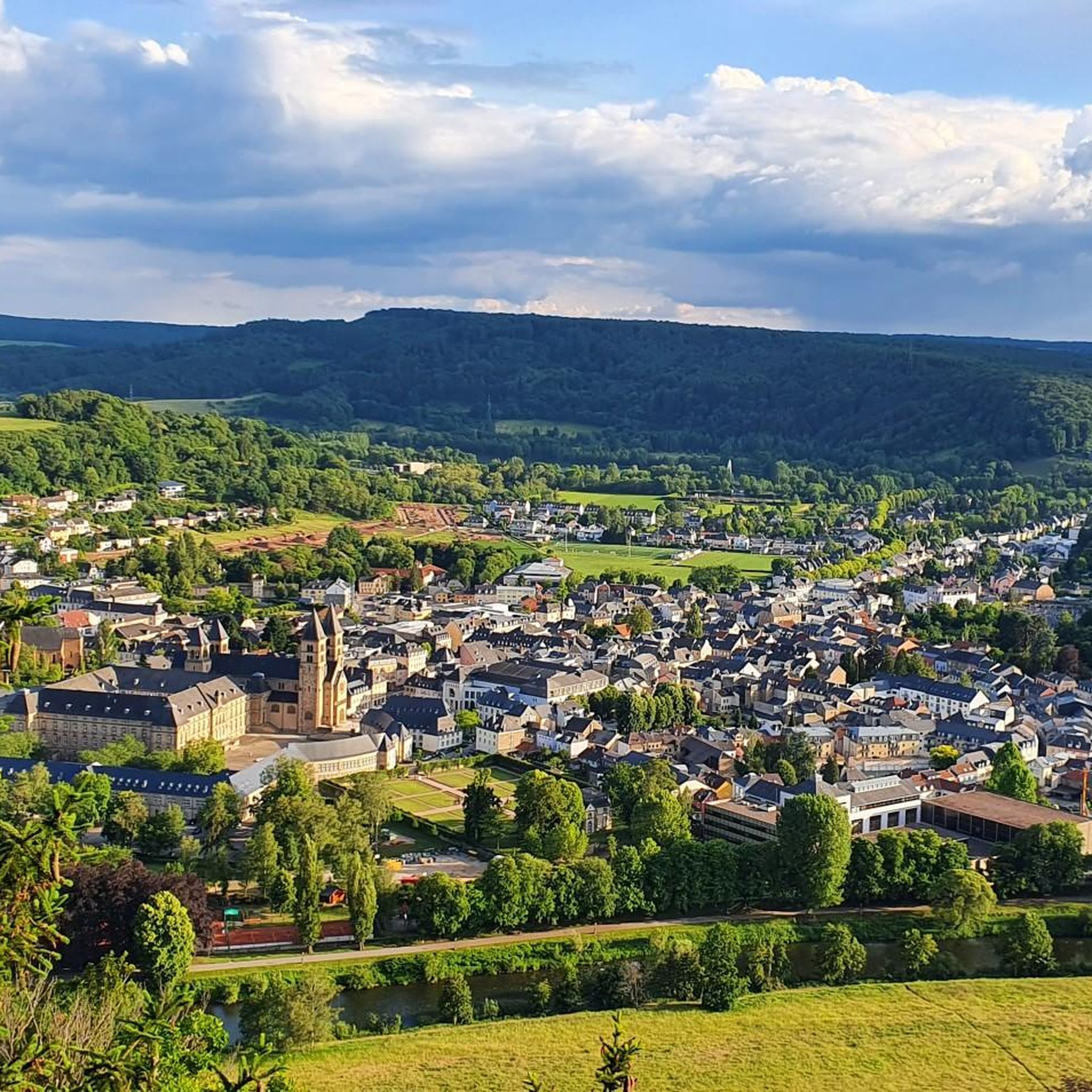
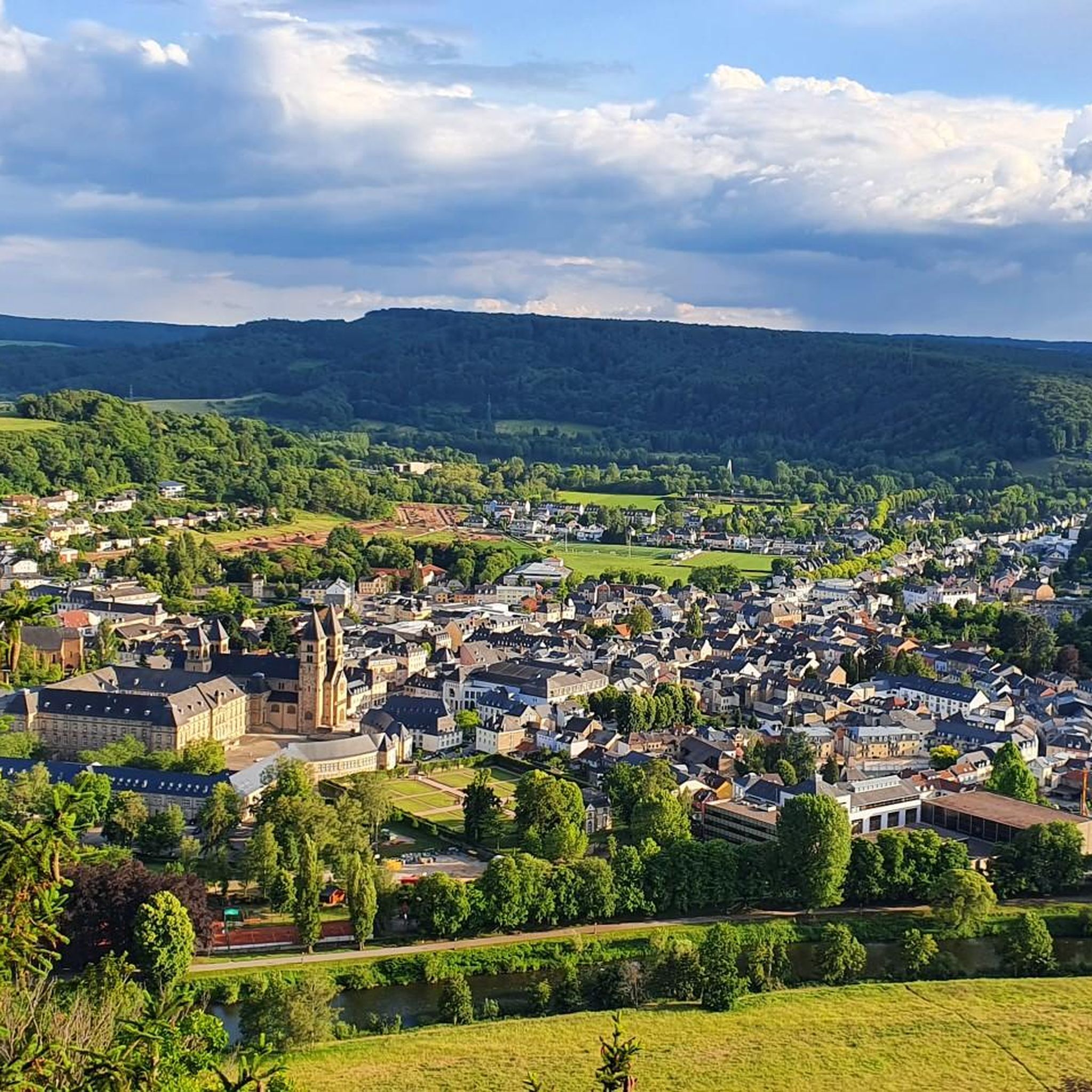
A beautiful conclusion to route 2, the view of Echternach.
0
0

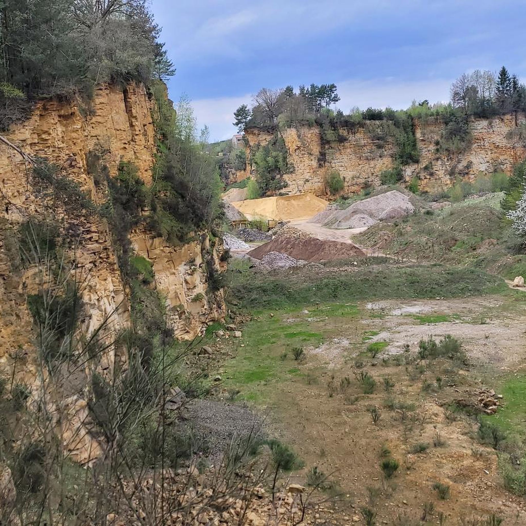
The amphitheater "Breechkaul" was established in 1979 in a rock hollowed out in the Middle Ages for the extraction of millstones. In summer, well-attended concerts of all kinds are held there. Known and loved far beyond the borders is the "Berdorfer Hubertusmesse" (Haupeschmass) on the first Sunday after November 2nd at 10:45 AM. (Regio Mullerthal)
4
0
Perekop is a heavily visited giant rock on the road from Berdorf to Echternach. So you have to deviate from the path for a moment and cross the roadway.
5
0
After the climb, you have a beautiful view of the Basilica, Echternach and the surrounding area.
6
0
At the end of the 18th century, Empress Maria Theresa of Austria, also Duchess of Luxembourg, had the land surveyed by engineers and cartographers. Here, on the border between the possessions of the Abbey of Echternach and the County of Vianden, a boundary stone was erected on the site of a cross that had marked the border for centuries. The massive, square stone, over a meter high and 80 cm wide, now bears the name of the esteemed sovereign, the "Maria Theresa Stone". On the east side of the marker stone is the coat of arms of the "Holy Roman Empire of the German Nation", the double-headed eagle. This testifies to the fact that the Abbey of Echternach was an imperial abbey directly subordinate to the emperor. The year of construction, 1771, is engraved above the imperial coat of arms. The coat of arms of the Counts of Vianden can be seen on the west side of the stone. The two crosses on the sides date from the Prussian era (1816). The border ran from the Maria Theresa Stone in a westerly direction through a deeply cut valley, popularly known as the "Moarkendell" - "boundary stone valley". The Moarkendell still marks the border between the districts of Bollendorf and Wallendorf today. (Felsenland Südeifel)
6
0
This Benedictine Abbey was built in the Lorraine style from 1727 to 1736. The facade length of the abbey, built in the shape of a regular quadrilateral, is 75 meters, with a cloister and an inner courtyard. The designer is the Benedictine architect Leopold Durand from the Abbey of St. Avold, and it was built by the Austrian master builder family Mungenast. In 1797 the abbey was dissolved, and since 1899 the Gymnasium has been housed in these buildings. (Echternach Tourist Office)
5
0
Close to the main entrance of this recreation area, you have a beautiful view of the lake.
7
0
Beautiful lake, even though it is artificial. The recreation center offers many opportunities, recreational, sporting and cultural. At the entrance to the lake there is a large free parking lot. You can walk or cycle around the lake, which is surrounded by 375 hectares of forest, with various hiking trails running through it.
7
0
Frequently Asked Questions
How many mountain bike trails are available around Echternacherbrück?
The Echternacherbrück area offers a comprehensive network of over 280 mountain bike trails. These routes cater to various skill levels, with options for easy, moderate, and difficult rides, ensuring there's something for every mountain biker.
What kind of terrain can I expect on mountain bike trails in the Echternacherbrück area?
You can expect a diverse and challenging terrain. The region, often called "Luxembourg's Little Switzerland," features striking sandstone cliffs, dense forests, picturesque streams, and deep valleys. Trails include thrilling steep ascents, fast descents, and technically demanding sections, often winding through bizarre rock formations and along old railway lines.
Are there mountain bike trails suitable for beginners or families in Echternacherbrück?
Yes, while the region is known for its challenging routes, there are 47 easy mountain bike trails available around Echternacherbrück. These trails offer a gentler introduction to the area's beautiful landscapes, making them suitable for beginners or families looking for a less strenuous ride.
What are some scenic points or natural features to look out for on the trails?
The trails often lead through areas with breathtaking natural beauty. You can expect to see impressive rock formations, dense forests, and picturesque streams. Notable features include the bizarre rock formations around Berdorf, the mystical Huel Lee (Hohllay Cave), and the dramatic Teufelsschlucht (Devil's Gorge). Many routes also offer panoramic views over Echternach Lake and the Sauer valley.
Are there any specific landmarks or attractions near the mountain bike routes?
Yes, the region is rich in landmarks and natural attractions. You might encounter the serene Echternach Lake, or pass by the MTB Singletrail Beaufort–Berdorf. Other points of interest include the Beaufort Forest Flowtrail and the Felsenweg 53 (Südeifel Nature Park). The wider Mullerthal Region also features historical castles like those in Larochette and Beaufort.
What is the best time of year for mountain biking in Echternacherbrück?
The Mullerthal Region is generally enjoyable for mountain biking from spring through autumn. During these seasons, the weather is typically mild, and the forests are lush. It's always a good idea to check local weather conditions before heading out, especially after heavy rain, as some trails can become muddy.
Are there any long-distance or challenging loop trails for experienced riders?
For experienced riders seeking a challenge, the area offers several demanding loop trails. One such route is the View of the Lake at Echternach – View of Echternach loop from Echternach, a difficult 21.2-mile (34.1 km) path that includes significant climbs and rewards with panoramic views. Another option is the Narrow Gorge Cycle Path – Echternach Lake loop from Echternach, which is 21.7 miles (34.9 km) long and also rated difficult.
What do other mountain bikers enjoy most about mountain biking in Echternacherbrück?
The area is highly rated by the komoot community, with an average score of 4.4 stars from over 1600 reviews. Mountain bikers frequently praise the region's diverse terrain, the impressive rock formations, and the challenging single trails. Many appreciate the rewarding panoramic views after challenging climbs and the well-maintained network of routes.
Are there any mountain bike routes that incorporate sections along old railway lines?
Yes, some routes in the Echternacherbrück area utilize old railway lines, offering a unique riding experience. For example, the Ralinger Railway Tunnel – Fisherman Statue on the Moselle River, Wasserbillig loop from Minden is a moderate 31.4-mile (50.5 km) trail that includes sections along these historic paths, providing varied terrain and scenic views.
Are dogs allowed on the mountain bike trails in Echternacherbrück?
While specific regulations can vary by trail and local municipality, generally, dogs are permitted on many outdoor trails in the Mullerthal Region, provided they are kept on a leash and owners clean up after them. It's always recommended to check local signage or specific trail information for any restrictions before heading out with your dog.
Where can I find parking for mountain biking in Echternacherbrück?
Echternacherbrück and the surrounding towns in the Mullerthal Region typically offer various parking options, especially near popular trailheads and tourist centers. Look for designated parking areas in towns like Echternach, Berdorf, and Beaufort, which serve as common starting points for many mountain bike routes.
Can I reach the mountain bike trails using public transport?
The Mullerthal Region has a public transport network that can help you access various points within the area. Buses connect the main towns, including Echternach, which is a central hub. While direct access to every trailhead might not be possible, public transport can get you close to many starting points, allowing you to cycle from there.
Most popular routes around Echternacherbrück
Most popular attractions around Echternacherbrück

Get inspired with the komoot mobile app


Explore more
Browse the best MTB trails in other regions.
