The best walks and hikes around Cannon Falls
5.0
(1)
3
hikers
5
hikes
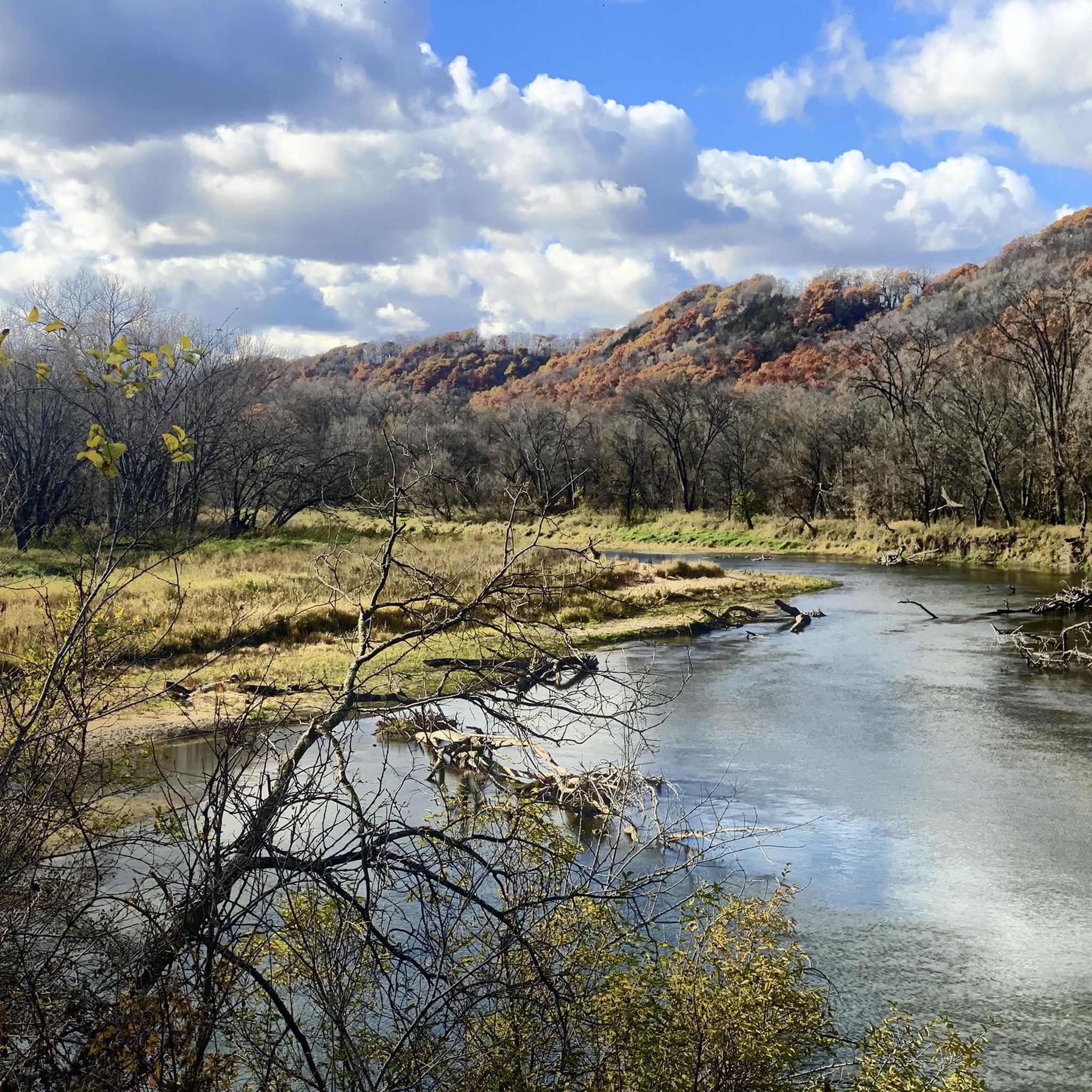
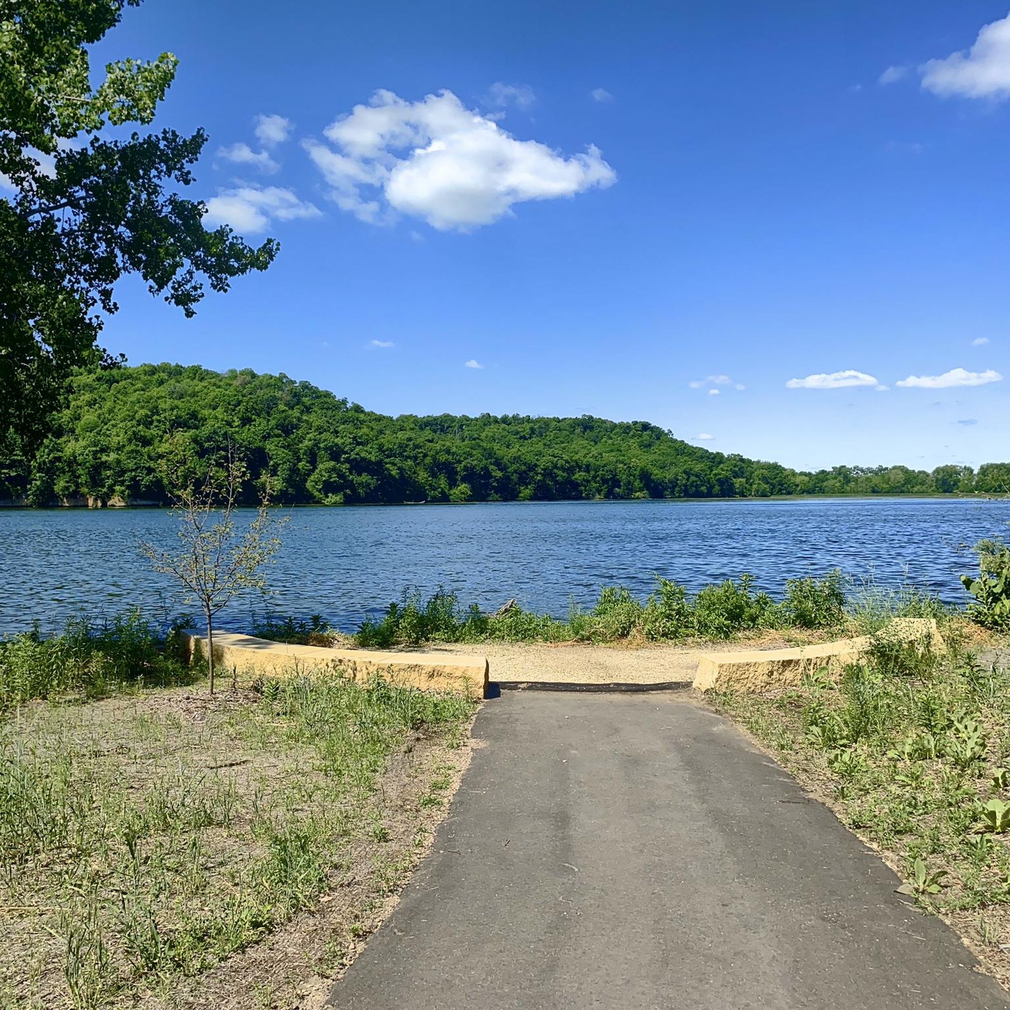
Hiking around Cannon Falls offers diverse natural landscapes in the scenic Cannon Valley, where the Big Cannon and Little Cannon Rivers converge. The region is characterized by the Cannon River, which features picturesque falls and is safeguarded by the Minnesota Wild & Scenic Rivers program. Further west, Lake Byllesby and its regional park provide views of the lake and historic dam, complemented by dramatic overhanging bluffs and extensive wetland biomes. This varied terrain provides a range of hiking experiences.
Best hiking trails around Cannon Falls
- The most popular hiking route is Cannon Valley Trail, a 21.2 miles (34.1 km) trail that takes 8 hours 51 minutes to complete. This difficult route follows a former railroad line, paralleling the Cannon River through overhanging cliffs and wetlands.
- Another top favourite among local hikers is Mill Towns State Trail: Cannon Falls Segment, an easy 1.6 miles (2.5 km) path. This segment offers an accessible route through the local landscape, often completed in under an hour.
- Local hikers also love the Echo Point loop, a 4.2 miles (6.8 km) trail leading through varied terrain, often completed in about 1 hour 43 minutes.
- Hiking around Cannon Falls is defined by river valleys, scenic bluffs, and wetland complexes. The network offers options for different ability levels, from easy loops to more challenging long-distance paths.
- The routes in Cannon Falls are highly rated by the komoot community with an average score of 5.0 stars from reviews. More than 3 hikers have used komoot to explore Cannon Falls's varied terrain.
Last updated: August 18, 2026
34.1km
08:51
190m
240m
Embark on a difficult 21.2-mile (34.1 km) hike along the Cannon Valley Trail, a scenic route that closely follows the Cannon River, offering continuous views of the waterway. You will experience a generally flat and even paved rail trail surface, winding through diverse landscapes. Expect to pass through areas shaded by lush hardwoods and alongside steep slopes with exposed rock ridges, providing a varied visual experience. The journey involves gaining 622 feet (190 metres) in elevation and typically takes around 8 hours and 51 minutes to complete. Keep an eye out for the beautiful Little Cannon River falls, a notable landmark that adds to the trail's charm.
When planning your hike on the Cannon Valley Trail, you will find several convenient rest stops equipped with benches and toilets along the way. Parking and trailhead access points are readily available, including the Bob O'Gorman Trail Access point. Be aware that if you are an adult user (18 and older) engaging in activities other than walking or using a wheelchair, a Wheel Pass is required. This pass is necessary from April 1 to November 1 and helps support the ongoing maintenance of the trail.
This trail offers a significant recreational corridor through southeastern Minnesota, making it a key route for outdoor enthusiasts. As you hike, you will traverse extensive wetland complexes, providing opportunities to observe local wildlife in their natural habitat. The trail's design as a rail trail means it follows a historic path, offering a unique perspective on the region's landscape and development. It's a great option if you are looking for a long, challenging hike with varied scenery and practical amenities.
2.51km
00:39
20m
10m
Explore the easy Mill Towns State Trail: Cannon Falls Segment, a paved route perfect for a quick hike. This trail spans 1.6 miles (2.5 km) with a gentle elevation gain of 54 feet (17 metres), taking about 39 minutes to complete. You will enjoy tranquil views of the Cannon River and the surrounding prairie and farmland, especially as you approach Lake Byllesby.
To begin your adventure, access the trail from Hannahs Bend Park in Cannon Falls or Lake Byllesby Park. While most of the path is smooth asphalt, be aware that a short initial section might be older and a bit rougher before you reach the main state trail. This segment offers clear and convenient access points for hikers looking for a straightforward outdoor experience.
The trail is notable for its scenic bridge, which provides excellent viewpoints of both the Cannon River and the Lake Byllesby dam. After your hike, you can easily find places to relax and refuel in Cannon Falls, with local cafes and pubs like Tillion Brewery offering refreshments.

Sign up for free
2
hikers
2.64km
00:42
20m
20m
Embark on an easy hike along the Miesville Ravine Park Loop, a 1.6-mile (2.6 km) route that takes you through the scenic Cannon River Valley. You'll experience a lush, wooded environment, winding past mature oak, maple, and pine trees. With only 76 feet (23 metres) of elevation gain, this loop is a gentle journey, perfect for a quick outing. Expect to complete your hike in about 41 minutes, enjoying views of Trout Brook and the Cannon River as you go.
Planning your visit to Miesville Ravine Park Reserve is straightforward and convenient. You'll find free admission and ample parking available, making access simple. The park provides useful amenities for your comfort, including picnic shelters for a post-hike meal and vault toilets. Public water access is also available, so you can easily refill your bottles. This easy loop is accessible year-round, offering a pleasant escape whenever you choose to visit.
This trail offers a unique opportunity to explore the heart of the Cannon River Valley, showcasing its rustic beauty. As you hike, you'll be surrounded by densely wooded areas, providing a tranquil atmosphere. The route is notable for its proximity to Trout Brook, a designated trout stream, and the Cannon River, allowing for glimpses of the surrounding bluffs. It's an ideal spot to connect with nature and enjoy the region's natural charm.
5.0
(1)
1
hikers
6.82km
01:43
10m
10m
Embark on the Echo Point loop, an easy hiking route that offers picturesque views of Lake Byllesby and the Cannon River. This 4.2-mile (6.8 km) trail, with a gentle elevation gain of just 43 feet (13 metres), winds through woodlands and prairie landscapes. You can expect scenic glimpses of distinctive sandstone and limestone cliffs bordering the lake. The route typically takes around 1 hour and 43 minutes to complete, providing a pleasant outdoor experience for all skill levels.
When planning your visit, you will find the Echo Point loop is largely considered an easy hike, welcoming to all fitness levels. The paths are easily accessible, combining natural surfaces, asphalt, and some gravel, making for a comfortable journey. Parking is generally available at Lake Byllesby Regional Park, which serves as a convenient starting point for your adventure. This accessibility ensures a smooth beginning to your exploration of the area.
As you hike, a highlight is Echo Point itself, where you can enjoy expansive views across Lake Byllesby, with dramatic limestone cliffs providing a stunning backdrop. A shaded bench at this point offers a perfect spot to relax and take in the scenery. The trail's blend of natural beauty and easy accessibility makes it a notable option for a refreshing outing in the region, allowing you to connect with nature without a strenuous effort.
2.51km
00:41
30m
30m
Embark on an easy hike along the Miesville Trail, a pleasant 1.6-mile (2.5 km) loop that takes you through diverse woodlands. You'll gain a gentle 105 feet (32 metres) in elevation, making this a perfect route for a quick outdoor escape, typically completed in about 40 minutes. As you hike, you can enjoy picturesque views along the Cannon River and Trout Brook, winding past oak, maple, and pine trees. The trail features natural surface paths, footbridges, and boardwalks, offering glimpses of the valley floor and surrounding bluffs.
Planning your visit is straightforward, as admission and parking are free at Miesville Ravine Park Preserve. You will find two convenient parking lots located off Orlando Trail. If you plan to bring your furry friend, leashed pets are welcome on the trails. However, please be aware that the Miesville Ravine Park Reserve Trailhead is scheduled for closure due to construction from March to November 2026.
This biologically diverse area is notable for its rich variety of trees, including oak, maple, and pine, which contribute to the scenic beauty of the ravine. The route provides an engaging walk through a landscape shaped by the Cannon River and Trout Brook, highlighting the natural features of the valley floor and surrounding bluffs. It's a great option if you are looking for a short, accessible outdoor experience in the region.
Our route recommendations are based on thousands of hikes, rides, and runs completed by other people on komoot.
Start today with a free account
Your next adventure awaits.
Login or Signup
Popular around Cannon Falls
Tips from the Community

The river is pretty fast here, which can make launching in a group a bit tricky, but you'll catch up again as you go down the river.
0
0
I like the old depot by here that has been converted into a house.
1
0

The Bob O'Gorman Rest Area is a designated stopping point on the Cannon Valley Trail in Minnesota, commemorating Robert P. "Bob" O'Gorman (1926–2012), a significant figure in Cannon Falls' business and civic life. The rest area is located near the western trailhead of the 19.7-mile Cannon Valley Trail, close to the Ballfield and Ski Access points in Cannon Falls. The rest area has a bike repair station and a bench with an overhead rain shelter.
0
0
Another nice trail access point, there is a booth where volunteers sell trail passes on the weekend in the summer. Access to the ball fields and playground equipment in the park.
1
0
It's always hard to tell if this parking lot is allowed to be driven in to, because they have all kinds of signs saying "Don't Drive In Here" since it's also an access point of the fairground. But still there is a nice picnic table and it's quiet.
0
0
Nice place to entertain the ducks (they thought I was hilarious, Wah Wah Wah Wah!). And also see the falls. They have a couple swans that are tagged and I'm guessing clipped in this pond too.
1
0
Frequently Asked Questions
Are there easy hiking trails suitable for beginners or families in Cannon Falls?
Yes, Cannon Falls offers several easy trails perfect for beginners and families. For instance, the Mill Towns State Trail: Cannon Falls Segment is a gentle 2.5 km (1.5 mi) route. Another great option is the Miesville Ravine Park Loop, which is also easy and about 2.6 km (1.6 mi) long, offering a pleasant outdoor experience without significant elevation changes.
Can I see waterfalls while hiking in Cannon Falls?
Yes, the town of Cannon Falls itself is named for the picturesque falls where the Big Cannon and Little Cannon Rivers converge. While not directly on a specific hiking trail listed, the falls are a prominent feature in downtown Cannon Falls, easily accessible and visible from city parks and recreational trails that connect along the Cannon River.
Are there any loop trails available for hiking?
Yes, you can find loop trails in the area. The Echo Point loop is a 6.8 km (4.2 mi) easy route that provides a circular hiking experience. Another option is the Miesville Ravine Park Loop, which is a shorter 2.6 km (1.6 mi) easy loop.
What are the longest hiking trails in the Cannon Falls area?
The longest trail in the immediate area is the Cannon Valley Trail, which spans over 34 km (21 mi). This paved trail follows a former railroad line, connecting Cannon Falls with Red Wing, offering diverse scenery along the Cannon River. It's considered a difficult route due to its length.
What natural features and landmarks can I explore along the trails?
The trails around Cannon Falls offer a variety of natural beauty and points of interest. Along the Cannon Valley Trail, you'll encounter overhanging bluffs, lush wetland complexes, and scenic views of the Cannon River. You can also visit the Lake Byllesby Dam, which is a significant landmark in the area, or explore Two Rivers Park in Cannon Falls for riverside views.
Are dogs allowed on the hiking trails in Cannon Falls?
Many trails in the Cannon Falls area are dog-friendly, but it's always best to check specific trail regulations. The Cannon Valley Trail, for example, generally welcomes leashed dogs. Lake Byllesby Regional Park also typically allows dogs on trails. Always ensure your dog is on a leash and you clean up after them.
Is there public transport available to reach the trailheads?
Public transportation options directly to specific trailheads in Cannon Falls are limited. Most visitors rely on personal vehicles. However, the town itself is compact, and some city parks and trail access points are within walking distance of the downtown area. For longer trails like the Cannon Valley Trail, driving to a designated parking area is recommended.
What is the best time of year to go hiking in Cannon Falls?
Cannon Falls offers hiking opportunities year-round. Spring brings lush greenery and flowing rivers, while autumn showcases vibrant fall foliage, making it a particularly popular time. Summer is excellent for longer hikes and combining with water activities. Even in winter, trails like the Cannon Valley Trail are accessible for snowshoeing and cross-country skiing, offering a serene, snowy landscape.
Are there places to eat or drink near the hiking trails?
Yes, Cannon Falls has several local cafes, restaurants, and pubs, many of which are conveniently located in the downtown area, close to city parks and access points for trails like the Cannon Valley Trail. You'll find options for a meal or a refreshing drink before or after your hike.
What do other hikers enjoy most about hiking in Cannon Falls?
The area is highly rated by the komoot community, with an average score of 5.0 stars. Reviewers often praise the scenic beauty of the Cannon Valley, the accessibility of the trails, and the diverse landscapes ranging from river views to bluffs and wetlands. The well-maintained Cannon Valley Trail is a particular favorite for its length and varied scenery.
Can I hike in Cannon Falls during the winter months?
Yes, hiking in Cannon Falls is possible during winter. The Cannon Valley Trail, being paved, is often cleared or suitable for winter activities like snowshoeing and cross-country skiing, offering a unique perspective of the snow-covered landscape. Always check local conditions and dress appropriately for cold weather.
Most popular routes around Cannon Falls
Most popular attractions around Cannon Falls

Get inspired with the komoot mobile app


