The best walks and hikes around St. Paul
4.3
(62)
894
hikers
69
hikes
Hiking around St. Paul offers a mix of urban and natural environments, with many trails following the Mississippi River. The region's landscape is characterized by river bluffs, dense floodplain forests, and expansive city parks. Most routes are on paved or well-maintained paths with minimal elevation change, making them accessible for various fitness levels.
Best hiking trails around St. Paul
- The most popular hiking route is Lake Phalen loop — Saint Paul, a 3.7 mile (6.0 km) trail that takes…
Last updated: September 27, 2026
4
hikers
8.65km
02:16
70m
70m
The Snelling Lake, Fort Snelling, Picnic Island Loop offers a unique blend of natural beauty and historical significance right in the Twin Cities. You'll wander along the peaceful shores of…
5.0
(1)
2
hikers
1.97km
00:30
0m
10m
Discover the tranquil beauty of the Crosby Farm Upper Lake Loop, an easy 1.2-mile (2.0 km) hiking trail that offers a delightful journey through varied landscapes. You'll stroll through mature…

1
hikers
3.26km
00:53
50m
60m
If you're looking for a quick, engaging hike with a unique payoff, the Shadow Falls Loop in St. Paul is a great choice. This easy 2.0-mile (3.3 km) route, which…
5.22km
01:26
80m
90m
The Indian Mounds Loop Trail in St. Paul, Minnesota, offers a unique urban hiking experience, blending natural beauty with historical significance. You'll traverse varied terrain, from paved paths to rolling…
1.22km
00:20
30m
20m
The Shadow Falls via Shadow Falls Trail offers a delightful, brief escape into a hidden natural gem within St. Paul. This easy 0.8-mile (1.2 km) hike, with a gentle 83…
Get access to more routes and recommendations from other explorers.
Already have an account?
Our route recommendations are based on thousands of hikes, rides, and runs completed by other people on komoot.
Start today with a free account
Your next adventure awaits.

Tips from the Community

I hadn't been here in maybe 40 years since I was in 6th grade. There is quite a bit to see here in this rebuilt fort. Neat to see how many different trades people they had at the fort and what life would have been like on the frontier.
2
0

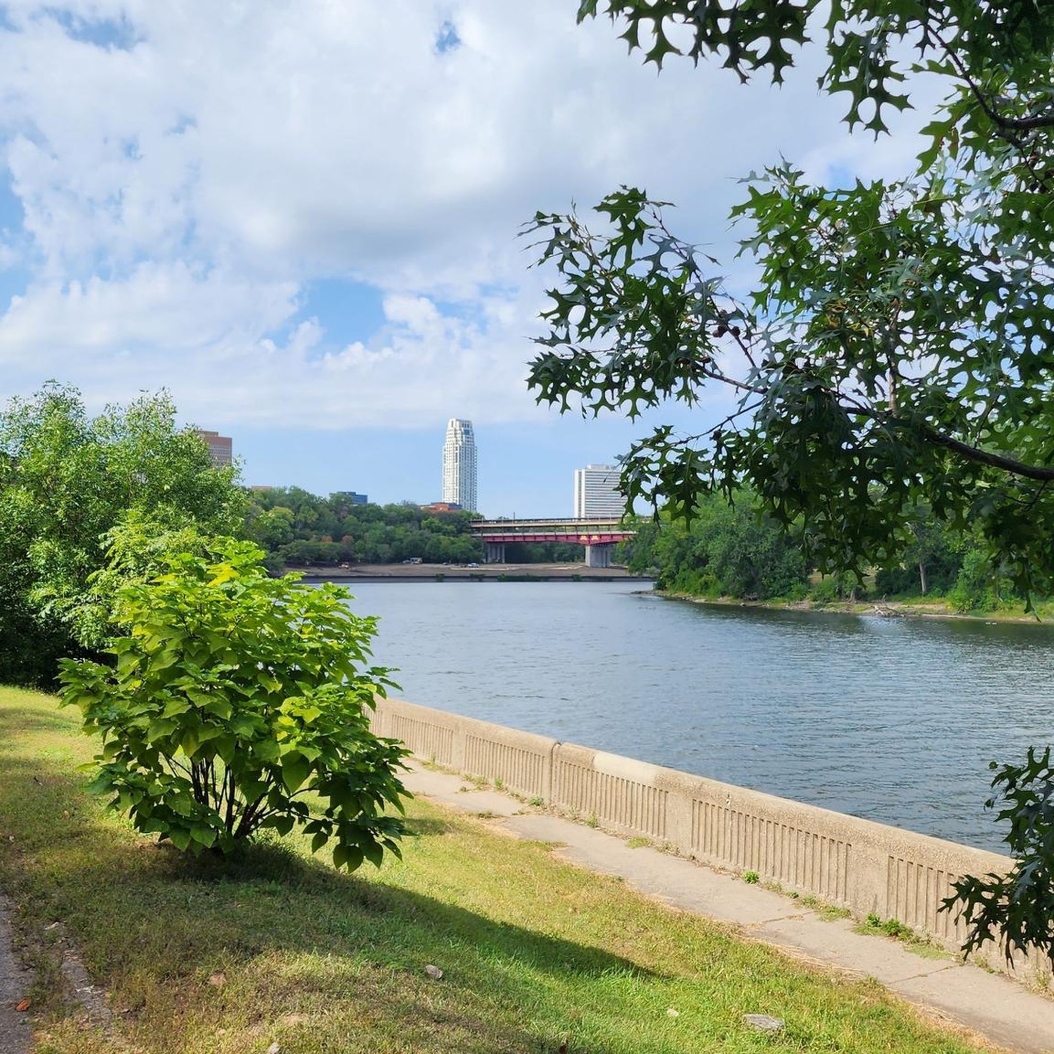
An easily accessible section of the Mississippi River Boulevard that offers an elevated view of the river, with the Lake Street Bridge visible in the background. The lush green trees framing the scenery and the flowing river make this path a perfect place to ride.
0
0
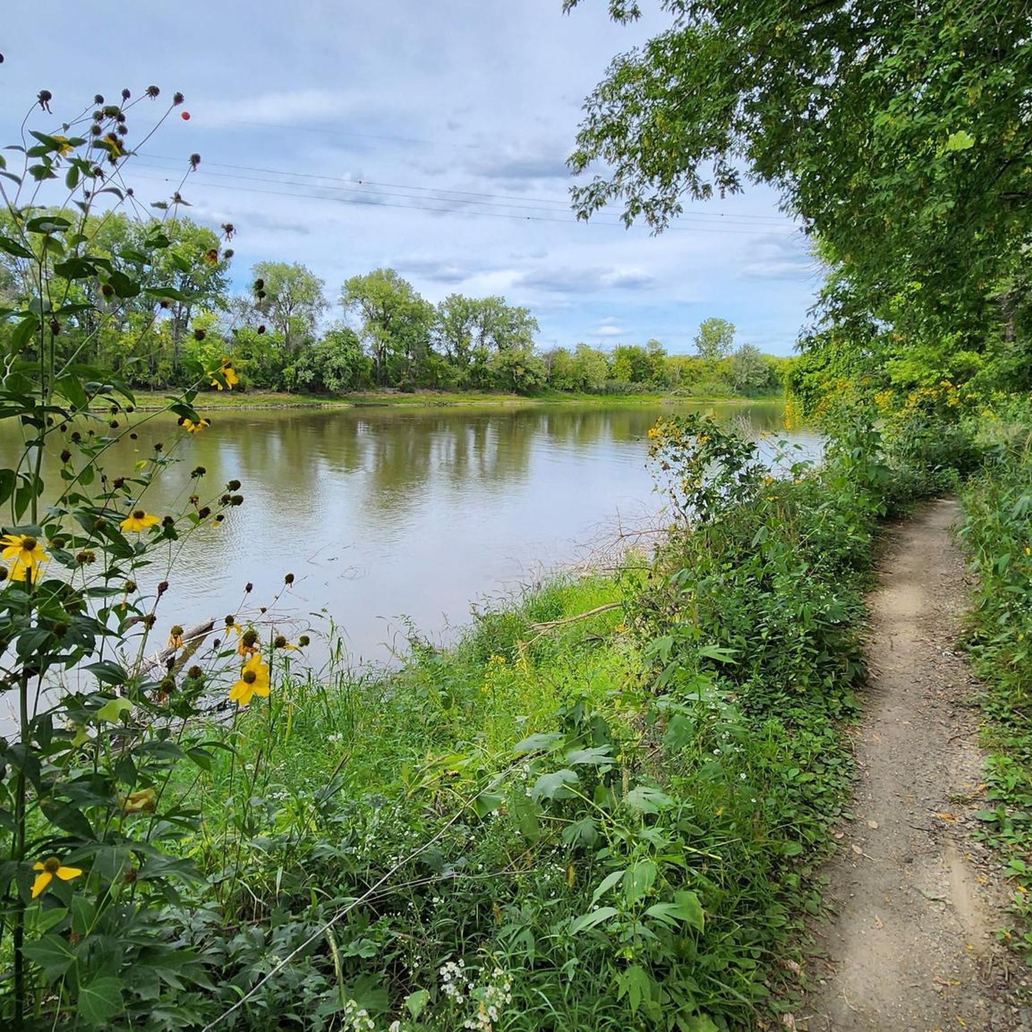
A spot along the trail where you can pause and appreciate the river views. There is a bench where you can sit and admire the river flowing gracefully between the trees.
0
0

Today I tried to visit this highlight but the trail leading to it was closed by the park service. Hopefully, next time.
0
0

This little stretch of boardwalk cuts between Crosby Lake and Upper Lake, giving you better access to trails along the shores of the Mississippi.
0
0

Fort Snelling, a National Historic Landmark located on the Dakota homeland known as Bdote, has a rich history over the last 10,000 years. Visitors can explore stories of the military fort and its surroundings, learn of the history of Native peoples, trade, soldiers, veterans, enslaved individuals, immigrants, and the evolving landscape. Admission fees vary with age, but MNHS members, Native Americans, and veterans are given free entry. Hours and days of operation vary by season.
0
0

The island is situated between the Minnesota River on one side and the Mississippi River on the other. It was regarded as a sacred place by the Dakota Indians, as it marks the point where these two great rivers converge. One can observe a subtle distinction where they meet, as the Minnesota River carries sediment and has a slightly muddier color compared to the clearer waters of the Mississippi River.
0
0

Upper Lake, the smaller of two lakes in Crosby Farm Regional Park, is surrounded by scenic hiking trails, making it ideal for exploring on foot or mountain biking. Nestled in a serene setting, it provides a peaceful escape for outdoor enthusiasts seeking tranquility amidst nature's beauty.
0
0
Frequently Asked Questions
Are dogs allowed on the hiking trails in St. Paul?
Yes, many parks in St. Paul are dog-friendly, but they must be kept on a leash. Highly-regarded parks like Crosby Farm Regional Park and Battle Creek Regional Park welcome leashed dogs on their trails. Always check the specific park's regulations before you go.
Are there any hikes with waterfalls in the St. Paul area?
Definitely. Hidden Falls Regional Park is a local favorite, featuring a charming waterfall that is easily accessible via a short trail. For another option, Shadow Falls Park offers a serene setting with a trail leading down to its own waterfall and views of the Mississippi River.
What are some good, easy hikes for families with children?
St. Paul has numerous easy trails perfect for a family outing. The trails at Indian Mounds Regional Park are generally flat and offer great views of the river and city skyline, along with historical points of interest. The paved paths at Crosby Farm Regional Park are also an excellent choice, providing a gentle walk through a peaceful, wooded environment.
Can I find paved trails suitable for strollers or wheelchairs?
Yes, many of St. Paul's parks feature paved trails. Hidden Falls Regional Park has about 6.7 miles of paved paths that are great for strollers. Crosby Farm Regional Park also offers extensive paved trails through its woodlands, making it another accessible option for a smooth walk.
What is the best time of year for hiking around St. Paul?
Hiking in St. Paul is enjoyable year-round, but autumn is particularly spectacular. The trails along the Mississippi River bluffs, such as those in Cherokee Regional Park, offer stunning fall colors. Summer provides lush greenery in the floodplain forests, while spring brings wildflowers and flowing waterfalls.
How difficult are the hiking trails in St. Paul?
The majority of trails are rated as easy. Most routes are on flat or gently rolling terrain, often within city parks or along the river. For a bit more of a challenge, some trails in Battle Creek Regional Park include steeper sections and a 200-foot elevation gain, providing a moderate workout.
What do other hikers enjoy most about the trails in St. Paul?
The trails around St. Paul are highly rated by the komoot community, with an average score of 4.2 stars. Reviewers frequently praise the surprising feeling of being immersed in nature so close to the city, the beautiful views of the Mississippi River from the bluffs, and the well-maintained paths in the regional parks.
Are there any fees for hiking in St. Paul's parks?
Most regional parks in St. Paul, such as Crosby Farm, Hidden Falls, and Battle Creek, are free to enter and use. However, state parks like Fort Snelling State Park require a vehicle permit for entry, which can be purchased for a day or a full year.
What kind of wildlife might I see while hiking?
The parks around St. Paul are home to a variety of wildlife. It's common to see deer, foxes, squirrels, and a wide array of bird species, especially along the Mississippi River corridor. While black bears exist in Minnesota, they are not typically seen on trails within the city limits of St. Paul.
How can I find circular hiking routes?
Many of the most popular trails in St. Paul are loops. For example, the Harriet Island & Cherokee Regional Parks loop offers a scenic circuit with river views. You can easily find more circular routes by using the 'Tour type' filter in the komoot Route Planner and selecting 'Round trip'.
What should I wear for a hike in this region?
Dressing in layers is key. Minnesota weather can change quickly. Wear moisture-wicking clothing and bring a waterproof jacket, even if the forecast is clear. Sturdy walking shoes are sufficient for most paved and dirt paths, but waterproof hiking boots are recommended for muddier trails, especially in the spring or after rain.
Are there any moderate hikes for a better workout?
Yes, if you're looking for something more strenuous than a flat walk, the Mississippi Gorge Regional Park loop is a great option. This 5.7-mile trail includes some elevation changes as it follows the river gorge, offering a solid moderate hike.
Most popular routes around St. Paul
Most popular attractions around St. Paul

Get inspired with the komoot mobile app


Explore more
Browse the best Hikes in other regions.
