The best road cycling routes around Harvey
5.0
(3)
122
riders
10
rides
Road cycling around Harvey offers diverse terrain, from coastal paths and agricultural lands to routes through hinterland and forest environments. The region features a mix of flat sections and gentle hills, providing varied experiences for cyclists. Routes often pass by natural features such as lakes and rivers, offering scenic views across open spaces and developed areas.
Best road cycling routes around Harvey
- The most popular road cycling route is Presque Isle Park – Black Rocks loop from Northern Michigan University…
Last updated: July 9, 2026
31
riders
36.9km
02:02
160m
160m
Moderate road ride. Good fitness required. Some segments of this route may be unpaved and difficult to ride.
5.0
(2)
31
riders
33.8km
02:03
140m
140m
Moderate road ride. Good fitness required. Some segments of this route may be unpaved and difficult to ride.

Sign up for free
5.0
(1)
10
riders
21.6km
01:05
60m
60m
Moderate road ride. Great for any fitness level. Some segments of this route may be unpaved and difficult to ride.
15
riders
60.9km
03:17
480m
480m
Moderate road ride. Good fitness required. Some segments of this route may be unpaved and difficult to ride.
5
riders
12.0km
00:35
40m
40m
Easy road ride. Great for any fitness level. Mostly well-paved surfaces and easy to ride.
Get access to more routes and recommendations from other explorers.
Sign up for free
Already have an account?
Our route recommendations are based on thousands of hikes, rides, and runs completed by other people on komoot.
Start today with a free account
Your next adventure awaits.
Login or Signup


Tips from the Community

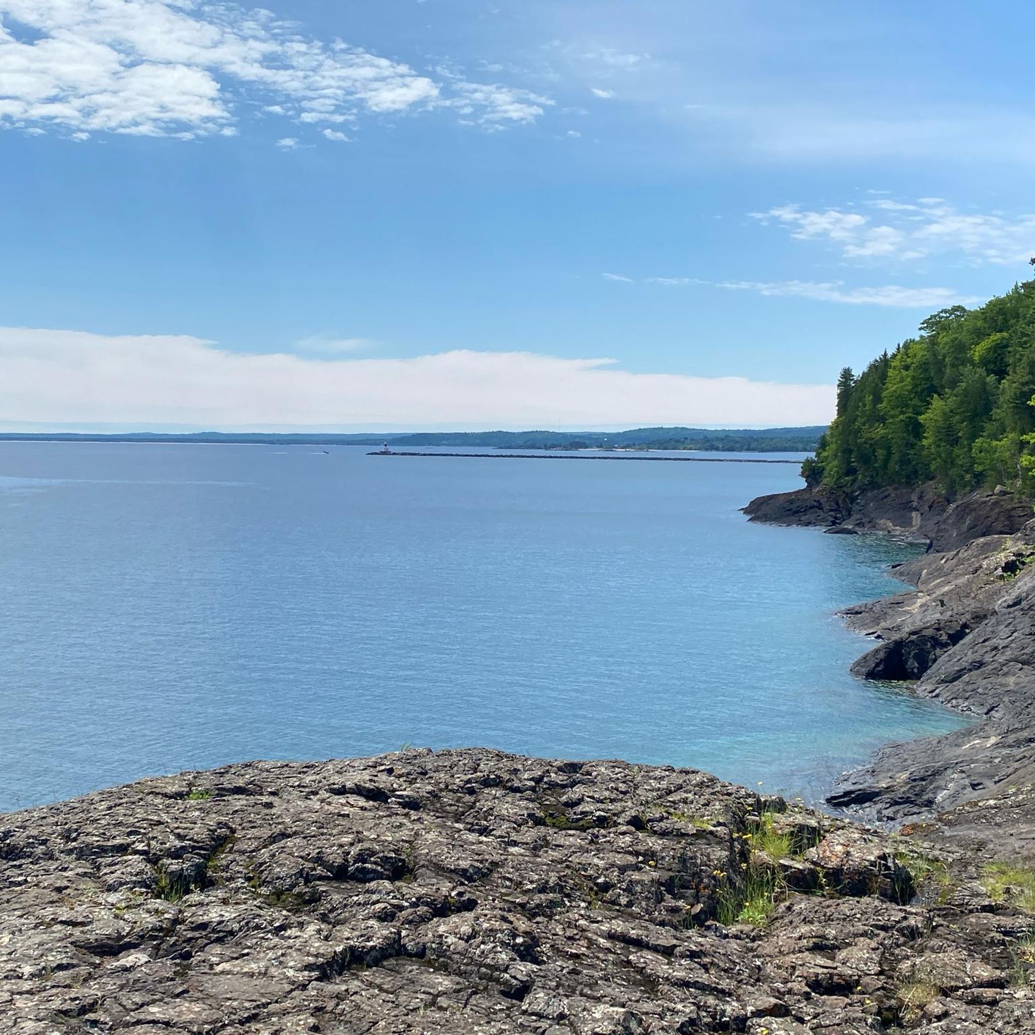
This easily accessible beach along the Marquette Bay provides great views and a calm spot to stop if you are looking for a short break.
0
0

Presque Isle Park is the crowned jewel for exploring nature in Marquette. The park features walking trails and paved roads for walking, driving, and biking. The isle stretches out into Lake Superior via some rocky outcrops and a breakwater, both of which you can walk out onto. The paved road loop is closed to cars 2 hours each day, that way cyclists can safely have the road to themselves. Check at the visitor's center to get the daily closure hours!
0
0

A quality welcome center that provides information on the wide range of activities and attractions available in Marquette and the wider Michigan area. Of particular interest to the cyclist will be the 47 mile Iron Ore Heritage Trail. Along with parking there are restrooms, picnic tables, a kiosk with a trail map, access to Lake Superior and tourist information.
0
0
The Iron Ore Heritage Trail is a 47-mile, year round, multi-use, interpretive trail that crosses the Marquette Iron Range. It travels through some of the key historical industrial sites located in and around Marquette. Trailheads are located at the Marquette Welcome Center in Marquette and in Republic west of Marquette.
0
0
This is simply a magnificent structure. It is the historic Ore Dock that is in Marquette’s Lower Harbor. It is a relic of Marquette’s iron ore mining and maritime industry used for loading ore onto lake freighters. It is no longer in use today but was once a prominent pillar to the local Marquette economy. The Upper Harbor Ore Dock at Presque Isle is still in use for those interested in seeing such a giant structure in its working environment.
0
0
Presque Isle Park is the crowned jewel for exploring nature in Marquette. The park features walking trails and paved roads for walking, driving, and biking. The isle stretches out into Lake Superior via some rocky outcrops and a breakwater, both of which you can walk out onto. The paved road loop is closed to cars 2 hours each day, that way cyclists can safely have the road to themselves. Check at the visitor's center to get the daily closure hours!
0
0
Sunset Point is a great viewpoint on the side of Peter White Drive. This is a great spot to pause during your ride and take in the view of Lake Superior.
0
0

By 1960, all passenger services ended on this railroad. Diesel replaced steam by 1962. Marquette tourist railroad preserved LS&I's steam locomotives until 2002.
0
0
Frequently Asked Questions
How many road cycling routes are available around Harvey?
On komoot, you can find 9 road cycling routes around Harvey, offering diverse experiences for cyclists. These routes range from easy to moderate difficulty.
What kind of terrain can I expect on road cycling routes in Harvey?
The Harvey Region offers a varied road cycling terrain. You'll find routes through flat agricultural lands with citrus groves and dairy farms, as well as more challenging climbs in the rolling hills of the Darling Scarp. Some routes also feature coastal paths and sections near picturesque dams like Harvey Dam and Logue Brook Dam.
Are there any easy road cycling routes suitable for beginners in Harvey?
Yes, there are several easy road cycling routes in Harvey. For instance, the Picnic Rocks Beach – Presque Isle Park loop from Marquette is an easy 10.4-mile (16.7 km) trail through coastal areas. Another easy option is the South Beach loop from Harvey, which is 10.5 miles (17 km) long.
Can I find longer road cycling routes for more challenging rides in Harvey?
Absolutely. For longer and more challenging rides, consider routes like the Presque Isle Park – Black Rocks loop from Northern Michigan University, which spans 22.9 miles (36.9 km) with moderate elevation. Another great option is the Presque Isle Park – Black Rocks loop from Harvey, a moderate 21.0-mile (33.8 km) path.
What scenic attractions or landmarks can I see while cycling in Harvey?
Road cycling routes in Harvey often pass by beautiful natural features and points of interest. You might encounter the tranquil waters of Harvey Dam, Logue Brook Dam, or Stirling Dam. Some routes offer views of the Darling Scarp, while others traverse the charming agricultural heartland. Notable landmarks include Black Rocks and the Marquette Lower Harbor Ore Dock.
Are there family-friendly road cycling options in the Harvey region?
Yes, the Harvey Region offers family-friendly cycling options, particularly along its coastal areas and flatter agricultural routes. The Eaton-Australind Historic Trail, for example, is suitable for families. Look for routes with lower elevation gains and well-maintained surfaces for a comfortable family ride.
What is the best time of year to go road cycling in Harvey?
The Harvey Region is suitable for cycling year-round, but the best times are generally during the cooler, drier months. Spring (September to November) and Autumn (March to May) offer pleasant temperatures and vibrant scenery. Summer can be warm, especially inland, so early morning rides are recommended. Winter rides are also possible, with mild conditions compared to many other regions.
Are there circular road cycling routes available in Harvey?
Many of the road cycling routes in Harvey are designed as loops, allowing you to start and end at the same point. Examples include the Presque Isle Park – Black Rocks loop from Northern Michigan University and the South Beach loop from Chocolay River. These circular routes are convenient for exploring the region without needing to retrace your path.
Where can I find parking for road cycling routes in Harvey?
Parking availability varies by route. Many trailheads, particularly near popular attractions like Harvey Dam or in town centers, offer designated parking areas. For routes starting from specific locations, such as the Presque Isle Park – Black Rocks loop from Harvey, you can often find parking nearby. It's advisable to check the specific route details on komoot for parking information.
What do other cyclists say about road cycling in Harvey?
The road cycling routes around Harvey are highly rated by the komoot community, with an average score of 5.0 stars from over 3 reviews. Cyclists often praise the diverse scenery, from coastal views to agricultural landscapes and forest roads, as well as the variety of routes suitable for different skill levels.
Are there routes that explore the agricultural heartland of Harvey?
Yes, the Harvey Region is known as the 'food bowl of Western Australia,' and many back roads are ideal for cycling through its agricultural heartland. You can ride past flat paddocks, citrus groves, and dairy farms, offering a charming countryside experience. These routes provide a peaceful setting away from busier roads.
Can I find routes that offer views of the Leschenault Estuary?
The Harvey Region boasts 42 kilometers of coastline, and cycling along coastal roads can offer panoramic views of the Leschenault Estuary. The Eaton-Australind Historic Trail is one such route that provides scenic vistas of the estuary, making for a picturesque ride.
Are there any routes that pass by waterfalls in the Harvey area?
While the region is known for its dams and waterways, you can find natural features like Morgan Falls listed as a nearby attraction. While not directly on a road cycling route, it's a point of interest worth exploring if you're in the vicinity.
Where can I find information about local amenities like cafes along the routes?
While specific cafes are not listed for every route, the towns and smaller communities within the Harvey Region, such as Harvey itself, Brunswick Junction, and Australind, offer various amenities including cafes, pubs, and shops. Planning your route to pass through these towns will allow for refreshment stops. For more general information on places to explore in the region, you can visit Visit Bunbury Geographe.
Most popular routes around Harvey
Most popular attractions around Harvey

Get inspired with the komoot mobile app


Explore more
Browse the best Road cycling routes in other regions.
