The best walks and hikes around Pocasset
5.0
(8)
28
hikers
13
hikes
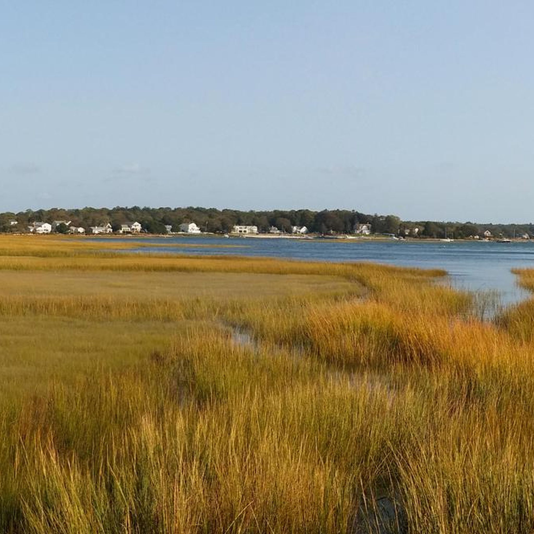
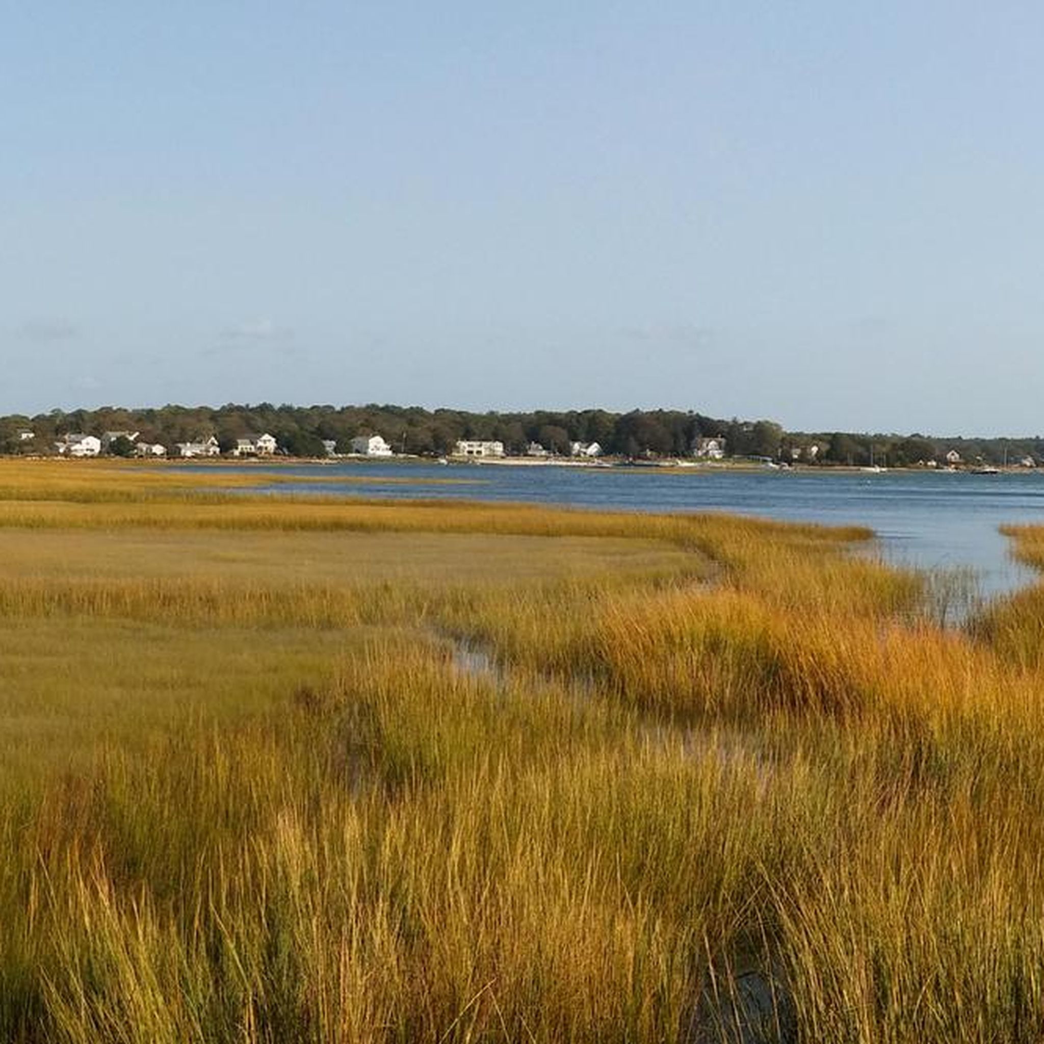
Hiking around Pocasset, located on Cape Cod in Massachusetts, offers access to diverse natural landscapes. The region is characterized by pine-filled forests, sandy ponds, and vibrant wetlands, with an understory of blueberry and huckleberry. Trails often meander through oak-pine woodlands and past freshwater bodies. The terrain generally features gentle elevation changes, making it suitable for various hiking abilities.
Best hiking trails around Pocasset
- The most popular hiking route is Long Pond Loop via Moraine Trail – Falmouth, a 5.4 miles (8.8 km) trail that takes 2 hours 20 minutes to complete. This route explores varied woodland and pondside scenery.
- Another top favourite among local hikers is Shining Sea Bikeway from Bourne Farm to Nobska Point Light — Falmouth, a difficult 17.6 miles (28.3 km) path. This trail offers extensive coastal views and passes through varied landscapes.
- Local hikers also love the Bourne Farm and Wing Pond Loop — Falmouth, a 2.5 miles (4.0 km) trail leading through open fields and along pond edges, often completed in about 1 hour.
- Hiking around Pocasset is defined by pine forests, freshwater ponds, and coastal paths. The network offers options for different ability levels, from easy loops to more challenging long-distance routes.
- The routes in Pocasset are highly rated by the komoot community with an average score of 5.0 stars from over 4 reviews. More than 24 hikers have used komoot to explore Pocasset's varied terrain.
Last updated: October 10, 2026
2
hikers
3.96km
01:02
30m
30m
The Breivogel Ponds to Shallow Pond Woodlands trail offers a delightful mix of scenery, transitioning from open sandplain grasslands around freshwater ponds to hilly woodlands with towering white pines and views of Shallow Pond. This easy 2.5-mile (4.0 km) hike, with a gentle 101 feet (31 metres) of elevation gain, typically takes just over an hour to complete, making it an ideal choice for a quick nature escape. You'll find yourself immersed in diverse habitats, from seasonal vernal pools to dense forests, providing a rich and varied experience.
When planning your visit, spring is particularly rewarding for spotting amphibians in the vernal pools and enjoying active bird migration. Alternatively, fall provides comfortable temperatures and a display of vibrant foliage, also excellent for birdwatching. The trail is welcoming to dogs, provided they are kept on a leash, making it a great option for a family-friendly outing with your canine companion.
This trail is part of a larger 183-acre protected open space, serving as a vital ecological corridor that preserves important upland, wetland, and wildlife habitats. The 300 Committee Land Trust played a key role in conserving the Shallow Pond Woodlands, recognizing its high natural resource values. Keep an eye out for the imperiled shrub swamp/kettle hole level bog community southeast of Shallow Pond, a unique and vulnerable ecosystem.
1
hikers
1.95km
00:31
20m
10m
Embark on the Monks Cove Loop for an easy hike that blends peaceful woodland paths with scenic shoreline views. This route offers a gentle experience, covering 1.2 miles (1.9 km) with a minimal elevation gain of 62 feet (19 metres), making it perfect for a quick 30-minute outing. As you follow the trail, you'll discover picturesque marshlands and sweeping vistas of Bourne's Little Bay, with wooded Tobey Island and the upper reaches of Buzzards Bay visible in the distance.
Planning your visit to the Monks Cove Loop is straightforward. The trail is located within a small conservation area, and you'll find the paths well-marked, ensuring easy navigation. Parking is generally available, making access convenient for most visitors. You can also reach Monk's Cove directly from the trail, which is a great option if you fancy a swim on a warm day.
This trail offers a unique opportunity to observe boats navigating the nearby Cape Cod Canal from its sandy shore. Along the way, you'll find trailside benches strategically placed, inviting you to pause and soak in the tranquil atmosphere and expansive views. It's a wonderful spot to connect with nature and enjoy the coastal scenery.

17.3km
04:37
200m
200m
Embark on the Otis 151 Trails for a moderate hike through dense woodlands, where you will navigate paths of packed dirt, roots, and occasional rocky sections. This route covers 10.7 miles (17.3 km) and involves a total elevation gain of 660 feet (201 metres), typically taking around 4 hours and 37 minutes to complete. As you traverse the rolling hills, you might catch glimpses of the Otis Reservoir or even reach Mt. Zig, a notable summit offering a sense of accomplishment.
When planning your visit, be aware that parking is generally available, providing good access to the trail network. However, some trails located east of Cole Road are strictly off-limits as they are on Joint Base Cape Cod property; always stick to marked paths to avoid trespassing. The extensive, interlacing singletrack means you should stay alert to your route to prevent getting lost.
Located within the Frances A. Crane Wildlife Management Area, the Otis 151 Trails offer a diverse outdoor experience. While the area is popular with mountain bikers, the extensive network of paths warmly welcomes hikers. This trail system stands out for its varied terrain and the opportunity to explore a significant natural area.
1
hikers
7.27km
01:52
30m
30m
Explore the gentle landscapes of Cardoza and Bourne Farms on an easy 4.5-mile (7.3 km) hike. You will experience a mix of open, wildflower-filled meadows and peaceful shaded wooded paths, with some sections offering moderately steep hills. This route involves a modest 110 feet (33 metres) of elevation gain and typically takes around 1 hour and 52 minutes to complete, making it a perfect choice for a relaxed outing.
When planning your visit, you will find that parking is generally available at the trailheads, making access straightforward. The trail offers a pleasant blend of flat terrain and some gentle inclines, suitable for most hikers. You won't need any special permits or have to pay fees to enjoy these protected properties, ensuring a hassle-free experience.
The area is rich in history, allowing you to wander through what were once active farmlands. Keep an eye out for the historic Bourne Farmhouse, a notable landmark along the way, and observe the active Working Cranberry Bog, which adds a unique agricultural touch to the scenery. You might also spot local wildlife, such as various songbirds and rabbits, as you make your way through the diverse habitats.
1
hikers
2.21km
00:33
0m
0m
Embark on an easy hiking adventure along the Cape Cod Canal Bikeway, a paved route offering continuous water views. This pleasant trail spans 1.4 miles (2.2 km) with a minimal elevation gain of just 9 feet (3 metres), making it accessible for nearly everyone. You can expect to complete the hike in about 33 minutes, enjoying the serene atmosphere as you watch ships navigate the canal and pass by the impressive Cape Cod Canal Railroad Bridge.
Planning your visit is straightforward, as the trail conditions are generally excellent, maintained by the U.S. Army Corps of Engineers. You'll find convenient parking available at access points, such as the Tidal Flats Recreation Area. The route is suitable for all ages and provides amenities like picnic areas and restrooms along the way, ensuring a comfortable outing.
This unique trail offers more than just a walk; it's an opportunity to observe local wildlife, including native birds, rabbits, and even seals in the canal. The path itself is framed by natural greenery and wildflowers, adding to the scenic beauty. It's a perfect choice if you're looking for a relaxing outdoor experience with panoramic views and a chance to see a working canal up close.
Get access to more routes and recommendations from other explorers.
Already have an account?
Our route recommendations are based on thousands of hikes, rides, and runs completed by other people on komoot.
Start today with a free account
Your next adventure awaits.


Tips from the Community

Built around 1690 by the Bourne family, it's one of the oldest surviving English Colonial houses in Connecticut. The farmhouse originally served as a homestead and remained in the Bourne family for over 200 years. Today, the Bourne Farmhouse stands as a living history museum, offering educational programs and events.
0
0

Deer Horn Hill is a mountain near Joint Base Cape Cod. Deer Horn Hill tops out at an elevation of 232 feet. Be careful as you bike in this area, any trail east of Cole Road is on private property.
0
0

The railroad bridge is a great curiosity as it lifts up and down to allow boat traffic to pass underneath. A wonderful thing to see if you time your ride right and get to see it move.
0
0
Deer Horn Hill is a mountain near Joint Base Cape Cod. Deer Horn Hill tops out at an elevation of 232 feet. Be careful as you bike in this area- any trail east of Cole Road is on private property.
0
0

At a fairly high altitude, reaching Mt. Zig can be a climb, but the views over Falmouth and the surrounding areas are stunning.
0
0

At the edge of Wind Pond Woods is a working cranberry bog. This iconic Massachusetts berry is harvested in the fall by flooding the bogs, which then cause the ripe fruits to float off their stems for collection. This spot is on a section of trail takes you up on a causeway overlooking one of the large bogs. This quintessential Cape Cod view is lovely all year round, but particularly beautiful in the fall when the ripening berries turn the fields a bright red.
1
0
The Wing Pond Herring Run is where herring swim up Herring Brook from Buzzards Bay at Old Silver Beach into Wing Pond to spawn in the freshwater before returning to the sea. These fish are a vital food sources for many other larger fish, whales, and coastal birds. Its amazing to watch these fish swim upstream to their breeding grounds in the spring! Even when the herring aren't "running," this is still an enjoyable, peaceful woodland spot near Wing Pond.
1
0
This old tunnel passes below what is currently the Shinning Sea Bikeway, but what used to be a railroad and is how livestock at Bourne Farm got from the barn to the pastures safely. This tunnel is a tight squeeze, but a neat way to experience some of the history of the area.
1
0
Frequently Asked Questions
What kind of terrain can I expect on hiking trails around Pocasset?
Pocasset, particularly the Massachusetts area, features diverse landscapes including pine-filled forests, sandy ponds, and vibrant wetlands. Trails often meander through oak-pine woodlands with an understory of blueberry and huckleberry. The terrain generally has gentle elevation changes. In contrast, Pocasset Ridge in Rhode Island offers a more rugged experience with an oak-huckleberry forest, giant boulders from the Ice Age, and a 90-foot sheer cliff providing treetop views.
Are there any easy hiking options suitable for beginners or casual walkers in Pocasset?
Yes, there are easy options available. For instance, the Bourne Farm and Wing Pond Loop — Falmouth is an easy 2.5-mile trail leading through open fields and along pond edges, typically completed in about 1 hour. The Four Ponds Conservation Area in Pocasset, MA, also offers shorter loops like the Eagle Trail and Lions Trail, which are great for a relaxed walk.
How many hiking trails are available in the Pocasset area?
The komoot guide features 5 hiking routes around Pocasset, ranging from easy to difficult, ensuring options for various skill levels.
Are the hiking trails in Pocasset suitable for families with children?
Many trails in the Pocasset area are suitable for families, especially those with gentle terrain and shorter distances. The Four Ponds Conservation Area in Pocasset, MA, with its pine forests and sandy ponds, offers accessible trails that are enjoyable for children. The Bourne Farm and Wing Pond Loop — Falmouth is another excellent family-friendly choice.
Can I bring my dog on the hiking trails in Pocasset?
While specific regulations can vary by conservation area, many natural areas in Pocasset and surrounding Cape Cod are generally dog-friendly, often requiring dogs to be on a leash. It's always recommended to check local signage or conservation area websites for the most current rules regarding pets.
What natural features or landmarks can I expect to see while hiking in Pocasset?
You can expect to see a variety of natural features. In Pocasset, MA, trails often pass by sandy ponds, vibrant wetlands, and pine-filled forests. The Pocasset River Trail is also a notable feature. If you venture towards Pocasset Ridge in Rhode Island, you'll encounter unique geological features like giant boulders deposited during the last Ice Age and a dramatic 90-foot sheer cliff offering treetop views. Nearby attractions include the Great Sippewissett Marsh and the Frances A. Crane Wildlife Management Area.
Are there any circular hiking routes in Pocasset?
Yes, there are several circular routes. The Long Pond Loop via Moraine Trail – Falmouth is a popular 5.4-mile option. Another is the Bourne Farm and Wing Pond Loop — Falmouth, which is 2.5 miles. The Four Ponds Conservation Area in Pocasset, MA, also features several shorter loop trails like the Eagle Trail and Lions Trail.
Is parking available at the trailheads in Pocasset?
Parking is generally available at conservation areas and designated trailheads in Pocasset, MA, such as the Four Ponds Conservation Area. For specific routes, it's advisable to check the route details on komoot for parking information, as availability can vary.
What kind of wildlife might I encounter on the trails?
The diverse ecosystems around Pocasset support various wildlife. In the wetlands of Pocasset, MA, you might spot painted turtles, pickerel frogs, and spring peepers. Pocasset Ridge in Rhode Island is a significant stopover and nesting site for migratory birds like scarlet tanagers, wood thrushes, and warblers, and its streams and wetlands provide habitat for frogs and salamanders.
What is the best time of year to go hiking in Pocasset?
Pocasset offers appealing hiking opportunities throughout much of the year. Spring and fall are particularly pleasant, with mild temperatures and beautiful foliage. Spring brings blooming wildflowers and active wildlife, while fall showcases vibrant autumn colors. Summer is also popular, though trails can be busier. Winter hiking is possible, but conditions may vary, and appropriate gear is recommended.
What do other hikers enjoy most about the trails in Pocasset?
The trails around Pocasset are highly rated by the komoot community, with an average score of 5.0 stars. Hikers often praise the quiet woodlands, the serene pondside scenery, and the well-maintained paths that offer a peaceful escape into nature.
Are there any trails that offer a more 'wild' or secluded hiking experience?
Yes, Pocasset Ridge in Tiverton, Rhode Island, is known for its 'wild place' atmosphere. It's part of a ten-mile-long nature corridor, offering an undeveloped character where hikers can experience the silence of the forest and the symphony of songbirds. This area is characterized by oak-huckleberry forests and giant boulders, providing a rugged and secluded feel. You can learn more about this area at nature.org.
Most popular routes around Pocasset
Most popular attractions around Pocasset

Get inspired with the komoot mobile app


Explore more
Browse the best Hikes in other regions.
