The best cycling routes around Braintree
4.5
(19)
468
riders
52
rides
Touring cycling routes around Braintree offer a diverse landscape, ranging from flat, traffic-free paths to undulating countryside and river valleys. The region features a mix of farmlands, woodlands, and historic villages, with elevations varying from 11 to 127 meters. Dedicated cycling infrastructure, including the Flitch Way, provides accessible options for various skill levels.
Best touring cycling routes around Braintree
- The most popular touring cycling route is Blue Hills Reservation loop, a 20.1 miles (32.3 km) trail that takes 2 hours 30 minutes to complete. This moderate route features varied terrain and elevation changes.
- Another top favourite among local touring cyclists is Quincy to Chickatawbut Road, an easy 7.5 miles (12.0 km) path. This route offers a straightforward ride suitable for a quicker outing.
- Local touring cyclists also love the Wompatuck State Park loop from Weymouth, a 27.0 miles (43.5 km) trail leading through parkland and natural areas, often completed in about 2 hours 31 minutes.
- Touring cycling around Braintree is defined by traffic-free paths like the Flitch Way, river valleys, and undulating rural landscapes. The network offers options for different ability levels, from leisurely rides to more challenging excursions.
- The routes in Braintree are highly rated by the komoot community with an average score of 4.3 stars from over 17 reviews. More than 500 touring cyclists have used komoot to explore Braintree's varied terrain.
Last updated: September 27, 2026
4.0
(1)
10
riders
9.51km
00:50
60m
60m
The Ponkapoag Pond Trail offers a delightful touring cycling experience, winding 5.9 miles (9.5 km) around the scenic Ponkapoag Pond. You'll pedal through peaceful woods and reeds, enjoying picturesque views and a vibrant ecosystem. The highlight is undoubtedly the Ponkapoag Bog Boardwalk, which guides you into a rare Atlantic white cedar bog, providing a unique natural immersion.
Planning your ride is straightforward; this easy route with only 196 feet (60 metres) of elevation gain is best tackled in late spring, summer, or fall to avoid muddy conditions. The estimated duration is a quick 50 minutes, making it ideal for a leisurely outing. No permits or fees are needed, and you'll share the predominantly flat doubletrack with hikers and horseback riders.
This trail stands out as an accessible natural escape within the Blue Hills Reservation, just an hour from Boston. Its varied unpaved surfaces, including sections with roots and rocks, are best navigated with a hybrid or gravel bike. The changing seasons bring different beauty, from spring wildflowers to stunning autumn foliage, making it a rewarding ride any time of year.
1
riders
32.3km
02:30
440m
440m
This moderate 20.1-mile touring cycling loop in Blue Hills Reservation offers diverse scenery and panoramic views of the Boston skyline.

1
riders
43.5km
02:31
220m
220m
Embark on a delightful touring cycling adventure through Wompatuck State Park, where the route winds through dense oak-conifer woodlands and serene hemlock groves. You'll pedal past tranquil streams, ponds, and wetlands, with the impressive 136-acre Aaron River Reservoir providing a scenic backdrop. The terrain is predominantly paved, featuring gentle rolling hills that make for a smooth and enjoyable ride.
Planning your visit is straightforward, as the park offers free, highly-regarded water from Mt. Blue Spring, a welcome stop for any cyclist. The best times to experience this moderate 27.0-mile (43.5 km) loop, which includes 731 feet (223 metres) of elevation gain and takes around 2 hours and 31 minutes, are during the mild spring, summer, and fall seasons. The paved paths ensure a good experience even after light rain.
Beyond its natural beauty, Wompatuck State Park holds a unique history as a former naval ammunition depot, adding an intriguing layer to your journey. The park is renowned for its extensive network of automobile-free, paved roads and dedicated bicycle paths, creating a safe and welcoming environment for touring cyclists of all skill levels.
1
riders
12.0km
00:46
140m
140m
This easy 7.5-mile touring bicycle route on a mostly paved surface in Blue Hills Reservation offers scenic views and 471 feet of elevation g
1
riders
14.0km
01:16
220m
220m
The Blue Hills Skyline Loop is a misnomer for touring cyclists; this 8.7-mile (14.0 km) route, with 737 feet (225 metres) of elevation gain, is a rugged, technical hiking and mountain biking trail, not suitable for touring bikes. It's rated moderate for hikers, but for cyclists, it presents an impossible challenge of rocky paths, stone steps, and exposed ledges. Despite the terrain, it offers impressive panoramic views of the Boston skyline from spots like Great Blue Hill Summit and the Eliot Observation Tower, making it a rewarding experience for those on foot.
If you're planning a cycling trip to the Blue Hills Reservation, look for alternative routes within the park. The reservation offers dedicated mountain biking trails with varying difficulties, including smoother pathways and fire roads, as well as road cycling routes that are mostly paved. These options provide a more appropriate experience for touring cyclists, some even featuring significant climbs on paved surfaces, allowing you to enjoy the area without tackling the Skyline Loop's extreme conditions.
This trail is notable for its proximity to Boston, offering a wild, mountain-like experience just south of the city. It's a popular choice for those seeking a demanding workout on foot or mountain bike, traversing diverse ecosystems from dense woods to open meadows. The Eliot Tower also adds a touch of historical significance, named after Charles Eliot, instrumental in establishing the reservation, making it a landmark worth seeking out on more suitable paths.
Get access to more routes and recommendations from other explorers.
Already have an account?
Our route recommendations are based on thousands of hikes, rides, and runs completed by other people on komoot.
Start today with a free account
Your next adventure awaits.
Tips from the Community


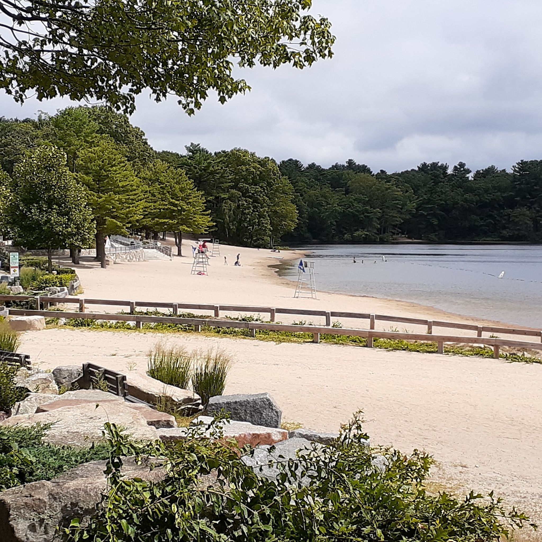
Houghton's Pond is close to the most popular trailhead and parking area within the Blue Hills Reservation. This is a popular spot, so you'll likely have to share the trail. That being said, the trails on the banks of the pond are rated as "green" trails and are pretty wide, relatively smooth, and super easy to navigate.
0
0
A great area for biking specially with gravel bikes or MTB
1
0

St. Moritz is a beautiful man-made pond located on the eastern edge of Blue Hills Reservation. The pond was once a popular spot for competitive ice skaters, and hosted the annual St. Moritz Winter Carnival between 1929 and 1942, until the pond no longer froze over for such lengths of time.
0
0

Ponkapoag Pond is the largest body of water on the Blue Hills Reservation. A beautiful loop trail leads once around the shining lake. Just relax.
0
0
Frequently Asked Questions
How many touring cycling routes are available around Braintree?
There are over 60 touring cycling routes around Braintree, offering a wide variety of experiences. These routes are highly rated by the komoot community, with an average score of 4.3 stars.
Are there any easy or family-friendly touring cycling routes in Braintree?
Yes, Braintree offers many easy and family-friendly options. The region is known for its traffic-free paths like the Flitch Way, which is flat and well-maintained, making it suitable for all abilities. Overall, 35 of the routes are rated as easy. A good example is Quincy to Chickatawbut Road, an easy 7.5-mile path.
What kind of terrain can I expect on touring cycling routes around Braintree?
The terrain around Braintree is quite diverse. You'll find flat, traffic-free paths, especially along disused railway lines like the Flitch Way. There are also undulating river valleys, such as the River Pant valley, and hillier routes through rural countryside. Elevations vary from 11 to 127 meters, offering a mix of gentle and more challenging rides through farmlands, woodlands, and wet meadows.
Are there any circular touring cycling routes in the Braintree area?
Yes, many routes around Braintree are designed as loops. For instance, the Blue Hills Reservation loop is a popular moderate route covering 20.1 miles with varied terrain. Another option is the Wompatuck State Park loop from Weymouth, a 27.0-mile trail through parkland.
What are some interesting places to stop or see along the touring cycling routes?
You'll find several points of interest. Along the Flitch Way, the former Rayne Station now hosts a café, visitor center, and rail museum. The region is also dotted with picturesque villages like Finchingfield and Coggeshall, offering charming stops. For natural beauty, you can explore areas like Wompatuck State Park or Pond Meadow Park, which feature woodlands, meadows, and lakes.
Are there any routes suitable for advanced touring cyclists looking for a challenge?
While many routes are easy or moderate, the undulating countryside and river valleys can offer more challenging sections. The region's varied terrain, with altitudes up to 127 meters, allows for routes with significant elevation changes. There are 2 routes rated as difficult, and 23 routes are rated as moderate, providing more demanding options for experienced riders.
Can I find cafes or pubs along the touring cycling routes in Braintree?
Yes, the area offers several spots for refreshments. Rayne Station, located on the Flitch Way, is a popular stop with a café. Many of the historic villages along the routes, such as Finchingfield and Coggeshall, will also have local pubs and cafes where you can take a break.
What are the typical lengths and durations of touring cycling routes in Braintree?
Route lengths vary significantly. You can find shorter rides like Chickatawbut Road from Quincy, which is about 5.2 miles (8.4 km) and takes around 30 minutes. Longer routes, such as the Blue Hills Reservation loop, span over 20 miles (32.3 km) and can take around 2 hours 30 minutes to complete, offering options for various time commitments.
What do other touring cyclists enjoy most about cycling in Braintree?
The area is highly rated by the komoot community, with an average score of 4.3 stars from over 17 reviews. Reviewers often praise the diverse landscape, from traffic-free paths like the Flitch Way to the scenic river valleys and historic villages. The well-maintained trails and the mix of natural beauty with cultural stops are frequently highlighted.
Are there any specific natural features or conservation areas I can cycle through?
Absolutely. The region boasts several natural areas. You can cycle through parts of Great Notley Country Park with its woodlands and meadows. Further afield, areas like Cranberry Pond Conservation Area are known for unique quaking bogs and rare species, while Pond Meadow Park offers a paved bicycle trail through its 320-acre conservation space.
Is there public transport access to the cycling routes in Braintree?
Braintree is a market town with public transport links. While specific route access points may vary, the Flitch Way, for example, connects Braintree to Bishop's Stortford, and Braintree itself has a railway station, which could provide access to the start or end points of some routes. It's advisable to check local bus and train schedules for specific route connections.
Where can I find parking for touring cycling routes in Braintree?
Many popular cycling spots, such as Great Notley Country Park and Rayne Station (on the Flitch Way), offer dedicated parking facilities for visitors. For routes starting in or near Braintree town, public car parks are available. When planning your ride, it's always a good idea to check the starting point of your chosen route for specific parking information.
Most popular routes around Braintree
Most popular attractions around Braintree

Get inspired with the komoot mobile app


Explore more
Browse the best Cycling routes in other regions.
