The best road cycling routes around Lochearn
4.3
(34)
600
riders
87
rides
Road cycling routes around Lochearn are set within the dramatic landscapes of the Scottish Highlands, specifically at the western end of Loch Earn and within Loch Lomond & The Trossachs National Park. The region features freshwater lochs, glens like Glen Ogle, and a backdrop of mountains such as Ben Vorlich. The terrain offers a mix of gentle inclines and smooth sections, alongside more challenging gradients and switchbacks, providing varied cycling experiences.
Best road cycling routes around Lochearn
- The most popular…
Last updated: July 12, 2026
5.0
(2)
57
riders
66.5km
03:12
760m
760m
Moderate road ride. Good fitness required. Mostly well-paved surfaces and easy to ride.
5.0
(1)
27
riders
50.8km
02:28
610m
610m
Moderate road ride. Good fitness required. Mostly well-paved surfaces and easy to ride.

Sign up for free
5.0
(3)
15
riders
38.2km
01:44
410m
410m
Moderate road ride. Good fitness required. Mostly well-paved surfaces and easy to ride.
5.0
(1)
12
riders
47.7km
02:18
580m
580m
Moderate road ride. Good fitness required. Mostly well-paved surfaces and easy to ride.
11
riders
Moderate road ride. Good fitness required. Some segments of this route may be unpaved and difficult to ride.
Get access to more routes and recommendations from other explorers.
Sign up for free
Already have an account?
Our route recommendations are based on thousands of hikes, rides, and runs completed by other people on komoot.
Start today with a free account
Your next adventure awaits.
Login or Signup

Tips from the Community

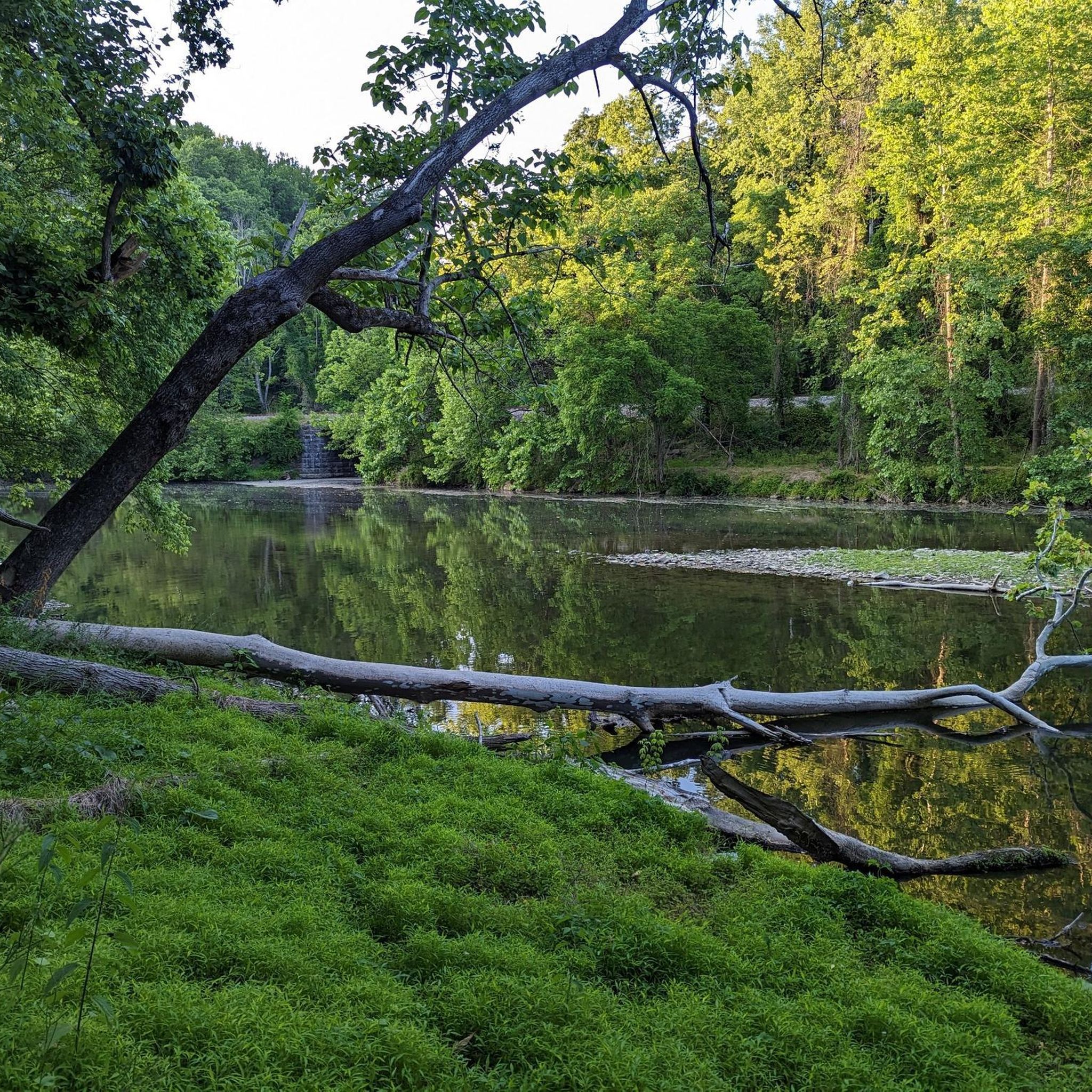
It gets very cold as you get close to Patapsco River near the bridge. The bridge does move a little but very secure as you cross it. Be mindful if you’re wearing a skirt (Ms Monroe)
0
0

The Grist Mill Trail crosses over the Patapsco River here. You get a great view over the water from here too.
0
0

The Ilchester Road access point to the Ridge Trail offers a thrilling start for cyclists exploring Patapsco Valley State Park. Expect a steep, technical climb with rocky sections, rewarding you with flowing trails and forest views at the top. For a longer ride, connect to the Orange Grove area to enjoy smoother paths and cross the historic swinging bridge. Be prepared for limited parking and challenging terrain that tests both endurance and skill.
0
0

This beautiful pond offers a peaceful escape amidst the bustling city. Also serves as a valuable educational resource for local schools, offering opportunities to learn about local ecology and the importance of urban green spaces. Keep an eye out for the two sculptures nestled amidst the greenery – “Frog Family” and “Great Blue Heron” – adding a touch of artistic whimsy to the natural setting.
0
0

As you cross over Jones Falls you get a great view of the Lake Roland Dam. The dam was completed in 1861 to meet the needs of Baltimore's growing population and today stands as a historical landmark.
0
0

The Patapsco Valley was Maryland's first and remains its largest state park. The 14,000 acres (5,700 ha) are made up of forests, winding rivers and cascading waterfalls. It's a great place for hiking, camping, canoeing, horseback riding and mountain biking. Or simply just bring a picnic and relax by the river. Some historical sites are also worth visiting in the park such as the Thomas Viaduct and Orange Grove Flour Mill.
0
0

Jones Falls is a 17-mile stream that is dammed to create Lake Roland. It runs through the city of Baltimore and empties into the Inner Harbor downtown.
0
0

Truss Bridge crossing the Western Run River. It's a nice view of the river and surrounding countryside.
0
0
Frequently Asked Questions
How many road cycling routes are available around Lochearn?
There are over 90 road cycling routes around Lochearn, catering to various skill levels. You'll find options ranging from easier rides to more challenging ascents, with 16 easy, 64 moderate, and 11 difficult routes.
What kind of terrain can I expect when road cycling in Lochearn?
Lochearn offers a diverse road cycling terrain. You'll encounter scenic lochside paths, routes through picturesque glens like Glen Ogle, and roads with dramatic mountain backdrops. The area features a mix of gentle inclines and smooth sections, alongside more challenging gradients and switchbacks, providing a varied experience for road cyclists.
Are there any family-friendly road cycling routes in Lochearn?
Yes, Lochearn offers several family-friendly road cycling options, particularly on sections of the National Cycle Network Route 7 (NCN 7). This route, part of the 'Lochs and Glens North' series, includes smooth sections suitable for a more relaxed ride. For a shorter, moderate option, consider the Druid Lake – Druid Hill Park loop from Cold Spring Lane, which is 18.6 km long and takes about 55 minutes.
What are some notable natural features or landmarks I can see while cycling in Lochearn?
While cycling in Lochearn, you can experience the stunning freshwater Druid Lake, which is a central feature of the landscape. The area is also known for its picturesque glens, such as Glen Ogle, and the dramatic backdrop of mountains like Ben Vorlich. You might also encounter the Swinging Bridge and Patapsco Riverbank or the Swinging Bridge on Grist Mill Trail.
Are there any waterfalls accessible from the road cycling routes?
Yes, while not directly on every road cycling route, the region around Lochearn is home to beautiful waterfalls. You can find the impressive Cascade Falls nearby, offering a refreshing natural spectacle.
What do other road cyclists say about their experience in Lochearn?
The road cycling routes in Lochearn are highly rated by the komoot community, with an average score of 4.4 stars from over 19 reviews. Cyclists often praise the diverse terrain, from lochside paths to challenging climbs, and the stunning natural beauty of the Scottish Highlands.
Are there any long-distance or challenging road cycling routes in the area?
For those seeking longer or more challenging rides, Lochearn offers several options. The Roland Water Tower – Western Run Bridge loop from Cold Spring Lane is a moderate 66.4 km route that takes about 3 hours and 11 minutes. Another popular choice is the Jones Falls Trail – Jones Falls loop from Cold Spring Lane, a moderate 50.8 km path that can be completed in approximately 2 hours and 28 minutes.
Can I find circular road cycling routes around Lochearn?
Yes, many of the road cycling routes around Lochearn are designed as loops, allowing you to start and finish in the same location. For example, the Jones Falls – Baltimore Waterfront loop from Woodberry is a moderate 26.1 km route, and the Jones Falls – Lake Roland loop from Woodberry offers a moderate 38.2 km ride.
What is the best time of year for road cycling in Lochearn?
Lochearn's dramatic landscapes are beautiful year-round, but the best time for road cycling generally aligns with milder weather. Spring and autumn offer pleasant temperatures and stunning scenery, while summer provides longer daylight hours. Be prepared for changeable weather conditions typical of the Scottish Highlands, regardless of the season.
Are there any specific national cycle routes that pass through Lochearn?
Yes, Lochearn is well-integrated into national cycle routes. The National Cycle Network Route 7 (NCN 7), part of the 'Lochs and Glens North' series, runs from Callander through Lochearnhead all the way to Killin. This route offers varied surfaces and gradients, with some sections being very smooth.
What kind of natural environments can I explore near the cycling routes?
Beyond the lochs and glens, you can explore diverse natural environments. The Druid Hill Park offers a green oasis, and the Patapsco Valley State Park Alberton Area provides opportunities to cycle through beautiful forest landscapes.
Most popular routes around Lochearn
Most popular attractions around Lochearn

Get inspired with the komoot mobile app


Explore more
Browse the best Road cycling routes in other regions.
