The best running trails around Brownsville
4.0
(1)
76
runners
12
runs
Jogging routes around Brownsville offer diverse terrain, from flat canal towpaths to more challenging trails with significant elevation gain. The region features a mix of riverine landscapes and forested areas, providing varied running experiences. Trails often follow historical paths or natural waterways, offering a blend of scenic beauty and accessible routes. The area's topography includes gentle inclines along canals and more pronounced ascents on trails leading to overlooks.
Best jogging routes around Brownsville
- The most popular jogging route is Chesapeake…
Last updated: October 15, 2026
12
runners
19.5km
02:12
40m
40m
Hard run. Very good fitness required. Mostly paved surfaces. Suitable for all skill levels.
5
runners
20.8km
02:31
370m
370m
Hard run. Very good fitness required. Mostly paved surfaces. Suitable for all skill levels.

3
runners
11.0km
01:11
10m
10m
Moderate run. Good fitness required. Mostly paved surfaces. Suitable for all skill levels.
2
runners
11.7km
01:29
220m
220m
Moderate run. Good fitness required. Mostly paved surfaces. Suitable for all skill levels.
2
runners
11.2km
01:28
240m
240m
Moderate run. Good fitness required. Mostly paved surfaces. Suitable for all skill levels.
Get access to more routes and recommendations from other explorers.
Already have an account?
Our route recommendations are based on thousands of hikes, rides, and runs completed by other people on komoot.
Start today with a free account
Your next adventure awaits.


Tips from the Community

You can walk along the side or bike through the middle
0
0

The beginning and end section of this segment of the Appalachian Trail between Gathland Picnic Shelter and White Rocks gains a fair bit of elevation at the start and end, but the middle is fairly flat. It's a lovely, challenging run for those familiar with trail running. The ground can become rocky underfoot and tends to collect ice in the winter, so best completed in the warmer months.
0
0
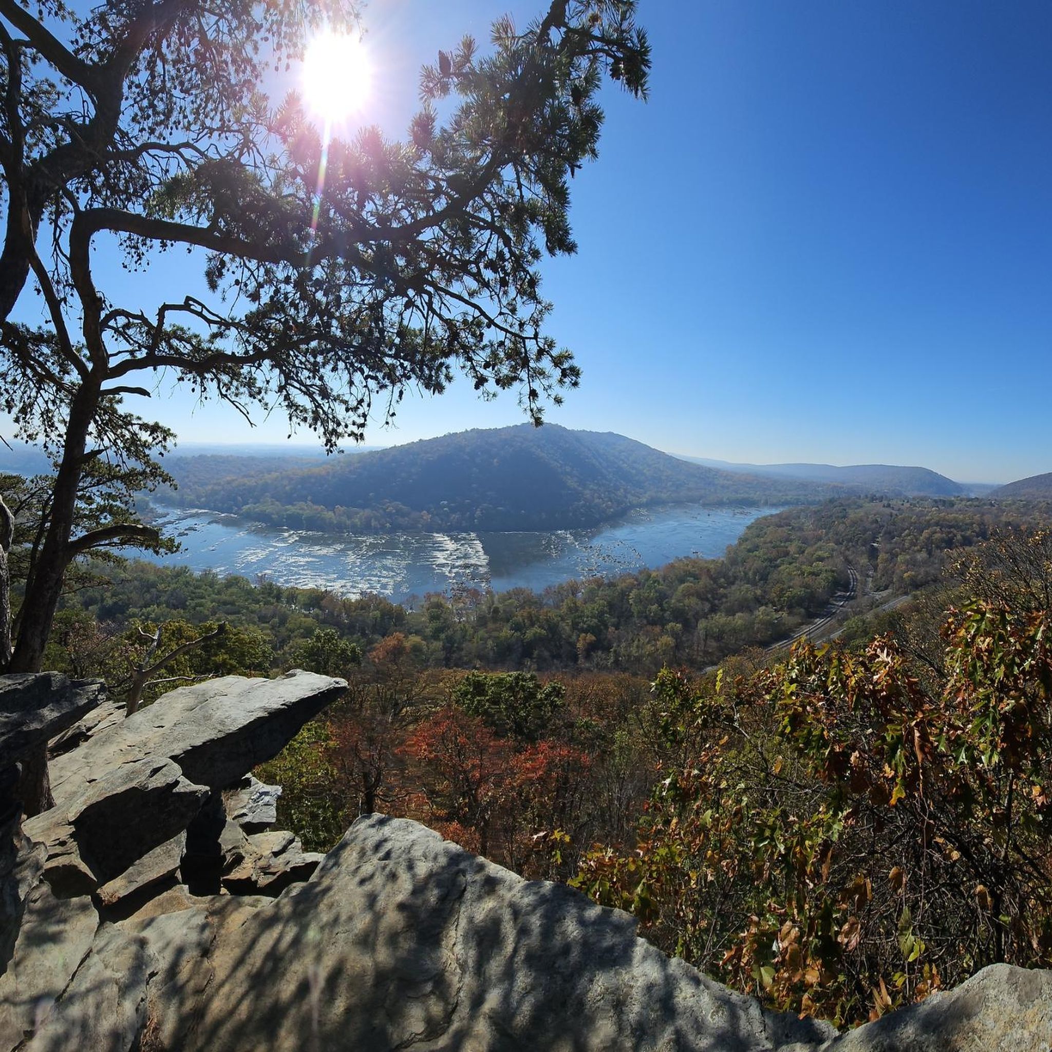
Take a turn here and travel 50m or so along a rocky footpath to enjoy tremendous views across the South Mountain State Park. The trail to White Rocks is a little overgrown and rocky, but well-marked and easy to see. It's a lovely place to catch your breath whilst admiring the phenomenal views.
0
0
This is a nice, not too challenging, section of the Appalachian Trail to run. There are some inclines and declines, but not as much as many other sections of the trail. The ground can get rocky underfoot and tends to hold ice in the winter, so best completed in the warmer months.
1
0
This is a tough and rewarding route that I'd only recommend for the avid trail runners. If you're coming up it's one hell of a climb, and if you're coming down it's steep, so you'll need to watch your footing. The ground is rocky underneath and tends to hold ice in the colder months, so best completed in spring and summer.
1
0

This is one of the fancier and more contemporary Appalachian Trail shelters, making it a popular layover for hikers/trail runners. The enclosed loft offers above-average protection from the elements, and a privy is also available at the site. There's a reliable spring approximately half a mile downhill from the shelter, but an intermittent seep may be found much closer to the shelter, depending on the season.
0
0
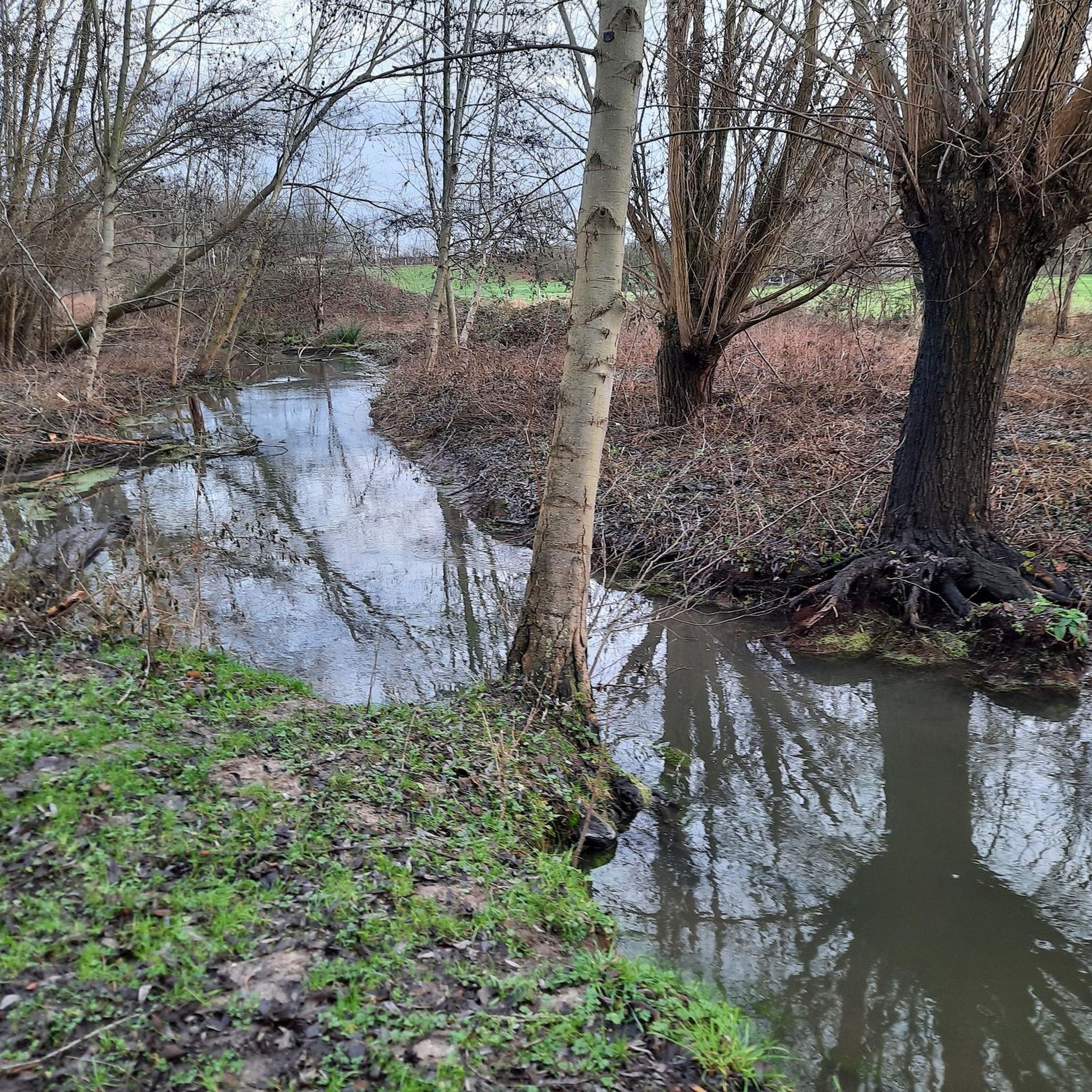
Lovely, entirely flat compact gravel and concrete multi-use trail that runs along the Potomac River. This ground is perfect for running and offers glorious waterside and forest scenes throughout.
1
0
Lovely, entirely flat compact gravel and concrete multi-use trail that runs along the Potomac River. This ground is perfect for running and offers glorious waterside and forest scenes throughout.
0
0
Frequently Asked Questions
How many running routes are available in Brownsville?
Brownsville offers over 10 diverse running routes, catering to various skill levels. You'll find a mix of easy, moderate, and difficult trails to explore.
What kind of terrain can I expect on Brownsville's jogging trails?
The jogging routes around Brownsville feature diverse terrain, from flat canal towpaths and river valleys to more challenging trails with significant elevation gain in forested areas. The region's unique subtropical climate also means you might encounter coastal, wetland, and semi-tropical landscapes, especially closer to the coast.
Are there any easy running routes suitable for beginners or families in Brownsville?
Yes, Brownsville has easy running options. While many routes offer varied challenges, you can find paths like the Chesapeake and Ohio Canal Towpath, which provides a relatively flat surface suitable for a more relaxed run or a family outing. The city also manages numerous multi-use paths and parks, such as Joe and Tony Oliveira Park, which feature walking trails.
What do other runners think about the trails in Brownsville?
The running routes in Brownsville are highly rated by the komoot community, with an average score of 4.0 stars. Runners often praise the varied terrain, from scenic canal towpaths to trails with notable climbs, offering a blend of natural beauty and accessible routes.
Are there any running routes that offer historical or natural points of interest?
Absolutely! Many routes in Brownsville follow historical paths or natural waterways. For instance, the Maryland Heights and C&O Canal Loop combines a canal towpath with a climb to an overlook, offering scenic views. You can also explore areas near the Palo Alto Battlefield National Historical Park or the Sabal Palm Sanctuary, which features over four miles of trails through old-growth Sabal palm forest and wetland boardwalks.
Can I find running routes with significant elevation gain for a more challenging workout?
Yes, for a more challenging workout, Brownsville offers routes with significant elevation gain. The Maryland Heights and C&O Canal Loop, for example, includes a climb to an overlook. Other routes like the Appalachian Trail to White Rocks Overlook also feature notable ascents, providing a good test for your endurance.
Are there any specific parks or areas known for their running trails in Brownsville?
Brownsville boasts several excellent locations for running. The City of Brownsville Parks and Recreation Department manages 46 parks and 47 miles of hike/bike trails. Notable areas include the Monte Bella Trails Park with its 7-mile single-track course, the Historic Battlefield Trail, and the Event Center Running Trail (Paseo de la Resaca System) which runs along a resaca.
What are some unique features of Brownsville's running trails?
Brownsville's running trails offer unique features such as segments of the Historic Battlefield Trail that glow in the dark, providing a distinctive nighttime running experience. Many trails also meander alongside tranquil resacas (oxbow lakes), offering picturesque views and a peaceful atmosphere. The region's subtropical environment means you'll often run amidst unique flora like the native Texas sabal palm.
What is the best time of year to go running in Brownsville?
Brownsville's warm climate generally supports outdoor activities year-round. However, it can be brutally hot from May to September. For more comfortable running conditions, consider visiting during the cooler months, typically from October to April, when the subtropical weather is more pleasant.
Are there any long-distance running options in Brownsville?
Yes, for longer runs, you can explore routes like the Chesapeake and Ohio Canal Towpath, which offers a 12.1-mile (19.5 km) stretch. The city also has an extensive network of multi-use paths, including the 6.6-mile Rose M.Z. Gowen M.D. Trail and the 7-mile Paseo de la Resaca Community Trail, which can be combined for extended distances.
Are there opportunities to see wildlife while running in Brownsville?
Brownsville is rich in wildlife, especially birds. Running trails in areas like Resaca de la Palma State Park & World Birding Center or Laguna Atascosa Wildlife Refuge offer excellent opportunities for nature enthusiasts to spot numerous bird species and other local fauna amidst diverse habitats. The Sabal Palm Sanctuary also provides trails through a significant natural preserve.
Most popular routes around Brownsville
Most popular attractions around Brownsville

Get inspired with the komoot mobile app


Explore more
Browse the best Running Trails & Routes in other regions.
