The best walks and hikes around New Albany
5.0
(1)
83
hikers
15
hikes
Hiking around New Albany offers a diverse range of trails, primarily characterized by riverine landscapes and local park systems. The region features paths along the Ohio River, providing views of the waterway and surrounding natural areas. Many trails are situated within community parks, offering accessible routes through green spaces. The terrain generally includes gentle gradients, with some routes featuring minor elevation changes.
Best hiking trails around New Albany
- The most popular hiking route is Big 4 Walking Bridge, a 1.3 miles (2.0 km) trail that takes 31 minutes to complete. This easy route crosses a historic bridge, offering panoramic views of the Ohio River.
- Another top favourite among local hikers is Mount Saint Francis Loop Trail, an easy 3.0 miles (4.9 km) path. This trail winds through wooded areas with some gentle climbs, providing a peaceful natural experience.
- Local hikers also love the Ohio River Greenway Trail, a 26.0 miles (41.8 km) trail leading through riverfront landscapes, often completed in about 10 hours 44 minutes.
- Hiking around New Albany is defined by riverfront paths, community park loops, and wooded trails. The network offers options for different ability levels, from short, easy walks to longer, more challenging routes.
- The routes in New Albany are highly rated by the komoot community with an average score of 5.0 stars from over 1 review. More than 80 hikers have used komoot to explore New Albany's varied terrain.
Last updated: August 18, 2026
27
hikers
2.04km
00:31
0m
0m
Step onto the Big 4 Walking Bridge for a truly unique urban adventure, where you'll traverse the Ohio River on a converted railroad bridge. The paved path offers expansive, unobstructed views of the Louisville and Jeffersonville skylines, with river traffic gliding beneath you. It's a smooth, level journey that feels more like a scenic promenade than a traditional hike, perfect for soaking in the atmosphere and enjoying the open air.
This easy 1.3-mile (2.0 km) route, with a negligible 6 feet (2 metres) of elevation gain, can be completed in about 30 minutes, making it an ideal choice for a quick, family-friendly outing. You can access the bridge from Waterfront Park in Louisville, where parking is readily available. The bridge is open around the clock, so you can plan your visit for any time of day, perhaps catching a sunset or the bridge's evening lights.
Once a "Bridge That Goes Nowhere," the Big 4 Walking Bridge has been transformed into a bustling pedestrian and bicycle pathway, connecting two states and offering a vital link to the Louisville Riverwalk and Indiana's trail systems. This historic structure provides a fascinating blend of engineering marvel and natural beauty, allowing you to walk between Kentucky and Indiana while observing local wildlife like peregrine falcons.
4
hikers
1.96km
00:30
10m
10m
Enjoy an easy, paved 1.2-mile loop hike around Sam Peden Community Park, featuring lake views, waterfowl, and family-friendly amenities.

Sign up for free
3
hikers
4.88km
01:19
60m
60m
Hike the easy 3.0-mile Mount Saint Francis Loop Trail, winding around a private lake with 199 feet of elevation gain.
2
hikers
3.58km
00:55
10m
10m
Hike the easy 2.2-mile Clarksville Discovery Trail Loop, a paved path offering scenic views, historical railway remnants, and wildlife.
41.8km
10:44
170m
180m
Embark on a challenging hike along the Ohio River Greenway Trail, a difficult 26.0 miles (41.8 km) route that promises expansive views of the river and the Louisville skyline. You will gain 556 feet (169 metres) over an estimated 10 hours and 43 minutes, making this a substantial journey. The trail offers diverse scenery, from paved sections to wetland areas where you might spot wildlife like deer and turkey. As you hike, you will experience the unique atmosphere of the riverfront, with the city's backdrop contrasting with natural elements. This long-distance path provides a continuous experience of the region's dynamic landscape.
Planning your visit to the Ohio River Greenway Trail is straightforward, with multiple access points available. You will find parking generally available at various locations along the route, making it convenient to start your hike. The trail connects communities such as Jeffersonville, Clarksville, and New Albany, offering flexibility for entry and exit points. Since it is a long route, consider starting early in the day to allow ample time to complete your desired section or the entire trail. The largely paved and relatively flat nature of much of the trail makes it accessible for many users.
This trail is notable for its unique geological features, particularly the Falls of the Ohio State Park and Interpretive Center. Here, you can explore massive 390-million-year-old exposed fossil beds, offering a fascinating glimpse into ancient history. The Ohio River Greenway Trail provides a significant connection between urban areas and natural riverine environments, highlighting the rich biodiversity of the region. It stands as a testament to the area's natural heritage and offers a distinct outdoor experience.
Get access to more routes and recommendations from other explorers.
Sign up for free
Already have an account?
Our route recommendations are based on thousands of hikes, rides, and runs completed by other people on komoot.
Start today with a free account
Your next adventure awaits.
Login or Signup
Popular around New Albany


Tips from the Community

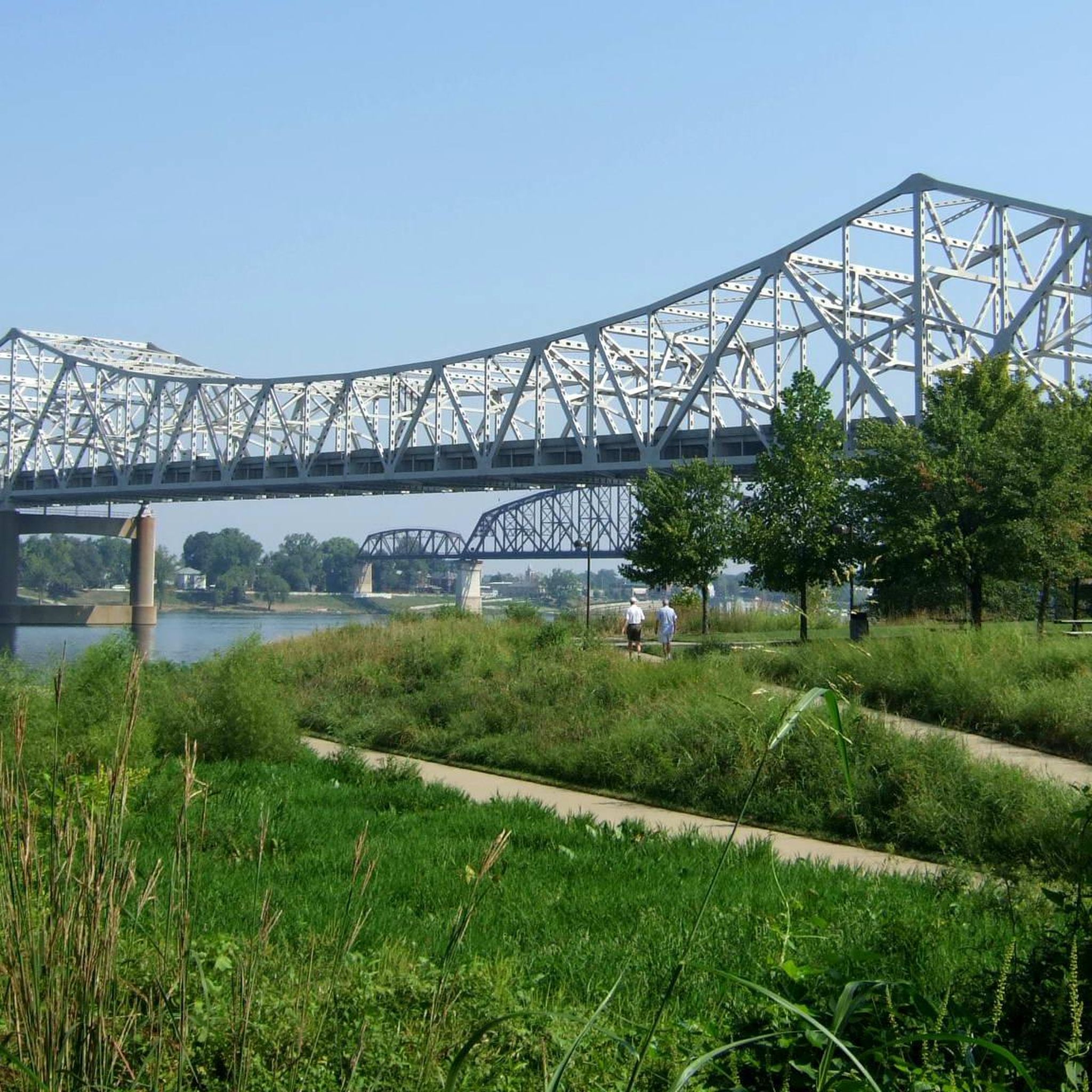
Waterfront Park is an attractive riverside park with benches, picnic areas, open areas, and paved walking/biking paths. You get great views over the river and of the Big Four Bridge, a pedestrian/ cycling bridge which spans the Ohio River, connecting Louisville, Kentucky, and Jeffersonville, Indiana.
0
0

The Big Four Bridge, originally completed in 1895 as a railroad bridge, now connects Louisville, Kentucky, and Jeffersonville, Indiana, for pedestrians and cyclists. After closing for rail use in the sixties, the bridge reopened in 2013 with ramps for walkers and bikers. Spanning 2,525 feet, the bridge offers a two-mile roundtrip, including the ramps. It attracts an average of 1.5 million visitors annually, making it a key recreational link between the two cities. There are bike rental places close by to the bridge too.
1
0


Don't pass up the Lewis and Clark Cabins on the Ohio River Greenway. If you have binoculars you can look across the river and see the hawks nesting.
0
0
Make sure you check out the Widows Walk Ice Cream Shop at the start or end of your ride (right across the street from the Ohio River Greenway sign and Ashland Park).
2
0
Frequently Asked Questions
How many hiking trails are available in New Albany?
New Albany offers a variety of hiking experiences with over 15 routes documented on komoot. These range from easy strolls to more challenging, longer paths, catering to different preferences and fitness levels.
What kind of landscapes can I expect to see while hiking in New Albany?
Hiking in New Albany primarily features riverine landscapes, community parks, and wooded areas. You'll find paths along the Ohio River, offering scenic views, as well as trails winding through natural preserves with diverse tree canopies and even small creek beds.
Are there easy hiking options suitable for beginners or families in New Albany?
Yes, New Albany has many easy hiking options, with 12 out of 15 routes rated as easy. Trails like the Big 4 Walking Bridge or the Mount Saint Francis Loop Trail are great choices for beginners and families looking for a pleasant outdoor experience.
Are there any accessible trails for wheelchairs or strollers in New Albany?
The Campbell-Woodland Nature Trails, just a short drive from downtown New Albany, offer a mix of paved, boardwalk, gravel, and dirt paths, including a paved section that is handicap accessible, making it suitable for wheelchairs and strollers.
Can I find trails with scenic views of the Ohio River?
Absolutely. The Big 4 Walking Bridge provides panoramic views of the Ohio River. Additionally, the Ohio River Greenway Trail offers extensive riverfront landscapes and views as it connects New Albany with neighboring towns.
Are there any trails that feature waterfalls in the New Albany area?
Yes, the Campbell-Woodland Nature Trails, located near downtown New Albany, include small creek beds and even a waterfall, providing a refreshing natural feature along your hike.
Are there historical trails or landmarks to explore while hiking?
New Albany offers unique historical trails. The Silver Hills Historical Nature Trails allow hikers to walk along a former trolley line, featuring historical markers and ruins. The Big 4 Walking Bridge itself is a historic landmark, offering a walk across a repurposed railroad bridge.
Are there any long-distance hiking options in the New Albany area?
For those seeking a longer adventure, the Ohio River Greenway Trail is an excellent choice. This trail spans approximately 26 miles (41.8 km) and leads through extensive riverfront landscapes, offering a significant long-distance hiking experience.
What do other hikers enjoy most about the trails in New Albany?
The trails in New Albany are highly rated by the komoot community, with an average score of 5.0 stars. Hikers often praise the diverse terrain, from riverfront paths to peaceful wooded loops, and the accessibility of routes for various skill levels.
Are the hiking trails in New Albany dog-friendly?
Many trails in New Albany are generally dog-friendly, especially those in community parks and greenways, provided dogs are kept on a leash. Always check specific park regulations before heading out, but areas like the Ohio River Greenway are popular for walks with pets.
Are there any circular hiking routes available in New Albany?
Yes, New Albany offers several convenient circular routes. Examples include the Sam Peden Community Park Loop and the Mount Saint Francis Loop Trail, which are perfect for a contained walk that brings you back to your starting point.
What are some notable attractions or points of interest near the hiking trails?
Near the hiking trails, you can explore several attractions. The Big Four Bridge is a prominent landmark. Other nearby points of interest include the Ohio River Greenway Entrance in Clarksville, and the natural beauty of Cherokee Park.
Most popular attractions around New Albany

Get inspired with the komoot mobile app


